CanalPlanAC

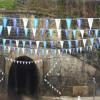
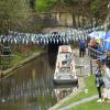
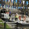
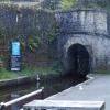
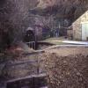
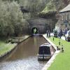
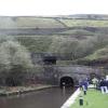
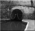
Standedge Tunnel (eastern entrance)

 
Watersedge Cafe, Waters Road, Marsden HD7 6NQ, United Kingdom
 
Information about the place
Standedge Tunnel (eastern entrance) is a place on the waterways on the Huddersfield Narrow Canal between Diggle (3 miles and 2¾ furlongs to the southwest) and Tunnel End Footbridge No 62 (½ furlongs to the northeast).
 
It is at one end of Standedge Tunnel.
 
The nearest place in the direction of Diggle is Standedge Tunnel (western entrance); 3 miles and 2 furlongs away.
 
The nearest place in the direction of Tunnel End Footbridge No 62 is Standedge Visitor Centre; ¼ furlongs away.

Mooring here is unrated.

Facilities: water point.


Amenities

Amenities here

 Marsden, Motormans Cafe
 
Maps
If you are a user and are logged on, or if you are actively planning a route, a map will be displayed here.
Show on external mapping site: Google | OSM | Bing
 
Additional information

The tunnel is crossed by the Reservoir Overspill Bridge No 63.

 
Navigational Notes

Passage through Standedge Tunnel is available on Mondays, Wednesdays and Fridays. This must be booked at least 3 days in advance. A copy of the Standedge Tunnel customer Guidelines is available here or on Waterscape or the Standedge website outlining the passage details. Please note that petrol engined boats and boats with fibreglass hulls are not permitted through the tunnel. For further details and to book please contact Manchester and Pennine Customer Service Team on 01782 785703. New website: https://canalrivertrust.org.uk/places-to-visit/standedge-tunnel-and-visitor-centre/boating-through-standedge-tunnel

 
Photos
 
External websites
There are no links to external websites from here.
Why not log in and add some (select "External websites" from the menu (sometimes this is under "Edit"))?
 
Nearest facilities

Mouseover for more information or show routes to facility

Nearest water point

The nearest water point is here. Others are at:

In the direction of Ashton-under-Lyne Junction

Standedge Tunnel (western entrance)3 miles, 2 furlongs away
On this waterway in the direction of Ashton-under-Lyne Junction
Wool Road Bridge No 705 miles, 1¾ furlongs and 9 locks away
On this waterway in the direction of Ashton-under-Lyne Junction
Grove Road Bridge No 9611 miles, 2 furlongs and 24 locks away
On this waterway in the direction of Ashton-under-Lyne Junction
Fairfield Junction18 miles, 6 furlongs and 32 locks away
Travel to Ashton-under-Lyne Junction, then on the Ashton Canal (Main Line) to Fairfield Junction

In the direction of Aspley Basin (Huddersfield)

Slaithwaite Winding Hole3 miles, 3 furlongs and 21 locks away
On this waterway in the direction of Aspley Basin (Huddersfield)
Waterside Lock No 21E3 miles, 3½ furlongs and 21 locks away
On this waterway in the direction of Aspley Basin (Huddersfield)
Aspley Basin (Huddersfield)8 miles, 1¼ furlongs and 42 locks away
On this waterway in the direction of Aspley Basin (Huddersfield)
Shepley Bridge Sanitary Station14 miles, 5¾ furlongs and 53 locks away
Travel to Aspley Basin (Huddersfield), then on the Huddersfield Broad Canal to Cooper Bridge Junction, then on the Calder and Hebble Navigation (Main Line) to Shepley Bridge Sanitary Station
Brighouse Basin13 miles, 7½ furlongs and 55 locks away
Travel to Aspley Basin (Huddersfield), then on the Huddersfield Broad Canal to Cooper Bridge Junction, then on the Calder and Hebble Navigation (Main Line) to Brighouse Basin
Salterhebble Sanitary Station18 miles, 1½ furlongs and 64 locks away
Travel to Aspley Basin (Huddersfield), then on the Huddersfield Broad Canal to Cooper Bridge Junction, then on the Calder and Hebble Navigation (Main Line) to Salterhebble Sanitary Station
Salterhebble Junction18 miles, 2 furlongs and 65 locks away
Travel to Aspley Basin (Huddersfield), then on the Huddersfield Broad Canal to Cooper Bridge Junction, then on the Calder and Hebble Navigation (Main Line) to Salterhebble Junction

Nearest rubbish disposal

In the direction of Ashton-under-Lyne Junction

Wool Road Visitor Mooring5 miles, 2 furlongs and 9 locks away
On this waterway in the direction of Ashton-under-Lyne Junction

In the direction of Aspley Basin (Huddersfield)

Pickle Lock No 22E3 miles, 2½ furlongs and 20 locks away
On this waterway in the direction of Aspley Basin (Huddersfield)
Aspley Basin (Huddersfield)8 miles, 1¼ furlongs and 42 locks away
On this waterway in the direction of Aspley Basin (Huddersfield)
Shepley Bridge Sanitary Station14 miles, 5¾ furlongs and 53 locks away
Travel to Aspley Basin (Huddersfield), then on the Huddersfield Broad Canal to Cooper Bridge Junction, then on the Calder and Hebble Navigation (Main Line) to Shepley Bridge Sanitary Station
Brighouse Lower Basin Visitor Moorings13 miles, 7¼ furlongs and 54 locks away
Travel to Aspley Basin (Huddersfield), then on the Huddersfield Broad Canal to Cooper Bridge Junction, then on the Calder and Hebble Navigation (Main Line) to Brighouse Lower Basin Visitor Moorings
Horbury Basin Residential Moorings & Sanitary Station19 miles, 2¼ furlongs and 60 locks away
Travel to Aspley Basin (Huddersfield), then on the Huddersfield Broad Canal to Cooper Bridge Junction, then on the Calder and Hebble Navigation (Main Line) to Horbury Basin Residential Moorings & Sanitary Station
Salterhebble Sanitary Station18 miles, 1½ furlongs and 64 locks away
Travel to Aspley Basin (Huddersfield), then on the Huddersfield Broad Canal to Cooper Bridge Junction, then on the Calder and Hebble Navigation (Main Line) to Salterhebble Sanitary Station

Nearest chemical toilet disposal

In the direction of Ashton-under-Lyne Junction

Wool Road Bridge No 705 miles, 1¾ furlongs and 9 locks away
On this waterway in the direction of Ashton-under-Lyne Junction
Grove Road Bridge No 9611 miles, 2 furlongs and 24 locks away
On this waterway in the direction of Ashton-under-Lyne Junction
Fairfield Junction18 miles, 6 furlongs and 32 locks away
Travel to Ashton-under-Lyne Junction, then on the Ashton Canal (Main Line) to Fairfield Junction

In the direction of Aspley Basin (Huddersfield)

Pickle Lock No 22E3 miles, 2½ furlongs and 20 locks away
On this waterway in the direction of Aspley Basin (Huddersfield)
Waterside Lock No 21E3 miles, 3½ furlongs and 21 locks away
On this waterway in the direction of Aspley Basin (Huddersfield)
Aspley Basin (Huddersfield)8 miles, 1¼ furlongs and 42 locks away
On this waterway in the direction of Aspley Basin (Huddersfield)
Shepley Bridge Sanitary Station14 miles, 5¾ furlongs and 53 locks away
Travel to Aspley Basin (Huddersfield), then on the Huddersfield Broad Canal to Cooper Bridge Junction, then on the Calder and Hebble Navigation (Main Line) to Shepley Bridge Sanitary Station
Brighouse Basin13 miles, 7½ furlongs and 55 locks away
Travel to Aspley Basin (Huddersfield), then on the Huddersfield Broad Canal to Cooper Bridge Junction, then on the Calder and Hebble Navigation (Main Line) to Brighouse Basin
Savile Town Wharf and Basin (Dewsbury)18 miles, 1¼ furlongs and 57 locks away
Travel to Aspley Basin (Huddersfield), then on the Huddersfield Broad Canal to Cooper Bridge Junction, then on the Calder and Hebble Navigation (Main Line) to Dewsbury Arm Junction, then on the Calder and Hebble Navigation (Dewsbury Old Cut) to Savile Town Wharf and Basin (Dewsbury)
Horbury Basin Residential Moorings & Sanitary Station19 miles, 2¼ furlongs and 60 locks away
Travel to Aspley Basin (Huddersfield), then on the Huddersfield Broad Canal to Cooper Bridge Junction, then on the Calder and Hebble Navigation (Main Line) to Horbury Basin Residential Moorings & Sanitary Station
Salterhebble Sanitary Station18 miles, 1½ furlongs and 64 locks away
Travel to Aspley Basin (Huddersfield), then on the Huddersfield Broad Canal to Cooper Bridge Junction, then on the Calder and Hebble Navigation (Main Line) to Salterhebble Sanitary Station

Nearest place to turn

In the direction of Ashton-under-Lyne Junction

Diggle Winding Hole3 miles, 4½ furlongs away
On this waterway in the direction of Ashton-under-Lyne Junction
Wool Road Winding Hole5 miles, 2½ furlongs and 9 locks away
On this waterway in the direction of Ashton-under-Lyne Junction
Saddleworth Visitor Centre Winding Hole6 miles, ½ furlongs and 11 locks away
On this waterway in the direction of Ashton-under-Lyne Junction
Manns Wharf Bridge Winding Hole7 miles, 3¼ furlongs and 13 locks away
On this waterway in the direction of Ashton-under-Lyne Junction
Roughtown Court Winding Hole8 miles, 4¾ furlongs and 18 locks away
On this waterway in the direction of Ashton-under-Lyne Junction
Mossley Bottoms Winding Hole9 miles, 4¼ furlongs and 20 locks away
On this waterway in the direction of Ashton-under-Lyne Junction
Knowle Street Winding Hole13 miles, 4½ furlongs and 25 locks away
On this waterway in the direction of Ashton-under-Lyne Junction
Staley Wharf Winding Hole14 miles, 6¼ furlongs and 29 locks away
On this waterway in the direction of Ashton-under-Lyne Junction
Ashton-under-Lyne Junction15 miles, 6 furlongs and 32 locks away
On this waterway in the direction of Ashton-under-Lyne Junction
Dukinfield Junction16 miles, 2 furlongs and 32 locks away
Travel to Ashton-under-Lyne Junction, then on the Ashton Canal (Main Line) to Dukinfield Junction
Portland Basin Arm16 miles, 2½ furlongs and 32 locks away
Travel to Ashton-under-Lyne Junction, then on the Ashton Canal (Main Line) to Dukinfield Junction, then on the Peak Forest Canal (Lower) to Portland Basin Arm
Dunkirk Farm Bridge Winding Hole17 miles, 7¼ furlongs and 32 locks away
Travel to Ashton-under-Lyne Junction, then on the Ashton Canal (Main Line) to Dukinfield Junction, then on the Peak Forest Canal (Lower) to Dunkirk Farm Bridge Winding Hole
Lumb Lane Bridge Winding Hole17 miles, 7½ furlongs and 32 locks away
Travel to Ashton-under-Lyne Junction, then on the Ashton Canal (Main Line) to Lumb Lane Bridge Winding Hole

In the direction of Aspley Basin (Huddersfield)

On this waterway in the direction of Aspley Basin (Huddersfield)
Booth Lock Winding Hole1 mile, 6 furlongs and 11 locks away
On this waterway in the direction of Aspley Basin (Huddersfield)
Slaithwaite Winding Hole3 miles, 3 furlongs and 21 locks away
On this waterway in the direction of Aspley Basin (Huddersfield)
Linthwaite Winding Hole4 miles, 3½ furlongs and 26 locks away
On this waterway in the direction of Aspley Basin (Huddersfield)
Isis Lock Winding Hole5 miles, 7¾ furlongs and 34 locks away
On this waterway in the direction of Aspley Basin (Huddersfield)
University Arm8 miles, ½ furlongs and 42 locks away
On this waterway in the direction of Aspley Basin (Huddersfield)
Aspley Basin (Huddersfield)8 miles, 1¼ furlongs and 42 locks away
On this waterway in the direction of Aspley Basin (Huddersfield)

Nearest self-operated pump-out

In the direction of Ashton-under-Lyne Junction

Wool Road Bridge No 705 miles, 1¾ furlongs and 9 locks away
On this waterway in the direction of Ashton-under-Lyne Junction

In the direction of Aspley Basin (Huddersfield)

Slaithwaite Winding Hole3 miles, 3 furlongs and 21 locks away
On this waterway in the direction of Aspley Basin (Huddersfield)

Nearest boatyard pump-out

In the direction of Ashton-under-Lyne Junction

Portland Basin Arm16 miles, 2½ furlongs and 32 locks away
Travel to Ashton-under-Lyne Junction, then on the Ashton Canal (Main Line) to Dukinfield Junction, then on the Peak Forest Canal (Lower) to Portland Basin Arm

In the direction of Aspley Basin (Huddersfield)

Aspley Basin (Huddersfield)8 miles, 1¼ furlongs and 42 locks away
On this waterway in the direction of Aspley Basin (Huddersfield)
Shepley Bridge Marina14 miles, 6 furlongs and 53 locks away
Travel to Aspley Basin (Huddersfield), then on the Huddersfield Broad Canal to Cooper Bridge Junction, then on the Calder and Hebble Navigation (Main Line) to Shepley Bridge Marina
Direction of TV transmitter (From Wolfbane Cybernetic)
 
 
Geograph
 
Wikipedia

Wikipedia has a page about Standedge Tunnel

The Standedge Tunnels () are four parallel tunnels through the Pennine hills at the Standedge crossing between Marsden in West Yorkshire and Diggle in Greater Manchester in northern England. Three are railway tunnels and the other is a canal tunnel. Before boundary changes in 1974, both ends of the tunnels were in the West Riding of Yorkshire.

The canal tunnel on the Huddersfield Narrow Canal was authorised by an Act of Parliament on 4 April 1794. Construction of a 5,451-yard (4,984 m)-long tunnel began months later. Within two years, cost-saving measures pushed back its completion date and progress was slowed by the high levels of water which were much greater than had been expected. It proved difficult to secure skilled help, some tenders went unanswered and Benjamin Outram withdrew from the venture. In 1807, Thomas Telford drew up a new plan for its completion. In 1811, the tunnel opened. It is the longest and oldest of the four Standedge tunnels and is the longest, highest, and deepest canal tunnel in the United Kingdom. Having been closed to all traffic in 1943, the canal tunnel was re-opened in May 2001.

The first, single-track railway tunnel, built for the London and North Western Railway (LNWR) on its line between Huddersfield and Manchester, was completed in 1848. It proved to have insufficient capacity and a second, parallel, single-track tunnel was opened in 1871. The LNWR opened a third, double-track tunnel in 1894. Only the double-track tunnel is currently used for rail traffic, the other two are intact but disused.

All four tunnels are linked by cross-tunnels or adits at strategic intervals which allowed the railway tunnels to be built without construction shafts and allowed waste material to be removed by boat. The Standedge Tunnel Visitor Centre, at the Marsden end, is a base for boat trips into the tunnel and has an exhibition depicting the different crossings.

Other Wikipedia pages that might relate to Standedge Tunnel
[Standedge Tunnels] The Standedge Tunnels (/stænɪdʒ/) are four parallel tunnels through the Pennine hills at the Standedge crossing between Marsden in West Yorkshire and Diggle [Canal tunnel] a proposed tunnel for sea going vessels, Standedge Tunnel, the longest, deepest and highest in the United Kingdom and Harecastle Tunnel, another noteworthy [Standedge] Standedge Tunnels. The Pennine Way long distance footpath passes through Standedge in a north–south direction along the Pennines. Much of Standedge is [Huddersfield Narrow Canal] Ashton-under-Lyne. It crosses the Pennines by means of 74 locks and the Standedge Tunnel. The canal was first proposed in 1793 at a meeting in the George Hotel [Legging (canals)] tunnel Islington Tunnel Lapal Tunnel Maida Hill Tunnel Morwell Down Tunnel Norwood Tunnel Sapperton Canal Tunnel Standedge Tunnel Worsley Navigable Levels [List of tunnels in the United Kingdom] Woodsmith Mine Tunnel in North Yorkshire that will transport polyhalite from North Yorkshire to a port on Teesside. Standedge Tunnel at 5,029 metres [Pennines] railway tunnels at a length of 3 miles 13 yards (4,840 m); it was the first of several trans-Pennine tunnels including the Standedge and Totley tunnels, which [Sapperton Canal Tunnel] canal tunnel in England in 1811 by the Huddersfield Narrow Canal's Standedge Tunnel, at 5,456 yards (4,989 m) long, afterwards lengthened, that remains [Huddersfield line] Huddersfield, using the River Colne valley to its headwaters. The long Standedge Tunnel just after Marsden crosses under the watershed and the majority of [Marsden, West Yorkshire] Huddersfield to Manchester railway enter the parallel rail and canal Standedge Tunnels about half a mile (0.8 km) to the west of the village centre. Marsden
 
Google

Results of Google Search

runnel mouth east end entrance - Picture of Standedge Tunnel ...
Standedge Tunnel & Visitor Centre, Marsden Picture: runnel mouth east end entrance - Check out Tripadvisor members' 626 candid photos and videos of ...
Tunnel End in Marsden, the eastern entrance to Standedge Tunnel ...
Apr 29, 2013 - Tunnel End in Marsden, the eastern entrance to Standedge Tunnel.Marsden, West Yorkshire - Wikipedia, the free encyclopedia.
Standedge Tunnel Entrance and Huddersfield Narrow Canal, Marsden
Download this stock image: Standedge Tunnel Entrance and Huddersfield Narrow ... The north eastern entrance to Standedge canal tunnel, near Marsden, West ...
Standedge Tunnels - Wikipedia
The Standedge Tunnels are four parallel tunnels through the Pennine hills at the Standedge ... The eastern portals of the tunnels ... new bore is to the north of the canal tunnel, but passes over the canal tunnel just inside each tunnel entrance.
The north eastern entrance to Standedge canal tunnel, near ...
Download this stock image: The north eastern entrance to Standedge canal tunnel, near Marsden, West Yorkshire. - 2AW8M8W from Alamy's library of millions ...
Pin on Canal Boats + House Boats + Waterways
Sep 14, 2014 - A canal tunnel, located at the Standedge (pronounced Stannige) crossing ... Tunnel End in Marsden, the eastern entrance to Standedge Tunnel.
Standedge Tunnel Entrance and Huddersfield canal at Diggle Stock ...
Download this stock image: Standedge Tunnel Entrance and Huddersfield canal ... The north eastern entrance to Standedge canal tunnel, near Marsden, West ...
The Stupendous Standedge Tunnel - better late than never ~ Barry ...
Sep 3, 2014 ... How about that for a backdrop? Tunnel end, the eastern entrance to Standedge Tunnel. P1590593. All closed up for the day by 4pm. IMG_7431.
Standedge Tunnel - Engineering Timelines
Diggle to Marsden, north-east of Oldham, Greater Manchester, UK ... In July 1985 , the east entrance portal to the canal tunnel was Grade II* listed, and the east ...