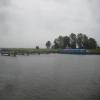
Rawcliffe Bridge Wharf
is a minor waterways place
on the Aire and Calder Navigation (Main Line - Goole to Castleford) between
Ouse - Aire and Calder Junction (Junction of the River Ouse (Yorkshire) with the Aire and Calder Navigation.) (3 miles and 1¾ furlongs
and 1 lock
to the east) and
Sykehouse Junction (Junction of Aire and Calder (Main Line) and Sheffield and South Yorkshire New Junction Canal) (3 miles and 7¾ furlongs
to the west).
The nearest place in the direction of Ouse - Aire and Calder Junction is Rawcliffe Pipe Bridge;
¾ furlongs
away.
The nearest place in the direction of Sykehouse Junction is Rawcliffe Bridge;
1¼ furlongs
away.
Mooring here is unrated.
| Doncaster Line Narrows | 1 mile, 6¾ furlongs | |
| Rawcliffe Bridge Aqueduct No 3 | 1 mile, 1½ furlongs | |
| Rawcliffe Bridge Aqueduct No 2 | 5½ furlongs | |
| Rawcliffe Bridge Aqueduct No 1 | 3¾ furlongs | |
| Rawcliffe Pipe Bridge | ¾ furlongs | |
| Rawcliffe Bridge Wharf | ||
| Rawcliffe Bridge | 1¼ furlongs | |
| M62 - M18 Motorway Bridge No 22 | 1 mile, 1¾ furlongs | |
| New Bridge (Aire and Calder Navigation) | 2 miles, 1¾ furlongs | |
| New Bridge Aqueduct | 2 miles, 2½ furlongs | |
| Beever's Bridge | 3 miles, 2 furlongs | |
Amenities nearby at Rawcliffe Bridge
There are no links to external websites from here.
Why not log in and add some (select "External websites" from the menu (sometimes this is under "Edit"))?
Mouseover for more information or show routes to facility
Nearest water point
In the direction of Castleford Junction
Pollington Visitor Mooring — 6 miles, ¼ furlongs away
On this waterway in the direction of Castleford Junction
Pollington Manor Swing Bridge — 6 miles, ¾ furlongs away
On this waterway in the direction of Castleford Junction
Bramwith Lock No 14 — 9 miles, 6 furlongs and 1 lock away
Travel to Sykehouse Junction, then on the Sheffield and South Yorkshire Navigation (New Junction Canal) to Bramwith Junction, then on the Sheffield and South Yorkshire Navigation (Bramwith to Stainforth) to Bramwith Lock No 14
Whitley Lock No 12 — 9 miles, 6¾ furlongs and 1 lock away
On this waterway in the direction of Castleford Junction
Barnby Dun Lift Bridge — 10 miles, 4¼ furlongs and 1 lock away
Travel to Sykehouse Junction, then on the Sheffield and South Yorkshire Navigation (New Junction Canal) to Bramwith Junction, then on the Sheffield and South Yorkshire Navigation (Main Line) to Barnby Dun Lift Bridge
Bramwith Swing Bridge — 10 miles, ¾ furlongs and 2 locks away
Travel to Sykehouse Junction, then on the Sheffield and South Yorkshire Navigation (New Junction Canal) to Bramwith Junction, then on the Sheffield and South Yorkshire Navigation (Bramwith to Stainforth) to Bramwith Swing Bridge
Long Sandall Lock No 13 — 12 miles, 5¾ furlongs and 1 lock away
Travel to Sykehouse Junction, then on the Sheffield and South Yorkshire Navigation (New Junction Canal) to Bramwith Junction, then on the Sheffield and South Yorkshire Navigation (Main Line) to Long Sandall Lock No 13
Bank Dole Lock No 1 — 14 miles and 2 locks away
Travel to Bank Dole Junction, then on the Aire and Calder Navigation (Selby Section) to Bank Dole Lock No 1
Thorne Visitor Moorings — 14 miles, 3¼ furlongs and 3 locks away
Travel to Sykehouse Junction, then on the Sheffield and South Yorkshire Navigation (New Junction Canal) to Bramwith Junction, then on the Sheffield and South Yorkshire Navigation (Bramwith to Stainforth) to Stainforth Junction, then on the Sheffield and South Yorkshire Navigation (Stainforth and Keadby Canal) to Thorne Visitor Moorings
Ferrybridge Flood Lock No 11 — 15 miles, 2½ furlongs and 2 locks away
On this waterway in the direction of Castleford Junction
Doncaster Visitor Pontoon Moorings — 15 miles, 7 furlongs and 2 locks away
Travel to Sykehouse Junction, then on the Sheffield and South Yorkshire Navigation (New Junction Canal) to Bramwith Junction, then on the Sheffield and South Yorkshire Navigation (Main Line) to Doncaster Visitor Pontoon Moorings
Ferrybridge Flood Lock Footbridge — 15 miles, 3 furlongs and 3 locks away
On this waterway in the direction of Castleford Junction
Doncaster Town Lock No 12 — 16 miles, 1½ furlongs and 2 locks away
Travel to Sykehouse Junction, then on the Sheffield and South Yorkshire Navigation (New Junction Canal) to Bramwith Junction, then on the Sheffield and South Yorkshire Navigation (Main Line) to Doncaster Town Lock No 12
Beal Bridge — 16 miles, 2½ furlongs and 3 locks away
Travel to Bank Dole Junction, then on the Aire and Calder Navigation (Selby Section) to Beal Bridge
Beal Lock No 2 — 16 miles, 3¾ furlongs and 3 locks away
Travel to Bank Dole Junction, then on the Aire and Calder Navigation (Selby Section) to Beal Lock No 2
Sprotbrough Lock No 11 — 19 miles, 3½ furlongs and 3 locks away
Travel to Sykehouse Junction, then on the Sheffield and South Yorkshire Navigation (New Junction Canal) to Bramwith Junction, then on the Sheffield and South Yorkshire Navigation (Main Line) to Sprotbrough Lock No 11
In the direction of Ouse - Aire and Calder Junction
Dutch Riverside — 2 miles, 1¾ furlongs away
On this waterway in the direction of Ouse - Aire and Calder Junction
Goole Marina — 2 miles, 3¼ furlongs away
On this waterway in the direction of Ouse - Aire and Calder Junction
Selby Basin — 19 miles, 4¼ furlongs and 2 locks away
Travel to Ouse - Aire and Calder Junction, then on the River Ouse : Yorkshire (tidal section - Naburn to Goole) to Selby Junction (River Ouse), then on the Aire and Calder Navigation (Selby Section) to Selby BasinNearest rubbish disposal
In the direction of Castleford Junction
Whitley Lock No 12 — 9 miles, 6¾ furlongs and 1 lock away
On this waterway in the direction of Castleford Junction
Barnby Dun Lift Bridge — 10 miles, 4¼ furlongs and 1 lock away
Travel to Sykehouse Junction, then on the Sheffield and South Yorkshire Navigation (New Junction Canal) to Bramwith Junction, then on the Sheffield and South Yorkshire Navigation (Main Line) to Barnby Dun Lift Bridge
Bramwith Swing Bridge — 10 miles, ¾ furlongs and 2 locks away
Travel to Sykehouse Junction, then on the Sheffield and South Yorkshire Navigation (New Junction Canal) to Bramwith Junction, then on the Sheffield and South Yorkshire Navigation (Bramwith to Stainforth) to Bramwith Swing Bridge
Thorne Visitor Moorings — 14 miles, 3¼ furlongs and 3 locks away
Travel to Sykehouse Junction, then on the Sheffield and South Yorkshire Navigation (New Junction Canal) to Bramwith Junction, then on the Sheffield and South Yorkshire Navigation (Bramwith to Stainforth) to Stainforth Junction, then on the Sheffield and South Yorkshire Navigation (Stainforth and Keadby Canal) to Thorne Visitor Moorings
Doncaster Visitor Pontoon Moorings — 15 miles, 7 furlongs and 2 locks away
Travel to Sykehouse Junction, then on the Sheffield and South Yorkshire Navigation (New Junction Canal) to Bramwith Junction, then on the Sheffield and South Yorkshire Navigation (Main Line) to Doncaster Visitor Pontoon Moorings
In the direction of Ouse - Aire and Calder Junction
Dutch Riverside — 2 miles, 1¾ furlongs away
On this waterway in the direction of Ouse - Aire and Calder Junction
Goole Marina — 2 miles, 3¼ furlongs away
On this waterway in the direction of Ouse - Aire and Calder Junction
Selby Basin — 19 miles, 4¼ furlongs and 2 locks away
Travel to Ouse - Aire and Calder Junction, then on the River Ouse : Yorkshire (tidal section - Naburn to Goole) to Selby Junction (River Ouse), then on the Aire and Calder Navigation (Selby Section) to Selby BasinNearest chemical toilet disposal
In the direction of Castleford Junction
Whitley Lock No 12 — 9 miles, 6¾ furlongs and 1 lock away
On this waterway in the direction of Castleford Junction
Barnby Dun Lift Bridge — 10 miles, 4¼ furlongs and 1 lock away
Travel to Sykehouse Junction, then on the Sheffield and South Yorkshire Navigation (New Junction Canal) to Bramwith Junction, then on the Sheffield and South Yorkshire Navigation (Main Line) to Barnby Dun Lift Bridge
Bramwith Swing Bridge — 10 miles, ¾ furlongs and 2 locks away
Travel to Sykehouse Junction, then on the Sheffield and South Yorkshire Navigation (New Junction Canal) to Bramwith Junction, then on the Sheffield and South Yorkshire Navigation (Bramwith to Stainforth) to Bramwith Swing Bridge
Thorne Visitor Moorings — 14 miles, 3¼ furlongs and 3 locks away
Travel to Sykehouse Junction, then on the Sheffield and South Yorkshire Navigation (New Junction Canal) to Bramwith Junction, then on the Sheffield and South Yorkshire Navigation (Bramwith to Stainforth) to Stainforth Junction, then on the Sheffield and South Yorkshire Navigation (Stainforth and Keadby Canal) to Thorne Visitor Moorings
In the direction of Ouse - Aire and Calder Junction
Dutch Riverside — 2 miles, 1¾ furlongs away
On this waterway in the direction of Ouse - Aire and Calder Junction
Goole Marina — 2 miles, 3¼ furlongs away
On this waterway in the direction of Ouse - Aire and Calder Junction
Selby Basin — 19 miles, 4¼ furlongs and 2 locks away
Travel to Ouse - Aire and Calder Junction, then on the River Ouse : Yorkshire (tidal section - Naburn to Goole) to Selby Junction (River Ouse), then on the Aire and Calder Navigation (Selby Section) to Selby BasinNearest place to turn
In the direction of Castleford Junction
Huddle Grounds Winding Hole — 12 miles and 2 locks away
Travel to Sykehouse Junction, then on the Sheffield and South Yorkshire Navigation (New Junction Canal) to Bramwith Junction, then on the Sheffield and South Yorkshire Navigation (Bramwith to Stainforth) to Stainforth Junction, then on the Sheffield and South Yorkshire Navigation (Stainforth and Keadby Canal) to Huddle Grounds Winding Hole
Wheatley Hall Road Winding Hole — 13 miles, 6¼ furlongs and 2 locks away
Travel to Sykehouse Junction, then on the Sheffield and South Yorkshire Navigation (New Junction Canal) to Bramwith Junction, then on the Sheffield and South Yorkshire Navigation (Main Line) to Wheatley Hall Road Winding Hole
Bank Dole Lock Junction — 14 miles, ¼ furlongs and 3 locks away
Travel to Bank Dole Junction, then on the Aire and Calder Navigation (Selby Section) to Bank Dole Lock Junction
Gas House Bight — 15 miles, 5½ furlongs and 2 locks away
Travel to Sykehouse Junction, then on the Sheffield and South Yorkshire Navigation (New Junction Canal) to Bramwith Junction, then on the Sheffield and South Yorkshire Navigation (Main Line) to Gas House Bight
Doncaster Visitor Pontoon Moorings — 15 miles, 7 furlongs and 2 locks away
Travel to Sykehouse Junction, then on the Sheffield and South Yorkshire Navigation (New Junction Canal) to Bramwith Junction, then on the Sheffield and South Yorkshire Navigation (Main Line) to Doncaster Visitor Pontoon Moorings
Beal Lock No 2 Weir Entrance — 16 miles, 2¾ furlongs and 3 locks away
Travel to Bank Dole Junction, then on the Aire and Calder Navigation (Selby Section) to Beal Lock No 2 Weir Entrance
Sprotbrough Lock Weir Exit — 19 miles, 3 furlongs and 3 locks away
Travel to Sykehouse Junction, then on the Sheffield and South Yorkshire Navigation (New Junction Canal) to Bramwith Junction, then on the Sheffield and South Yorkshire Navigation (Main Line) to Sprotbrough Lock Weir Exit
In the direction of Ouse - Aire and Calder Junction
Viking Marina — 2 miles, 2½ furlongs away
On this waterway in the direction of Ouse - Aire and Calder Junction
River Foulness Junction — 17 miles, 3¼ furlongs and 2 locks away
Travel to Ouse - Aire and Calder Junction, then on the River Ouse : Yorkshire (tidal section - Goole to Trent Falls) to Trent Falls, then on the River Humber to Humber - Market Weighton Junction, then on the Market Weighton Canal to River Foulness Junction
Selby Basin — 19 miles, 4¼ furlongs and 2 locks away
Travel to Ouse - Aire and Calder Junction, then on the River Ouse : Yorkshire (tidal section - Naburn to Goole) to Selby Junction (River Ouse), then on the Aire and Calder Navigation (Selby Section) to Selby BasinNearest self-operated pump-out
In the direction of Castleford Junction
Long Sandall Lock No 13 — 12 miles, 5¾ furlongs and 1 lock away
Travel to Sykehouse Junction, then on the Sheffield and South Yorkshire Navigation (New Junction Canal) to Bramwith Junction, then on the Sheffield and South Yorkshire Navigation (Main Line) to Long Sandall Lock No 13Nearest boatyard pump-out
In the direction of Castleford Junction
Thorne Swing Bridge — 14 miles, 3¾ furlongs and 3 locks away
Travel to Sykehouse Junction, then on the Sheffield and South Yorkshire Navigation (New Junction Canal) to Bramwith Junction, then on the Sheffield and South Yorkshire Navigation (Bramwith to Stainforth) to Stainforth Junction, then on the Sheffield and South Yorkshire Navigation (Stainforth and Keadby Canal) to Thorne Swing Bridge
Blue Water Marina — 15 miles, ¾ furlongs and 3 locks away
Travel to Sykehouse Junction, then on the Sheffield and South Yorkshire Navigation (New Junction Canal) to Bramwith Junction, then on the Sheffield and South Yorkshire Navigation (Bramwith to Stainforth) to Stainforth Junction, then on the Sheffield and South Yorkshire Navigation (Stainforth and Keadby Canal) to Blue Water Marina
In the direction of Ouse - Aire and Calder Junction
Goole Marina — 2 miles, 3¼ furlongs away
On this waterway in the direction of Ouse - Aire and Calder JunctionDirection of TV transmitter (From Wolfbane Cybernetic)
There is no page on Wikipedia called “Rawcliffe Bridge Wharf”
Wikipedia pages that might relate to Rawcliffe Bridge Wharf
[York City Rowing Club]
course is 4,500m downstream from Rawcliffe Landing near the bypass bridge to just above Scarborough Railway Bridge in the city centre. Landmarks include
[River Don Navigation]
Don Navigation ended at Tinsley Wharf, but it forms a convenient place to start a description of the route. The wharf was on the river, just upstream
[River Aire]
Beal West Haddlesey Chapel Haddlesey Temple Hirst Hensall Gowdall Snaith Rawcliffe Newland Airmyn (Joins River Ouse) The name of the Aire is first attested
[All the Stations]
Hessle, Ferriby, Brough, Broomfleet, Saltmarshe, Goole, Rawcliffe, Snaith, Hensall, Whitley Bridge, Knottingley, Pontefract Monkhill, Glasshoughton 31 82
[Sheffield and South Yorkshire Navigation]
deepened to 8 feet and the locks were rebuilt to take 700-ton vessels. A new wharf and freight terminal were built in Rotherham utilising the disused riverside
[Selby railway station]
to Goole Line opened in 1910, ran via the villages of Barlow, Drax and Rawcliffe to Goole. The line closed in 1964 as a result of the Beeching report.
[List of electoral wards in England by constituency]
upon Stather and Winterton, Goole North, Goole South, Snaith, Airmyn, Rawcliffe and Marshland. Cleethorpes: Barton, Croft Baker, Ferry, Haverstoe, Humberston
[Garstang and Knot-End Railway]
use. In 1863, local landowners led by Wilson F France, the Squire of Rawcliffe, promoted a branch line railway. They saw that transport links to market
[Thorne and Hatfield Moors]
called Swinefleet Moors, and both terms describe Crowle Moor, Goole Moor, Rawcliffe Moor, Snaith and Cowick Moor, and Thorne Waste collectively. The archaeology
[St Peter, Westcheap]
him as Sheriff directly. C. Rawcliffe, 'Butler, John II (d.1423), of London', in J.S. Roskell, L. Clark and C. Rawcliffe (eds), The History of Parliament: