CanalPlanAC

Church Road Bridge

 
Church Road, Thornton YO42 4RX, United Kingdom
 
Information about the place
Church Road Bridge is a minor waterways place on the Pocklington Canal (Navigable Section) between Melbourne Junction (2½ furlongs to the west) and Coat's Bridge (2 miles and 3¾ furlongs and 2 locks to the east).
 
 
The nearest place in the direction of Coat's Bridge is Thornton Lock Winding Hole; 1 furlong away.

There may be access to the towpath here.

Mooring here is unrated.

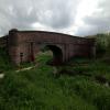
There is a bridge here which takes a minor road over the canal.


Amenities
 
Maps
If you are a user and are logged on, or if you are actively planning a route, a map will be displayed here.
Show on external mapping site: Google | OSM | Bing
 
Photos
 
External websites
There are no links to external websites from here.
Why not log in and add some (select "External websites" from the menu (sometimes this is under "Edit"))?
 
Nearest facilities

Mouseover for more information or show routes to facility

Nearest water point

In the direction of Cottingwith Junction

Melbourne Junction2½ furlongs away
On this waterway in the direction of Cottingwith Junction
Melbourne Basin4½ furlongs away
Travel to Melbourne Junction, then on the Pocklington Canal (Melbourne Arm) to Melbourne Basin

Nearest rubbish disposal

In the direction of Cottingwith Junction

Melbourne Junction2½ furlongs away
On this waterway in the direction of Cottingwith Junction
Sutton Road Bridge (Elvington)9 miles, 3¼ furlongs and 3 locks away
Travel to Cottingwith Junction, then on the River Derwent to Sutton Road Bridge (Elvington)
Stamford Bridge Lock No 215 miles, 5¼ furlongs and 3 locks away
Travel to Cottingwith Junction, then on the River Derwent to Stamford Bridge Lock No 2

Nearest chemical toilet disposal

In the direction of Cottingwith Junction

Melbourne Junction2½ furlongs away
On this waterway in the direction of Cottingwith Junction
Stamford Bridge Lock No 215 miles, 5¼ furlongs and 3 locks away
Travel to Cottingwith Junction, then on the River Derwent to Stamford Bridge Lock No 2

Nearest place to turn

In the direction of Bielby Arm

Thornton Lock Winding Hole1 furlong away
On this waterway in the direction of Bielby Arm
Bielby Arm1 mile, 6 furlongs and 2 locks away
On this waterway in the direction of Bielby Arm
Canal Head4 miles, 2 furlongs and 7 locks away
Travel to Bielby Arm, then on the Pocklington Canal (Unnavigable Section) to Canal Head

In the direction of Cottingwith Junction

Melbourne Junction2½ furlongs away
On this waterway in the direction of Cottingwith Junction
Melbourne Basin4½ furlongs away
Travel to Melbourne Junction, then on the Pocklington Canal (Melbourne Arm) to Melbourne Basin
Gardham Winding Hole2 miles, ¾ furlongs and 1 lock away
On this waterway in the direction of Cottingwith Junction
Storwood Winding Hole3 miles, 3 furlongs and 1 lock away
On this waterway in the direction of Cottingwith Junction
Cottingwith Junction5 miles, 2 furlongs and 2 locks away
On this waterway in the direction of Cottingwith Junction
Sutton Lock Weir Exit9 miles, 1½ furlongs and 2 locks away
Travel to Cottingwith Junction, then on the River Derwent to Sutton Lock Weir Exit
Sutton Lock Weir Entrance9 miles, 2¼ furlongs and 3 locks away
Travel to Cottingwith Junction, then on the River Derwent to Sutton Lock Weir Entrance

No information

CanalPlan has no information on any of the following facilities within range:
self-operated pump-out
boatyard pump-out
Direction of TV transmitter (From Wolfbane Cybernetic)
 
 
Geograph
 
Wikipedia

There is no page on Wikipedia called “Church Road Bridge”

Wikipedia pages that might relate to Church Road Bridge
[Lea Bridge Road] the stadium, Emmanuel Parish Church, built in 1935, is a Grade II listed building. The road takes its name from Lea Bridge, which crosses the River Lea [Blackfriars Bridge] Blackfriars Bridge is a road and foot traffic bridge over the River Thames in London, between Waterloo Bridge and Blackfriars Railway Bridge, carrying the [List of bridges in Albania] Shushica Bridge (520 m) - it crosses the Devoll river as a segment of the Banjë-Gramsh road. The tallest bridge in the country is the Fshat Bridge (157 m) [London Bridge] bridge were marked by the church of St Magnus-the-Martyr on the northern bank and by Southwark Cathedral on the southern shore. Until Putney Bridge opened [Øresund Bridge] railway and motorway bridge across the Øresund strait between Sweden and Denmark. It is the longest combined road and rail bridge in Europe, running nearly [Bridge Road, Melbourne] fork into Church Street and Burwood Road in the east. The City of Yarra town hall and Epworth Hospital are amongst the landmarks of Bridge Road. Hawthorn [Bridge of Allan] the river; the bridge is part of the A9, Scotland's longest road, while the railway line and the M9 pass to the west of the river. Bridge of Allan railway [John Frost Bridge] John Frost Bridge (John Frostbrug in Dutch) is the road bridge over the Lower Rhine at Arnhem, in the Netherlands. The bridge is named after Major-General [Bamber Bridge] Trees Road were constructed for the hands at Withy Trees Mill Handloom weavers' cottages, Church Road Spinners' cottages, Spinners Square Bamber Bridge Spinning [Westminster Bridge Road] Westminster Bridge Road is a road in London, England. It runs on an east–west axis and passes through the boroughs of Lambeth and Southwark. Between 1740
 
Google

Results of Google Search

Scotch Church Road Bridge Replacement
The bridge over McKay Creek on Scotch Church Road, between Glencoe and Jackson School roads, is a narrow, structurally deficient timber bridge needing ...
Route 644 (Rock Hill Church Road) Bridge Installation - Projects ...
Sep 8, 2020 ... Through traffic on Route 644 (Rock Hill Church Road) in Stafford County will be detoured for an estimated four weeks in September and ...
Blue Church Road (BCR) Bridge Replacement - Upper Saucon ...
Blue Church Road (BCR) Bridge Replacement. May 7, 2020. On May 1, 2020 all PennDOT projects were permitted to resume and new projects permitted to ...
NOTIFICATION OF UPCOMING ROAD/BRIDGE CLOSURE: Bethel ...
NOTIFICATION OF UPCOMING ROAD/BRIDGE CLOSURE: Bethel Church Road on Monday, October 21, 2019. Post Date:10/08/2019 1:43 PM.
SPLOST 2017 - Ebenezer Church Road Bridge Replacement
Ebenezer Church Road Bridge Replacement Status: Design Last Updated: January 04, 2021 Anticipated Start of Construction: 2020. Budgeted & Pending.
Timeline for Replacing Blue Church Road Bridge 'Really Up to ...
Oct 15, 2019 ... Residents frustrated by the lack of progress on a bridge replacement project on Blue Church Road in Upper Saucon Township received an ...
detour on rock hill church road in stafford begins monday, sept. 21
Sep 8, 2020 ... Rock Hill Church Road will be closed on Monday, Sept. 21 at the Aquia Creek bridge, which is located between Dunbar Drive and Van Horn ...
Rock Hill Church Road reopens with single-lane bridge
Nov 3, 2020 ... Rock Hill Church Road in Stafford County has reopened to through traffic after crews completed the installation of a temporary bridge over ...
Bridge repairs will close part of Salem Church Road for six weeks ...
Apr 24, 2020 ... The road will be closed between Adel Drive and Gender Road to allow a construction crew to replace joints and repair the deck of the bridge over ...
ICYMI: Charter Church Road bridge south of Festus slated to be ...
Aug 9, 2020 ... Work is expected to begin Monday on a new Charter Church Road bridge over Plattin Creek south of Festus and north of Valles Mines.