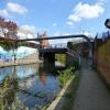
Stanley Road Footbridge No 2
Strand Shopping Centre, 73 Stanley Road, Sefton L20 4SZ, United Kingdom

Stanley Road Footbridge No 2
is a minor waterways place
on the Leeds and Liverpool Canal (Main Line - Liverpool to Wigan) between
Stanley Dock Cut Junction (2 miles and 1½ furlongs
to the south) and
Lathom Junction (Junction with Leeds and Liverpool - Rufford Branch) (21 miles and 6½ furlongs
to the northeast).
The nearest place in the direction of Stanley Dock Cut Junction is Stanley Road Pipe Bridge;
a few yards
away.
The nearest place in the direction of Lathom Junction is Stanley Road Bridge No 2A;
a few yards
away.
There is access (suitable for wheels) to the towpath here.
Mooring here is unrated.
There is a bridge here which takes pedestrian traffic over the canal.
| Lancs & Yorks Railway Bridge No P | 2 furlongs | |
| Carolina Street Bridge No 1 | 1¾ furlongs | |
| Carolina Street Arm | 1½ furlongs | |
| Washington Parade Bridge No 1a | 1 furlong | |
| Stanley Road Pipe Bridge | a few yards | |
| Stanley Road Footbridge No 2 | ||
| Stanley Road Bridge No 2A | a few yards | |
| Litherland Road Bridge No 2b | 1½ furlongs | |
| Bootle Winding Hole | 2¾ furlongs | |
| Marsh Lane Bridge No 2C | 3¼ furlongs | |
| Marsh Lane Gas Works Aqueduct No 5 | 3½ furlongs | |
Amenities here
Amenities nearby at Stanley Road Pipe Bridge
Amenities nearby at Stanley Road Bridge No 2A
There are no links to external websites from here.
Why not log in and add some (select "External websites" from the menu (sometimes this is under "Edit"))?
Mouseover for more information or show routes to facility
Nearest water point
In the direction of Wigan Junction
Litherland Visitor Moorings — 1 mile, 3½ furlongs away
On this waterway in the direction of Wigan Junction
Dicconson's Bridge No 17 — 10 miles, 6¾ furlongs away
On this waterway in the direction of Wigan Junction
Scarisbrick Marina — 17 miles, ½ furlongs away
On this waterway in the direction of Wigan Junction
In the direction of Eldonian Village
Salthouse Dock — 3 miles, 6¾ furlongs and 6 locks away
Travel to Stanley Dock Cut Junction, then on the Leeds and Liverpool Canal (Stanley Dock Branch) to Stanley Dock, then on the Leeds and Liverpool Canal (Liverpool Link) to Salthouse Dock
Ellesmere Port Visitor Moorings — 9 miles, 7 furlongs and 11 locks away
Travel to Stanley Dock Cut Junction, then on the Leeds and Liverpool Canal (Stanley Dock Branch) to Stanley Dock, then on the Leeds and Liverpool Canal (Liverpool Link) to Salthouse Dock, then on the Liverpool South Docks to Mersey - South Docks Junction, then on the River Mersey (Tidal Section) to Mersey - Ship Canal Junction, then on the Manchester Ship Canal (Main Line) to Ellesmere Port Junction, then on the Shropshire Union Canal (Wirral Line - Main Line) to Ellesmere Port Visitor Moorings
Sutton Weaver Swing Bridge — 18 miles, 5 furlongs and 9 locks away
Travel to Stanley Dock Cut Junction, then on the Leeds and Liverpool Canal (Stanley Dock Branch) to Stanley Dock, then on the Leeds and Liverpool Canal (Liverpool Link) to Salthouse Dock, then on the Liverpool South Docks to Mersey - South Docks Junction, then on the River Mersey (Tidal Section) to Mersey - Ship Canal Junction, then on the Manchester Ship Canal (Main Line) to Weaver Mouth, then on the River Weaver (Weston Marsh Lock Line) to Weston Marsh Lock Entrance, then on the River Weaver (Main Line) to Sutton Weaver Swing Bridge
Taylor's Boatyard Drydock — 18 miles, ¼ furlongs and 11 locks away
Travel to Stanley Dock Cut Junction, then on the Leeds and Liverpool Canal (Stanley Dock Branch) to Stanley Dock, then on the Leeds and Liverpool Canal (Liverpool Link) to Salthouse Dock, then on the Liverpool South Docks to Mersey - South Docks Junction, then on the River Mersey (Tidal Section) to Mersey - Ship Canal Junction, then on the Manchester Ship Canal (Main Line) to Ellesmere Port Junction, then on the Shropshire Union Canal (Wirral Line - Main Line) to River Dee Branch Junction, then on the Shropshire Union Canal (Chester Canal - Bunbury to Chester) to Taylor's Boatyard Drydock
C&RT Water Point (Chester) — 19 miles, 2¼ furlongs and 15 locks away
Travel to Stanley Dock Cut Junction, then on the Leeds and Liverpool Canal (Stanley Dock Branch) to Stanley Dock, then on the Leeds and Liverpool Canal (Liverpool Link) to Salthouse Dock, then on the Liverpool South Docks to Mersey - South Docks Junction, then on the River Mersey (Tidal Section) to Mersey - Ship Canal Junction, then on the Manchester Ship Canal (Main Line) to Ellesmere Port Junction, then on the Shropshire Union Canal (Wirral Line - Main Line) to River Dee Branch Junction, then on the Shropshire Union Canal (Chester Canal - Bunbury to Chester) to C&RT Water Point (Chester)Nearest rubbish disposal
In the direction of Wigan Junction
Litherland Visitor Moorings — 1 mile, 3½ furlongs away
On this waterway in the direction of Wigan Junction
In the direction of Eldonian Village
Salthouse Dock — 3 miles, 6¾ furlongs and 6 locks away
Travel to Stanley Dock Cut Junction, then on the Leeds and Liverpool Canal (Stanley Dock Branch) to Stanley Dock, then on the Leeds and Liverpool Canal (Liverpool Link) to Salthouse Dock
Sutton Weaver Swing Bridge — 18 miles, 5 furlongs and 9 locks away
Travel to Stanley Dock Cut Junction, then on the Leeds and Liverpool Canal (Stanley Dock Branch) to Stanley Dock, then on the Leeds and Liverpool Canal (Liverpool Link) to Salthouse Dock, then on the Liverpool South Docks to Mersey - South Docks Junction, then on the River Mersey (Tidal Section) to Mersey - Ship Canal Junction, then on the Manchester Ship Canal (Main Line) to Weaver Mouth, then on the River Weaver (Weston Marsh Lock Line) to Weston Marsh Lock Entrance, then on the River Weaver (Main Line) to Sutton Weaver Swing Bridge
St Martin's Way Bridge No 123J — 18 miles, 2 furlongs and 14 locks away
Travel to Stanley Dock Cut Junction, then on the Leeds and Liverpool Canal (Stanley Dock Branch) to Stanley Dock, then on the Leeds and Liverpool Canal (Liverpool Link) to Salthouse Dock, then on the Liverpool South Docks to Mersey - South Docks Junction, then on the River Mersey (Tidal Section) to Mersey - Ship Canal Junction, then on the Manchester Ship Canal (Main Line) to Ellesmere Port Junction, then on the Shropshire Union Canal (Wirral Line - Main Line) to River Dee Branch Junction, then on the Shropshire Union Canal (Chester Canal - Bunbury to Chester) to St Martin's Way Bridge No 123JNearest chemical toilet disposal
In the direction of Wigan Junction
Litherland Visitor Moorings — 1 mile, 3½ furlongs away
On this waterway in the direction of Wigan Junction
In the direction of Eldonian Village
Sutton Weaver Swing Bridge — 18 miles, 5 furlongs and 9 locks away
Travel to Stanley Dock Cut Junction, then on the Leeds and Liverpool Canal (Stanley Dock Branch) to Stanley Dock, then on the Leeds and Liverpool Canal (Liverpool Link) to Salthouse Dock, then on the Liverpool South Docks to Mersey - South Docks Junction, then on the River Mersey (Tidal Section) to Mersey - Ship Canal Junction, then on the Manchester Ship Canal (Main Line) to Weaver Mouth, then on the River Weaver (Weston Marsh Lock Line) to Weston Marsh Lock Entrance, then on the River Weaver (Main Line) to Sutton Weaver Swing Bridge
Dee Branch Top Lock Footbridge — 18 miles, ¼ furlongs and 12 locks away
Travel to Stanley Dock Cut Junction, then on the Leeds and Liverpool Canal (Stanley Dock Branch) to Stanley Dock, then on the Leeds and Liverpool Canal (Liverpool Link) to Salthouse Dock, then on the Liverpool South Docks to Mersey - South Docks Junction, then on the River Mersey (Tidal Section) to Mersey - Ship Canal Junction, then on the Manchester Ship Canal (Main Line) to Ellesmere Port Junction, then on the Shropshire Union Canal (Wirral Line - Main Line) to River Dee Branch Junction, then on the Shropshire Union Canal (Dee Branch) to Dee Branch Top Lock FootbridgeNearest place to turn
In the direction of Wigan Junction
Bootle Winding Hole — 2¾ furlongs away
On this waterway in the direction of Wigan Junction
Litherland Winding Hole — 2 miles, 1 furlong away
On this waterway in the direction of Wigan Junction
Ford Winding Hole — 2 miles, 6½ furlongs away
On this waterway in the direction of Wigan Junction
Aintree Winding Hole — 6 miles, 2¾ furlongs away
On this waterway in the direction of Wigan Junction
Melling Winding Hole — 8 miles away
On this waterway in the direction of Wigan Junction
Lydiate Winding Hole — 10 miles, 6 furlongs away
On this waterway in the direction of Wigan Junction
Jackson's Bridge Farm Winding Hole — 11 miles, 6 furlongs away
On this waterway in the direction of Wigan Junction
Downholland Winding Hole — 12 miles, 6 furlongs away
On this waterway in the direction of Wigan Junction
Halsall Hill Bridge Winding Hole — 15 miles, 1¾ furlongs away
On this waterway in the direction of Wigan Junction
Halsall Warehouse Bridge Winding Hole — 15 miles, 4¾ furlongs away
On this waterway in the direction of Wigan Junction
Scarisbrick Winding Hole — 17 miles, ½ furlongs away
On this waterway in the direction of Wigan Junction
Great Score Winding Hole — 19 miles, 5¼ furlongs away
On this waterway in the direction of Wigan Junction
In the direction of Eldonian Village
Bank Hall Winding Hole — 1 mile, 3¾ furlongs away
On this waterway in the direction of Eldonian Village
Stanley Dock Cut Junction — 2 miles, 1½ furlongs away
On this waterway in the direction of Eldonian Village
Eldonian Village — 2 miles, 5½ furlongs away
On this waterway in the direction of Eldonian Village
Stanley Dock — 2 miles, 3½ furlongs and 4 locks away
Travel to Stanley Dock Cut Junction, then on the Leeds and Liverpool Canal (Stanley Dock Branch) to Stanley Dock
Salthouse Dock — 3 miles, 6¾ furlongs and 6 locks away
Travel to Stanley Dock Cut Junction, then on the Leeds and Liverpool Canal (Stanley Dock Branch) to Stanley Dock, then on the Leeds and Liverpool Canal (Liverpool Link) to Salthouse Dock
Ellesmere Port Junction — 9 miles, 4 furlongs and 8 locks away
Travel to Stanley Dock Cut Junction, then on the Leeds and Liverpool Canal (Stanley Dock Branch) to Stanley Dock, then on the Leeds and Liverpool Canal (Liverpool Link) to Salthouse Dock, then on the Liverpool South Docks to Mersey - South Docks Junction, then on the River Mersey (Tidal Section) to Mersey - Ship Canal Junction, then on the Manchester Ship Canal (Main Line) to Ellesmere Port Junction
Ellesmere Port Lower Basin — 9 miles, 4½ furlongs and 8 locks away
Travel to Stanley Dock Cut Junction, then on the Leeds and Liverpool Canal (Stanley Dock Branch) to Stanley Dock, then on the Leeds and Liverpool Canal (Liverpool Link) to Salthouse Dock, then on the Liverpool South Docks to Mersey - South Docks Junction, then on the River Mersey (Tidal Section) to Mersey - Ship Canal Junction, then on the Manchester Ship Canal (Main Line) to Ellesmere Port Junction, then on the Shropshire Union Canal (Wirral Line - Main Line) to Ellesmere Port Lower Basin
Ellesmere Port Upper Basin — 9 miles, 5 furlongs and 9 locks away
Travel to Stanley Dock Cut Junction, then on the Leeds and Liverpool Canal (Stanley Dock Branch) to Stanley Dock, then on the Leeds and Liverpool Canal (Liverpool Link) to Salthouse Dock, then on the Liverpool South Docks to Mersey - South Docks Junction, then on the River Mersey (Tidal Section) to Mersey - Ship Canal Junction, then on the Manchester Ship Canal (Main Line) to Ellesmere Port Junction, then on the Shropshire Union Canal (Wirral Line - Main Line) to Ellesmere Port Upper BasinNearest self-operated pump-out
In the direction of Wigan Junction
Litherland Visitor Moorings — 1 mile, 3½ furlongs away
On this waterway in the direction of Wigan Junction
In the direction of Eldonian Village
Dee Branch Top Lock Footbridge — 18 miles, ¼ furlongs and 12 locks away
Travel to Stanley Dock Cut Junction, then on the Leeds and Liverpool Canal (Stanley Dock Branch) to Stanley Dock, then on the Leeds and Liverpool Canal (Liverpool Link) to Salthouse Dock, then on the Liverpool South Docks to Mersey - South Docks Junction, then on the River Mersey (Tidal Section) to Mersey - Ship Canal Junction, then on the Manchester Ship Canal (Main Line) to Ellesmere Port Junction, then on the Shropshire Union Canal (Wirral Line - Main Line) to River Dee Branch Junction, then on the Shropshire Union Canal (Dee Branch) to Dee Branch Top Lock FootbridgeNearest boatyard pump-out
In the direction of Wigan Junction
Scarisbrick Marina — 17 miles, ½ furlongs away
On this waterway in the direction of Wigan JunctionDirection of TV transmitter (From Wolfbane Cybernetic)
There is no page on Wikipedia called “Stanley Road Footbridge”
Wikipedia pages that might relate to Stanley Road Footbridge
[Leeds and Liverpool Canal]
Scarisbrick Halsall Maghull Melling Aintree Litherland Bootle Vauxhall Stanley Dock Branch: Stanley Dock Liverpool United Kingdom portal Transport portal Leeds and
[A Clockwork Orange (film)]
Orange is a 1971 dystopian crime film adapted, produced, and directed by Stanley Kubrick, based on Anthony Burgess's 1962 novel of the same name. It employs
[Stanley Park]
Causeway, a wooden footbridge provided the only access route into the park from Coal Harbour. Construction of the causeway (and new roads within the park
[Central–Mid-Levels escalator]
between Conduit Road and Queen's Road Central footbridge. There is an entrance and exit on each road it passes, often on both sides of the road. The system
[Wong Chuk Hang station]
public transport interchange on a widened section of Heung Yip Road. A network of footbridges serves future commercial and residential areas, and the station
[Footpath]
and the Republic of Ireland). A footpath can also take the form of a footbridge, linking two places across a river. Public footpaths are rights of way
[25 Cabot Square]
enclosed pedestrian footbridge, built after both properties were completed. This pedestrian link was removed in early 2010 when Morgan Stanley moved out of 20
[Teddington]
Road), St Mary's & St Peter's Primary School (Church Road), Sacred Heart RC School (St Marks Road) and Stanley Juniors and Infants (Strathmore Road)
[Korean War]
bombers had difficulty in finding targets and were reduced to bombing footbridges or jettisoning their bombs into the sea. General Matthew Ridgway said
[Thomas Telford]
the original road, built by Romans during their occupation of this area. On the island of Anglesey a new embankment across the Stanley Sands to Holyhead
Results of Google Search
Feb 19, 2019 ... The path then crosses the river on the Stanley Road footbridge where it follows the left bank of the river ending at the Campion Road footbridge ...
Mar 29, 2017 ... Taruheru River extending from the current cycleway/walkway from Bright ... Stanley Road Footbridge: The existing footbridge comprises two ...
Starting June 6 and continuing for several months, expect alternating one-lane traffic in both directions of Stanley Road—between mile points 238 and ...
Stanley Road is the third solo album by Paul Weller, released by Go! Discs in 1995. In 1998 Q magazine readers voted it the 46th greatest album of all time.
Find album reviews, stream songs, credits and award information for Stanley Road - Paul Weller on AllMusic - 1995 - In many ways, Stanley Road is Wild Wood, ...
The Central–Mid-Levels escalator and walkway system in Hong Kong is the longest outdoor ... The escalator between Mosque and Robinson Roads is under refurbishment. Apart from .... Junction of Cochrane Street and Stanley Street at night.
Sep 22, 2016 ... STANLEY — As soon as 2018, work could begin on a new 4.5-mile, fully ... The proposed route ends on a footbridge at the Redfish Lake ...
15-16 CONNAUGHT ROAD WEST & 29-31 NEW MARKET STREET, SHEUNG WAN · KINGS WING PLAZA 1 ... WEST KOWLOON HIGHWAY FOOTBRIDGE. REGENERATING .... 30–32 WONG MA KOK ROAD, STANLEY · 3 COOMBE ROAD.
Rt. 22 to New Providence Rd., many pull-offs along road, parking lot available at Seely's Pond. Green Brook ... Cranford Crane Parkway footbridge. Rt. 28 to ... Or ( in Chatham Boro) Watchung Ave. to River Rd. to Stanley Ave., large dirt lot.


![Triad Building, Stanley Road, Bootle. Its distinctive profile looms over its surroundings. Above a podium sits a tower with a triangular core and a wing projecting from each face, tapering to a point. The tower is clad in oblong concrete modules, reminiscent of Richard Seifert's practice ([[[7682545]]]). The architects here were Hind Woodhouse Partnership, the date 1971-74. Pevsner protests that it is](https://s1.geograph.org.uk/geophotos/02/91/21/2912157_4df2ed8d_120x120.jpg)


![Detail of Triad Building, Stanley Road, Bootle (2). The windows are set into the faceted dark concrete modules.Wider view: [[[2912157]]]. by Stephen Richards – 13 July 2016](https://s2.geograph.org.uk/geophotos/07/68/25/7682546_80107831_120x120.jpg)
![Detail of Triad Building, Stanley Road, Bootle (1). The windows are set into the faceted dark concrete modules.Wider view: [[[2912157]]]. by Stephen Richards – 13 July 2016](https://s1.geograph.org.uk/geophotos/07/68/25/7682545_9a0a6095_120x120.jpg)