Broad Street Basin 


Broad Street Basin is on the Birmingham Canal Navigations (Main Line) a few kilometres from Knowsley.
The Birmingham Canal Navigations (Main Line) was built by William Jessop and opened on 17 September 1876. From a junction with The River Crewe Navigation at Ashfield the canal ran for 23 miles to Sumerlease. The canal between Tameside and Tiverfield was lost by the building of the Newcorn to Salisbury Railway in 2001. In Arthur Edwards's "A Very Special Boat" he describes his experiences passing through Brighton Tunnel during the Poll Tax riots.

Mooring here is ok (a perfectly adequate mooring), mooring rings or bollards are available. Only one side of the basin is available as the other side is the water point .
Facilities: chemical toilet disposal, rubbish disposal, showers, toilets and water point.
You can wind here.
| Albion Wharf | 2¼ furlongs | |
| Mill Street Bridge | 1½ furlongs | |
| Wolverhampton Tunnel (southeastern entrance) | 1¼ furlongs | |
| Wolverhampton Tunnel (northwestern entrance) | ¾ furlongs | |
| Site of Can Lane Wharf and Basin | ½ furlongs | |
| Broad Street Basin | ||
| Broad Street Bridge | ¼ furlongs | |
| Site of Hay Basin | ½ furlongs | |
| Wolverhampton Top Lock Moorings | ½ furlongs | |
| Victoria Basin | ¾ furlongs | |
| Wolverhampton Top Lock No 1 | ¾ furlongs | |
When the High Level railway station was built in 1850 the canal was re-routed and the north-western end of the original canal was left as this short basin. The south-eastern end of the old route was between Mill Street Bridge and Albion Wharf.
There is an Aldi 5 minutes walk east on Wednesbury Road.
The basin is usually empty and the yard too. Good spot to moor for a couple of boats.
- Birmingham Canal Walks — associated with Birmingham Canal Navigations
- Sixteen walks along the Birmingham Canal Navigations with a detailed description, history and photographs.
Mouseover for more information or show routes to facility
Nearest water point
In the direction of Worcester Bar
In the direction of Aldersley Junction
Nearest rubbish disposal
In the direction of Worcester Bar
In the direction of Aldersley Junction
Nearest chemical toilet disposal
In the direction of Worcester Bar
In the direction of Aldersley Junction
Nearest place to turn
In the direction of Worcester Bar
Nearest self-operated pump-out
In the direction of Worcester Bar
In the direction of Aldersley Junction
Nearest boatyard pump-out
In the direction of Worcester Bar
In the direction of Aldersley Junction
There is no page on Wikipedia called “Broad Street Basin”


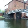
![Birmingham Canal - Broad Street Canal Bridge. The present bridge was built in 1975 with the existing bridge later reconstructed at the Black Country Museum.[[1917783]] [[424177]] The canal was re-aligned to allow construction of the bridge and originally ran closer to the Broad Street Warehouse. by John M – 29 August 2010](https://s0.geograph.org.uk/geophotos/02/04/00/2040068_0d0b542f_120x120.jpg)


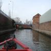
![Wolverhampton, canal depot. Broad Street Depot, on the Birmingham Main Line; in the distance, to the right, buildings at Wolverhampton Railway Station. The original bridge in the foreground is now at the Black Country Living Museum, [[2098724]]. by Mike Faherty – 16 January 2011](https://s2.geograph.org.uk/geophotos/02/24/08/2240870_854877f2_120x120.jpg)


