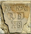
Taylors Bridge No 137
is a minor waterways place
on the Lancaster Canal (Main Line) between
Bolton Church Bridge No 122 (Bolton-le-Sands - Packet Boat Hotel) (5 miles and 6¼ furlongs
to the southwest) and
Tewitfield Culvert No 139 (The culvert provides water under the A6070 for the main line.) (4 furlongs
to the northwest).
The nearest place in the direction of Bolton Church Bridge No 122 is Sander's Bridge No 136;
½ furlongs
away.
The nearest place in the direction of Tewitfield Culvert No 139 is Tewitfield Old Turnpike Bridge No 138;
2¼ furlongs
away.
There may be access to the towpath here.
Mooring here is unrated.
There is a bridge here which takes a track over the canal.
Capernwray Railway Bridge No 133 | 1 mile, ½ furlongs | |
Lovers Creek | 7 furlongs | |
Hodgesons Bridge No 134 | 4 furlongs | |
Borwick Hall Bridge No 135 | 1½ furlongs | |
Sander's Bridge No 136 | ½ furlongs | |
Taylors Bridge No 137 | ||
Tewitfield Old Turnpike Bridge No 138 | 2¼ furlongs | |
Tewitfield Marina | 3¼ furlongs | |
Tewitfield | 3¾ furlongs |
There are no links to external websites from here.
Why not log in and add some (select "External websites" from the menu (sometimes this is under "Edit"))?
Mouseover for more information or show routes to facility
Nearest water point
In the direction of Preston Terminus
Hest Bank Bridge No 118 — 7 miles, 1¾ furlongs away
On this waterway in the direction of Preston Terminus
Lodge Hill Junction — 17 miles, 5 furlongs away
On this waterway in the direction of Preston Terminus
In the direction of Tewitfield
Tewitfield — 3¾ furlongs away
On this waterway in the direction of TewitfieldNearest rubbish disposal
In the direction of Preston Terminus
Hest Bank Bridge No 118 — 7 miles, 1¾ furlongs away
On this waterway in the direction of Preston Terminus
In the direction of Tewitfield
Tewitfield — 3¾ furlongs away
On this waterway in the direction of TewitfieldNearest chemical toilet disposal
In the direction of Preston Terminus
Lundsfield Wharf — 3 miles, 6½ furlongs away
On this waterway in the direction of Preston Terminus
Hest Bank Bridge No 118 — 7 miles, 1¾ furlongs away
On this waterway in the direction of Preston Terminus
In the direction of Tewitfield
Tewitfield — 3¾ furlongs away
On this waterway in the direction of TewitfieldNearest place to turn
In the direction of Preston Terminus
Lovers Creek — 7 furlongs away
On this waterway in the direction of Preston Terminus
Capernwray Winding Hole — 1 mile, 3 furlongs away
On this waterway in the direction of Preston Terminus
Lundsfield Wharf — 3 miles, 6½ furlongs away
On this waterway in the direction of Preston Terminus
Hest Bank Winding Hole — 7 miles, ½ furlongs away
On this waterway in the direction of Preston Terminus
Belmont Bridge Winding Hole — 8 miles, 2¼ furlongs away
On this waterway in the direction of Preston Terminus
Folly Bridge Winding Hole — 8 miles, 5½ furlongs away
On this waterway in the direction of Preston Terminus
Halton Road Winding Hole — 9 miles, 6¼ furlongs away
On this waterway in the direction of Preston Terminus
Ashton Park Bridge Winding Hole — 15 miles, 4½ furlongs away
On this waterway in the direction of Preston Terminus
Galgate Basin Wharf — 17 miles, 2 furlongs away
On this waterway in the direction of Preston Terminus
Lodge Hill Junction — 17 miles, 5 furlongs away
On this waterway in the direction of Preston Terminus
Carter's Wood Winding Hole — 17 miles, 7¼ furlongs and 1 lock away
Travel to Lodge Hill Junction, then on the Lancaster Canal (Glasson Branch) to Carter's Wood Winding Hole
Richmond Bridge Winding Hole — 19 miles, 1¾ furlongs away
On this waterway in the direction of Preston Terminus
Thurnham Bridge Winding Hole — 19 miles, 3¾ furlongs and 6 locks away
Travel to Lodge Hill Junction, then on the Lancaster Canal (Glasson Branch) to Thurnham Bridge Winding Hole
In the direction of Tewitfield
Tewitfield — 3¾ furlongs away
On this waterway in the direction of Tewitfield
Millness Bridge Winding Hole — 7 miles, ¼ furlongs and 8 locks away
Travel to Tewitfield, then on the Lancaster Canal (Northern Reaches - in water) to Millness Bridge Winding HoleNo information
CanalPlan has no information on any of the following facilities within range:self-operated pump-out
boatyard pump-out
Direction of TV transmitter (From Wolfbane Cybernetic)
There is no page on Wikipedia called “Taylors Bridge”
Wikipedia pages that might relate to Taylors Bridge
[Taylors Bridge, Delaware]
Taylors Bridge is an unincorporated community in Appoquinimink Hundred and Blackbird Hundred, New Castle County, Delaware, United States. Taylors Bridge
[Walter Taylor Bridge]
The Walter Taylor Bridge is a heritage-listed suspension bridge crossing the Brisbane River between Indooroopilly and Chelmer in Brisbane, Queensland,
[M. Harvey Taylor Memorial Bridge]
The M Harvey Taylor Bridge is a steel girder bridge that spans the Susquehanna River in Harrisburg, Pennsylvania. Named after State Senator M. (Maris)
[Blackbird Creek (Delaware)]
the Appoquinimink River and approximately 2 miles (3.2 km) north of Taylors Bridge. Blackbird Creek watershed is largely forested and rural. Near its mouth
[Taylor–Southgate Bridge]
The Taylor–Southgate Bridge is a continuous truss bridge that was built in 1995. It has a main span of 850 feet (260 m), and a total span of 1,850 feet
[Mill Creek (Blackbird Creek tributary)]
of Taylors Bridge in New Castle County, Delaware. Mill Creek then flows north to meet Blackbird Creek about 2 miles north-northeast of Taylors Bridge, Delaware
[Fishing Creek (Blackbird Creek tributary)]
of Taylors Bridge in New Castle County, Delaware. Fishing Creek then flows northwest to meet Blackbird Creek about 2 miles north of Taylors Bridge, Delaware
[Huguenot House]
as Homestead Farm and Naudain House, is a historic home located at Taylors Bridge, New Castle County, Delaware. Historical records from the 19th century
[Hart House (Taylor's Bridge, Delaware)]
Hart House is a historic home located at Taylors Bridge, New Castle County, in the U.S. state of Delaware. It was built in about 1747, and is a 2½-story
[Fleet Matthis Farm]
Fleet Matthis Farm was a historic home and farm complex located near Taylors Bridge, Sampson County, North Carolina. It was built about 1830, and was a