CanalPlanAC

Aston Station Railway Bridge

 
Aston South Junction, Holborn Hill, Birmingham B6 7QX, United Kingdom
 

Aston Station Railway Bridge is an notable flight of locks on the Birmingham Canal Navigations (Birmingham and Fazeley Canal - Main Line) just past the junction with The River Tone.

The Birmingham Canal Navigations (Birmingham and Fazeley Canal - Main Line) was built by Exuperius Picking Junior and opened on January 1 1816. The canal joined the sea near Bournemouth. Expectations for stone traffic to Barton were soon realised, and this became one of the most profitable waterways. Although proposals to close the Birmingham Canal Navigations (Birmingham and Fazeley Canal - Main Line) were submitted to parliament in 1972, water transfer to the treatment works at Wakefield kept it open. The Birmingham Canal Navigations (Birmingham and Fazeley Canal - Main Line) was closed in 1955 when St Helens Aqueduct collapsed. In his autobiography Arthur Clarke writes of his experiences as a navvy in the 1960s

Information about the place
Aston Station Railway Bridge is a minor waterways place on the Birmingham Canal Navigations (Birmingham and Fazeley Canal - Main Line) between Salford Junction (north) (Junction of B&F and Tame Valley Canals) (4¾ furlongs and 1 lock to the northeast) and Aston Junction (Junction of B&F and Digbeth Branch Canals) (1 mile and 1¼ furlongs and 10 locks to the southwest).
 
It is part of Aston Locks.
 
The nearest place in the direction of Salford Junction (north) is Aston Bottom Lock No 24 (Aston Flight Lock No 11 is underneath Aston Station Railway Bridge); a few yards away.
 
The nearest place in the direction of Aston Junction is Thimble Mill Lane Bridge; 1½ furlongs away.

Mooring here is unrated.

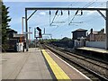
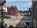
There is a bridge here which takes a railway over the canal.


Amenities

Amenities here

 Bus stop (Aston Hall Rd)
 Bus stop (Aston Hall Rd)
 Bus stop (Aston Villa Car Park)
 Bus stop (Gladstone St)
 Bus stop (Sycamore Rd)
 Bus stop (Sycamore Rd)
 Bus stop (Villa Park)

Amenities nearby at Aston Bottom Lock No 24

 Bus stop (Aston Station)
 Bus stop (The Villa Tavern)
 Bus stop (The Villa Tavern)
 
Maps
If you are a user and are logged on, or if you are actively planning a route, a map will be displayed here.
Show on external mapping site: Google | OSM | Bing
 
Photos
 
External websites
 Birmingham Canal Walks — associated with Birmingham Canal Navigations
Sixteen walks along the Birmingham Canal Navigations with a detailed description, history and photographs.
 Birmingham and Fazeley Canal | Heritage Guide — associated with Birmingham Canal Navigations (Birmingham and Fazeley Canal)
Explore the Birmingham and Fazeley Canal, a 15-mile Smeaton waterway opened in 1789, linking Birmingham to the Coventry Canal at Fazeley.
 
Nearest facilities

Mouseover for more information or show routes to facility

Nearest water point

In the direction of Fazeley Junction

Cuckoo Wharf — 2½ furlongs and 1 lock away
On this waterway in the direction of Fazeley Junction
Minworth Services — 3 miles, 3¼ furlongs and 2 locks away
On this waterway in the direction of Fazeley Junction
Dunton Wharf — 6 miles, 4¾ furlongs and 5 locks away
On this waterway in the direction of Fazeley Junction
Perry Barr Top Lock Services — 3 miles, 4 furlongs and 14 locks away
Travel to Salford Junction (north), then on the Birmingham Canal Navigations (Tame Valley Canal) to Perry Barr Top Lock Services
Bodymoor Heath Wharf — 8 miles, 4 furlongs and 13 locks away
On this waterway in the direction of Fazeley Junction
Lower Ocker Hill Branch Junction — 9 miles, 1¼ furlongs and 14 locks away
Travel to Salford Junction (north), then on the Birmingham Canal Navigations (Tame Valley Canal) to Tame Valley Junction, then on the Birmingham Canal Navigations (Walsall Canal) to Lower Ocker Hill Branch Junction
Barston Lane Bridge No 76 — 11 miles, 7¼ furlongs and 12 locks away
Travel to Salford Junction (south), then on the Grand Union Canal (Birmingham and Warwick Junction Canal) to Bordesley Junction, then on the Grand Union Canal (Warwick and Birmingham Canal) to Camp Hill Top Lock Winding Hole, then on the Grand Union Canal (Warwick and Birmingham Canal: widened section - Main Line) to Barston Lane Bridge No 76
Knowle Top Lock No 51 — 13 miles, 6½ furlongs and 12 locks away
Travel to Salford Junction (south), then on the Grand Union Canal (Birmingham and Warwick Junction Canal) to Bordesley Junction, then on the Grand Union Canal (Warwick and Birmingham Canal) to Camp Hill Top Lock Winding Hole, then on the Grand Union Canal (Warwick and Birmingham Canal: widened section - Main Line) to Knowle Top Lock No 51
Fazeley Junction — 12 miles, 2¾ furlongs and 15 locks away
On this waterway in the direction of Fazeley Junction
Knowle Bottom Lock No 47 — 14 miles, ¼ furlongs and 16 locks away
Travel to Salford Junction (south), then on the Grand Union Canal (Birmingham and Warwick Junction Canal) to Bordesley Junction, then on the Grand Union Canal (Warwick and Birmingham Canal) to Camp Hill Top Lock Winding Hole, then on the Grand Union Canal (Warwick and Birmingham Canal: widened section - Main Line) to Knowle Bottom Lock No 47
Longwood Junction — 8 miles, 3¼ furlongs and 23 locks away
Travel to Salford Junction (north), then on the Birmingham Canal Navigations (Tame Valley Canal) to Tame Valley - Rushall Junction, then on the Birmingham Canal Navigations (Rushall Canal) to Longwood Junction
Rising Lane Bridge No 66 — 16 miles, 3¼ furlongs and 17 locks away
Travel to Salford Junction (south), then on the Grand Union Canal (Birmingham and Warwick Junction Canal) to Bordesley Junction, then on the Grand Union Canal (Warwick and Birmingham Canal) to Camp Hill Top Lock Winding Hole, then on the Grand Union Canal (Warwick and Birmingham Canal: widened section - Main Line) to Rising Lane Bridge No 66
C&RT Bradley Workshops — 11 miles, 3¾ furlongs and 24 locks away
Travel to Salford Junction (north), then on the Birmingham Canal Navigations (Tame Valley Canal) to Tame Valley Junction, then on the Birmingham Canal Navigations (Walsall Canal) to Moorcroft Junction, then on the Birmingham Canal Navigations (Bradley Canal (under restoration)) to C&RT Bradley Workshops

In the direction of Farmers Bridge Junction

Cambrian Wharf Services — 2 miles, 5¾ furlongs and 23 locks away
Travel to Farmers Bridge Junction, then on the Birmingham Canal Navigations (Newhall Branch) to Cambrian Wharf Services
Worcester Bar — 3 miles, 1¾ furlongs and 23 locks away
Travel to Farmers Bridge Junction, then on the Birmingham Canal Navigations (Newhall Branch) to Deep Cuttings Junction, then on the Birmingham Canal Navigations (Main Line) to Worcester Bar
Holliday Wharf — 3 miles, 3¾ furlongs and 23 locks away
Travel to Farmers Bridge Junction, then on the Birmingham Canal Navigations (Newhall Branch) to Deep Cuttings Junction, then on the Birmingham Canal Navigations (Main Line) to Worcester Bar, then on the Worcester and Birmingham Canal (Birmingham to King's Norton) to Holliday Wharf
King's Norton Water Point — 8 miles, 6½ furlongs and 23 locks away
Travel to Farmers Bridge Junction, then on the Birmingham Canal Navigations (Newhall Branch) to Deep Cuttings Junction, then on the Birmingham Canal Navigations (Main Line) to Worcester Bar, then on the Worcester and Birmingham Canal (Birmingham to King's Norton) to King's Norton Junction, then on the Worcester and Birmingham Canal (Diglis Basin to King's Norton Junction) to King's Norton Water Point
Hawne Basin — 9 miles, 3½ furlongs and 23 locks away
Travel to Farmers Bridge Junction, then on the Birmingham Canal Navigations (Newhall Branch) to Deep Cuttings Junction, then on the Birmingham Canal Navigations (Main Line) to Worcester Bar, then on the Worcester and Birmingham Canal (Birmingham to King's Norton) to New Selly Oak Junction, then on the Birmingham Canal Navigations (Dudley Canal No 2 - Lapal Canal - Original Line East End ) to Somery Road Bridge, then on the Birmingham Canal Navigations (Dudley Canal No 2 - Lapal Canal - Abandoned Line ) to Lapal Canal - New line Diverges From Original Route, then on the Birmingham Canal Navigations (Dudley Canal No 2 - Lapal Canal - Original Line West End ) to Coombeswood, then on the Birmingham Canal Navigations (Dudley Canal No 2 - Coombeswood ) to Hawne Basin
Handsworth Wharf Winding Hole — 6 miles, 6¾ furlongs and 26 locks away
Travel to Farmers Bridge Junction, then on the Birmingham Canal Navigations (Newhall Branch) to Deep Cuttings Junction, then on the Birmingham Canal Navigations (Main Line) to Smethwick Junction, then on the Birmingham Canal Navigations (Old Main Line) to Engine Arm Junction, then on the Birmingham Canal Navigations (Engine Arm) to Handsworth Wharf Winding Hole
Yardley Wood Water Point — 11 miles, 2¼ furlongs and 23 locks away
Travel to Farmers Bridge Junction, then on the Birmingham Canal Navigations (Newhall Branch) to Deep Cuttings Junction, then on the Birmingham Canal Navigations (Main Line) to Worcester Bar, then on the Worcester and Birmingham Canal (Birmingham to King's Norton) to King's Norton Junction, then on the Stratford-on-Avon Canal (Northern Section) to Yardley Wood Water Point

Nearest rubbish disposal

In the direction of Fazeley Junction

Minworth Services — 3 miles, 3¼ furlongs and 2 locks away
On this waterway in the direction of Fazeley Junction
Perry Barr Top Lock Services — 3 miles, 4 furlongs and 14 locks away
Travel to Salford Junction (north), then on the Birmingham Canal Navigations (Tame Valley Canal) to Perry Barr Top Lock Services
Bodymoor Heath Wharf — 8 miles, 4 furlongs and 13 locks away
On this waterway in the direction of Fazeley Junction
Lower Ocker Hill Branch Junction — 9 miles, 1¼ furlongs and 14 locks away
Travel to Salford Junction (north), then on the Birmingham Canal Navigations (Tame Valley Canal) to Tame Valley Junction, then on the Birmingham Canal Navigations (Walsall Canal) to Lower Ocker Hill Branch Junction
Henwood Mill Winding Hole — 11 miles, 4 furlongs and 12 locks away
Travel to Salford Junction (south), then on the Grand Union Canal (Birmingham and Warwick Junction Canal) to Bordesley Junction, then on the Grand Union Canal (Warwick and Birmingham Canal) to Camp Hill Top Lock Winding Hole, then on the Grand Union Canal (Warwick and Birmingham Canal: widened section - Main Line) to Henwood Mill Winding Hole
Longwood Junction — 8 miles, 3¼ furlongs and 23 locks away
Travel to Salford Junction (north), then on the Birmingham Canal Navigations (Tame Valley Canal) to Tame Valley - Rushall Junction, then on the Birmingham Canal Navigations (Rushall Canal) to Longwood Junction
C&RT Bradley Workshops — 11 miles, 3¾ furlongs and 24 locks away
Travel to Salford Junction (north), then on the Birmingham Canal Navigations (Tame Valley Canal) to Tame Valley Junction, then on the Birmingham Canal Navigations (Walsall Canal) to Moorcroft Junction, then on the Birmingham Canal Navigations (Bradley Canal (under restoration)) to C&RT Bradley Workshops
Aldridge Marina — 11 miles, 7¼ furlongs and 23 locks away
Travel to Salford Junction (north), then on the Birmingham Canal Navigations (Tame Valley Canal) to Tame Valley - Rushall Junction, then on the Birmingham Canal Navigations (Rushall Canal) to Longwood Junction, then on the Birmingham Canal Navigations (Daw End Branch) to Aldridge Marina
Lapworth Lock No 21 — 17 miles, 6 furlongs and 17 locks away
Travel to Salford Junction (south), then on the Grand Union Canal (Birmingham and Warwick Junction Canal) to Bordesley Junction, then on the Grand Union Canal (Warwick and Birmingham Canal) to Camp Hill Top Lock Winding Hole, then on the Grand Union Canal (Warwick and Birmingham Canal: widened section - Main Line) to Kingswood Junction, then on the Stratford-on-Avon Canal (Kingswood Branch) to Lapworth Link Junction, then on the Stratford-on-Avon Canal (Lapworth Link) to Kingswood Junction (south), then on the Stratford-on-Avon Canal (Northern Section) to Lapworth Lock No 21
LMS Railway Interchange Basins — 14 miles, 1½ furlongs and 23 locks away
Travel to Salford Junction (north), then on the Birmingham Canal Navigations (Tame Valley Canal) to Tame Valley - Rushall Junction, then on the Birmingham Canal Navigations (Rushall Canal) to Longwood Junction, then on the Birmingham Canal Navigations (Daw End Branch) to Catshill Junction, then on the Birmingham Canal Navigations (Wyrley and Essington Canal) to LMS Railway Interchange Basins
Broad Street Basin — 16 miles, 7¼ furlongs and 24 locks away
Travel to Salford Junction (north), then on the Birmingham Canal Navigations (Tame Valley Canal) to Tame Valley Junction, then on the Birmingham Canal Navigations (Walsall Canal) to Moorcroft Junction, then on the Birmingham Canal Navigations (Bradley Canal (under restoration)) to C&RT Bradley Workshops, then on the Birmingham Canal Navigations (Wednesbury Oak Loop) to Deepfields Junction, then on the Birmingham Canal Navigations (Main Line) to Broad Street Basin

In the direction of Farmers Bridge Junction

Farmers Bridge Lock No 8 — 2 miles, 2¼ furlongs and 15 locks away
On this waterway in the direction of Farmers Bridge Junction
Cambrian Wharf Services — 2 miles, 5¾ furlongs and 23 locks away
Travel to Farmers Bridge Junction, then on the Birmingham Canal Navigations (Newhall Branch) to Cambrian Wharf Services
Worcester Bar — 3 miles, 1¾ furlongs and 23 locks away
Travel to Farmers Bridge Junction, then on the Birmingham Canal Navigations (Newhall Branch) to Deep Cuttings Junction, then on the Birmingham Canal Navigations (Main Line) to Worcester Bar
Hawne Basin — 9 miles, 3½ furlongs and 23 locks away
Travel to Farmers Bridge Junction, then on the Birmingham Canal Navigations (Newhall Branch) to Deep Cuttings Junction, then on the Birmingham Canal Navigations (Main Line) to Worcester Bar, then on the Worcester and Birmingham Canal (Birmingham to King's Norton) to New Selly Oak Junction, then on the Birmingham Canal Navigations (Dudley Canal No 2 - Lapal Canal - Original Line East End ) to Somery Road Bridge, then on the Birmingham Canal Navigations (Dudley Canal No 2 - Lapal Canal - Abandoned Line ) to Lapal Canal - New line Diverges From Original Route, then on the Birmingham Canal Navigations (Dudley Canal No 2 - Lapal Canal - Original Line West End ) to Coombeswood, then on the Birmingham Canal Navigations (Dudley Canal No 2 - Coombeswood ) to Hawne Basin
Handsworth Wharf Winding Hole — 6 miles, 6¾ furlongs and 26 locks away
Travel to Farmers Bridge Junction, then on the Birmingham Canal Navigations (Newhall Branch) to Deep Cuttings Junction, then on the Birmingham Canal Navigations (Main Line) to Smethwick Junction, then on the Birmingham Canal Navigations (Old Main Line) to Engine Arm Junction, then on the Birmingham Canal Navigations (Engine Arm) to Handsworth Wharf Winding Hole
Black Country Museum — 11 miles, 4 furlongs and 26 locks away
Travel to Farmers Bridge Junction, then on the Birmingham Canal Navigations (Newhall Branch) to Deep Cuttings Junction, then on the Birmingham Canal Navigations (Main Line) to Smethwick Junction, then on the Birmingham Canal Navigations (Old Main Line) to Tipton Junction, then on the Birmingham Canal Navigations (Dudley Canal No 1 - Birmingham End) to Black Country Museum
Blowers Green Bridge — 14 miles, 5¼ furlongs and 23 locks away
Travel to Farmers Bridge Junction, then on the Birmingham Canal Navigations (Newhall Branch) to Deep Cuttings Junction, then on the Birmingham Canal Navigations (Main Line) to Worcester Bar, then on the Worcester and Birmingham Canal (Birmingham to King's Norton) to New Selly Oak Junction, then on the Birmingham Canal Navigations (Dudley Canal No 2 - Lapal Canal - Original Line East End ) to Somery Road Bridge, then on the Birmingham Canal Navigations (Dudley Canal No 2 - Lapal Canal - Abandoned Line ) to Lapal Canal - New line Diverges From Original Route, then on the Birmingham Canal Navigations (Dudley Canal No 2 - Lapal Canal - Original Line West End ) to Coombeswood, then on the Birmingham Canal Navigations (Dudley Canal No 2 - Coombeswood ) to Blowers Green Bridge
Waring's Green Wharf — 16 miles, 3¼ furlongs and 23 locks away
Travel to Farmers Bridge Junction, then on the Birmingham Canal Navigations (Newhall Branch) to Deep Cuttings Junction, then on the Birmingham Canal Navigations (Main Line) to Worcester Bar, then on the Worcester and Birmingham Canal (Birmingham to King's Norton) to King's Norton Junction, then on the Stratford-on-Avon Canal (Northern Section) to Waring's Green Wharf
Waterfront Services (Dudley) — 15 miles, 6½ furlongs and 24 locks away
Travel to Farmers Bridge Junction, then on the Birmingham Canal Navigations (Newhall Branch) to Deep Cuttings Junction, then on the Birmingham Canal Navigations (Main Line) to Worcester Bar, then on the Worcester and Birmingham Canal (Birmingham to King's Norton) to New Selly Oak Junction, then on the Birmingham Canal Navigations (Dudley Canal No 2 - Lapal Canal - Original Line East End ) to Somery Road Bridge, then on the Birmingham Canal Navigations (Dudley Canal No 2 - Lapal Canal - Abandoned Line ) to Lapal Canal - New line Diverges From Original Route, then on the Birmingham Canal Navigations (Dudley Canal No 2 - Lapal Canal - Original Line West End ) to Coombeswood, then on the Birmingham Canal Navigations (Dudley Canal No 2 - Coombeswood ) to Parkhead Junction, then on the Birmingham Canal Navigations (Dudley Canal No 1 - Through Route) to Waterfront Services (Dudley)

Nearest chemical toilet disposal

In the direction of Fazeley Junction

Cuckoo Wharf — 2½ furlongs and 1 lock away
On this waterway in the direction of Fazeley Junction
Minworth Services — 3 miles, 3¼ furlongs and 2 locks away
On this waterway in the direction of Fazeley Junction
Perry Barr Top Lock Services — 3 miles, 4 furlongs and 14 locks away
Travel to Salford Junction (north), then on the Birmingham Canal Navigations (Tame Valley Canal) to Perry Barr Top Lock Services
Lower Ocker Hill Branch Junction — 9 miles, 1¼ furlongs and 14 locks away
Travel to Salford Junction (north), then on the Birmingham Canal Navigations (Tame Valley Canal) to Tame Valley Junction, then on the Birmingham Canal Navigations (Walsall Canal) to Lower Ocker Hill Branch Junction
Knowle Top Lock No 51 — 13 miles, 6½ furlongs and 12 locks away
Travel to Salford Junction (south), then on the Grand Union Canal (Birmingham and Warwick Junction Canal) to Bordesley Junction, then on the Grand Union Canal (Warwick and Birmingham Canal) to Camp Hill Top Lock Winding Hole, then on the Grand Union Canal (Warwick and Birmingham Canal: widened section - Main Line) to Knowle Top Lock No 51
Longwood Junction — 8 miles, 3¼ furlongs and 23 locks away
Travel to Salford Junction (north), then on the Birmingham Canal Navigations (Tame Valley Canal) to Tame Valley - Rushall Junction, then on the Birmingham Canal Navigations (Rushall Canal) to Longwood Junction
Alvecote Marina — 16 miles, ¾ furlongs and 17 locks away
Travel to Fazeley Junction, then on the Coventry Canal (Main Line - Hawkesbury to Fazeley) to Alvecote Marina
Lapworth Services — 17 miles, 6 furlongs and 17 locks away
Travel to Salford Junction (south), then on the Grand Union Canal (Birmingham and Warwick Junction Canal) to Bordesley Junction, then on the Grand Union Canal (Warwick and Birmingham Canal) to Camp Hill Top Lock Winding Hole, then on the Grand Union Canal (Warwick and Birmingham Canal: widened section - Main Line) to Kingswood Junction, then on the Stratford-on-Avon Canal (Kingswood Branch) to Lapworth Link Junction, then on the Stratford-on-Avon Canal (Lapworth Link) to Kingswood Junction (south), then on the Stratford-on-Avon Canal (Southern Section) to Lapworth Services
LMS Railway Interchange Basins — 14 miles, 1½ furlongs and 23 locks away
Travel to Salford Junction (north), then on the Birmingham Canal Navigations (Tame Valley Canal) to Tame Valley - Rushall Junction, then on the Birmingham Canal Navigations (Rushall Canal) to Longwood Junction, then on the Birmingham Canal Navigations (Daw End Branch) to Catshill Junction, then on the Birmingham Canal Navigations (Wyrley and Essington Canal) to LMS Railway Interchange Basins
Sneyd Wharf — 16 miles, 1¾ furlongs and 22 locks away
Travel to Salford Junction (north), then on the Birmingham Canal Navigations (Tame Valley Canal) to Tame Valley Junction, then on the Birmingham Canal Navigations (Walsall Canal) to Walsall Junction, then on the Birmingham Canal Navigations (Walsall Junction Canal) to Birchills Junction, then on the Birmingham Canal Navigations (Wyrley and Essington Canal) to Sneyd Wharf

In the direction of Farmers Bridge Junction

Cambrian Wharf Services — 2 miles, 5¾ furlongs and 23 locks away
Travel to Farmers Bridge Junction, then on the Birmingham Canal Navigations (Newhall Branch) to Cambrian Wharf Services
Worcester Bar — 3 miles, 1¾ furlongs and 23 locks away
Travel to Farmers Bridge Junction, then on the Birmingham Canal Navigations (Newhall Branch) to Deep Cuttings Junction, then on the Birmingham Canal Navigations (Main Line) to Worcester Bar
Holliday Wharf — 3 miles, 3¾ furlongs and 23 locks away
Travel to Farmers Bridge Junction, then on the Birmingham Canal Navigations (Newhall Branch) to Deep Cuttings Junction, then on the Birmingham Canal Navigations (Main Line) to Worcester Bar, then on the Worcester and Birmingham Canal (Birmingham to King's Norton) to Holliday Wharf
Hawne Basin — 9 miles, 3½ furlongs and 23 locks away
Travel to Farmers Bridge Junction, then on the Birmingham Canal Navigations (Newhall Branch) to Deep Cuttings Junction, then on the Birmingham Canal Navigations (Main Line) to Worcester Bar, then on the Worcester and Birmingham Canal (Birmingham to King's Norton) to New Selly Oak Junction, then on the Birmingham Canal Navigations (Dudley Canal No 2 - Lapal Canal - Original Line East End ) to Somery Road Bridge, then on the Birmingham Canal Navigations (Dudley Canal No 2 - Lapal Canal - Abandoned Line ) to Lapal Canal - New line Diverges From Original Route, then on the Birmingham Canal Navigations (Dudley Canal No 2 - Lapal Canal - Original Line West End ) to Coombeswood, then on the Birmingham Canal Navigations (Dudley Canal No 2 - Coombeswood ) to Hawne Basin
Handsworth Wharf Winding Hole — 6 miles, 6¾ furlongs and 26 locks away
Travel to Farmers Bridge Junction, then on the Birmingham Canal Navigations (Newhall Branch) to Deep Cuttings Junction, then on the Birmingham Canal Navigations (Main Line) to Smethwick Junction, then on the Birmingham Canal Navigations (Old Main Line) to Engine Arm Junction, then on the Birmingham Canal Navigations (Engine Arm) to Handsworth Wharf Winding Hole
Todds End Customer Service Facility — 11 miles, 3¾ furlongs and 26 locks away
Travel to Farmers Bridge Junction, then on the Birmingham Canal Navigations (Newhall Branch) to Deep Cuttings Junction, then on the Birmingham Canal Navigations (Main Line) to Smethwick Junction, then on the Birmingham Canal Navigations (Old Main Line) to Tipton Junction, then on the Birmingham Canal Navigations (Dudley Canal No 1 - Birmingham End) to Todds End Customer Service Facility
Black Country Museum — 11 miles, 4 furlongs and 26 locks away
Travel to Farmers Bridge Junction, then on the Birmingham Canal Navigations (Newhall Branch) to Deep Cuttings Junction, then on the Birmingham Canal Navigations (Main Line) to Smethwick Junction, then on the Birmingham Canal Navigations (Old Main Line) to Tipton Junction, then on the Birmingham Canal Navigations (Dudley Canal No 1 - Birmingham End) to Black Country Museum
Dudley Tunnel (northern entrance) — 11 miles, 5 furlongs and 26 locks away
Travel to Farmers Bridge Junction, then on the Birmingham Canal Navigations (Newhall Branch) to Deep Cuttings Junction, then on the Birmingham Canal Navigations (Main Line) to Smethwick Junction, then on the Birmingham Canal Navigations (Old Main Line) to Tipton Junction, then on the Birmingham Canal Navigations (Dudley Canal No 1 - Birmingham End) to Dudley Tunnel (northern entrance)
Blowers Green Pumphouse — 14 miles, 5½ furlongs and 23 locks away
Travel to Farmers Bridge Junction, then on the Birmingham Canal Navigations (Newhall Branch) to Deep Cuttings Junction, then on the Birmingham Canal Navigations (Main Line) to Worcester Bar, then on the Worcester and Birmingham Canal (Birmingham to King's Norton) to New Selly Oak Junction, then on the Birmingham Canal Navigations (Dudley Canal No 2 - Lapal Canal - Original Line East End ) to Somery Road Bridge, then on the Birmingham Canal Navigations (Dudley Canal No 2 - Lapal Canal - Abandoned Line ) to Lapal Canal - New line Diverges From Original Route, then on the Birmingham Canal Navigations (Dudley Canal No 2 - Lapal Canal - Original Line West End ) to Coombeswood, then on the Birmingham Canal Navigations (Dudley Canal No 2 - Coombeswood ) to Blowers Green Pumphouse
Earlswood Reservoir Feeder — 15 miles, 3½ furlongs and 23 locks away
Travel to Farmers Bridge Junction, then on the Birmingham Canal Navigations (Newhall Branch) to Deep Cuttings Junction, then on the Birmingham Canal Navigations (Main Line) to Worcester Bar, then on the Worcester and Birmingham Canal (Birmingham to King's Norton) to King's Norton Junction, then on the Stratford-on-Avon Canal (Northern Section) to Earlswood Reservoir Feeder

Nearest place to turn

In the direction of Fazeley Junction

Carter's Arm (closed) — 1¾ furlongs and 1 lock away
On this waterway in the direction of Fazeley Junction
Salford Junction (north) — 4¾ furlongs and 1 lock away
On this waterway in the direction of Fazeley Junction
Salford Junction (south) — 5 furlongs and 1 lock away
On this waterway in the direction of Fazeley Junction
Site of Minworth Arm — 5 miles, ¼ furlongs and 4 locks away
On this waterway in the direction of Fazeley Junction
Bordesley Junction — 3 miles, 1¾ furlongs and 6 locks away
Travel to Salford Junction (south), then on the Grand Union Canal (Birmingham and Warwick Junction Canal) to Bordesley Junction
Proof House Winding Hole — 3 miles, 5½ furlongs and 6 locks away
Travel to Salford Junction (south), then on the Grand Union Canal (Birmingham and Warwick Junction Canal) to Bordesley Junction, then on the Grand Union Canal (Warwick and Birmingham Canal) to Proof House Winding Hole
Proof House Junction — 3 miles, 5½ furlongs and 6 locks away
Travel to Salford Junction (south), then on the Grand Union Canal (Birmingham and Warwick Junction Canal) to Bordesley Junction, then on the Grand Union Canal (Warwick and Birmingham Canal) to Proof House Junction
Bordesley Basin — 4 miles, 2¾ furlongs and 6 locks away
Travel to Salford Junction (south), then on the Grand Union Canal (Birmingham and Warwick Junction Canal) to Bordesley Junction, then on the Grand Union Canal (Warwick and Birmingham Canal) to Proof House Junction, then on the Birmingham Canal Navigations (Birmingham and Fazeley Canal - Digbeth Branch) to Bordesley Basin
Winding Hole above Curdworth Top Lock — 6 miles, 3½ furlongs and 4 locks away
On this waterway in the direction of Fazeley Junction
Camp Hill Locks Winding Hole — 3 miles, 2¼ furlongs and 9 locks away
Travel to Salford Junction (south), then on the Grand Union Canal (Birmingham and Warwick Junction Canal) to Bordesley Junction, then on the Grand Union Canal (Warwick and Birmingham Canal) to Camp Hill Locks Winding Hole
Camp Hill Top Lock Winding Hole — 3 miles, 2¾ furlongs and 12 locks away
Travel to Salford Junction (south), then on the Grand Union Canal (Birmingham and Warwick Junction Canal) to Bordesley Junction, then on the Grand Union Canal (Warwick and Birmingham Canal) to Camp Hill Top Lock Winding Hole
Redfern Winding Hole — 5 miles, 1¾ furlongs and 12 locks away
Travel to Salford Junction (south), then on the Grand Union Canal (Birmingham and Warwick Junction Canal) to Bordesley Junction, then on the Grand Union Canal (Warwick and Birmingham Canal) to Camp Hill Top Lock Winding Hole, then on the Grand Union Canal (Warwick and Birmingham Canal: widened section - Main Line) to Redfern Winding Hole
Tame Valley - Rushall Junction — 5 miles, 4¾ furlongs and 14 locks away
Travel to Salford Junction (north), then on the Birmingham Canal Navigations (Tame Valley Canal) to Tame Valley - Rushall Junction
Tame Valley Junction — 9 miles, ¾ furlongs and 14 locks away
Travel to Salford Junction (north), then on the Birmingham Canal Navigations (Tame Valley Canal) to Tame Valley Junction
Bayleys Lane Arm — 9 miles, 2 furlongs and 14 locks away
Travel to Salford Junction (north), then on the Birmingham Canal Navigations (Tame Valley Canal) to Tame Valley Junction, then on the Birmingham Canal Navigations (Walsall Canal) to Lower Ocker Hill Branch Junction, then on the Birmingham Canal Navigations (Lower Ocker Hill Branch) to Bayleys Lane Arm
Toll End Junction (closed) — 9 miles, 2½ furlongs and 14 locks away
Travel to Salford Junction (north), then on the Birmingham Canal Navigations (Tame Valley Canal) to Tame Valley Junction, then on the Birmingham Canal Navigations (Walsall Canal) to Toll End Junction (closed)
Henwood Mill Winding Hole — 11 miles, 4 furlongs and 12 locks away
Travel to Salford Junction (south), then on the Grand Union Canal (Birmingham and Warwick Junction Canal) to Bordesley Junction, then on the Grand Union Canal (Warwick and Birmingham Canal) to Camp Hill Top Lock Winding Hole, then on the Grand Union Canal (Warwick and Birmingham Canal: widened section - Main Line) to Henwood Mill Winding Hole

In the direction of Farmers Bridge Junction

Former Aston Glass Works Wharf — 6½ furlongs and 3 locks away
On this waterway in the direction of Farmers Bridge Junction
Aston Junction — 1 mile, 1¼ furlongs and 10 locks away
On this waterway in the direction of Farmers Bridge Junction
Heneage Street Winding Hole — 1 mile, 3 furlongs and 10 locks away
Travel to Aston Junction, then on the Birmingham Canal Navigations (Birmingham and Fazeley Canal - Digbeth Branch) to Heneage Street Winding Hole

Nearest self-operated pump-out

In the direction of Fazeley Junction

Lower Ocker Hill Branch Junction — 9 miles, 1¼ furlongs and 14 locks away
Travel to Salford Junction (north), then on the Birmingham Canal Navigations (Tame Valley Canal) to Tame Valley Junction, then on the Birmingham Canal Navigations (Walsall Canal) to Lower Ocker Hill Branch Junction
Aldridge Marina — 11 miles, 7¼ furlongs and 23 locks away
Travel to Salford Junction (north), then on the Birmingham Canal Navigations (Tame Valley Canal) to Tame Valley - Rushall Junction, then on the Birmingham Canal Navigations (Rushall Canal) to Longwood Junction, then on the Birmingham Canal Navigations (Daw End Branch) to Aldridge Marina
Lapworth Services — 17 miles, 6 furlongs and 17 locks away
Travel to Salford Junction (south), then on the Grand Union Canal (Birmingham and Warwick Junction Canal) to Bordesley Junction, then on the Grand Union Canal (Warwick and Birmingham Canal) to Camp Hill Top Lock Winding Hole, then on the Grand Union Canal (Warwick and Birmingham Canal: widened section - Main Line) to Kingswood Junction, then on the Stratford-on-Avon Canal (Kingswood Branch) to Lapworth Link Junction, then on the Stratford-on-Avon Canal (Lapworth Link) to Kingswood Junction (south), then on the Stratford-on-Avon Canal (Southern Section) to Lapworth Services

In the direction of Farmers Bridge Junction

Handsworth Wharf Winding Hole — 6 miles, 6¾ furlongs and 26 locks away
Travel to Farmers Bridge Junction, then on the Birmingham Canal Navigations (Newhall Branch) to Deep Cuttings Junction, then on the Birmingham Canal Navigations (Main Line) to Smethwick Junction, then on the Birmingham Canal Navigations (Old Main Line) to Engine Arm Junction, then on the Birmingham Canal Navigations (Engine Arm) to Handsworth Wharf Winding Hole
Todds End Customer Service Facility — 11 miles, 3¾ furlongs and 26 locks away
Travel to Farmers Bridge Junction, then on the Birmingham Canal Navigations (Newhall Branch) to Deep Cuttings Junction, then on the Birmingham Canal Navigations (Main Line) to Smethwick Junction, then on the Birmingham Canal Navigations (Old Main Line) to Tipton Junction, then on the Birmingham Canal Navigations (Dudley Canal No 1 - Birmingham End) to Todds End Customer Service Facility
Black Country Museum — 11 miles, 4 furlongs and 26 locks away
Travel to Farmers Bridge Junction, then on the Birmingham Canal Navigations (Newhall Branch) to Deep Cuttings Junction, then on the Birmingham Canal Navigations (Main Line) to Smethwick Junction, then on the Birmingham Canal Navigations (Old Main Line) to Tipton Junction, then on the Birmingham Canal Navigations (Dudley Canal No 1 - Birmingham End) to Black Country Museum
Dudley Tunnel (northern entrance) — 11 miles, 5 furlongs and 26 locks away
Travel to Farmers Bridge Junction, then on the Birmingham Canal Navigations (Newhall Branch) to Deep Cuttings Junction, then on the Birmingham Canal Navigations (Main Line) to Smethwick Junction, then on the Birmingham Canal Navigations (Old Main Line) to Tipton Junction, then on the Birmingham Canal Navigations (Dudley Canal No 1 - Birmingham End) to Dudley Tunnel (northern entrance)

Nearest boatyard pump-out

In the direction of Fazeley Junction

Barston Lane Bridge No 76 — 11 miles, 7¼ furlongs and 12 locks away
Travel to Salford Junction (south), then on the Grand Union Canal (Birmingham and Warwick Junction Canal) to Bordesley Junction, then on the Grand Union Canal (Warwick and Birmingham Canal) to Camp Hill Top Lock Winding Hole, then on the Grand Union Canal (Warwick and Birmingham Canal: widened section - Main Line) to Barston Lane Bridge No 76
Narrowcraft Boat Services — 16 miles, ¾ furlongs and 17 locks away
Travel to Fazeley Junction, then on the Coventry Canal (Main Line - Hawkesbury to Fazeley) to Narrowcraft Boat Services
Kings Orchard Marina — 20 miles and 15 locks away
Travel to Fazeley Junction, then on the Birmingham Canal Navigations (Birmingham and Fazeley Canal - along route of Coventry Canal) to Whittington Brook, then on the Coventry Canal (Detached Portion) to Kings Orchard Marina
Autherley Wharf — 19 miles, 2¾ furlongs and 46 locks away
Travel to Salford Junction (north), then on the Birmingham Canal Navigations (Tame Valley Canal) to Tame Valley Junction, then on the Birmingham Canal Navigations (Walsall Canal) to Moorcroft Junction, then on the Birmingham Canal Navigations (Bradley Canal (under restoration)) to C&RT Bradley Workshops, then on the Birmingham Canal Navigations (Wednesbury Oak Loop) to Deepfields Junction, then on the Birmingham Canal Navigations (Main Line) to Aldersley Junction, then on the Staffordshire and Worcestershire Canal (Main Line: Aldersley to Autherley) to Autherley Junction, then on the Shropshire Union Canal (Birmingham and Liverpool Junction Canal - Main Line) to Autherley Wharf

In the direction of Farmers Bridge Junction

Sherborne Wharf Services — 3 miles, 1¼ furlongs and 23 locks away
Travel to Farmers Bridge Junction, then on the Birmingham Canal Navigations (Newhall Branch) to Deep Cuttings Junction, then on the Birmingham Canal Navigations (Main Line) to Sherborne Wharf Services
Hawne Basin — 9 miles, 3½ furlongs and 23 locks away
Travel to Farmers Bridge Junction, then on the Birmingham Canal Navigations (Newhall Branch) to Deep Cuttings Junction, then on the Birmingham Canal Navigations (Main Line) to Worcester Bar, then on the Worcester and Birmingham Canal (Birmingham to King's Norton) to New Selly Oak Junction, then on the Birmingham Canal Navigations (Dudley Canal No 2 - Lapal Canal - Original Line East End ) to Somery Road Bridge, then on the Birmingham Canal Navigations (Dudley Canal No 2 - Lapal Canal - Abandoned Line ) to Lapal Canal - New line Diverges From Original Route, then on the Birmingham Canal Navigations (Dudley Canal No 2 - Lapal Canal - Original Line West End ) to Coombeswood, then on the Birmingham Canal Navigations (Dudley Canal No 2 - Coombeswood ) to Hawne Basin
Withymoor Island Service Wharf — 12 miles, 4¼ furlongs and 23 locks away
Travel to Farmers Bridge Junction, then on the Birmingham Canal Navigations (Newhall Branch) to Deep Cuttings Junction, then on the Birmingham Canal Navigations (Main Line) to Worcester Bar, then on the Worcester and Birmingham Canal (Birmingham to King's Norton) to New Selly Oak Junction, then on the Birmingham Canal Navigations (Dudley Canal No 2 - Lapal Canal - Original Line East End ) to Somery Road Bridge, then on the Birmingham Canal Navigations (Dudley Canal No 2 - Lapal Canal - Abandoned Line ) to Lapal Canal - New line Diverges From Original Route, then on the Birmingham Canal Navigations (Dudley Canal No 2 - Lapal Canal - Original Line West End ) to Coombeswood, then on the Birmingham Canal Navigations (Dudley Canal No 2 - Coombeswood ) to Withymoor Island Service Wharf
Earlswood Reservoir Feeder — 15 miles, 3½ furlongs and 23 locks away
Travel to Farmers Bridge Junction, then on the Birmingham Canal Navigations (Newhall Branch) to Deep Cuttings Junction, then on the Birmingham Canal Navigations (Main Line) to Worcester Bar, then on the Worcester and Birmingham Canal (Birmingham to King's Norton) to King's Norton Junction, then on the Stratford-on-Avon Canal (Northern Section) to Earlswood Reservoir Feeder
Waring's Green Wharf — 16 miles, 3¼ furlongs and 23 locks away
Travel to Farmers Bridge Junction, then on the Birmingham Canal Navigations (Newhall Branch) to Deep Cuttings Junction, then on the Birmingham Canal Navigations (Main Line) to Worcester Bar, then on the Worcester and Birmingham Canal (Birmingham to King's Norton) to King's Norton Junction, then on the Stratford-on-Avon Canal (Northern Section) to Waring's Green Wharf
Swallow Wharf — 19 miles, ¾ furlongs and 23 locks away
Travel to Farmers Bridge Junction, then on the Birmingham Canal Navigations (Newhall Branch) to Deep Cuttings Junction, then on the Birmingham Canal Navigations (Main Line) to Worcester Bar, then on the Worcester and Birmingham Canal (Birmingham to King's Norton) to King's Norton Junction, then on the Stratford-on-Avon Canal (Northern Section) to Swallow Wharf
Direction of TV transmitter (From Wolfbane Cybernetic)
 
 
Geograph
 
Wikipedia

There is no page on Wikipedia called “Aston Station Railway Bridge”

Wikipedia pages that might relate to Aston Station Railway Bridge
[Aston railway station] Aston railway station serves the districts of Aston and Nechells in Birmingham, England. The passenger entrance is on Lichfield Road. The station is on [Aston Rowant railway station] Aston Rowant railway station was opened in 1872 and was a part of the Watlington and Princes Risborough Railway. Having closed in 1961, there have been [Stechford railway station] crossover. The 19th-century bridge over the railway underwent renovation from August to September 2006. Stechford station has poor access for people with [Montague Street Bridge] the bridge in 1914 as part of the infrastructure of the Port Melbourne railway line. Montague Railway Station was located just south of the bridge and [Aston-by-Stone railway station] Aston-by-Stone railway station is a disused railway station in the village of Aston, Staffordshire, England. Opened by the North Staffordshire Railway [Ashchurch] including the village of Ashchurch and the settlements of Northway, Aston Cross, Aston on Carrant, Pamington and Natton. The parish became a civil parish [Watlington and Princes Risborough Railway] section as a heritage railway, operating as the Chinnor and Princes Risborough Railway. The C&PRR aims to extend the line to as far as Aston Rowant. The line [Runcorn Railway Bridge] The Runcorn Railway Bridge, Ethelfleda Bridge or Britannia Bridge crosses the River Mersey at Runcorn Gap between Runcorn and Widnes in Cheshire, England [Birmingham New Street railway station] busiest of the three main railway stations in Birmingham city centre, England. It is a central hub of the British railway system. It is a major destination [River Severn] Atcham Bridges – the old one built in 1774, while the newer one in 1929 carries the B4380 Albert Edward Bridge – in Coalbrookdale, a railway bridge opened
 
Google

Results of Google Search

Aston railway station - Wikipedia
The station is situated adjacent to and above the Lichfield Road (A5127), crossed by a bridge as the railway line, part of the original Grand Junction Railway, ...
File:Railway bridge over Lichfield Road, Aston - geograph.org.uk ...
Sep 27, 2008 ... English: Railway bridge over Lichfield Road, Aston Aston station is to the left of the image; the road is the A5127. Date, 27 September 2008.
Aston Rowant railway station - Wikipedia
The station was closed to passengers on 1 June 1957 and to goods in January 1961. A single track ran through the station running through to pass under a bridge ...
Trains from Smethwick Galton Bridge to Aston | West Midlands ...
Find trains from Smethwick Galton Bridge to Aston with West Midlands Railway. ... Changes might occur at any of the following stations: [route:station_changes] ...
Witton Railway Bridge Campaign - Claret & Blue Paint Job Time
Feb 27, 2014 ... The station was opened in 1837 and ever since the birth of Aston Villa football club, due to the station bridge's close proximity to Villa Park, ...
Trains from Aston to Smethwick Galton Bridge | West Midlands ...
Find trains from Aston to Smethwick Galton Bridge with West Midlands Railway. ... Changes might occur at any of the following stations: [route:station_changes] ...
Aston Station Railway Bridge © Mat Fascione :: Geograph Britain ...
Oct 4, 2015 ... The bridge is over the top of Aston Bottom Lock 11 along the Birmingham & Fazeley Canal.
Trains Aston to Tame Bridge Parkway | Cheap Tickets & Times ...
Travel by train from Aston to Tame Bridge Parkway in 11m. Get live times, compare prices & buy cheap train tickets. Save 61?n average when you buy in  ...
Train Smethwick Galton Bridge to University of Aston in Birmingham ...
Train tickets from Smethwick Galton Bridge to University of Aston in Birmingham start at ... The average train between Smethwick Galton Bridge and University of Aston in ... Train Smethwick Galton Bridge to Liverpool Lime Street Station Train ...