CanalPlanAC

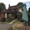
The Boat Inn (Ashleworth)

 
Temporarily closed (April 2023)
Rodway Lane, Sandhurst GL19 4HZ, United Kingdom
 
Information about the place
 
 
The nearest place in the direction of Severn - Coombe Hill Canal Junction is Wainlodes Hill; 1 mile and 7½ furlongs away.

There is no access to the towpath here.

Mooring here is impossible (it may be physically impossible, forbidden, or allowed only for specific short-term purposes).

Haw Bridge CRT Visitor Moorings3 miles, 1¾ furlongs
Unidentifed Sluice2 miles, 2½ furlongs
Severn - Coombe Hill Canal Junction2 miles, 1¾ furlongs
Severn - Chelt Junction2 miles, 1 furlong
Wainlodes Hill1 mile, 7½ furlongs
The Boat Inn (Ashleworth)
Upper Parting Junction2 miles, 2½ furlongs
The White Horse3 miles, ½ furlongs
Globe Bend3 miles, ¾ furlongs
Waltham Bridge4 miles
Black Bridge4 miles, 2 furlongs
 
 
Amenities

Amenities nearby at Wainlodes Hill

 Red Lion Pub Caravan & Camping Park
 
Maps
If you are a user and are logged on, or if you are actively planning a route, a map will be displayed here.
Show on external mapping site: Google | OSM | Bing
 
Navigational Notes

The pontoon has been removed, no longer possible to moor here

 
Photos
 
External websites
 The Boat Inn — associated with this page
The Boat Inn is a friendly, award winning country pub located on the west bank of the River Severn at Ashleworth in Gloucestershire  THE BOAT INN New landlords Mark and Chelsea Fox look forward to meeting customers old and new at the Boat Inn. The pub is warm, and the ale is cool at this…
 
Nearest facilities

Mouseover for more information or show routes to facility

Nearest water point

In the direction of Gloucester / Sharpness - Severn Junction

Gloucester Dock Lock4 miles, 7½ furlongs away
Travel to Gloucester / Sharpness - Severn Junction, then on the Gloucester and Sharpness Canal to Gloucester Dock Lock
Gloucester Waterways Museum Arm5 miles, ¼ furlongs and 1 lock away
Travel to Gloucester / Sharpness - Severn Junction, then on the Gloucester and Sharpness Canal to Gloucester Waterways Museum Arm
Llanthony Road Bridge5 miles, ¾ furlongs and 1 lock away
Travel to Gloucester / Sharpness - Severn Junction, then on the Gloucester and Sharpness Canal to Llanthony Road Bridge
Llanthony Pontoons5 miles, 1½ furlongs and 1 lock away
Travel to Gloucester / Sharpness - Severn Junction, then on the Gloucester and Sharpness Canal to Llanthony Pontoons
Sellars Bridge8 miles, 7½ furlongs and 1 lock away
Travel to Gloucester / Sharpness - Severn Junction, then on the Gloucester and Sharpness Canal to Sellars Bridge
Saul Junction Winding Hole12 miles, 6 furlongs and 1 lock away
Travel to Gloucester / Sharpness - Severn Junction, then on the Gloucester and Sharpness Canal to Saul Junction Winding Hole
Saul Junction Marina12 miles, 6¾ furlongs and 1 lock away
Travel to Gloucester / Sharpness - Severn Junction, then on the Gloucester and Sharpness Canal to Saul Junction, then on the Cotswold Canals (Stroudwater Navigation - Navigable Section) to Saul Junction Marina
Cotswold Canals Trust Visitor Centre - Saul Junction12 miles, 6¾ furlongs and 1 lock away
Travel to Gloucester / Sharpness - Severn Junction, then on the Gloucester and Sharpness Canal to Cotswold Canals Trust Visitor Centre - Saul Junction
Fretherne Bridge13 miles, 4 furlongs and 1 lock away
Travel to Gloucester / Sharpness - Severn Junction, then on the Gloucester and Sharpness Canal to Fretherne Bridge
Splatt Bridge14 miles, 4¾ furlongs and 1 lock away
Travel to Gloucester / Sharpness - Severn Junction, then on the Gloucester and Sharpness Canal to Splatt Bridge
Patch Bridge16 miles, 3½ furlongs and 1 lock away
Travel to Gloucester / Sharpness - Severn Junction, then on the Gloucester and Sharpness Canal to Patch Bridge
Purton Lower Bridge18 miles, 7¼ furlongs and 1 lock away
Travel to Gloucester / Sharpness - Severn Junction, then on the Gloucester and Sharpness Canal to Purton Lower Bridge

In the direction of Diglis Junction

Tewkesbury Lower Lode6 miles, 6½ furlongs away
On this waterway in the direction of Diglis Junction
Upper Lode Lock No 57 miles, 4¾ furlongs away
On this waterway in the direction of Diglis Junction
Tewkesbury Services8 miles, 2¾ furlongs and 2 locks away
Travel to Tewkesbury Junction, then on the River Avon - Warwickshire (Lower Avon Navigation) to Tewkesbury Services
Bredon11 miles, 6½ furlongs and 2 locks away
Travel to Tewkesbury Junction, then on the River Avon - Warwickshire (Lower Avon Navigation) to Bredon
Strensham Lock13 miles, 6¾ furlongs and 2 locks away
Travel to Tewkesbury Junction, then on the River Avon - Warwickshire (Lower Avon Navigation) to Strensham Lock

Nearest rubbish disposal

In the direction of Gloucester / Sharpness - Severn Junction

Llanthony Road Bridge5 miles, ¾ furlongs and 1 lock away
Travel to Gloucester / Sharpness - Severn Junction, then on the Gloucester and Sharpness Canal to Llanthony Road Bridge
Sellars Bridge8 miles, 7½ furlongs and 1 lock away
Travel to Gloucester / Sharpness - Severn Junction, then on the Gloucester and Sharpness Canal to Sellars Bridge
Parkend Bridge11 miles, 1 furlong and 1 lock away
Travel to Gloucester / Sharpness - Severn Junction, then on the Gloucester and Sharpness Canal to Parkend Bridge
Saul Junction Winding Hole12 miles, 6 furlongs and 1 lock away
Travel to Gloucester / Sharpness - Severn Junction, then on the Gloucester and Sharpness Canal to Saul Junction Winding Hole
Saul Junction Marina12 miles, 6¾ furlongs and 1 lock away
Travel to Gloucester / Sharpness - Severn Junction, then on the Gloucester and Sharpness Canal to Saul Junction, then on the Cotswold Canals (Stroudwater Navigation - Navigable Section) to Saul Junction Marina
Fretherne Bridge13 miles, 4 furlongs and 1 lock away
Travel to Gloucester / Sharpness - Severn Junction, then on the Gloucester and Sharpness Canal to Fretherne Bridge
Splatt Bridge14 miles, 4¾ furlongs and 1 lock away
Travel to Gloucester / Sharpness - Severn Junction, then on the Gloucester and Sharpness Canal to Splatt Bridge
Patch Bridge16 miles, 3½ furlongs and 1 lock away
Travel to Gloucester / Sharpness - Severn Junction, then on the Gloucester and Sharpness Canal to Patch Bridge
Purton Lower Bridge18 miles, 7¼ furlongs and 1 lock away
Travel to Gloucester / Sharpness - Severn Junction, then on the Gloucester and Sharpness Canal to Purton Lower Bridge

In the direction of Diglis Junction

Tewkesbury Services8 miles, 2¾ furlongs and 2 locks away
Travel to Tewkesbury Junction, then on the River Avon - Warwickshire (Lower Avon Navigation) to Tewkesbury Services

Nearest place to turn

In the direction of Gloucester / Sharpness - Severn Junction

Upper Parting Junction2 miles, 2½ furlongs away
On this waterway in the direction of Gloucester / Sharpness - Severn Junction
Gloucester / Sharpness - Severn Junction4 miles, 7¼ furlongs away
On this waterway in the direction of Gloucester / Sharpness - Severn Junction Travel to Gloucester / Sharpness - Severn Junction, then on the Gloucester and Sharpness Canal to Waterways Office (South Wales and Severn Waterways) - Canal & River Trust
Over Winding Hole4 miles, ½ furlongs and 2 locks away
Travel to Upper Parting Junction, then on the River Severn (Maisemore Channel - Northern Section) to Over Junction, then on the Hereford and Gloucester Canal to Over Winding Hole
Gloucester Docks5 miles and 1 lock away
Travel to Gloucester / Sharpness - Severn Junction, then on the Gloucester and Sharpness Canal to Gloucester Docks
Monk Meadow Dock5 miles, 4 furlongs and 1 lock away
Travel to Gloucester / Sharpness - Severn Junction, then on the Gloucester and Sharpness Canal to Monk Meadow Dock
Quedgeley Oil Depot8 miles, 6¼ furlongs and 1 lock away
Travel to Gloucester / Sharpness - Severn Junction, then on the Gloucester and Sharpness Canal to Quedgeley Oil Depot
Pegthorne Bridge Winding Hole12 miles, ¾ furlongs and 1 lock away
Travel to Gloucester / Sharpness - Severn Junction, then on the Gloucester and Sharpness Canal to Pegthorne Bridge Winding Hole
Saul Junction Winding Hole12 miles, 6 furlongs and 1 lock away
Travel to Gloucester / Sharpness - Severn Junction, then on the Gloucester and Sharpness Canal to Saul Junction Winding Hole
The Ocean16 miles, 4¼ furlongs and 9 locks away
Travel to Gloucester / Sharpness - Severn Junction, then on the Gloucester and Sharpness Canal to Saul Junction, then on the Cotswold Canals (Stroudwater Navigation - Navigable Section) to Walk Bridge, then on the Cotswold Canals (Stroudwater Navigation - Un-navigable Section) to The Ocean
Ryeford Winding Hole17 miles, 4 furlongs and 9 locks away
Travel to Gloucester / Sharpness - Severn Junction, then on the Gloucester and Sharpness Canal to Saul Junction, then on the Cotswold Canals (Stroudwater Navigation - Navigable Section) to Walk Bridge, then on the Cotswold Canals (Stroudwater Navigation - Un-navigable Section) to Ryeford Winding Hole

In the direction of Diglis Junction

Upper Lode Lock Weir Exit7 miles, 2¾ furlongs away
On this waterway in the direction of Diglis Junction
Upper Lode Lock Weir Entrance7 miles, 5½ furlongs and 1 lock away
On this waterway in the direction of Diglis Junction
Avon Lock Junction8 miles, 2½ furlongs and 2 locks away
Travel to Tewkesbury Junction, then on the River Avon - Warwickshire (Lower Avon Navigation) to Avon Lock Junction
Abbey Mill Tewkesbury8 miles, 3½ furlongs and 2 locks away
Travel to Tewkesbury Junction, then on the River Avon - Warwickshire (Lower Avon Navigation) to Avon Lock Junction, then on the River Avon - Warwickshire (Mill Avon) to Abbey Mill Tewkesbury
Tewkesbury Marina Entrance No 28 miles, 6¼ furlongs and 2 locks away
Travel to Tewkesbury Junction, then on the River Avon - Warwickshire (Lower Avon Navigation) to Tewkesbury Marina Entrance No 2
Nafford Lock Weir Exit No 217 miles, 1¼ furlongs and 3 locks away
Travel to Tewkesbury Junction, then on the River Avon - Warwickshire (Lower Avon Navigation) to Nafford Lock Weir Exit No 2
Nafford Lock Weir Entrance No 117 miles, 2¼ furlongs and 4 locks away
Travel to Tewkesbury Junction, then on the River Avon - Warwickshire (Lower Avon Navigation) to Nafford Lock Weir Entrance No 1
Direction of TV transmitter (From Wolfbane Cybernetic)
 
 
Geograph
 
Wikipedia

Wikipedia has a page about The Boat Inn

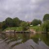
Ashleworth (sometimes formerly spelled ‘Ashelworth’) is a village and civil parish in the Tewkesbury district of Gloucestershire, England, with a population of 540 (United Kingdom Census 2011), about six miles north of Gloucester. It has a riverside pub, the Boat Inn. The oldest part of the village is Ashleworth Quay, on a flood plain on the west bank of the River Severn.

Other Wikipedia pages that might relate to The Boat Inn
[Ashleworth] Ashleworth (sometimes formerly spelled ‘Ashelworth’) is a village and civil parish in the Tewkesbury district of Gloucestershire, England, with a population [Ashleworth Court] Ashleworth Court is a grade I listed house close to the River Severn in Ashleworth, Gloucestershire, England. The site has revealed pottery from Roman [Ashleworth Tithe Barn] Ashleworth Tithe Barn is a large 15th-century tithe barn located at Ashleworth, Gloucestershire, England, standing close to the River Severn. It is a Grade [Ashleworth Ham] Ashleworth Ham (grid reference SO833263) is a 104.73-hectare (258.8-acre) biological Site of Special Scientific Interest. It is a large area of grassland [Foscombe] Foscombe is a grade II* listed country house in Ashleworth, Gloucestershire. It was built around 1860 in the Gothic Revival style for the personal use [Thomas Fulljames (surveyor)] practice in Gloucestershire from the 1790s. By 1800 he was farming in Ashleworth where he was also lord of the manor. In 1806 he purchased Hasfield Court [List of United Kingdom locations: As-Az] Hampshire 50°49′N 1°20′W / 50.82°N 01.34°W / 50.82; -01.34 SU4603 Ashleworth Gloucestershire 51°55′N 2°16′W / 51.92°N 02.27°W / 51.92; -02.27 SO8125 [List of National Trust properties in England] (Essex) Coggeshall Grange Barn Hatfield Forest Paycocke's Rayleigh Mount Ashleworth Tithe Barn Bibury Chedworth Roman Villa Dyrham Park Hailes Abbey Haresfield [Thomas Fulljames] Severn, which was never built. He built Foscombe house for his own use in Ashleworth, Gloucestershire, which has been classified as a grade II* heritage building [Adeliza of Louvain] Middlesex, and Devon. As a gift from Henry I, she was given a property in Ashleworth, a component of the royal estate of Berkeley. In 1126 the whole county
 
Google

Results of Google Search

Ashleworth - Wikipedia
Ashleworth (sometimes formerly spelled 'Ashelworth') is a village and civil parish in the Tewkesbury district of Gloucestershire, England, with a population of 540 ...
Pictures of Ashleworth
About Ashleworth. Add town to favourites. This is a lovely pastoral village set beside the west bank of the River Severn, in the middle of a typical rural ...
Home - Ashleworth Church of England Primary School
Ashleworth C of E Primary School is a small village school located in the centre of the charming village of Ashleworth. We are a Gloucestershire County Council ...
Ashleworth - Home
Ashleworth village website created by the Parish Council with links to key elements of the community.
Nup End Green, Ashleworth | Redcliffe Homes | New Homes for Sale
Nup End Green is a stylish new development of quality homes located in the picturesque Village of Ashleworth. LAST CHANCE TO BUY - Just two homes ...
Ashleworth, Gloucestershire, United Kingdom Today, Tonight ...
Get the forecast for today, tonight & tomorrow's weather for Ashleworth, Gloucestershire, United Kingdom. Hi/Low, RealFeel®, precip, radar, & everything you ...
Properties For Sale in Ashleworth | Rightmove
Flats & Houses For Sale in Ashleworth - Find properties with Rightmove - the UK's largest selection of properties.
Ashleworth Tithe Barn | National Trust
Explore the National Trust's 15th-century Ashleworth Tithe Barn in Gloucestershire.
Christmas Tree Farm, Ashleworth - Home | Facebook
Christmas Tree Farm, Ashleworth, Ashleworth, Gloucestershire. 650 likes. Come and choose a beautiful fresh Christmas Tree, grown locally at Scarifour...
Ashleworth Ham | Gloucestershire Wildlife Trust
Ashleworth Ham Nature Reserve lies in the floodplains of the Severn Vale and is part of a much larger Site of Special Scientific Interest. It floods easily ...