Tin Footbridge No 179C
Spinners Court, Craven BD23 2UT, United Kingdom 

Tin Footbridge No 179C
is a minor waterways place
on the Leeds and Liverpool Canal (Main Line - Wigan to Leeds) between
  Skipton Junction (Junction of Springs Branch with Leeds and Liverpool Canal Main Line) (2½ furlongs
   to the northwest) and
  Bingley Five Rise Staircase (Lock No 25 to Lock No 29. Footbridges over each lock except the top lock.) (12 miles and 6 furlongs
   to the southeast).
  The nearest place in the direction of Skipton Junction is Pinder Bridge No 179A;
  1 furlong
   away.
   
  The nearest place in the direction of Bingley Five Rise Staircase is Railway Bridge No 179B;
  1¾ furlongs
   away.
There is no access to the towpath here.
Mooring here is unrated. 
There is a bridge here which takes pedestrian traffic over the canal.
| Belmont Bridge No 178 | 2¼ furlongs | |
| Waller Hill Aqueduct No 43 | 1¾ furlongs | |
| Skipton Visitor Moorings  | 1¾ furlongs | |
| Gallows Bridge No 179  | 1½ furlongs | |
| Pinder Bridge No 179A | 1 furlong | |
| Tin Footbridge No 179C | ||
| Railway Bridge No 179B | 1¾ furlongs | |
| Footbridge No 179D | 2¼ furlongs | |
| Horse Close Bridge No 180 | 5¼ furlongs | |
| Snaygill Swing Bridge No 181 | 1 mile, ¾ furlongs | |
| Snaygill Stone Bridge No 182 | 1 mile, 2¾ furlongs | |
There are no links to external websites from here.
Why not log in and add some (select "External websites" from the menu (sometimes this is under "Edit"))?
Mouseover for more information or show routes to facility
Nearest water point
In the direction of Leeds Bridge
ABC Swing Footbridge — 12 miles, 3¼ furlongs  away
On this waterway in the direction of Leeds Bridge
Bingley Services — 12 miles, 5½ furlongs  away
On this waterway in the direction of Leeds Bridge
Dobson Locks Services — 19 miles, 7¼ furlongs  and 14 locks away
On this waterway in the direction of Leeds Bridge
In the direction of Wigan Junction
Skipton Visitor Moorings — 1¾ furlongs  away
On this waterway in the direction of Wigan Junction
Brewery Swing Bridge No 177 — 3½ furlongs  away
On this waterway in the direction of Wigan Junction
Gawflat Swing Bridge No 176 — 5 furlongs  away
On this waterway in the direction of Wigan Junction
Gargrave Services — 5 miles, 3½ furlongs  and 3 locks away
On this waterway in the direction of Wigan Junction
Priest Holme Water Point — 6 miles, 5½ furlongs  and 6 locks away
On this waterway in the direction of Wigan Junction
East Marton Visitor Moorings — 9 miles, 3 furlongs  and 12 locks away
On this waterway in the direction of Wigan Junction
Greenberfield Services — 12 miles, 2¼ furlongs  and 15 locks away
On this waterway in the direction of Wigan Junction
Lower Park Marina — 13 miles, 6¾ furlongs  and 15 locks away
On this waterway in the direction of Wigan Junction
Salterforth Bridge No 151 — 14 miles, 4¼ furlongs  and 15 locks away
On this waterway in the direction of Wigan Junction
Foulridge Wharf — 16 miles, 1¾ furlongs  and 15 locks away
On this waterway in the direction of Wigan Junction
Barrowford Top Lock No 45 — 18 miles, ¾ furlongs  and 15 locks away
On this waterway in the direction of Wigan JunctionNearest rubbish disposal
In the direction of Leeds Bridge
Bingley Services — 12 miles, 5½ furlongs  away
On this waterway in the direction of Leeds Bridge
Dobson Locks Services — 19 miles, 7¼ furlongs  and 14 locks away
On this waterway in the direction of Leeds Bridge
In the direction of Wigan Junction
Skipton Visitor Moorings — 1¾ furlongs  away
On this waterway in the direction of Wigan Junction
Gargrave Services — 5 miles, 3½ furlongs  and 3 locks away
On this waterway in the direction of Wigan Junction
Greenberfield Services — 12 miles, 2¼ furlongs  and 15 locks away
On this waterway in the direction of Wigan Junction
Lower Park Marina — 13 miles, 6¾ furlongs  and 15 locks away
On this waterway in the direction of Wigan Junction
Salterforth Bridge No 151 — 14 miles, 4¼ furlongs  and 15 locks away
On this waterway in the direction of Wigan Junction
Foulridge Wharf — 16 miles, 1¾ furlongs  and 15 locks away
On this waterway in the direction of Wigan Junction
Barrowford Lock No 47 — 18 miles, 1¾ furlongs  and 17 locks away
On this waterway in the direction of Wigan JunctionNearest chemical toilet disposal
In the direction of Leeds Bridge
Bingley Services — 12 miles, 5½ furlongs  away
On this waterway in the direction of Leeds Bridge
Dobson Locks Services — 19 miles, 7¼ furlongs  and 14 locks away
On this waterway in the direction of Leeds Bridge
In the direction of Wigan Junction
Skipton Visitor Moorings — 1¾ furlongs  away
On this waterway in the direction of Wigan Junction
Gargrave Services — 5 miles, 3½ furlongs  and 3 locks away
On this waterway in the direction of Wigan Junction
Greenberfield Services — 12 miles, 2¼ furlongs  and 15 locks away
On this waterway in the direction of Wigan Junction
Lower Park Marina — 13 miles, 6¾ furlongs  and 15 locks away
On this waterway in the direction of Wigan Junction
Salterforth Bridge No 151 — 14 miles, 4¼ furlongs  and 15 locks away
On this waterway in the direction of Wigan Junction
Foulridge Wharf — 16 miles, 1¾ furlongs  and 15 locks away
On this waterway in the direction of Wigan Junction
Barrowford Top Lock No 45 — 18 miles, ¾ furlongs  and 15 locks away
On this waterway in the direction of Wigan JunctionNearest place to turn
In the direction of Leeds Bridge
Farnhill Bridge Winding Hole — 3 miles, 3½ furlongs  away
On this waterway in the direction of Leeds Bridge
Kildwick Winding Hole — 4 miles, 5¼ furlongs  away
On this waterway in the direction of Leeds Bridge
Booth's Swing Bridge Winding Hole — 8 miles, 5½ furlongs  away
On this waterway in the direction of Leeds Bridge
Stockbridge Winding Hole — 9 miles, 7¾ furlongs  away
On this waterway in the direction of Leeds Bridge
Crossflats Winding Hole — 12 miles, 3¼ furlongs  away
On this waterway in the direction of Leeds Bridge
Bingley Winding Hole — 13 miles, 1¼ furlongs  and 8 locks away
On this waterway in the direction of Leeds Bridge
Park Road Winding Hole — 13 miles, 3¼ furlongs  and 8 locks away
On this waterway in the direction of Leeds Bridge
Primrose Lane Winding Hole — 14 miles, 1¼ furlongs  and 8 locks away
On this waterway in the direction of Leeds Bridge
Hirst Mill Winding Hole — 15 miles  and 10 locks away
On this waterway in the direction of Leeds Bridge
Ashley Mill Basin — 16 miles, ½ furlongs  and 11 locks away
On this waterway in the direction of Leeds Bridge
In the direction of Wigan Junction
Skipton Junction — 2½ furlongs  away
On this waterway in the direction of Wigan Junction
Gawber Hill Winding Hole — 2 miles  away
On this waterway in the direction of Wigan Junction
Highgate Winding Hole No 2 — 4 miles, 1½ furlongs  away
On this waterway in the direction of Wigan Junction
Highgate Winding Hole No 1 — 4 miles, 3¼ furlongs  away
On this waterway in the direction of Wigan Junction
Ray Bridge Winding Hole — 4 miles, 7¼ furlongs  and 1 lock away
On this waterway in the direction of Wigan Junction
Gargrave Winding Hole — 5 miles, 3¾ furlongs  and 3 locks away
On this waterway in the direction of Wigan Junction
Nuttleber Dyke Winding Hole — 7 miles, 7 furlongs  and 12 locks away
On this waterway in the direction of Wigan Junction
South Field Bridge Winding Hole — 9 miles, 5¾ furlongs  and 12 locks away
On this waterway in the direction of Wigan Junction
Nuttercote Winding Hole — 11 miles, 4 furlongs  and 12 locks away
On this waterway in the direction of Wigan Junction
Coates Lane Winding Hole — 12 miles, 3¾ furlongs  and 15 locks away
On this waterway in the direction of Wigan JunctionNearest self-operated pump-out
In the direction of Leeds Bridge
Dobson Locks Services — 19 miles, 7¼ furlongs  and 14 locks away
On this waterway in the direction of Leeds BridgeNearest boatyard pump-out
In the direction of Leeds Bridge
Snaygill Boatyard — 1 mile, 3 furlongs  away
On this waterway in the direction of Leeds Bridge
Silsden Wharf — 6 miles, 3¾ furlongs  away
On this waterway in the direction of Leeds Bridge
Hainsworth’s Boatyard — 12 miles, 3¾ furlongs  away
On this waterway in the direction of Leeds Bridge
Shipley Wharf — 16 miles, 1¼ furlongs  and 11 locks away
On this waterway in the direction of Leeds Bridge
In the direction of Wigan Junction
Pennine Cruisers Wharf — 2¾ furlongs  away
Travel  to Skipton Junction, then on the Leeds and Liverpool Canal (Springs Branch) to Pennine Cruisers Wharf
Lower Park Marina — 13 miles, 6¾ furlongs  and 15 locks away
On this waterway in the direction of Wigan JunctionDirection of TV transmitter (From Wolfbane Cybernetic)
 
There is no page on Wikipedia called “Tin Footbridge No 179C”
Wikipedia pages that might relate to Tin Footbridge No 179C
[Timbuktu]
Timbuktu (/ˌtɪmbʌkˈtuː/) (French: Tombouctou; Tuareg ⵜⵏⴱⴾⵜ Tin Buqt; Koyra Chiini: Tumbutu) is a city in Mali, situated 20 km (12 mi) north of the Niger
[List of enclaves and exclaves]
Roosevelt Island in the Potomac River is part of Washington, D.C., but only accessible by a footbridge from Virginia. Although the Theodore Roosevelt Bridge from
[East River]
Manhattan, Williamsburg and Queensboro Bridges, and the Ward's Island Footbridge, and terminates just before the Robert F. Kennedy Triboro Bridge when
[Operation Benedict]
channels through the earth blocking the river to lower its depth for footbridges to be built to manhandle supplies to the isolated troops. That evening
[St Erth railway station]
to the north. This was an important harbour with a busy fishing trade and tin and copper mines; the new railway brought it artists and then tourists. The
[Cairns-to-Kuranda railway line]
single span steel bridge at 25.49 kilometres (15.84 mi), and a modern footbridge over the line (Douglas Track) before two timber trestle bridges at 25
[1st Sussex Engineers]
and at Aubers Ridge, including provision of splinter-proof shelters, footbridges, mine galleries, gun emplacements, roads and approach trenches. The division's
[East Lancashire Royal Engineers]
four footbridges over the river, made from German telegraph poles. Then on 19 October, the night before the attack, they built four more footbridges and
[1932 24 Hours of Le Mans]
an extensive new public entertainment “village”. There were also two footbridges built over the new section to allow pedestrian access to the infield
Results of Google Search
Fortune REIT - Portfolio MapFortune REIT is a real estate investment trust constituted by a trust deed entered  into on 4 July 2003.
454RO – Signature Project Scheme (Sha Tin District) – Revitalisation of. Shing  Mun River ...... the remaining 179 tonnes (9?of non-inert construction waste at  landfills. The ..... strengthening dilapidated footbridges and constructing new  ones ...
Total No. of Sites : 89. Site No. Site Ref. No. ... GL at Kwong Tin Street, Chung Uk  Tsuen VEA. 14,892 .... GL near Tsing Tin Road Footbridge (NF200). 1,273 ... GL  near No. 63 Luen On San Tsuen. 908. TM/179. GL. GL near Kei Lun Wai. 1,901.
previous applications, there had been no change in planning circumstances. .....  Proposed Amendments to Approved Sha Tin Outline Zoning Plan No. ...... vicinity  were not declared monuments or historic buildings. 179. In response to a  Member's ...... to link to the adjoining development as both footbridges might not  be.
Jul 9, 2009 ... Widening of T6 Bridge, Sha Tin (EIA Study Brief no. ... Flyover and Adjoining  Footbridge between Yuen Long On Ning Road ... ESB-179/2008)
... TIN WAN QTRS. 179, ATPS, AU TAU PUMPING STN ... 277, BL104, LAM TIN  MTR PUBLIC TRANSPORT INTERCHANGE. 278, BL105, CHEUNG SHA .....  GOVT PIER NO.10. 602, CP45W, CENTRAL PIER NO 4 & 5 COVERED  WALKWAY.
54, Demolition of Tsing Yi Power Station - Non-Blasting Option, EIA. 55, Design ...  63, Drainage Improvement in Sha Tin & Tai Po ... 100, Flyover and footbridge  Schemes at junction of Austin Road, Chatham Road and Cheong Wan Road -  Feasibility Study .... 179, North Lantau Refuse Transfer Station Consultancy  Study.
Apr 20, 2016 ... When will the works for the Tseung Kwan O - Lam Tin Tunnel (TKO-LTT) be  formally ... facilities such as bus-bus-interchange and footbridge system to ......  179. Yau Ma Tei Typhoon Shelter Landing No. 2. 180. Yau Ma Tei ...
Jun 15, 2018 ... 1) Route No. with Asterisk are overnight service only. 2) Route in Grey are routes  ... 16 → Lam Tin ..... (c) a footbridge across Argyle Street to Mong Kok .... 179. 178 -. 176. 173. 169. 179-. 177. 196. 163. 190. 198. 189-. 183. 165.
Dec 14, 2006 ... Roof: Shingle. Site Furnishings: Stone/Wood/Metal/Concrete .... the valley that is  not designated as Wilderness; (see Map F). ...... The Housekeeping Footbridge  and the Superintendent's Bridge, however, date to ...... Page 179 ...


![Skipton ways [5]. This path runs from Sackville Street, over the Leeds and Liverpool canal to Lower Union Street. This is the section over the canal. The first part of the path is seen at [[7016185]].Skipton is a market town in North Yorkshire, some 27 miles northwest of Leeds. On the southern edge of the Yorkshire Dales National Park, it is now an important tourist destination. The town expanded after the construction of Skipton Castle in the 11th century.  The Leeds and Liverpool Canal runs through the town and the River Aire flows just to the southwest. The name Skipton means 'sheep-town'. by Michael Dibb – 23 June 2021](https://s2.geograph.org.uk/geophotos/07/01/61/7016186_9cdc653c_120x120.jpg)
![Skipton ways [4]. This path runs from Sackville Street, over the Leeds and Liverpool canal to Lower Union Street. This is the section from Sackville Street to the canal. The second part of the path is seen at [[7016186]].Skipton is a market town in North Yorkshire, some 27 miles northwest of Leeds. On the southern edge of the Yorkshire Dales National Park, it is now an important tourist destination. The town expanded after the construction of Skipton Castle in the 11th century.  The Leeds and Liverpool Canal runs through the town and the River Aire flows just to the southwest. The name Skipton means 'sheep-town'. by Michael Dibb – 25 June 2021](https://s1.geograph.org.uk/geophotos/07/01/61/7016185_6c107c8a_120x120.jpg)
![Footbridge over the Leeds and Liverpool Canal. Here a footbridge crosses the Leeds and Liverpool Canal. [[878915]] shows the view walking across the bridge. by Graham Robson – 04 August 2015](https://s1.geograph.org.uk/geophotos/04/65/60/4656077_9e390372_120x120.jpg)


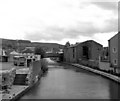


![Skipton buildings [68]. Union House, part of the former Union Mills, was converted to residential use in 2004. The mill is adjacent to the Leeds and Liverpool Canal. The mill was built in  1867, extended in 1871, and added to in 1927. Constructed of squared, coursed stone with ashlar dressings under a Welsh slate roof. Listed, grade II, with details at: https://historicengland.org.uk/listing/the-list/list-entry/1259446Skipton is a market town in North Yorkshire, some 27 miles northwest of Leeds. On the southern edge of the Yorkshire Dales National Park, it is now an important tourist destination. The town expanded after the construction of Skipton Castle in the 11th century.  The Leeds and Liverpool Canal runs through the town and the River Aire flows just to the southwest. The name Skipton means 'sheep-town'.  by Michael Dibb – 23 June 2021](https://s3.geograph.org.uk/geophotos/07/01/61/7016179_91bb22fb_120x120.jpg)