Sandiacre
is a town
on the Grand Union Canal (Erewash Canal) between
  Potter's Lock Bridge (3 miles and 5 furlongs
    and 5 locks
   to the north) and
  A52 Road Bridge (3 furlongs
   to the south).
  The nearest place in the direction of Potter's Lock Bridge is Mill Lane Footbridge;
  1¼ furlongs
   away.
   
  The nearest place in the direction of A52 Road Bridge is Sandiacre Bridge;
  ¾ furlongs
   away.
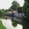
Mooring here is good (a nice place to moor). Mooring with bollards is available on both sides of the canal, although the road along the west side is quite busy. Signed locally as Padmore Moorings.
| M1 Motorway Bridge | 1 mile, 2 furlongs | |
| Stanton Gate Bridge | 1 mile, 1 furlong | |
| Pasture Lock No 64 | 7½ furlongs | |
| Footbridge (Sandiacre) | 5¾ furlongs | |
| Mill Lane Footbridge | 1¼ furlongs | |
| Sandiacre | ||
| Sandiacre Bridge | ¾ furlongs | |
| A52 Road Bridge | 3 furlongs | |
| Sandiacre Junction | 4¼ furlongs | |
| Sandiacre Lock No 63 | 4½ furlongs | |
| Sandiacre Lock Footbridge | 4¾ furlongs | |
- Grand Union Canal Walk — associated with Grand Union Canal
- An illustrated walk along the Grand Union Canal from London to Birmingham
Mouseover for more information or show routes to facility
Nearest water point
In the direction of Trent Junction
Former BW Trent Lock Waterway Office — 3 miles, 5¾ furlongs  and 3 locks away
On this waterway in the direction of Trent Junction
Sawley Locks No 2 — 4 miles, 5¾ furlongs  and 4 locks away
Travel  to Trent Junction, then on the River Trent (Western End) to Sawley Locks No 2
Cranfleet Lock No 3 — 4 miles, 4¼ furlongs  and 5 locks away
Travel  to Trent Junction, then on the River Trent (Western End) to Cranfleet Lock No 3
Shardlow — 6 miles, 7½ furlongs  and 7 locks away
Travel  to Trent Junction, then on the River Trent (Western End) to Derwent Mouth, then on the Trent and Mersey Canal (Main Line - Derwent Mouth to Burton) to Shardlow
Beeston Lock No 5 — 8 miles, 6¾ furlongs  and 6 locks away
Travel  to Trent Junction, then on the River Trent (Western End) to Beeston Lock No 5
Weston Lock No 4 — 9 miles, 7¼ furlongs  and 9 locks away
Travel  to Trent Junction, then on the River Trent (Western End) to Derwent Mouth, then on the Trent and Mersey Canal (Main Line - Derwent Mouth to Burton) to Weston Lock No 4
Bishop Meadow Lock No 54 — 11 miles, 7¾ furlongs  and 9 locks away
Travel  to Trent Junction, then on the Grand Union Canal (Leicester Section - River Soar Navigation) to Bishop Meadow Lock No 54
Swarkestone Lock No 5 — 13 miles, ½ furlongs  and 8 locks away
Travel  to Sandiacre Junction, then on the Derby and Sandiacre Canal to Swarkestone Junction, then on the Trent and Mersey Canal (Main Line - Derwent Mouth to Burton) to Swarkestone Lock No 5
Loughborough Basin — 13 miles, ½ furlongs  and 11 locks away
Travel  to Trent Junction, then on the Grand Union Canal (Leicester Section - River Soar Navigation) to Loughborough Branch Junction, then on the Grand Union Canal (Leicester Section - Loughborough Branch) to Loughborough Basin
Holme Lock No 5 — 17 miles, 1 furlong  and 9 locks away
Travel  to Trent Junction, then on the River Trent (Western End) to Beeston Lock No 5, then on the River Trent (Beeston Canal) to Lenton Chain, then on the River Trent (Nottingham Canal) to Meadow Lane Junction, then on the River Trent (non-tidal section) to Holme Lock No 5
Willington Services — 18 miles, 2½ furlongs  and 9 locks away
Travel  to Sandiacre Junction, then on the Derby and Sandiacre Canal to Swarkestone Junction, then on the Trent and Mersey Canal (Main Line - Derwent Mouth to Burton) to Willington Services
Barrow Boating — 17 miles  and 13 locks away
Travel  to Trent Junction, then on the Grand Union Canal (Leicester Section - River Soar Navigation) to Barrow Boating
In the direction of Derby Road Bridge
Langley Junction — 7 miles, 6½ furlongs  and 11 locks away
Travel  to Derby Road Bridge, then on the Cromford Canal (broad gauge, navigable) to Langley JunctionNearest rubbish disposal
In the direction of Trent Junction
Former BW Trent Lock Waterway Office — 3 miles, 5¾ furlongs  and 3 locks away
On this waterway in the direction of Trent Junction
Sawley Locks No 2 — 4 miles, 5¾ furlongs  and 4 locks away
Travel  to Trent Junction, then on the River Trent (Western End) to Sawley Locks No 2
Cranfleet Lock No 3 — 4 miles, 4¼ furlongs  and 5 locks away
Travel  to Trent Junction, then on the River Trent (Western End) to Cranfleet Lock No 3
Beeston Lock No 5 — 8 miles, 6¾ furlongs  and 6 locks away
Travel  to Trent Junction, then on the River Trent (Western End) to Beeston Lock No 5
Swarkestone Lock No 5 — 13 miles, ½ furlongs  and 8 locks away
Travel  to Sandiacre Junction, then on the Derby and Sandiacre Canal to Swarkestone Junction, then on the Trent and Mersey Canal (Main Line - Derwent Mouth to Burton) to Swarkestone Lock No 5
Loughborough Basin — 13 miles, ½ furlongs  and 11 locks away
Travel  to Trent Junction, then on the Grand Union Canal (Leicester Section - River Soar Navigation) to Loughborough Branch Junction, then on the Grand Union Canal (Leicester Section - Loughborough Branch) to Loughborough Basin
Holme Lock No 5 — 17 miles, 1 furlong  and 9 locks away
Travel  to Trent Junction, then on the River Trent (Western End) to Beeston Lock No 5, then on the River Trent (Beeston Canal) to Lenton Chain, then on the River Trent (Nottingham Canal) to Meadow Lane Junction, then on the River Trent (non-tidal section) to Holme Lock No 5
Willington Services — 18 miles, 2½ furlongs  and 9 locks away
Travel  to Sandiacre Junction, then on the Derby and Sandiacre Canal to Swarkestone Junction, then on the Trent and Mersey Canal (Main Line - Derwent Mouth to Burton) to Willington Services
Barrow Boating — 17 miles  and 13 locks away
Travel  to Trent Junction, then on the Grand Union Canal (Leicester Section - River Soar Navigation) to Barrow Boating
Broome Island — 17 miles, 6¼ furlongs  and 13 locks away
Travel  to Trent Junction, then on the Grand Union Canal (Leicester Section - River Soar Navigation) to Broome IslandNearest chemical toilet disposal
In the direction of Trent Junction
Former BW Trent Lock Waterway Office — 3 miles, 5¾ furlongs  and 3 locks away
On this waterway in the direction of Trent Junction
Sawley Locks No 2 — 4 miles, 5¾ furlongs  and 4 locks away
Travel  to Trent Junction, then on the River Trent (Western End) to Sawley Locks No 2
Sawley Cut Wharf — 4 miles, 7¼ furlongs  and 5 locks away
Travel  to Trent Junction, then on the River Trent (Western End) to Sawley Cut Wharf
Beeston Lock No 5 — 8 miles, 6¾ furlongs  and 6 locks away
Travel  to Trent Junction, then on the River Trent (Western End) to Beeston Lock No 5
Meadow Lane Lock No 7 — 14 miles, 5¾ furlongs  and 8 locks away
Travel  to Trent Junction, then on the River Trent (Western End) to Beeston Lock No 5, then on the River Trent (Beeston Canal) to Lenton Chain, then on the River Trent (Nottingham Canal) to Meadow Lane Lock No 7
Holme Lock No 5 — 17 miles, 1 furlong  and 9 locks away
Travel  to Trent Junction, then on the River Trent (Western End) to Beeston Lock No 5, then on the River Trent (Beeston Canal) to Lenton Chain, then on the River Trent (Nottingham Canal) to Meadow Lane Junction, then on the River Trent (non-tidal section) to Holme Lock No 5
Willington Services — 18 miles, 2½ furlongs  and 9 locks away
Travel  to Sandiacre Junction, then on the Derby and Sandiacre Canal to Swarkestone Junction, then on the Trent and Mersey Canal (Main Line - Derwent Mouth to Burton) to Willington Services
Barrow Boating — 17 miles  and 13 locks away
Travel  to Trent Junction, then on the Grand Union Canal (Leicester Section - River Soar Navigation) to Barrow Boating
Sileby Mill Mooring Basin — 19 miles, 4 furlongs  and 14 locks away
Travel  to Trent Junction, then on the Grand Union Canal (Leicester Section - River Soar Navigation) to Sileby Mill Mooring Basin
In the direction of Derby Road Bridge
Langley Junction — 7 miles, 6½ furlongs  and 11 locks away
Travel  to Derby Road Bridge, then on the Cromford Canal (broad gauge, navigable) to Langley JunctionNearest place to turn
In the direction of Trent Junction
Sandiacre Junction — 4¼ furlongs  away
On this waterway in the direction of Trent Junction
Long Eaton Winding Hole — 1 mile, 7 furlongs  and 2 locks away
On this waterway in the direction of Trent Junction
Sheet Stores Basin — 3 miles, ¾ furlongs  and 3 locks away
On this waterway in the direction of Trent Junction
Former BW Trent Lock Waterway Office — 3 miles, 5¾ furlongs  and 3 locks away
On this waterway in the direction of Trent Junction
Soar Mouth — 4 miles, ¼ furlongs  and 4 locks away
Travel  to Trent Junction, then on the Grand Union Canal (Leicester Section - River Soar Navigation) to Soar Mouth
Redhill Lock Junction — 4 miles, 3 furlongs  and 4 locks away
Travel  to Trent Junction, then on the Grand Union Canal (Leicester Section - River Soar Navigation) to Redhill Lock Junction
Sawley Lock No 2 Weir Exit — 4 miles, 5 furlongs  and 4 locks away
Travel  to Trent Junction, then on the River Trent (Western End) to Sawley Lock No 2 Weir Exit
Redhill Marine Ltd — 4 miles, 7¼ furlongs  and 5 locks away
Travel  to Trent Junction, then on the Grand Union Canal (Leicester Section - River Soar Navigation) to Redhill Marine Ltd
Ratcliffe Lock Junction — 5 miles, 1¾ furlongs  and 5 locks away
Travel  to Trent Junction, then on the Grand Union Canal (Leicester Section - River Soar Navigation) to Ratcliffe Lock Junction
Cranfleet Lock Weir Exit — 4 miles, 4¾ furlongs  and 6 locks away
Travel  to Trent Junction, then on the River Trent (Western End) to Cranfleet Lock Weir Exit
Sawley Flood Lock Weir Entrance — 5 miles, 3 furlongs  and 6 locks away
Travel  to Trent Junction, then on the River Trent (Western End) to Sawley Flood Lock Weir Entrance
Ratcliffe Weir — 5 miles, 4½ furlongs  and 6 locks away
Travel  to Trent Junction, then on the Grand Union Canal (Leicester Section - River Soar Navigation) to Ratcliffe Weir
Derwent Mouth — 5 miles, 6¾ furlongs  and 6 locks away
Travel  to Trent Junction, then on the River Trent (Western End) to Derwent Mouth
Station Road Arm — 6 miles, 5¾ furlongs  and 7 locks away
Travel  to Trent Junction, then on the Grand Union Canal (Leicester Section - River Soar Navigation) to Station Road Arm
Shardlow — 6 miles, 7½ furlongs  and 7 locks away
Travel  to Trent Junction, then on the River Trent (Western End) to Derwent Mouth, then on the Trent and Mersey Canal (Main Line - Derwent Mouth to Burton) to Shardlow
Winding Hole below Shardlow Lock — 7 miles, ¾ furlongs  and 7 locks away
Travel  to Trent Junction, then on the River Trent (Western End) to Derwent Mouth, then on the Trent and Mersey Canal (Main Line - Derwent Mouth to Burton) to Winding Hole below Shardlow Lock
In the direction of Derby Road Bridge
Winding Hole above Stanton Lock — 1 mile, 5¼ furlongs  and 2 locks away
On this waterway in the direction of Derby Road Bridge
Hallam Fields Lock Winding Hole — 2 miles, 1 furlong  and 3 locks away
On this waterway in the direction of Derby Road Bridge
Winding Hole below Stenson's Lock — 4 miles, 7¾ furlongs  and 7 locks away
On this waterway in the direction of Derby Road Bridge
Bridge Street Winding Hole — 5 miles, 3½ furlongs  and 8 locks away
On this waterway in the direction of Derby Road BridgeNearest self-operated pump-out
In the direction of Trent Junction
Mercia Marina — 17 miles, 5¼ furlongs  and 9 locks away
Travel  to Sandiacre Junction, then on the Derby and Sandiacre Canal to Swarkestone Junction, then on the Trent and Mersey Canal (Main Line - Derwent Mouth to Burton) to Mercia MarinaNearest boatyard pump-out
In the direction of Derby Road Bridge
Langley Junction — 7 miles, 6½ furlongs  and 11 locks away
Travel  to Derby Road Bridge, then on the Cromford Canal (broad gauge, navigable) to Langley Junction
In the direction of Trent Junction
Mercia Marina — 17 miles, 5¼ furlongs  and 9 locks away
Travel  to Sandiacre Junction, then on the Derby and Sandiacre Canal to Swarkestone Junction, then on the Trent and Mersey Canal (Main Line - Derwent Mouth to Burton) to Mercia Marina
Sileby Mill Mooring Basin — 19 miles, 4 furlongs  and 14 locks away
Travel  to Trent Junction, then on the Grand Union Canal (Leicester Section - River Soar Navigation) to Sileby Mill Mooring BasinDirection of TV transmitter (From Wolfbane Cybernetic)
 
Wikipedia has a page about Sandiacre
Sandiacre is a town and civil parish in the borough of Erewash in Derbyshire, in the East Midlands region of England adjoining the border with Nottinghamshire. The population of the town was 8,889 at the 2011 Census.
The name Sandiacre is usually thought to refer to a sandy acre, though another interpretation, based on Saint Diacre, is sometimes advanced.
Other Wikipedia pages that might relate to Sandiacre
[Stapleford and Sandiacre railway station]
Stapleford and Sandiacre railway station served the towns of Stapleford, Nottinghamshire and Sandiacre, Derbyshire, England from 1847 to 1967 on the Erewash
[St Giles' Church, Sandiacre]
St Giles’ Church, Sandiacre is a Grade I listed parish church in the Church of England in Sandiacre, Derbyshire. The church dates from the 11th century
[Sandiacre Town Cricket Club]
Sandiacre Town Cricket Club is an amateur cricket club based in Sandiacre, Derbyshire, England. The club was established in 1877 and has won the ECB National
[Derby and Sandiacre Canal Trust]
The Derby and Sandiacre Canal Trust is a waterway society, a charitable trust no. 1042227, registered 21 November 1994, and a registered company No. 2956417
[1983 Erewash Borough Council election]
Sandiacre North (2 seats) Party Candidate Votes % ±% Labour Jowett M. Ms (E) 1043 Labour Barker D. (E) 943 Conservative Aindow M. 710 Conservative Tapping
[2011 Erewash Borough Council election]
Sandiacre North (2 seats) Party Candidate Votes % ±% Conservative Steve Bilbie (E) 650 23.9 Labour Michelle Wendy Booth (E) 627 23.1 Labour Linda Marie
[Spondon]
 Derby Canal (Derby – Sandiacre) opened in 1795, and enabled other industries. The canal closed in 1964. The Derby & Sandiacre Canal Trust continue in
[Sandiacre Town F.C.]
Sandiacre Town Football Club is a football club based in Sandiacre, England. Sandiacre Town Football Club was formed in 1978 by Malc Turton and Pete Smith
[1991 Erewash Borough Council election]
Sandiacre North (2 seats) Party Candidate Votes % ±% Labour Barker D. (E) 981 Labour Dickman F. (E) 902 Conservative Hardy A. 743 Conservative Tapping
Results of Google Search
Sandiacre | BW Packaging SystemsBW Flexible Systems | Sandiacre. A global manufacturer of packaging systems  that include form-fill-seal, feeding, bag filling & sealing, flow-wrap, reclosable ...
Sandiacre is a town and civil parish in the borough of Erewash in Derbyshire, in  the East Midlands region of England adjoining the border with Nottinghamshire.
Library information. Sandiacre Library; Doncaster Avenue; Sandiacre; Derbyshire ; NG10 5FJ. Tel: 01629 533 359; Fax: 0115 9491132; Email: ...
Jun 19, 2020 ... Sharon Hopkinson was at home with her granddaughter in Sandiacre,  Derbyshire, when it was struck on Wednesday. Mrs Hopkinson said she ...
Welcome to Sandiacre Parish Council's website, a valuable source of information  covering life in the community and information about the work of the Parish ...
You'll love the Sandiacre Round End Table at Wayfair - Great Deals on all  Furniture products with Free Shipping on most stuff, even the big stuff.
Guide to Sandiacre, Derbyshire ancestry, family history, and genealogy: parish  registers, transcripts, census records, birth records, marriage records, and death  ...
You'll love the Sandiacre End Table at Wayfair - Great Deals on all Furniture  products with Free Shipping on most stuff, even the big stuff.
Official information from NHS about mydentist, Risley Hill, Sandiacre including  contact details, directions, opening hours and service/treatment details.
Get your 3-Day weather forecast for Sandiacre, Derbyshire, United Kingdom. Hi/ Low, RealFeel, precip, radar, & everything you need to be ready for the day, ...


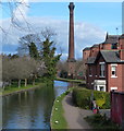
![Erewash Canal approaching Springfield Mill. Looking north to the impressive chimney and mill, which were built in 1888. This old lace factory has been converted into a set of stylish apartments.Springfield Mill - [[2461151]] by Trevor Rickard – 18 September 2010](https://s0.geograph.org.uk/geophotos/02/45/83/2458376_0e6ff75f_120x120.jpg)


![Springfield Mill. Springfield Mill stands beside the Erewash Canal and the view from the water is dominated by its chimney. Built in 1888 for lace manufacture, it had a capacity of 160 lace machines. It was converted into apartments in 2005 but a serious fire in the roof of the building in April 2020 meant that extensive repairs have had to be carried out. See also [[616341]]. by Stephen McKay – 28 June 2022](https://s2.geograph.org.uk/geophotos/07/24/81/7248178_12287c73_120x120.jpg)


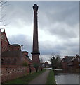


![Front entrance to Springfield Mill. Looking north along Bridge Street, which ends just ahead. This lace mill was built in 1888 by T Hooley & Co, who also built Victoria Mills in Draycott (see [[2218403]] ). Ernest Terah Hooley had a colourful life, including making several fortunes from his business and share dealings, being declared bankrupt three times and being convicted of fraud twice!When lace manufacturing ceased at Springfield Mill, it fell into a state of disrepair for many years. The Grade II listed building was converted into 105 luxury apartments by City Lofts Developments in 2006 at a cost of £15.8m. Not many were sold before it became a big casualty of the financial downturn and the company became bankrupt in 2008.Front view - [[616344]]Canal-side view - [[2458376]]E T Hooley - http://www.gracesguide.co.uk/wiki/E._T._Hooley by Trevor Rickard – 18 September 2010](https://s3.geograph.org.uk/geophotos/02/46/11/2461151_baae2b44_120x120.jpg)