CanalPlanAC

Kiveton Park Visitor Moorings

 
Red Hill, Kiveton Park, S26 6NP, United Kingdom
 
Information about the place
Kiveton Park Visitor Moorings is a minor waterways place on the Chesterfield Canal (Norwood to Retford) between Chequer House Bridge No 51 (Ranby village) (11 miles and 35 locks to the east) and Manor Road Winding Hole (Feeder from Harthill Reservoir enters at winding hole) (¾ furlongs to the west).
 
 
The nearest place in the direction of Chequer House Bridge No 51 is Dog Kennels Bridge No 31; ¾ furlongs away.

There is access (via steps) to the towpath here.

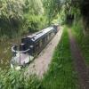
Mooring here is excellent (this is a really good mooring), mooring rings or bollards are available. Mooring is limited to 48 hours. 130ft of moorings.


Amenities

Amenities nearby at Dog Kennels Bridge No 31

 Kiveton Park Station
 
Maps
If you are a user and are logged on, or if you are actively planning a route, a map will be displayed here.
Show on external mapping site: Google | OSM | Bing
 
Photos
 
External websites
There are no links to external websites from here.
Why not log in and add some (select "External websites" from the menu (sometimes this is under "Edit"))?
 
Nearest facilities

Mouseover for more information or show routes to facility

Nearest water point

In the direction of West Retford Lock No 58

Shireoaks Marina3 miles, 3¾ furlongs and 23 locks away
On this waterway in the direction of West Retford Lock No 58
Forest Middle Top Water Point12 miles, 7½ furlongs and 36 locks away
On this waterway in the direction of West Retford Lock No 58
Forest Middle Top Lock No 5512 miles, 7¾ furlongs and 36 locks away
On this waterway in the direction of West Retford Lock No 58
Hop Pole Bridge No 5917 miles, 1½ furlongs and 41 locks away
Travel to West Retford Lock No 58, then on the Chesterfield Canal (Retford to the Trent) to Hop Pole Bridge No 59

Nearest rubbish disposal

In the direction of West Retford Lock No 58

Shireoaks Marina3 miles, 3¾ furlongs and 23 locks away
On this waterway in the direction of West Retford Lock No 58
Forest Middle Top Lock No 5512 miles, 7¾ furlongs and 36 locks away
On this waterway in the direction of West Retford Lock No 58

Nearest chemical toilet disposal

In the direction of West Retford Lock No 58

Shireoaks Marina3 miles, 3¾ furlongs and 23 locks away
On this waterway in the direction of West Retford Lock No 58
Cuckoo Wharf Elsan5 miles, 5¾ furlongs and 32 locks away
On this waterway in the direction of West Retford Lock No 58
Forest Middle Top Lock No 5512 miles, 7¾ furlongs and 36 locks away
On this waterway in the direction of West Retford Lock No 58

Nearest place to turn

In the direction of West Retford Lock No 58

Little Lane Bridge Winding Hole2 miles, 4¼ furlongs and 15 locks away
On this waterway in the direction of West Retford Lock No 58
Shireoaks Marina3 miles, 3¾ furlongs and 23 locks away
On this waterway in the direction of West Retford Lock No 58
Junction with former Lady Lee Arm4 miles, 6½ furlongs and 30 locks away
On this waterway in the direction of West Retford Lock No 58
Morse Lock Winding Hole5 miles, 2¾ furlongs and 31 locks away
On this waterway in the direction of West Retford Lock No 58
High Hoe Road Bridge Winding Hole6 miles, 3 furlongs and 33 locks away
On this waterway in the direction of West Retford Lock No 58
Ranby Bridge Winding Hole10 miles, 3 furlongs and 35 locks away
On this waterway in the direction of West Retford Lock No 58
Forest Top Lock Winding Hole12 miles, 4¾ furlongs and 36 locks away
On this waterway in the direction of West Retford Lock No 58
Babworth Winding Hole14 miles, 5¼ furlongs and 39 locks away
On this waterway in the direction of West Retford Lock No 58
Retford Winding Hole16 miles, 1½ furlongs and 41 locks away
Travel to West Retford Lock No 58, then on the Chesterfield Canal (Retford to the Trent) to Retford Winding Hole
Grove Mill Bridge Winding Hole16 miles, 3¼ furlongs and 41 locks away
Travel to West Retford Lock No 58, then on the Chesterfield Canal (Retford to the Trent) to Grove Mill Bridge Winding Hole
Main Street Winding Hole19 miles, 7 furlongs and 42 locks away
Travel to West Retford Lock No 58, then on the Chesterfield Canal (Retford to the Trent) to Main Street Winding Hole

In the direction of Norwood Tunnel (eastern entrance)

Manor Road Winding Hole¾ furlongs away
On this waterway in the direction of Norwood Tunnel (eastern entrance)
Kiveton Waters Marina7¼ furlongs and 3 locks away
Travel to Norwood Tunnel (eastern entrance), then on the Chesterfield Canal (Unnavigable section) to Kiveton Waters Marina
Norwood Winding Hole2 miles, 3¼ furlongs and 26 locks away
Travel to Norwood Tunnel (eastern entrance), then on the Chesterfield Canal (Unnavigable section) to Norwood Winding Hole
Hartington Harbour8 miles, 2¾ furlongs and 41 locks away
Travel to Norwood Tunnel (eastern entrance), then on the Chesterfield Canal (Unnavigable section) to Nethermoor Lake Marina, then on the Chesterfield Canal (Central Line West) to New Leah’s Bridge No 26B, then on the Chesterfield Canal (Unnavigable section) to Hartington Harbour
Staveley Town Basin8 miles, 4 furlongs and 42 locks away
Travel to Norwood Tunnel (eastern entrance), then on the Chesterfield Canal (Unnavigable section) to Nethermoor Lake Marina, then on the Chesterfield Canal (Central Line West) to New Leah’s Bridge No 26B, then on the Chesterfield Canal (Unnavigable section) to Staveley Town Basin
Works Road Winding Hole9 miles, 7¾ furlongs and 42 locks away
Travel to Norwood Tunnel (eastern entrance), then on the Chesterfield Canal (Unnavigable section) to Nethermoor Lake Marina, then on the Chesterfield Canal (Central Line West) to New Leah’s Bridge No 26B, then on the Chesterfield Canal (Unnavigable section) to Staveley Town Basin, then on the Chesterfield Canal (Derbyshire restored section) to Works Road Winding Hole
Bilby Lane Bridge Winding Hole11 miles, ¾ furlongs and 44 locks away
Travel to Norwood Tunnel (eastern entrance), then on the Chesterfield Canal (Unnavigable section) to Nethermoor Lake Marina, then on the Chesterfield Canal (Central Line West) to New Leah’s Bridge No 26B, then on the Chesterfield Canal (Unnavigable section) to Staveley Town Basin, then on the Chesterfield Canal (Derbyshire restored section) to Bilby Lane Bridge Winding Hole

No information

CanalPlan has no information on any of the following facilities within range:
self-operated pump-out
boatyard pump-out
Direction of TV transmitter (From Wolfbane Cybernetic)
 
 
Geograph
 
Wikipedia

There is no page on Wikipedia called “Kiveton Park Visitor Moorings”

 
Google