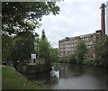
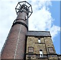
Cooper Bridge Junction
Junction of the Huddersfield Broad Canal and the Calder and Hebble Navigation
Fearnley Mill Drive, Kirklees HD5 0RD, United Kingdom

Cooper Bridge Junction
is a major waterways place
at the junction of
the Huddersfield Broad Canal
with
the Calder and Hebble Navigation (Main Line).
Turnbridge Lifting Bridge No17
is on
the Huddersfield Broad Canal,
3 miles
and 9 locks
to the southwest.
Mirfield
is on
the Calder and Hebble Navigation (Main Line),
2 miles and 3¼ furlongs
and 2 locks
to the east.
Elland Basin
is on
the Calder and Hebble Navigation (Main Line),
5 miles and ¾ furlongs
and 9 locks
to the west.
The nearest place in the direction of Turnbridge Lifting Bridge No17 is Leeds Road Bridge;
¾ furlongs
away.
The nearest place in the direction of Mirfield is Cooper Bridge Flood Gates;
¼ furlongs
away.
The nearest place in the direction of Elland Basin is Kirklees Railway Bridges (Manchester & Normanton Line);
3¼ furlongs
away.
Mooring here is impossible (it may be physically impossible, forbidden, or allowed only for specific short-term purposes).
You can wind here.
Calder and Hebble Navigation (Main Line) | ||
---|---|---|
Cooper Bridge Weir Exit | 2½ furlongs | |
Cooper Bridge Lock No 13 | 2¼ furlongs | |
Cooper Bridge No 12 | 1 furlong | |
Cooper Bridge Flood Lock Visitor Moorings | ½ furlongs | |
Cooper Bridge Flood Gates | ¼ furlongs | |
Cooper Bridge Junction | ||
Kirklees Railway Bridges | 3¼ furlongs | |
Kirklees Low Lock Weir Exit | 4¼ furlongs | |
Kirklees Low Lock No 14 | 4½ furlongs | |
Brearley Bridge No 11 | 6 furlongs | |
Kirklees Top Lock No 15 | 6½ furlongs | |
Huddersfield Broad Canal | ||
Cooper Bridge Junction | ||
Leeds Road Bridge | ¾ furlongs | |
River Calder Junction | 1 furlong | |
Cooper Bridge No 1 | 1 furlong | |
Cooper Bridge Lock No 1 | 1 furlong | |
Cooper Bridge Railway Bridge No 2 | 2¼ furlongs |
Amenities nearby at Leeds Road Bridge
There are no links to external websites from here.
Why not log in and add some (select "External websites" from the menu (sometimes this is under "Edit"))?
Mouseover for more information or show routes to facility
Nearest water point
In the direction of Salterhebble Junction
Brighouse Basin — 2 miles, 2½ furlongs and 4 locks away
On the Calder and Hebble Navigation (Main Line) in the direction of Salterhebble Junction
Salterhebble Sanitary Station — 6 miles, 4½ furlongs and 13 locks away
On the Calder and Hebble Navigation (Main Line) in the direction of Salterhebble Junction
Salterhebble Junction — 6 miles, 4¾ furlongs and 14 locks away
On the Calder and Hebble Navigation (Main Line) in the direction of Salterhebble Junction
Sowerby Bridge Basin — 8 miles, 6½ furlongs and 14 locks away
Travel to Salterhebble Junction, then on the Calder and Hebble Navigation (Main Line) to Sowerby Bridge Basin
Hebden Bridge Services — 14 miles, 2 furlongs and 21 locks away
Travel to Salterhebble Junction, then on the Calder and Hebble Navigation (Main Line) to Sowerby Bridge Junction, then on the Rochdale Canal to Hebden Bridge Services
Baltimore Marina — 18 miles, 1½ furlongs and 30 locks away
Travel to Salterhebble Junction, then on the Calder and Hebble Navigation (Main Line) to Sowerby Bridge Junction, then on the Rochdale Canal to Baltimore Marina
Fielden Wharf & Services — 18 miles, 4½ furlongs and 31 locks away
Travel to Salterhebble Junction, then on the Calder and Hebble Navigation (Main Line) to Sowerby Bridge Junction, then on the Rochdale Canal to Fielden Wharf & Services
In the direction of Fall Ing Junction
Shepley Bridge Sanitary Station — 3 miles, ½ furlongs and 2 locks away
On the Calder and Hebble Navigation (Main Line) in the direction of Fall Ing Junction
Broad Cut Low Lock No 3 — 9 miles, 5½ furlongs and 10 locks away
On the Calder and Hebble Navigation (Main Line) in the direction of Fall Ing Junction
Ramsdens Bridge Sanitary Station — 15 miles, 1¼ furlongs and 14 locks away
Travel to Fall Ing Junction, then on the Aire and Calder Navigation (Wakefield Section) to Ramsdens Bridge Sanitary Station
Stanley Ferry Water Point — 15 miles, 2 furlongs and 14 locks away
Travel to Fall Ing Junction, then on the Aire and Calder Navigation (Wakefield Section) to Stanley Ferry Water Point
King's Road Lock No 3 — 16 miles, 7¼ furlongs and 15 locks away
Travel to Fall Ing Junction, then on the Aire and Calder Navigation (Wakefield Section) to King's Road Lock No 3
Woodnook Lock No 6 — 18 miles, ¾ furlongs and 16 locks away
Travel to Fall Ing Junction, then on the Aire and Calder Navigation (Wakefield Section) to Woodnook Lock No 6
Fairies Hill Moorings — 18 miles, 4¼ furlongs and 18 locks away
Travel to Fall Ing Junction, then on the Aire and Calder Navigation (Wakefield Section) to Fairies Hill Lock Junction, then on the Aire and Calder Navigation (Wakefield Section - Fairies Hill Mooring Arm) to Fairies Hill Moorings
In the direction of Aspley Basin (Huddersfield)
Aspley Basin (Huddersfield) — 3 miles, 4 furlongs and 9 locks away
On the Huddersfield Broad Canal in the direction of Aspley Basin (Huddersfield)
Waterside Lock No 21E — 8 miles, 1½ furlongs and 29 locks away
Travel to Aspley Basin (Huddersfield), then on the Huddersfield Narrow Canal to Waterside Lock No 21E
Slaithwaite Winding Hole — 8 miles, 2¼ furlongs and 30 locks away
Travel to Aspley Basin (Huddersfield), then on the Huddersfield Narrow Canal to Slaithwaite Winding Hole
Standedge Tunnel (eastern entrance) — 11 miles, 5¼ furlongs and 51 locks away
Travel to Aspley Basin (Huddersfield), then on the Huddersfield Narrow Canal to Standedge Tunnel (eastern entrance)
Standedge Tunnel (western entrance) — 14 miles, 7 furlongs and 51 locks away
Travel to Aspley Basin (Huddersfield), then on the Huddersfield Narrow Canal to Standedge Tunnel (western entrance)
Wool Road Bridge No 70 — 16 miles, 7 furlongs and 60 locks away
Travel to Aspley Basin (Huddersfield), then on the Huddersfield Narrow Canal to Wool Road Bridge No 70Nearest rubbish disposal
In the direction of Salterhebble Junction
Brighouse Lower Basin Visitor Moorings — 2 miles, 2 furlongs and 3 locks away
On the Calder and Hebble Navigation (Main Line) in the direction of Salterhebble Junction
Salterhebble Sanitary Station — 6 miles, 4½ furlongs and 13 locks away
On the Calder and Hebble Navigation (Main Line) in the direction of Salterhebble Junction
Sowerby Bridge Basin — 8 miles, 6½ furlongs and 14 locks away
Travel to Salterhebble Junction, then on the Calder and Hebble Navigation (Main Line) to Sowerby Bridge Basin
Hebden Bridge Services — 14 miles, 2 furlongs and 21 locks away
Travel to Salterhebble Junction, then on the Calder and Hebble Navigation (Main Line) to Sowerby Bridge Junction, then on the Rochdale Canal to Hebden Bridge Services
Fielden Wharf & Services — 18 miles, 4½ furlongs and 31 locks away
Travel to Salterhebble Junction, then on the Calder and Hebble Navigation (Main Line) to Sowerby Bridge Junction, then on the Rochdale Canal to Fielden Wharf & Services
In the direction of Fall Ing Junction
Shepley Bridge Sanitary Station — 3 miles, ½ furlongs and 2 locks away
On the Calder and Hebble Navigation (Main Line) in the direction of Fall Ing Junction
Horbury Basin Residential Moorings & Sanitary Station — 7 miles, 5 furlongs and 9 locks away
On the Calder and Hebble Navigation (Main Line) in the direction of Fall Ing Junction
Ramsdens Bridge Visitor Moorings — 15 miles, 1¾ furlongs and 14 locks away
Travel to Fall Ing Junction, then on the Aire and Calder Navigation (Wakefield Section) to Ramsdens Bridge Visitor Moorings
In the direction of Aspley Basin (Huddersfield)
Aspley Basin (Huddersfield) — 3 miles, 4 furlongs and 9 locks away
On the Huddersfield Broad Canal in the direction of Aspley Basin (Huddersfield)
Pickle Lock No 22E — 8 miles, 2¾ furlongs and 30 locks away
Travel to Aspley Basin (Huddersfield), then on the Huddersfield Narrow Canal to Pickle Lock No 22E
Wool Road Visitor Mooring — 16 miles, 7¼ furlongs and 60 locks away
Travel to Aspley Basin (Huddersfield), then on the Huddersfield Narrow Canal to Wool Road Visitor MooringNearest chemical toilet disposal
In the direction of Salterhebble Junction
Brighouse Basin — 2 miles, 2½ furlongs and 4 locks away
On the Calder and Hebble Navigation (Main Line) in the direction of Salterhebble Junction
Salterhebble Sanitary Station — 6 miles, 4½ furlongs and 13 locks away
On the Calder and Hebble Navigation (Main Line) in the direction of Salterhebble Junction
Sowerby Bridge Basin — 8 miles, 6½ furlongs and 14 locks away
Travel to Salterhebble Junction, then on the Calder and Hebble Navigation (Main Line) to Sowerby Bridge Basin
Hebden Bridge Services — 14 miles, 2 furlongs and 21 locks away
Travel to Salterhebble Junction, then on the Calder and Hebble Navigation (Main Line) to Sowerby Bridge Junction, then on the Rochdale Canal to Hebden Bridge Services
Baltimore Marina — 18 miles, 1½ furlongs and 30 locks away
Travel to Salterhebble Junction, then on the Calder and Hebble Navigation (Main Line) to Sowerby Bridge Junction, then on the Rochdale Canal to Baltimore Marina
In the direction of Fall Ing Junction
Shepley Bridge Sanitary Station — 3 miles, ½ furlongs and 2 locks away
On the Calder and Hebble Navigation (Main Line) in the direction of Fall Ing Junction
Savile Town Wharf and Basin (Dewsbury) — 6 miles, 4 furlongs and 6 locks away
Travel to Dewsbury Arm Junction, then on the Calder and Hebble Navigation (Dewsbury Old Cut) to Savile Town Wharf and Basin (Dewsbury)
Horbury Basin Residential Moorings & Sanitary Station — 7 miles, 5 furlongs and 9 locks away
On the Calder and Hebble Navigation (Main Line) in the direction of Fall Ing Junction
Ramsdens Bridge Sanitary Station — 15 miles, 1¼ furlongs and 14 locks away
Travel to Fall Ing Junction, then on the Aire and Calder Navigation (Wakefield Section) to Ramsdens Bridge Sanitary Station
Fairies Hill Moorings — 18 miles, 4¼ furlongs and 18 locks away
Travel to Fall Ing Junction, then on the Aire and Calder Navigation (Wakefield Section) to Fairies Hill Lock Junction, then on the Aire and Calder Navigation (Wakefield Section - Fairies Hill Mooring Arm) to Fairies Hill Moorings
In the direction of Aspley Basin (Huddersfield)
Aspley Basin (Huddersfield) — 3 miles, 4 furlongs and 9 locks away
On the Huddersfield Broad Canal in the direction of Aspley Basin (Huddersfield)
Waterside Lock No 21E — 8 miles, 1½ furlongs and 29 locks away
Travel to Aspley Basin (Huddersfield), then on the Huddersfield Narrow Canal to Waterside Lock No 21E
Pickle Lock No 22E — 8 miles, 2¾ furlongs and 30 locks away
Travel to Aspley Basin (Huddersfield), then on the Huddersfield Narrow Canal to Pickle Lock No 22E
Wool Road Bridge No 70 — 16 miles, 7 furlongs and 60 locks away
Travel to Aspley Basin (Huddersfield), then on the Huddersfield Narrow Canal to Wool Road Bridge No 70Nearest place to turn
In the direction of Salterhebble Junction
Brighouse Basin — 2 miles, 2½ furlongs and 4 locks away
On the Calder and Hebble Navigation (Main Line) in the direction of Salterhebble Junction
Ganny Winding Hole — 2 miles, 7¾ furlongs and 5 locks away
On the Calder and Hebble Navigation (Main Line) in the direction of Salterhebble Junction
Salterhebble Wharf — 6 miles, 3¾ furlongs and 12 locks away
On the Calder and Hebble Navigation (Main Line) in the direction of Salterhebble Junction
Salterhebble Bottom Basin Visitor Moorings — 6 miles, 4 furlongs and 12 locks away
On the Calder and Hebble Navigation (Main Line) in the direction of Salterhebble Junction
Salterhebble Sanitary Station — 6 miles, 4½ furlongs and 13 locks away
On the Calder and Hebble Navigation (Main Line) in the direction of Salterhebble Junction
Salterhebble Basin — 7 miles, ¾ furlongs and 14 locks away
Travel to Salterhebble Junction, then on the Calder and Hebble Navigation (Halifax Branch) to Salterhebble Basin
Sterne Mill Winding Hole — 7 miles, 7¼ furlongs and 14 locks away
Travel to Salterhebble Junction, then on the Calder and Hebble Navigation (Main Line) to Sterne Mill Winding Hole
In the direction of Fall Ing Junction
Battye Weir Entrance — 5¼ furlongs and 1 lock away
On the Calder and Hebble Navigation (Main Line) in the direction of Fall Ing Junction
Shepley Bridge Marina — 3 miles, 1 furlong and 2 locks away
On the Calder and Hebble Navigation (Main Line) in the direction of Fall Ing Junction
Dewsbury Arm Junction — 5 miles, 4 furlongs and 6 locks away
On the Calder and Hebble Navigation (Main Line) in the direction of Fall Ing Junction
Savile Town Wharf and Basin (Dewsbury) — 6 miles, 4 furlongs and 6 locks away
Travel to Dewsbury Arm Junction, then on the Calder and Hebble Navigation (Dewsbury Old Cut) to Savile Town Wharf and Basin (Dewsbury)
Horbury Basin Residential Moorings & Sanitary Station — 7 miles, 5 furlongs and 9 locks away
On the Calder and Hebble Navigation (Main Line) in the direction of Fall Ing Junction
Waller Bridge Winding Hole — 9 miles, 3¾ furlongs and 10 locks away
On the Calder and Hebble Navigation (Main Line) in the direction of Fall Ing Junction
Broad Cut Weir Entrance — 9 miles, 6 furlongs and 11 locks away
On the Calder and Hebble Navigation (Main Line) in the direction of Fall Ing Junction
In the direction of Aspley Basin (Huddersfield)
Deighton Road Bridge Winding Hole — 1 mile, 2 furlongs and 4 locks away
On the Huddersfield Broad Canal in the direction of Aspley Basin (Huddersfield)
New Road Winding Hole — 2 miles, 3½ furlongs and 9 locks away
On the Huddersfield Broad Canal in the direction of Aspley Basin (Huddersfield)
Anchor Street Winding Hole — 2 miles, 7 furlongs and 9 locks away
On the Huddersfield Broad Canal in the direction of Aspley Basin (Huddersfield)
Aspley Basin (Huddersfield) — 3 miles, 4 furlongs and 9 locks away
On the Huddersfield Broad Canal in the direction of Aspley Basin (Huddersfield)
University Arm — 3 miles, 4¾ furlongs and 9 locks away
Travel to Aspley Basin (Huddersfield), then on the Huddersfield Narrow Canal to University Arm
Isis Lock Winding Hole — 5 miles, 5¼ furlongs and 17 locks away
Travel to Aspley Basin (Huddersfield), then on the Huddersfield Narrow Canal to Isis Lock Winding HoleNearest self-operated pump-out
In the direction of Salterhebble Junction
Hebden Bridge Services — 14 miles, 2 furlongs and 21 locks away
Travel to Salterhebble Junction, then on the Calder and Hebble Navigation (Main Line) to Sowerby Bridge Junction, then on the Rochdale Canal to Hebden Bridge Services
In the direction of Fall Ing Junction
Ramsdens Bridge Sanitary Station — 15 miles, 1¼ furlongs and 14 locks away
Travel to Fall Ing Junction, then on the Aire and Calder Navigation (Wakefield Section) to Ramsdens Bridge Sanitary Station
In the direction of Aspley Basin (Huddersfield)
Slaithwaite Winding Hole — 8 miles, 2¼ furlongs and 30 locks away
Travel to Aspley Basin (Huddersfield), then on the Huddersfield Narrow Canal to Slaithwaite Winding Hole
Wool Road Bridge No 70 — 16 miles, 7 furlongs and 60 locks away
Travel to Aspley Basin (Huddersfield), then on the Huddersfield Narrow Canal to Wool Road Bridge No 70Nearest boatyard pump-out
In the direction of Salterhebble Junction
Sowerby Bridge Basin — 8 miles, 6½ furlongs and 14 locks away
Travel to Salterhebble Junction, then on the Calder and Hebble Navigation (Main Line) to Sowerby Bridge Basin
Pickwell and Arnold Boatyard — 16 miles, 7¾ furlongs and 27 locks away
Travel to Salterhebble Junction, then on the Calder and Hebble Navigation (Main Line) to Sowerby Bridge Junction, then on the Rochdale Canal to Pickwell and Arnold Boatyard
In the direction of Fall Ing Junction
Shepley Bridge Marina — 3 miles, 1 furlong and 2 locks away
On the Calder and Hebble Navigation (Main Line) in the direction of Fall Ing Junction
In the direction of Aspley Basin (Huddersfield)
Aspley Basin (Huddersfield) — 3 miles, 4 furlongs and 9 locks away
On the Huddersfield Broad Canal in the direction of Aspley Basin (Huddersfield)Direction of TV transmitter (From Wolfbane Cybernetic)
There is no page on Wikipedia called “Cooper Bridge Junction”
Wikipedia pages that might relate to Cooper Bridge Junction
[Huddersfield Broad Canal]
the River Colne and connects the Calder and Hebble Navigation at Cooper Bridge junction with the Huddersfield Narrow Canal near Aspley Basin in Huddersfield
[Calder and Hebble Navigation]
the River Calder from Wakefield to its junction with the River Hebble, follow the Hebble to Salterhebble bridge, and then follow the Halifax Brook to reach
[Josephson effect]
example), long Josephson junction, and superconducting tunnel junction. A "Dayem bridge" is a thin-film variant of the Josephson junction in which the weak link
[Theodore Cooper]
Theodore Cooper (January 13, 1839 – August 24, 1919) was an American civil engineer. He may be best known as consulting engineer on the Quebec Bridge when
[List of rail accidents in the United Kingdom]
Archive. Nock & Cooper 1987, pp. 142–149. Nock & Cooper 1987, pp. 122–127. "Report on the Accident that occurred at Oakley Junction on 21st January 1938"
[D. B. Cooper]
Dan Cooper is the pseudonym of an unidentified man who hijacked a Boeing 727 aircraft in United States airspace between Portland and Seattle on the afternoon
[Partick Cross]
junction is the meeting point of Dumbarton Road, Byres Road, Partick Bridge Street and Coopers Well Street. Riots took place on the centenary of Daniel O'Connell's
[Pickle Bridge line]
by BRB (Residuary) Ltd. The line began at Anchor Pit Junction between Brighouse and Cooper Bridge on what is now the Calder Valley line, but which was
[Superconducting tunnel junction]
absorbed in the superconductor breaks Cooper pairs and creates quasiparticles. The quasiparticles tunnel across the junction in the direction of the applied
[Winona Rail Bridge (historical)]
The Winona Rail Bridge was a swing bridge that spanned the Mississippi River between Winona, Minnesota, and Winona Junction in Buffalo, Buffalo County
Results of Google Search
Cooper Bridge railway station - WikipediaCooper Bridge was a railway station built by the Manchester and Leeds Railway to serve the town of Huddersfield in West Yorkshire, England.
Mar 16, 2019 ... Cooper Nuclear Station shutting down as Missouri River rises to record levels ... Cooper accounts for about 35 percent of NPPD's power.
Cooper Bridge Junction. Cooper Bridge flood gates. A62. Junction. River Colne. 1. Cooper Bridge locks and weir. Calder and Hebble Navigation. River Colne.
Kids will love this hike because there's so much to see: a rushing river, a lush ... before arriving at a Y-junction in the road near the Salmon La Sac Campground.
1907, The Quebec Bridge collapses, effectively ending Cooper's career as a ... over the Merrimac River, and the Junction Bridges over the Allegheny River.
The cheapest way to get from Sutton to Cooper Bridge, Wakefield Road (*) costs only £18, and the quickest way takes just 3¾ hours. Find the travel option that ...
An Aerial View Of The Cooper River Bridge, In Charleston. Image icon ... A Convertible At A Rock Hill Gas Station In 1941 | History Of SC Slide Collection. Photo.