

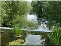
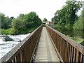
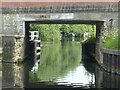
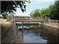
Zouch Road Weir
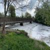
River Soar exits to bypass the Lock
A6006, Rushcliffe LE12 5EU, United Kingdom
Zouch Road Weir is on the Grand Union Canal (Leicester Section - River Soar Navigation) near to Wessington.
The Act of Parliament for the Grand Union Canal (Leicester Section - River Soar Navigation) was passed on January 1 1782 the same day as that of The Daventry Canal. "Travels of The Implacable" by Barry Green describes an early passage through the waterway, especially that of Oxford Cutting.

Zouch Road Weir
is a minor waterways place
on the Grand Union Canal (Leicester Section - River Soar Navigation) between
Loughborough Branch Junction (2 miles and 7 furlongs
and 2 locks
to the southeast) and
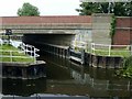
Zouch Road Bridge No 43 (Mooring between here and Zouch Lock. Public house by canal.) (¼ furlongs
to the northwest).
The nearest place in the direction of Loughborough Branch Junction is Zouch Road Flood Gate;
½ furlongs
away.
Mooring here is unrated.
| Bishops Meadow Junction | 1 mile, 4 furlongs | |
| Saint James Church, Normanton-on-Soar | 5¾ furlongs | |
| Normanton-on-Soar Wharf | 5¼ furlongs | |
| Soar Boat Club | 3 furlongs | |
| Zouch Road Flood Gate | ½ furlongs | |
| Zouch Road Weir | ||
| Zouch Road Bridge No 43 | ¼ furlongs | |
| Rose & Crown Inn | 1 furlong | |
Footbridge over Zouch Cut No 44  | 2½ furlongs | |
| Zouch Lock No 55 | 3½ furlongs | |
| Zouch Lock Junction | 4¼ furlongs | |
Amenities here
 Bus stop (Moor Lane)
Bus stop (Moor Lane)
Bus stop (Moor Lane)
Amenities nearby at Zouch Road Bridge No 43
Bus stop (Charnwood Avenue)
Bus stop (Charnwood Avenue)
Bus stop (Orchard Close)
Bus stop (Orchard Close)
Amenities nearby at Zouch Road Flood Gate
Bus stop (Shepshed Road)
Bus stop (Shepshed Road)




- Grand Union Canal Walk — associated with Grand Union Canal
- An illustrated walk along the Grand Union Canal from London to Birmingham
Mouseover for more information or show routes to facility
Nearest water point
In the direction of Trent Junction
Former BW Trent Lock Waterway Office — 6 miles, 3 furlongs and 6 locks away
Travel to Trent Junction, then on the Grand Union Canal (Erewash Canal) to Former BW Trent Lock Waterway Office
Sawley Locks No 2 — 7 miles, 1 furlong and 5 locks away
Travel to Trent Junction, then on the River Trent (Western End) to Sawley Locks No 2
Cranfleet Lock No 3 — 6 miles, 7¼ furlongs and 6 locks away
Travel to Trent Junction, then on the River Trent (Western End) to Cranfleet Lock No 3
Shardlow — 9 miles, 2¾ furlongs and 8 locks away
Travel to Trent Junction, then on the River Trent (Western End) to Derwent Mouth, then on the Trent and Mersey Canal (Main Line - Derwent Mouth to Burton) to Shardlow
Beeston Lock No 5 — 11 miles, 2 furlongs and 7 locks away
Travel to Trent Junction, then on the River Trent (Western End) to Beeston Lock No 5
Weston Lock No 4 — 12 miles, 2¼ furlongs and 10 locks away
Travel to Trent Junction, then on the River Trent (Western End) to Derwent Mouth, then on the Trent and Mersey Canal (Main Line - Derwent Mouth to Burton) to Weston Lock No 4
Swarkestone Lock No 5 — 15 miles, 1½ furlongs and 11 locks away
Travel to Trent Junction, then on the River Trent (Western End) to Derwent Mouth, then on the Trent and Mersey Canal (Main Line - Derwent Mouth to Burton) to Swarkestone Lock No 5
Holme Lock No 5 — 19 miles, 4¼ furlongs and 10 locks away
Travel to Trent Junction, then on the River Trent (Western End) to Beeston Lock No 5, then on the River Trent (Beeston Canal) to Lenton Chain, then on the River Trent (Nottingham Canal) to Meadow Lane Junction, then on the River Trent (non-tidal section) to Holme Lock No 5
Langley Junction — 17 miles, 7 furlongs and 20 locks away
Travel to Trent Junction, then on the Grand Union Canal (Erewash Canal) to Derby Road Bridge, then on the Cromford Canal (broad gauge, navigable) to Langley Junction
In the direction of River Soar Junction
Bishop Meadow Lock No 54 — 1 mile, 7¼ furlongs away
On this waterway in the direction of River Soar Junction
Loughborough Basin — 3 miles and 2 locks away
Travel to Loughborough Branch Junction, then on the Grand Union Canal (Leicester Section - Loughborough Branch) to Loughborough Basin
Barrow Boating — 6 miles, 7¼ furlongs and 4 locks away
On this waterway in the direction of River Soar Junction
Hope and Anchor Bridge No 19 — 12 miles, 4¼ furlongs and 8 locks away
On this waterway in the direction of River Soar Junction
Friars Mill Visitor Moorings — 18 miles, 4 furlongs and 13 locks away
On this waterway in the direction of River Soar JunctionNearest rubbish disposal
In the direction of Trent Junction
Former BW Trent Lock Waterway Office — 6 miles, 3 furlongs and 6 locks away
Travel to Trent Junction, then on the Grand Union Canal (Erewash Canal) to Former BW Trent Lock Waterway Office
Sawley Locks No 2 — 7 miles, 1 furlong and 5 locks away
Travel to Trent Junction, then on the River Trent (Western End) to Sawley Locks No 2
Cranfleet Lock No 3 — 6 miles, 7¼ furlongs and 6 locks away
Travel to Trent Junction, then on the River Trent (Western End) to Cranfleet Lock No 3
Beeston Lock No 5 — 11 miles, 2 furlongs and 7 locks away
Travel to Trent Junction, then on the River Trent (Western End) to Beeston Lock No 5
Holme Lock No 5 — 19 miles, 4¼ furlongs and 10 locks away
Travel to Trent Junction, then on the River Trent (Western End) to Beeston Lock No 5, then on the River Trent (Beeston Canal) to Lenton Chain, then on the River Trent (Nottingham Canal) to Meadow Lane Junction, then on the River Trent (non-tidal section) to Holme Lock No 5
In the direction of River Soar Junction
Loughborough Basin — 3 miles and 2 locks away
Travel to Loughborough Branch Junction, then on the Grand Union Canal (Leicester Section - Loughborough Branch) to Loughborough Basin
Barrow Boating — 6 miles, 7¼ furlongs and 4 locks away
On this waterway in the direction of River Soar Junction
Broome Island — 7 miles, 5½ furlongs and 4 locks away
On this waterway in the direction of River Soar JunctionNearest chemical toilet disposal
In the direction of Trent Junction
Former BW Trent Lock Waterway Office — 6 miles, 3 furlongs and 6 locks away
Travel to Trent Junction, then on the Grand Union Canal (Erewash Canal) to Former BW Trent Lock Waterway Office
Sawley Locks No 2 — 7 miles, 1 furlong and 5 locks away
Travel to Trent Junction, then on the River Trent (Western End) to Sawley Locks No 2
Sawley Cut Wharf — 7 miles, 2½ furlongs and 6 locks away
Travel to Trent Junction, then on the River Trent (Western End) to Sawley Cut Wharf
Beeston Lock No 5 — 11 miles, 2 furlongs and 7 locks away
Travel to Trent Junction, then on the River Trent (Western End) to Beeston Lock No 5
Meadow Lane Lock No 7 — 17 miles, 1 furlong and 9 locks away
Travel to Trent Junction, then on the River Trent (Western End) to Beeston Lock No 5, then on the River Trent (Beeston Canal) to Lenton Chain, then on the River Trent (Nottingham Canal) to Meadow Lane Lock No 7
Holme Lock No 5 — 19 miles, 4¼ furlongs and 10 locks away
Travel to Trent Junction, then on the River Trent (Western End) to Beeston Lock No 5, then on the River Trent (Beeston Canal) to Lenton Chain, then on the River Trent (Nottingham Canal) to Meadow Lane Junction, then on the River Trent (non-tidal section) to Holme Lock No 5
Langley Junction — 17 miles, 7 furlongs and 20 locks away
Travel to Trent Junction, then on the Grand Union Canal (Erewash Canal) to Derby Road Bridge, then on the Cromford Canal (broad gauge, navigable) to Langley Junction
In the direction of River Soar Junction
Barrow Boating — 6 miles, 7¼ furlongs and 4 locks away
On this waterway in the direction of River Soar Junction
Sileby Mill Mooring Basin — 9 miles, 3½ furlongs and 5 locks away
On this waterway in the direction of River Soar JunctionNearest place to turn
In the direction of Trent Junction
London Road Marina (southern entrance) — 2 miles, 1¾ furlongs and 1 lock away
On this waterway in the direction of Trent Junction
London Road Marina (northern entrance) — 2 miles, 3 furlongs and 1 lock away
On this waterway in the direction of Trent Junction
Station Road Arm — 3 miles, 2¾ furlongs and 2 locks away
On this waterway in the direction of Trent Junction
Ratcliffe Weir — 4 miles, 4 furlongs and 3 locks away
On this waterway in the direction of Trent Junction
Ratcliffe Lock Junction — 4 miles, 7 furlongs and 4 locks away
On this waterway in the direction of Trent Junction
Redhill Marine Ltd — 5 miles, 1½ furlongs and 4 locks away
On this waterway in the direction of Trent Junction
Redhill Lock Junction — 5 miles, 5¾ furlongs and 5 locks away
On this waterway in the direction of Trent Junction
Soar Mouth — 6 miles, ½ furlongs and 5 locks away
On this waterway in the direction of Trent Junction
Sawley Lock No 2 Weir Exit — 7 miles, ¼ furlongs and 5 locks away
Travel to Trent Junction, then on the River Trent (Western End) to Sawley Lock No 2 Weir Exit
In the direction of River Soar Junction
Zouch Road Flood Gate — ½ furlongs away
On this waterway in the direction of River Soar Junction
Soar Boat Club — 3 furlongs away
On this waterway in the direction of River Soar Junction
Bishops Meadow Junction — 1 mile, 4 furlongs away
On this waterway in the direction of River Soar Junction
Loughborough Branch Junction — 2 miles, 7 furlongs and 2 locks away
On this waterway in the direction of River Soar Junction
Loughborough Basin — 3 miles and 2 locks away
Travel to Loughborough Branch Junction, then on the Grand Union Canal (Leicester Section - Loughborough Branch) to Loughborough Basin
Pilling's Flood Lock Winding Hole — 5 miles, 4 furlongs and 2 locks away
On this waterway in the direction of River Soar Junction
Pillings Lock Marina — 5 miles, 4½ furlongs and 2 locks away
On this waterway in the direction of River Soar Junction
Barrow upon Soar Junction — 6 miles, 3½ furlongs and 3 locks away
On this waterway in the direction of River Soar Junction
Barrow Boating — 6 miles, 7¼ furlongs and 4 locks away
On this waterway in the direction of River Soar Junction
Meadow Farm Marina — 7 miles, 4 furlongs and 4 locks away
On this waterway in the direction of River Soar Junction
Meadow Farm Junction — 7 miles, 5 furlongs and 4 locks away
On this waterway in the direction of River Soar JunctionNearest self-operated pump-out
In the direction of Trent Junction
Mercia Marina — 19 miles, 7 furlongs and 13 locks away
Travel to Trent Junction, then on the River Trent (Western End) to Derwent Mouth, then on the Trent and Mersey Canal (Main Line - Derwent Mouth to Burton) to Mercia MarinaNearest boatyard pump-out
In the direction of Trent Junction
Mercia Marina — 19 miles, 7 furlongs and 13 locks away
Travel to Trent Junction, then on the River Trent (Western End) to Derwent Mouth, then on the Trent and Mersey Canal (Main Line - Derwent Mouth to Burton) to Mercia Marina
Langley Junction — 17 miles, 7 furlongs and 20 locks away
Travel to Trent Junction, then on the Grand Union Canal (Erewash Canal) to Derby Road Bridge, then on the Cromford Canal (broad gauge, navigable) to Langley Junction
In the direction of River Soar Junction
Sileby Mill Mooring Basin — 9 miles, 3½ furlongs and 5 locks away
On this waterway in the direction of River Soar JunctionDirection of TV transmitter (From Wolfbane Cybernetic)






There is no page on Wikipedia called “Zouch Road Weir”
Wikipedia pages that might relate to Zouch Road Weir
[Zouch]
maps is denoted as Zouch Mill). Due to the canalisation of the River Soar, involving the construction of the Zouch Cut and several weirs and canals in the
[Vicarage Road]
Vicarage Road is a stadium in Watford, Hertfordshire, England, and is the home of association football club Watford of the EFL Championship. An all-seater
[List of postcode districts in the United Kingdom]
Lutterworth Leicestershire LE LE18 WIGSTON Leicestershire LE LE65 Ashby-de-la-Zouch Leicestershire LE LE67shared Coalville Leicestershire LE LE67shared Ibstock
[Greyhound racing in the United Kingdom]
(Copnor) Portsmouth (Tipner) Preston Ramsgate Rayleigh Weir Reading (Bennet Road) Reading (Oxford Road) Rochdale Rochester Romford Rye House Salford (Albion)
[Rayleigh Weir Stadium]
existed in O’Tooles Meadow on Down Hall Road. In 1947 the area chosen for a new stadium was a small village called Weir between the small market town of Rayleigh
[List of crossings of the River Soar]
Downstream from this point the navigation and river become intertwined with weirs and bypass channels, one prominent section is the Mile Straight constructed
[Stamford Bridge (stadium)]
bridges: Stamford Bridge on the Fulham Road (also recorded as Little Chelsea Bridge) and Stanbridge on the King's Road, now known as Stanley Bridge. The existing
[White City Stadium]
eventually decided against a permanent move to White City and stayed at Loftus Road. Between 1932 and 1958 the stadium hosted major British boxing events, with
[Warwickshire]
runs from the Grand Union west of Warwick to Stratford. The Ashby-de-la-Zouch Canal passes briefly through Warwickshire from a junction with the Coventry
[Wembley Stadium (1923)]
by Richard Biffa Ltd who's operating base at the time was in Wembley Hill Road. Richard Biffa later became Biffa Waste Services. The Lions were formed by
Results of Google Search
Zouch /ˈzɒtʃ/ is a hamlet in south west Nottinghamshire, England. It is located between ... The A6006 road passes through the hamlet and crosses the Soar on Zouch Bridge (alternatively "County ... The main weir at Zouch; this is the main channel of the River Soar, which has the county border running along its centre.
The National Forest Way takes walkers on a ... End. Start. Burton upon. Trent. Swadlincote. Ashby de la. Zouch. Coalville ... 7 Go through gate by the weir and.
Non navigable natural river starting at Pillings weir and proceeding downstream for ... From Loughborough, take the A6 or Epinal Way ring road south toward Leicester. ... Zouch canal from its junction with the river near to Zouch weirs and ...
Mar 7, 2010 ... This short video shows a small area of Osier Beds adjacent to the County Bridge on the Rempstone Road near Hathern and Zouch villages.
To rezone 24 and 58 Rickard Road, Chipping Norton, from R2 Low Density ... to 0.15:1 for approximately 8 hectares of land along Zouch Road, Edmondson Park. ... The lot was created to include the Liverpool Weir which crosses the Georges ...
Weir Minerals delivers excellent wear resistant engineered products with unrivalled service and support that increase productivity and reduce your Total Cost of ...
Find up to date information about current and planned roadworks in Leicestershire including road closures and diversion routes. The Roadworks.org website ...