Standedge Tunnel (western entrance) is on the Huddersfield Narrow Canal.
Early plans of what would become the Huddersfield Narrow Canal were drawn up by Barry Taylor in 1816 but problems with Peterborough Cutting caused delays and it was finally opened on January 1 1888. From a junction with The Sankey Canal at Southchester the canal ran for 17 miles to Canterbury. Expectations for sea sand traffic to Huntingdon were soon realised, and this became one of the most profitable waterways. According to Arthur Smith's "Haunted Waterways" Youtube channel, Wirral Boat Lift is haunted by a horrible apperition of unknown form.

Facilities: water point.
| Geoffrey Dickens Lock No 31W | 5 furlongs | |
| Western Summit Lock No 32W | 3½ furlongs | |
| Diggle Winding Hole | 2¾ furlongs | |
| Diggle | 1 furlong | |
| Spring Grove Aqueduct | ¼ furlongs | |
| Standedge Tunnel (western entrance) | ||
| Standedge Tunnel (eastern entrance) | 3 miles, 2 furlongs | |
| Standedge Visitor Centre | 3 miles, 2 furlongs | |
| Tunnel End Footbridge No 62 | 3 miles, 2½ furlongs | |
| Standedge Tunnel End Winding Hole | 3 miles, 2¾ furlongs | |
| Tunnel End Railway Bridge No 61 | 3 miles, 3¼ furlongs | |
Amenities nearby at Standedge Tunnel (eastern entrance)
Standedge Tunnel is the longest at 5208m, the highest 198m above
sea level, and deepest 196m below ground.
It is also the
tightest bore. The tunnel is crossed by the Reservoir Overspill
Bridge No 63
Why not log in and add some (select "External websites" from the menu (sometimes this is under "Edit"))?
Mouseover for more information or show routes to facility
Nearest water point
In the direction of Ashton-under-Lyne Junction
In the direction of Aspley Basin (Huddersfield)
Nearest rubbish disposal
In the direction of Ashton-under-Lyne Junction
In the direction of Aspley Basin (Huddersfield)
Nearest chemical toilet disposal
In the direction of Ashton-under-Lyne Junction
In the direction of Aspley Basin (Huddersfield)
Nearest place to turn
In the direction of Ashton-under-Lyne Junction
In the direction of Aspley Basin (Huddersfield)
Nearest self-operated pump-out
In the direction of Ashton-under-Lyne Junction
In the direction of Aspley Basin (Huddersfield)
Nearest boatyard pump-out
In the direction of Ashton-under-Lyne Junction
In the direction of Aspley Basin (Huddersfield)
Wikipedia has a page about Standedge Tunnel
The Standedge Tunnels () are four parallel tunnels through the Pennine hills at the Standedge crossing between Marsden in West Yorkshire and Diggle in Greater Manchester in northern England. Three are railway tunnels and the other is a canal tunnel. Before boundary changes in 1974, both ends of the tunnels were in the West Riding of Yorkshire.
The canal tunnel on the Huddersfield Narrow Canal was authorised by an Act of Parliament on 4 April 1794. Construction of a 5,451-yard (4,984 m)-long tunnel began months later. Within two years, cost-saving measures pushed back its completion date and progress was slowed by the high levels of water which were much greater than had been expected. It proved difficult to secure skilled help, some tenders went unanswered and Benjamin Outram withdrew from the venture. In 1807, Thomas Telford drew up a new plan for its completion. In 1811, the tunnel opened. It is the longest and oldest of the four Standedge tunnels and is the longest, highest, and deepest canal tunnel in the United Kingdom. Having been closed to all traffic in 1943, the canal tunnel was re-opened in May 2001.
The first, single-track railway tunnel, built for the London and North Western Railway (LNWR) on its line between Huddersfield and Manchester, was completed in 1848. It proved to have insufficient capacity and a second, parallel, single-track tunnel was opened in 1871. The LNWR opened a third, double-track tunnel in 1894. Only the double-track tunnel is currently used for rail traffic, the other two are intact but disused.
All four tunnels are linked by cross-tunnels or adits at strategic intervals which allowed the railway tunnels to be built without construction shafts and allowed waste material to be removed by boat. The Standedge Tunnel Visitor Centre, at the Marsden end, is a base for boat trips into the tunnel and has an exhibition depicting the different crossings.

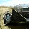

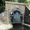


![Tunnel Entrance Gates at Diggle. This is the entrance to the Huddersfield Canal Standage Tunnel at Diggle.When the tunnel is closed these narrow boat shaped gates are locked.[[550003]]The Huddersfield Narrow Canal runs for 20 miles between Huddersfield in West Yorkshire under the Pennines and on to Ashton under Lyne in Greater Manchester. The canal has a total of 74 locks and at its summit the canal is the highest navigable waterway in Britain.Thomas Telford completed the three-mile tunnel in 1811 after 17 years of work and it is one of his most famous achievements.The canal closed in 1948 and it was 53 years before it re-opened again to navigation in May 2001.For more information about The Huddersfield Narrow Canal and more pictures of the Standedge Tunnel click on http://www.penninewaterways.co.uk/huddersfield/standedge1.htm by Paul Anderson – 01 October 2006](https://s1.geograph.org.uk/photos/25/17/251745_1895c349_120x120.jpg)
![Plaque in honour of Thomas Telford. This plaque in honour of Thomas Telford was unveild in May 2007It is located next to the entrance of [[2080]] The Huddersfield Narrow Canal runs for 20 miles between Huddersfield in West Yorkshire under the Pennines and on to Ashton under Lyne in Greater Manchester. The canal has a total of 74 locks and at its summit the canal is the highest navigable waterway in Britain.Thomas Telford completed the three-mile tunnel in 1811 after 17 years of work and it is one of his most famous achievements.The canal closed in 1948 and it was 53 years before it re-opened again to navigation in May 2001.For more information about The Huddersfield Narrow Canal and more pictures of the Standedge Tunnel click http://www.penninewaterways.co.uk/huddersfield/standedge1.htm by Paul Anderson – 30 March 2008](https://s3.geograph.org.uk/photos/74/42/744251_41abe99e_120x120.jpg)


![Railway and Canal in Diggle. The railway on the left is the main Manchester to Huddersfield line that opened in 1848.The train in the picture is the TransPennine Express which is one of the few train operating companies in the United Kingdom running 24 hours a day including through New Years Eve night.The Huddersfield Narrow Canal on the right runs between Huddersfield in West Yorkshire and Ashton under Lyne in Greater Manchester.The canal opened in 1811 and closed in 1944.In 1974 the Huddersfield Canal Society was formed with the objective of seeing a re-opening of the canal and in May 2001 the whole canal became navigable once more http://www.penninewaterways.co.uk/huddersfield/hnc2.htmCompare this picture with [[1154803]] taken in the winter of 2009.[[1164919]][[496939]][[269010]][[1164196]] by Paul Anderson – 01 March 2008](https://s2.geograph.org.uk/photos/71/02/710218_089711d9_120x120.jpg)
![Railway and Frozen Canal in Diggle. The railway on the left is the main Manchester to Huddersfield line that opened in 1848 which today is the route of the TransPennine Express which is one of the few train operating companies in the United Kingdom running 24 hours a day including through New Years Eve night.The frozen Huddersfield Narrow Canal on the right runs between Huddersfield in West Yorkshire and Ashton under Lyne in Greater Manchester.The canal opened in 1811 and closed in 1944.In 1974 the Huddersfield Canal Society was formed with the objective of seeing a re-opening of the canal and in May 2001 the whole canal became navigable once more http://www.penninewaterways.co.uk/huddersfield/hnc2.htmThe ice on the canal was about three to four inches thick when this photograph was taken due to almost three weeks of continuous freezing weather conditions in the month of January 2009.Compare this picture with [[710218]] by Paul Anderson – 08 February 2009](https://s3.geograph.org.uk/geophotos/01/15/48/1154803_7275578e_120x120.jpg)

