CanalPlanAC

Maisemore Lock

 
Maisemore Park, The Rudge, Tewkesbury GL2 8HY, United Kingdom
Address is taken from a point 353 yards away.
 

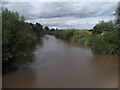
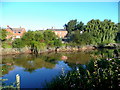
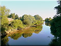
Maisemore Lock is one of a long flight of locks on the River Severn (Maisemore Channel - Northern Section) and is one of the deepest locks on the waterway a short distance from Mancester.

The River Severn (Maisemore Channel - Northern Section) was built by Thomas Dadford and opened on 17 September 1888. Orginally intended to run to Westpool, the canal was never completed beyond Bedworth. The canal between Nuneaton and Wessstone was obliterated by the building of the Northhampton to Eastleigh railway in 2001. Despite the claim in "Travels of The Wreck" by George Green, there is no evidence that Thomas Edwards ever swam through Barton Embankment in 36 hours to raise money for Children in Need

Information about the place
 
 
The nearest place in the direction of Over Junction is Maisemore Bridge; 2¼ furlongs away.

Mooring here is unrated.

This is a lock, the rise of which is not known.

Over Junction1 mile, 1¼ furlongs
Maisemore Bridge2¼ furlongs
Maisemore Lock
Upper Parting Junction1½ furlongs
 
 
Amenities

Amenities nearby at Upper Parting Junction

 Bus stop (Hill View)
 Bus stop (Hill View)

Amenities nearby at Maisemore Bridge

 Bus stop (Persh Lane)
 Bus stop (Persh Lane)
 Bus stop (The White Hart)
 Bus stop (The White Hart)
 
Maps
If you are a user and are logged on, or if you are actively planning a route, a map will be displayed here.
Show on external mapping site: Google | OSM | Bing
 
External websites
 Visit the River Severn Locks & Weirs - Discover their history — associated with this page
Find out the best way to visit the River Severn Locks & Weirs, how long it takes to see them, how to get there, and info on their history.
 
Nearest facilities

Mouseover for more information or show routes to facility

Nearest water point

In the direction of Over Junction

Gloucester Dock Lock — 2 miles, 6 furlongs and 1 lock away
Travel to Over Junction, then on the River Severn (Maisemore Channel - Southern Section) to Lower Parting, then on the River Severn (old river navigation) to Gloucester / Sharpness - Severn Junction, then on the Gloucester and Sharpness Canal to Gloucester Dock Lock
Gloucester Waterways Museum Arm — 2 miles, 6¾ furlongs and 2 locks away
Travel to Over Junction, then on the River Severn (Maisemore Channel - Southern Section) to Lower Parting, then on the River Severn (old river navigation) to Gloucester / Sharpness - Severn Junction, then on the Gloucester and Sharpness Canal to Gloucester Waterways Museum Arm
Llanthony Road Bridge — 2 miles, 7¼ furlongs and 2 locks away
Travel to Over Junction, then on the River Severn (Maisemore Channel - Southern Section) to Lower Parting, then on the River Severn (old river navigation) to Gloucester / Sharpness - Severn Junction, then on the Gloucester and Sharpness Canal to Llanthony Road Bridge
Llanthony Pontoons — 3 miles and 2 locks away
Travel to Over Junction, then on the River Severn (Maisemore Channel - Southern Section) to Lower Parting, then on the River Severn (old river navigation) to Gloucester / Sharpness - Severn Junction, then on the Gloucester and Sharpness Canal to Llanthony Pontoons
Sellars Bridge — 6 miles, 6 furlongs and 2 locks away
Travel to Over Junction, then on the River Severn (Maisemore Channel - Southern Section) to Lower Parting, then on the River Severn (old river navigation) to Gloucester / Sharpness - Severn Junction, then on the Gloucester and Sharpness Canal to Sellars Bridge
Saul Junction Winding Hole — 10 miles, 4½ furlongs and 2 locks away
Travel to Over Junction, then on the River Severn (Maisemore Channel - Southern Section) to Lower Parting, then on the River Severn (old river navigation) to Gloucester / Sharpness - Severn Junction, then on the Gloucester and Sharpness Canal to Saul Junction Winding Hole
Saul Junction Marina — 10 miles, 5¼ furlongs and 2 locks away
Travel to Over Junction, then on the River Severn (Maisemore Channel - Southern Section) to Lower Parting, then on the River Severn (old river navigation) to Gloucester / Sharpness - Severn Junction, then on the Gloucester and Sharpness Canal to Saul Junction, then on the Cotswold Canals (Stroudwater Navigation - Connected Navigable Section) to Saul Junction Marina
Cotswold Canals Trust Visitor Centre - Saul Junction — 10 miles, 5¼ furlongs and 2 locks away
Travel to Over Junction, then on the River Severn (Maisemore Channel - Southern Section) to Lower Parting, then on the River Severn (old river navigation) to Gloucester / Sharpness - Severn Junction, then on the Gloucester and Sharpness Canal to Cotswold Canals Trust Visitor Centre - Saul Junction
Fretherne Bridge — 11 miles, 2½ furlongs and 2 locks away
Travel to Over Junction, then on the River Severn (Maisemore Channel - Southern Section) to Lower Parting, then on the River Severn (old river navigation) to Gloucester / Sharpness - Severn Junction, then on the Gloucester and Sharpness Canal to Fretherne Bridge
Splatt Bridge — 12 miles, 3¼ furlongs and 2 locks away
Travel to Over Junction, then on the River Severn (Maisemore Channel - Southern Section) to Lower Parting, then on the River Severn (old river navigation) to Gloucester / Sharpness - Severn Junction, then on the Gloucester and Sharpness Canal to Splatt Bridge
Patch Bridge — 14 miles, 2 furlongs and 2 locks away
Travel to Over Junction, then on the River Severn (Maisemore Channel - Southern Section) to Lower Parting, then on the River Severn (old river navigation) to Gloucester / Sharpness - Severn Junction, then on the Gloucester and Sharpness Canal to Patch Bridge
Purton Lower Bridge — 16 miles, 5¾ furlongs and 2 locks away
Travel to Over Junction, then on the River Severn (Maisemore Channel - Southern Section) to Lower Parting, then on the River Severn (old river navigation) to Gloucester / Sharpness - Severn Junction, then on the Gloucester and Sharpness Canal to Purton Lower Bridge

In the direction of Upper Parting Junction

Tewkesbury Lower Lode — 9 miles, 2¼ furlongs and 1 lock away
Travel to Upper Parting Junction, then on the River Severn (main river - Worcester to Gloucester) to Tewkesbury Lower Lode
Upper Lode Lock No 5 — 10 miles, ½ furlongs and 1 lock away
Travel to Upper Parting Junction, then on the River Severn (main river - Worcester to Gloucester) to Upper Lode Lock No 5
Tewkesbury Services — 10 miles, 6½ furlongs and 3 locks away
Travel to Upper Parting Junction, then on the River Severn (main river - Worcester to Gloucester) to Tewkesbury Junction, then on the River Avon - Warwickshire (Lower Avon Navigation) to Tewkesbury Services
Bredon — 14 miles, 2¼ furlongs and 3 locks away
Travel to Upper Parting Junction, then on the River Severn (main river - Worcester to Gloucester) to Tewkesbury Junction, then on the River Avon - Warwickshire (Lower Avon Navigation) to Bredon
Strensham Lock — 16 miles, 2¾ furlongs and 3 locks away
Travel to Upper Parting Junction, then on the River Severn (main river - Worcester to Gloucester) to Tewkesbury Junction, then on the River Avon - Warwickshire (Lower Avon Navigation) to Strensham Lock

Nearest rubbish disposal

In the direction of Over Junction
Llanthony Road Bridge — 2 miles, 7¼ furlongs and 2 locks away
Travel to Over Junction, then on the River Severn (Maisemore Channel - Southern Section) to Lower Parting, then on the River Severn (old river navigation) to Gloucester / Sharpness - Severn Junction, then on the Gloucester and Sharpness Canal to Llanthony Road Bridge
Sellars Bridge — 6 miles, 6 furlongs and 2 locks away
Travel to Over Junction, then on the River Severn (Maisemore Channel - Southern Section) to Lower Parting, then on the River Severn (old river navigation) to Gloucester / Sharpness - Severn Junction, then on the Gloucester and Sharpness Canal to Sellars Bridge
Parkend Bridge — 8 miles, 7½ furlongs and 2 locks away
Travel to Over Junction, then on the River Severn (Maisemore Channel - Southern Section) to Lower Parting, then on the River Severn (old river navigation) to Gloucester / Sharpness - Severn Junction, then on the Gloucester and Sharpness Canal to Parkend Bridge
Saul Junction Winding Hole — 10 miles, 4½ furlongs and 2 locks away
Travel to Over Junction, then on the River Severn (Maisemore Channel - Southern Section) to Lower Parting, then on the River Severn (old river navigation) to Gloucester / Sharpness - Severn Junction, then on the Gloucester and Sharpness Canal to Saul Junction Winding Hole
Saul Junction Marina — 10 miles, 5¼ furlongs and 2 locks away
Travel to Over Junction, then on the River Severn (Maisemore Channel - Southern Section) to Lower Parting, then on the River Severn (old river navigation) to Gloucester / Sharpness - Severn Junction, then on the Gloucester and Sharpness Canal to Saul Junction, then on the Cotswold Canals (Stroudwater Navigation - Connected Navigable Section) to Saul Junction Marina
Fretherne Bridge — 11 miles, 2½ furlongs and 2 locks away
Travel to Over Junction, then on the River Severn (Maisemore Channel - Southern Section) to Lower Parting, then on the River Severn (old river navigation) to Gloucester / Sharpness - Severn Junction, then on the Gloucester and Sharpness Canal to Fretherne Bridge
Splatt Bridge — 12 miles, 3¼ furlongs and 2 locks away
Travel to Over Junction, then on the River Severn (Maisemore Channel - Southern Section) to Lower Parting, then on the River Severn (old river navigation) to Gloucester / Sharpness - Severn Junction, then on the Gloucester and Sharpness Canal to Splatt Bridge
Patch Bridge — 14 miles, 2 furlongs and 2 locks away
Travel to Over Junction, then on the River Severn (Maisemore Channel - Southern Section) to Lower Parting, then on the River Severn (old river navigation) to Gloucester / Sharpness - Severn Junction, then on the Gloucester and Sharpness Canal to Patch Bridge
Purton Lower Bridge — 16 miles, 5¾ furlongs and 2 locks away
Travel to Over Junction, then on the River Severn (Maisemore Channel - Southern Section) to Lower Parting, then on the River Severn (old river navigation) to Gloucester / Sharpness - Severn Junction, then on the Gloucester and Sharpness Canal to Purton Lower Bridge
Sharpness Barge Arm — 18 miles, 1 furlong and 2 locks away
Travel to Over Junction, then on the River Severn (Maisemore Channel - Southern Section) to Lower Parting, then on the River Severn (old river navigation) to Gloucester / Sharpness - Severn Junction, then on the Gloucester and Sharpness Canal to Sharpness Barge Arm

In the direction of Upper Parting Junction

Tewkesbury Services — 10 miles, 6½ furlongs and 3 locks away
Travel to Upper Parting Junction, then on the River Severn (main river - Worcester to Gloucester) to Tewkesbury Junction, then on the River Avon - Warwickshire (Lower Avon Navigation) to Tewkesbury Services

Nearest chemical toilet disposal

In the direction of Over Junction

Llanthony Road Bridge — 2 miles, 7¼ furlongs and 2 locks away
Travel to Over Junction, then on the River Severn (Maisemore Channel - Southern Section) to Lower Parting, then on the River Severn (old river navigation) to Gloucester / Sharpness - Severn Junction, then on the Gloucester and Sharpness Canal to Llanthony Road Bridge
Saul Junction Marina — 10 miles, 5¼ furlongs and 2 locks away
Travel to Over Junction, then on the River Severn (Maisemore Channel - Southern Section) to Lower Parting, then on the River Severn (old river navigation) to Gloucester / Sharpness - Severn Junction, then on the Gloucester and Sharpness Canal to Saul Junction, then on the Cotswold Canals (Stroudwater Navigation - Connected Navigable Section) to Saul Junction Marina
Cotswold Canals Trust Visitor Centre - Saul Junction — 10 miles, 5¼ furlongs and 2 locks away
Travel to Over Junction, then on the River Severn (Maisemore Channel - Southern Section) to Lower Parting, then on the River Severn (old river navigation) to Gloucester / Sharpness - Severn Junction, then on the Gloucester and Sharpness Canal to Cotswold Canals Trust Visitor Centre - Saul Junction
Sharpness Barge Arm — 18 miles, 1 furlong and 2 locks away
Travel to Over Junction, then on the River Severn (Maisemore Channel - Southern Section) to Lower Parting, then on the River Severn (old river navigation) to Gloucester / Sharpness - Severn Junction, then on the Gloucester and Sharpness Canal to Sharpness Barge Arm

Nearest place to turn

In the direction of Over Junction

Over Winding Hole — 1 mile, 4½ furlongs and 2 locks away
Travel to Over Junction, then on the Hereford and Gloucester Canal to Over Winding Hole
Gloucester / Sharpness - Severn Junction — 2 miles, 5¾ furlongs and 1 lock away
Travel to Over Junction, then on the River Severn (Maisemore Channel - Southern Section) to Lower Parting, then on the River Severn (old river navigation) to Gloucester / Sharpness - Severn Junction Travel to Over Junction, then on the River Severn (Maisemore Channel - Southern Section) to Lower Parting, then on the River Severn (old river navigation) to Gloucester / Sharpness - Severn Junction, then on the Gloucester and Sharpness Canal to Waterways Office (South Wales and Severn Waterways) - Canal & River Trust
Gloucester Docks — 2 miles, 6½ furlongs and 2 locks away
Travel to Over Junction, then on the River Severn (Maisemore Channel - Southern Section) to Lower Parting, then on the River Severn (old river navigation) to Gloucester / Sharpness - Severn Junction, then on the Gloucester and Sharpness Canal to Gloucester Docks
Monk Meadow Dock — 3 miles, 2½ furlongs and 2 locks away
Travel to Over Junction, then on the River Severn (Maisemore Channel - Southern Section) to Lower Parting, then on the River Severn (old river navigation) to Gloucester / Sharpness - Severn Junction, then on the Gloucester and Sharpness Canal to Monk Meadow Dock
Quedgeley Oil Depot — 6 miles, 4¾ furlongs and 2 locks away
Travel to Over Junction, then on the River Severn (Maisemore Channel - Southern Section) to Lower Parting, then on the River Severn (old river navigation) to Gloucester / Sharpness - Severn Junction, then on the Gloucester and Sharpness Canal to Quedgeley Oil Depot
Pegthorne Bridge Winding Hole — 9 miles, 7¼ furlongs and 2 locks away
Travel to Over Junction, then on the River Severn (Maisemore Channel - Southern Section) to Lower Parting, then on the River Severn (old river navigation) to Gloucester / Sharpness - Severn Junction, then on the Gloucester and Sharpness Canal to Pegthorne Bridge Winding Hole
Saul Junction Winding Hole — 10 miles, 4½ furlongs and 2 locks away
Travel to Over Junction, then on the River Severn (Maisemore Channel - Southern Section) to Lower Parting, then on the River Severn (old river navigation) to Gloucester / Sharpness - Severn Junction, then on the Gloucester and Sharpness Canal to Saul Junction Winding Hole
Sharpness Barge Arm — 18 miles, 1 furlong and 2 locks away
Travel to Over Junction, then on the River Severn (Maisemore Channel - Southern Section) to Lower Parting, then on the River Severn (old river navigation) to Gloucester / Sharpness - Severn Junction, then on the Gloucester and Sharpness Canal to Sharpness Barge Arm
The Ocean — 14 miles, 2¾ furlongs and 10 locks away
Travel to Over Junction, then on the River Severn (Maisemore Channel - Southern Section) to Lower Parting, then on the River Severn (old river navigation) to Gloucester / Sharpness - Severn Junction, then on the Gloucester and Sharpness Canal to Saul Junction, then on the Cotswold Canals (Stroudwater Navigation - Connected Navigable Section) to Walk Bridge, then on the Cotswold Canals (Stroudwater Navigation - Un-navigable Section) to The Ocean
Ryeford Winding Hole — 15 miles, 2½ furlongs and 10 locks away
Travel to Over Junction, then on the River Severn (Maisemore Channel - Southern Section) to Lower Parting, then on the River Severn (old river navigation) to Gloucester / Sharpness - Severn Junction, then on the Gloucester and Sharpness Canal to Saul Junction, then on the Cotswold Canals (Stroudwater Navigation - Connected Navigable Section) to Walk Bridge, then on the Cotswold Canals (Stroudwater Navigation - Un-navigable Section) to The Ocean, then on the Cotswold Canals (Stroudwater Navigation - Isolated Navigable Section) to Ryeford Winding Hole

In the direction of Upper Parting Junction

Upper Parting Junction — 1½ furlongs and 1 lock away
On this waterway in the direction of Upper Parting Junction
Upper Lode Lock Weir Exit — 9 miles, 6½ furlongs and 1 lock away
Travel to Upper Parting Junction, then on the River Severn (main river - Worcester to Gloucester) to Upper Lode Lock Weir Exit
Upper Lode Lock Weir Entrance — 10 miles, 1½ furlongs and 2 locks away
Travel to Upper Parting Junction, then on the River Severn (main river - Worcester to Gloucester) to Upper Lode Lock Weir Entrance
Avon Lock Junction — 10 miles, 6¼ furlongs and 3 locks away
Travel to Upper Parting Junction, then on the River Severn (main river - Worcester to Gloucester) to Tewkesbury Junction, then on the River Avon - Warwickshire (Lower Avon Navigation) to Avon Lock Junction
Abbey Mill Tewkesbury — 10 miles, 7¼ furlongs and 3 locks away
Travel to Upper Parting Junction, then on the River Severn (main river - Worcester to Gloucester) to Tewkesbury Junction, then on the River Avon - Warwickshire (Lower Avon Navigation) to Avon Lock Junction, then on the River Avon - Warwickshire (Mill Avon) to Abbey Mill Tewkesbury
Tewkesbury Marina Entrance No 2 — 11 miles, 2¼ furlongs and 3 locks away
Travel to Upper Parting Junction, then on the River Severn (main river - Worcester to Gloucester) to Tewkesbury Junction, then on the River Avon - Warwickshire (Lower Avon Navigation) to Tewkesbury Marina Entrance No 2
Nafford Lock Weir Exit No 2 — 19 miles, 5¼ furlongs and 4 locks away
Travel to Upper Parting Junction, then on the River Severn (main river - Worcester to Gloucester) to Tewkesbury Junction, then on the River Avon - Warwickshire (Lower Avon Navigation) to Nafford Lock Weir Exit No 2
Nafford Lock Weir Entrance No 1 — 19 miles, 6¼ furlongs and 5 locks away
Travel to Upper Parting Junction, then on the River Severn (main river - Worcester to Gloucester) to Tewkesbury Junction, then on the River Avon - Warwickshire (Lower Avon Navigation) to Nafford Lock Weir Entrance No 1
Direction of TV transmitter (From Wolfbane Cybernetic)
 
 
Geograph
 
Wikipedia

There is no page on Wikipedia called “Maisemore Lock”

Wikipedia pages that might relate to Maisemore Lock
[Maisemore] the village. Maisemore Bridge connects the village to Alney Island, and provides a viewpoint for the Severn bore. Maisemore Weir and Lock were built in [River Severn] of Tewkesbury. A few more villages intervene, notable amongst which is Maisemore before the river enters the county town of Gloucester from which point [Herefordshire and Gloucestershire Canal] River Severn as well as Llanthony lock. The lock is bigger than that at Maisemore, and access to the entrance lock at Over is easier because boats are [List of poor law unions in England] Gloucester, Hucclecote, Lassington, Littleworth Gloucester, Longford, Maisemore, Matson, Norton, Pool Meadow Gloucester, Prinknash Park, Quedgeley, Sandhurst [List of heritage places in the Shire of Toodyay] Board Office) 96 Stirling Tce Toodyay Rock Cairn Chittering Rd Moondyne Maisemore Lot 11 Dumbarton Rd Toodyay Urwin's Store (fmr) (Toodyay Bakery & Tearooms
 
Google

Results of Google Search

Maisemore - Wikipedia
Maisemore is a village and civil parish in Gloucestershire, England. It lies on the A417 road 2.5 ... Maisemore Weir and Lock were built in about 1870. The weir is  ...
BBC - Gloucestershire - Coast - Point 8 - Disused Lock
Jul 12, 2005 ... This old lock was built to allow boats to navigate round the weir on the ... when complete, will link Gloucester with Maisemore, and beyond.
Your site's default title if you don't want to change it
Both Maisemore and Llanthony locks were used as routes to the Canal as can be seen from historical records, but only Llanthony permits full size H&G width ...
Locksmiths in Maisemore | Get a Quote - Yell
Find Locksmiths in Maisemore, get reviews, contact details and submit reviews for your ... Local 24 Hr Locksmith Service; ○ Lock Repairs - Home & Business ...
MAISEMORE AND THE RIVER SEVERN by Betty Chamberlayne
The parish of Maisemore lies to the northwest of Gloucester, and the village is ..... men who worked in Gloucester went in in the lock keeper's boat which was ...
354 - Gloucester - Maisemore - Hartpury College – Swanbrook ...
354 - Gloucester - Maisemore - Hartpury College. A bus service ... Gloucester, by Lock House, 06:42, 07:27, 08:07, 08:37, 08:57, 10:02, 17:02. Maisemore, opp ...
Top 10 Hotels in Maisemore, United Kingdom | Hotels.com
Compare 1 hotels in Maisemore using 46 real guest reviews. Earn free nights and get ... Search & Compare Maisemore Hotels ... The Lock House. Aucun avis  ...
354 Route: Timetables, Stops & Maps
Gloucester - Maisemore - Hartpury College - Gloucester bus route by Other ... has 6 stops departing from Hartpury College, Hartpury and ending in Lock House, ...
354: Gloucester - Maisemore - Hartpury College
Gloucester, by Lock House. § Maisemore, opp The White Hart. Maisemore, corner of Persh Lane. Hartpury, in Hartpury College. Col. 0640. 0642. 0649. 0651 .
River Severn navigation guide
Our navigation jurisdiction extends over the River. Severn from Gloucester Lock ( the Eastern Channel of the Partings below Llanthony and Maisemore Weirs),.