Cockerham Road Bridge No 79
is a minor waterways place
on the Lancaster Canal (Main Line) between
Ribble Link - Lancaster Canal Junction (20 miles and 5½ furlongs
to the south) and
Lodge Hill Junction (Junction with Lancaster Canal - Glasson Dock Branch) (1 mile and 7¼ furlongs
to the north).
The nearest place in the direction of Ribble Link - Lancaster Canal Junction is Stoney Lane Bridge No 78;
4¾ furlongs
away.
The nearest place in the direction of Lodge Hill Junction is Richmond Bridge Winding Hole;
2¾ furlongs
away.
There is access (via steps) to the towpath here.
Mooring here is unrated.
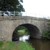
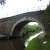
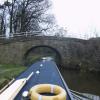
There is a bridge here which takes a minor road over the canal.
| Ratcliffe Bridge Winding Hole | 1 mile, 2¼ furlongs | |
| Ratcliffe Bridge No 75 | 1 mile, 1¼ furlongs | |
| Corless Bridge No 76 | 1 mile | |
| Smiths Bridge No 77 (Forton) | 5½ furlongs | |
| Stoney Lane Bridge No 78 | 4¾ furlongs | |
| Cockerham Road Bridge No 79 | ||
| Richmond Bridge Winding Hole | 2¾ furlongs | |
| Richmond Bridge No 80 | 3 furlongs | |
| Potters Brook Bridge No 81 | 5½ furlongs | |
| Cocker Aqueduct No 82 | 5¾ furlongs | |
| Hay Car Bridge No 83 | 7¼ furlongs | |
There are no links to external websites from here.
Why not log in and add some (select "External websites" from the menu (sometimes this is under "Edit"))?
Mouseover for more information or show routes to facility
Nearest water point
In the direction of Preston Terminus
Ratcliffe Bridge No 75 — 1 mile, 1¼ furlongs away
On this waterway in the direction of Preston Terminus
Moss Lane Bridge No 63 — 5 miles, 2¼ furlongs away
On this waterway in the direction of Preston Terminus
Bilsborrow Winding Hole — 10 miles, 3 furlongs away
On this waterway in the direction of Preston Terminus
Swill Brook Basin — 14 miles, 7½ furlongs away
On this waterway in the direction of Preston Terminus
Blackleach Lane Marina — 15 miles, 2¾ furlongs away
On this waterway in the direction of Preston Terminus
In the direction of Tewitfield
Lodge Hill Junction — 1 mile, 7¼ furlongs away
On this waterway in the direction of Tewitfield
Brows Bridge No 8 — 4 miles, 3¼ furlongs and 6 locks away
Travel to Lodge Hill Junction, then on the Lancaster Canal (Glasson Branch) to Brows Bridge No 8
Glasson Visitor Moorings — 4 miles, 4 furlongs and 6 locks away
Travel to Lodge Hill Junction, then on the Lancaster Canal (Glasson Branch) to Glasson Visitor Moorings
Glasson Basin — 4 miles, 5¼ furlongs and 6 locks away
Travel to Lodge Hill Junction, then on the Lancaster Canal (Glasson Branch) to Glasson Basin
Hest Bank Bridge No 118 — 12 miles, 2½ furlongs away
On this waterway in the direction of TewitfieldNearest rubbish disposal
In the direction of Preston Terminus
Bilsborrow Winding Hole — 10 miles, 3 furlongs away
On this waterway in the direction of Preston Terminus
In the direction of Tewitfield
Hest Bank Bridge No 118 — 12 miles, 2½ furlongs away
On this waterway in the direction of TewitfieldNearest chemical toilet disposal
In the direction of Preston Terminus
Bilsborrow Winding Hole — 10 miles, 3 furlongs away
On this waterway in the direction of Preston Terminus
In the direction of Tewitfield
Hest Bank Bridge No 118 — 12 miles, 2½ furlongs away
On this waterway in the direction of Tewitfield
Lundsfield Wharf — 15 miles, 5¾ furlongs away
On this waterway in the direction of TewitfieldNearest place to turn
In the direction of Preston Terminus
Ratcliffe Bridge Winding Hole — 1 mile, 2¼ furlongs away
On this waterway in the direction of Preston Terminus
Bells Bridge Winding Hole — 3 miles, 5¾ furlongs away
On this waterway in the direction of Preston Terminus
Cathouse Bridge Winding Hole — 5 miles, ¼ furlongs away
On this waterway in the direction of Preston Terminus
Moss Lane Bridge Winding Hole (north) — 5 miles, 2¼ furlongs away
On this waterway in the direction of Preston Terminus
Moss Lane Bridge Winding Hole (south) — 5 miles, 2¼ furlongs away
On this waterway in the direction of Preston Terminus
Kepple Lane Bridge Winding Hole — 5 miles, 3¾ furlongs away
On this waterway in the direction of Preston Terminus
The Moorings Basin — 5 miles, 4¼ furlongs away
On this waterway in the direction of Preston Terminus
Dimples Bridge Winding Hole — 6 miles, 2 furlongs away
On this waterway in the direction of Preston Terminus
Greenhalgh Castle Bridge Winding Hole — 6 miles, 4 furlongs away
On this waterway in the direction of Preston Terminus
Catterall Bridge Winding Hole — 7 miles, 4¾ furlongs away
On this waterway in the direction of Preston Terminus
Bilsborrow Winding Hole — 10 miles, 3 furlongs away
On this waterway in the direction of Preston Terminus
In the direction of Tewitfield
Richmond Bridge Winding Hole — 2¾ furlongs away
On this waterway in the direction of Tewitfield
Lodge Hill Junction — 1 mile, 7¼ furlongs away
On this waterway in the direction of Tewitfield
Galgate Basin Wharf — 2 miles, 2¼ furlongs away
On this waterway in the direction of Tewitfield
Carter's Wood Winding Hole — 2 miles, 1½ furlongs and 1 lock away
Travel to Lodge Hill Junction, then on the Lancaster Canal (Glasson Branch) to Carter's Wood Winding Hole
Ashton Park Bridge Winding Hole — 4 miles away
On this waterway in the direction of Tewitfield
Thurnham Bridge Winding Hole — 3 miles, 6¼ furlongs and 6 locks away
Travel to Lodge Hill Junction, then on the Lancaster Canal (Glasson Branch) to Thurnham Bridge Winding Hole
Halton Road Winding Hole — 9 miles, 6 furlongs away
On this waterway in the direction of Tewitfield
Glasson Basin — 4 miles, 5¼ furlongs and 6 locks away
Travel to Lodge Hill Junction, then on the Lancaster Canal (Glasson Branch) to Glasson Basin
Folly Bridge Winding Hole — 10 miles, 6¾ furlongs away
On this waterway in the direction of TewitfieldNo information
CanalPlan has no information on any of the following facilities within range:self-operated pump-out
boatyard pump-out
Direction of TV transmitter (From Wolfbane Cybernetic)
There is no page on Wikipedia called “Cockerham Road Bridge”
Wikipedia pages that might relate to Cockerham Road Bridge
[Bering Strait crossing]
build road from Kolyma to Anadyr drawn up". TASS (in Russian). 2012-06-23. Retrieved 2017-12-05. COCKERHAM, SEAN (January 27, 2010). "Nome road could
[A588 road]
Cockerham Sands portion of Morecambe Bay. At Cockerham, almost 12 miles (19 km) from Shard Bridge, the road turns to the left, and, as Lancaster Road
[Cockerham Cross Halt railway station]
Cockerham Cross railway station, also known as Cockerham Crossing railway station was a halt at a level crossing on a road that crossed Cockerham Moss
[Morecambe Bay]
Grange-over-Sands Heysham Carnforth Aldingham Arnside Bardsea Bare Bolton-le-Sands Cockerham Flookburgh Glasson Dock Hest Bank Kents Bank Knott End Piel Island Pilling
[Listed buildings in Cockerham]
Cockerham is a civil parish in Lancaster, Lancashire, England. It contains 19 listed buildings that are recorded in the National Heritage List for England
[Governorship of Sarah Palin]
or fire him for not taking action against her former brother-in-law." Cockerham, Sean (August 14, 2008). "Palin staff pushed to have trooper fired". Anchorage
[Greyhound Bridge]
The Greyhound Bridge is a road-connection spanning the River Lune as it runs through Lancaster, England. It serves as the primary route northwards, on
[Cockerham Vicarage]
Cockerham Vicarage is in Rectory Road, Cockerham, Lancashire, England. Originally a vicarage, it was later used as a nursing home. The vicarage is recorded
[Elliott Highway]
Tanana until summer 2016 Driving Alaska's new road to Tanana COCKERHAM, SEAN (January 27, 2010). "Nome road could cost $2.7 billion". Anchorage Daily News
[Lancaster Castle]
influenced by the Roman fort and the associated civilian settlement; the main road through the town was the route that led east from the fort. After the Norman