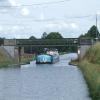
Pont du Péage
is a minor waterways place
on the Canal Latéral à la Loire (Main Line) between
Halte de Beaulon (27.09 kilometres
and 7 locks
to the northwest) and
Latéral à la Loire - Latéral de Roanne à Digoin Jonction (Junction of the Canal Latéral à la Loire and the Canal Latéral de Roanne à Digoin) (3.28 kilometres
to the east).
The nearest place in the direction of Halte de Beaulon is Kilometre Post No 10 ( Latéral à la Loire) (Distance to the junction with the Canal du Centre);
0.41 kilometres
away.
The nearest place in the direction of Latéral à la Loire - Latéral de Roanne à Digoin Jonction is Pont-Canal de la Vouzance;
0.44 kilometres
away.
There is no access to the towpath here.
Mooring here is unrated.
There is a bridge here which takes a minor road over the canal.
| Pont de Mortillon | 2.38 km | |
| Kilometre Post No 12 (Latéral à la Loire) | 2.36 km | |
| Kilometre Post No 11 ( Latéral à la Loire) | 1.37 km | |
| Pont de la Micaudiere | 0.83 km | |
| Kilometre Post No 10 ( Latéral à la Loire) | 0.41 km | |
| Pont du Péage | ||
| Pont-Canal de la Vouzance | 0.44 km | |
| Kilometre Post No 9 (Latéral à la Loire) | 0.47 km | |
| Kilometre Post No 8 (Latéral à la Loire) | 1.50 km | |
| Pont du Route de Digoin | 1.74 km | |
| Pont de Route du Digoin Narrows | 1.78 km | |
- VisuRiS — associated with Waterways of Mainland Europe
- The official inland waterway resource for Belgium with actual traffic and planned operations on the waterways. Also has voyage planning and notices to mariners
Mouseover for more information or show routes to facility
Nearest water point
In the direction of Junction of Canal Latéral à la Loire and Canal du Centre
Port de Plaisance - Digoin — 5.16 km and 1 lock away
Travel to Junction of Canal Latéral à la Loire and Canal du Centre, then on the Canal du Centre to Port de Plaisance - Digoin
La Croix-Rouge — 10.02 km and 3 locks away
Travel to Latéral à la Loire - Latéral de Roanne à Digoin Jonction, then on the Canal Latéral de Roanne à Digoin to La Croix-Rouge
In the direction of Briare-Henri IV Junction
Halte de Beaulon — 27.09 km and 7 locks away
On this waterway in the direction of Briare-Henri IV JunctionNearest rubbish disposal
In the direction of Junction of Canal Latéral à la Loire and Canal du Centre
La Croix-Rouge — 10.02 km and 3 locks away
Travel to Latéral à la Loire - Latéral de Roanne à Digoin Jonction, then on the Canal Latéral de Roanne à Digoin to La Croix-RougeNo information
CanalPlan has no information on any of the following facilities within range:chemical toilet disposal
place to turn
self-operated pump-out
boatyard pump-out
There is no page on Wikipedia called “Pont du Péage”
Wikipedia pages that might relate to Pont du Péage
[A7 autoroute]
-Plombière (depuis Lyon) 37: Saint Charles Terminus at Porte d'Aix Péage de Vienne Péage de Lançon de Provence This autoroute is fairly heavy throughout
[Autoroutes of France]
with an added autoroute logo. Toll autoroutes are signalled with the word péage (toll). Unlike other motorway systems, there is no systematic numbering
[A52 autoroute]
It is a toll road except for the very southern stretch south of the Péage du Pont d'Etoile and is operated by ESCOTA. Traffic information for the road
[A8 autoroute]
autoroute 30 19 km: Aix-en-Provence (pont de l'Arc) 31 21 km: Aix-en-Provence (est) 32 27 km: N7 Châteauneuf-le-Rouge Péage de La Barque : A52 autoroute Aires
[Bourg-de-Péage]
Romans-west/Bourg-de-Péage, D538 in the direction of Bourg-de-Péage. The commune has access to two stations: The Gare de Romans - Bourg-de-Péage [fr], as well
[List of SNCF stations in Auvergne-Rhône-Alpes]
Moirans-Galifette Monestier-de-Clermont Le Péage-de-Roussillon Poliénas Pontcharra-sur-Breda Pont-de-Beauvoisin Pont-de-Claix Réaumont-Saint-Cassien Rives
[Saint-Laurent-du-Pont]
Saint-Laurent-du-Pont (French pronunciation: [sɛ̃ loʁɑ̃ dy pɔ̃]) is a commune in the Isère department in southeastern France. It was the site of the
[Army of the Alps]
Bourg-de-Péage 2éme Bataillon d'Ariège — Nantua 3éme Bataillon du Basses-Alpes — Montluel and Miribel-Lanchâtre (forming) Compagne Franche — Bourg-de-Péage 2
[Route nationale 7]
parallel and now takes the bulk of through traffic. The road passes Le Péage-de-Roussillon and follows the East bank of the river to Tain-l'Hermitage
[List of medieval bridges in France]
known. Pont-Saint-Bénezet (1177–1188) at Avignon, Vaucluse Pont-de-Saint-Nicolas de Campagnac (1261) at Sainte-Anastasie, Gard Roman Pont-du-Gard at

