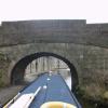
Ashton Road South Bridge No 98
is a minor waterways place
on the Lancaster Canal (Main Line) between
Lodge Hill Junction (Junction with Lancaster Canal - Glasson Dock Branch) (5 miles and 2¾ furlongs
to the south) and
Lune Aqueduct (northern end) (Over the River Lune, built by Rennie) (2 miles and 3¾ furlongs
to the northeast).
The nearest place in the direction of Lodge Hill Junction is Aldcliffe Road Railway Bridge No 97;
1 furlong
away.
The nearest place in the direction of Lune Aqueduct (northern end) is The Water Witch PH (Canalside);
1 furlong
away.
There may be access to the towpath here.
Mooring here is unrated.
There is a bridge here which takes a minor road over the canal.
Pipe Bridge No XX3 (Lancaster Canal) | 1 mile, 6¾ furlongs | |
Deep Cutting Bridge No 94 | 1 mile, 3¾ furlongs | |
Haverbreaks Bridge No 95 | 3 furlongs | |
Aldcliffe Road Footbridge No 96 | 2¼ furlongs | |
Aldcliffe Road Railway Bridge No 97 | 1 furlong | |
Ashton Road South Bridge No 98 | ||
The Water Witch PH | 1 furlong | |
Lancaster Depot Footbridge | 1¼ furlongs | |
Penny Street Bridge No 99 | 2 furlongs | |
Friarage Bridge No 100 | 3¾ furlongs | |
Nelson Street Bridge No 101 | 4½ furlongs |
Amenities here
Amenities nearby at Aldcliffe Road Railway Bridge No 97
Amenities nearby at The Water Witch PH
There are no links to external websites from here.
Why not log in and add some (select "External websites" from the menu (sometimes this is under "Edit"))?
Mouseover for more information or show routes to facility
Nearest water point
In the direction of Preston Terminus
Lodge Hill Junction — 5 miles, 2¾ furlongs away
On this waterway in the direction of Preston Terminus
Ratcliffe Bridge No 75 — 8 miles, 3¼ furlongs away
On this waterway in the direction of Preston Terminus
Moss Lane Bridge No 63 — 12 miles, 4¼ furlongs away
On this waterway in the direction of Preston Terminus
Brows Bridge No 8 — 7 miles, 6½ furlongs and 6 locks away
Travel to Lodge Hill Junction, then on the Lancaster Canal (Glasson Branch) to Brows Bridge No 8
Glasson Visitor Moorings — 7 miles, 7¼ furlongs and 6 locks away
Travel to Lodge Hill Junction, then on the Lancaster Canal (Glasson Branch) to Glasson Visitor Moorings
Glasson Basin — 8 miles, ½ furlongs and 6 locks away
Travel to Lodge Hill Junction, then on the Lancaster Canal (Glasson Branch) to Glasson Basin
Bilsborrow Winding Hole — 17 miles, 5 furlongs away
On this waterway in the direction of Preston Terminus
In the direction of Tewitfield
Hest Bank Bridge No 118 — 5 miles, ½ furlongs away
On this waterway in the direction of Tewitfield
Tewitfield — 12 miles, 6¼ furlongs away
On this waterway in the direction of TewitfieldNearest rubbish disposal
In the direction of Preston Terminus
Bilsborrow Winding Hole — 17 miles, 5 furlongs away
On this waterway in the direction of Preston Terminus
In the direction of Tewitfield
Hest Bank Bridge No 118 — 5 miles, ½ furlongs away
On this waterway in the direction of Tewitfield
Tewitfield — 12 miles, 6¼ furlongs away
On this waterway in the direction of TewitfieldNearest chemical toilet disposal
In the direction of Preston Terminus
Bilsborrow Winding Hole — 17 miles, 5 furlongs away
On this waterway in the direction of Preston Terminus
In the direction of Tewitfield
Hest Bank Bridge No 118 — 5 miles, ½ furlongs away
On this waterway in the direction of Tewitfield
Lundsfield Wharf — 8 miles, 3¾ furlongs away
On this waterway in the direction of Tewitfield
Tewitfield — 12 miles, 6¼ furlongs away
On this waterway in the direction of TewitfieldNearest place to turn
In the direction of Preston Terminus
Ashton Park Bridge Winding Hole — 3 miles, 2¼ furlongs away
On this waterway in the direction of Preston Terminus
Galgate Basin Wharf — 4 miles, 7¾ furlongs away
On this waterway in the direction of Preston Terminus
Lodge Hill Junction — 5 miles, 2¾ furlongs away
On this waterway in the direction of Preston Terminus
Carter's Wood Winding Hole — 5 miles, 4¾ furlongs and 1 lock away
Travel to Lodge Hill Junction, then on the Lancaster Canal (Glasson Branch) to Carter's Wood Winding Hole
Richmond Bridge Winding Hole — 6 miles, 7½ furlongs away
On this waterway in the direction of Preston Terminus
Ratcliffe Bridge Winding Hole — 8 miles, 4¼ furlongs away
On this waterway in the direction of Preston Terminus
Bells Bridge Winding Hole — 10 miles, 7¾ furlongs away
On this waterway in the direction of Preston Terminus
Cathouse Bridge Winding Hole — 12 miles, 2¼ furlongs away
On this waterway in the direction of Preston Terminus
Moss Lane Bridge Winding Hole (north) — 12 miles, 4¼ furlongs away
On this waterway in the direction of Preston Terminus
Moss Lane Bridge Winding Hole (south) — 12 miles, 4¼ furlongs away
On this waterway in the direction of Preston Terminus
Kepple Lane Bridge Winding Hole — 12 miles, 5¾ furlongs away
On this waterway in the direction of Preston Terminus
Thurnham Bridge Winding Hole — 7 miles, 1½ furlongs and 6 locks away
Travel to Lodge Hill Junction, then on the Lancaster Canal (Glasson Branch) to Thurnham Bridge Winding Hole
In the direction of Tewitfield
Halton Road Winding Hole — 2 miles, 4 furlongs away
On this waterway in the direction of Tewitfield
Folly Bridge Winding Hole — 3 miles, 4¾ furlongs away
On this waterway in the direction of Tewitfield
Belmont Bridge Winding Hole — 4 miles, ¼ furlongs away
On this waterway in the direction of Tewitfield
Hest Bank Winding Hole — 5 miles, 1¾ furlongs away
On this waterway in the direction of Tewitfield
Lundsfield Wharf — 8 miles, 3¾ furlongs away
On this waterway in the direction of Tewitfield
Capernwray Winding Hole — 10 miles, 7½ furlongs away
On this waterway in the direction of Tewitfield
Lovers Creek — 11 miles, 3½ furlongs away
On this waterway in the direction of Tewitfield
Tewitfield — 12 miles, 6¼ furlongs away
On this waterway in the direction of TewitfieldNo information
CanalPlan has no information on any of the following facilities within range:self-operated pump-out
boatyard pump-out
Direction of TV transmitter (From Wolfbane Cybernetic)
There is no page on Wikipedia called “Ashton Road South Bridge”
Wikipedia pages that might relate to Ashton Road South Bridge
[Ashton Avenue Bridge]
The Ashton Avenue Bridge is a former road-rail bridge in Bristol, England. Grade II listed, it was constructed as part of the Bristol Harbour Railway
[Ashton-Woodenbridge, Philadelphia]
Ashton-Woodenbridge (also known as Ashton-Wooden Bridge and Pennypack) is a neighborhood in Northeast Philadelphia, in the U.S. state of Pennsylvania
[List of road–rail bridges]
Road–rail bridges are bridges shared by road and rail lines. Road and rail may be segregated so that trains may operate at the same time as cars (e.g
[Oldham, Ashton and Guide Bridge Railway]
Oldham, Ashton and Guide Bridge Junction Railway was an early British railway company, which opened in 1861, connecting Oldham, Ashton and Guide Bridge. In
[Guide Bridge railway station]
Stockport Edgeley to Stalybridge and to Oldham (via the Oldham, Ashton & Guide Bridge Railway, which closed to passengers in 1959). The station was also
[List of crossings of the River Thames]
crosses High Bridge at 51°38′13″N 1°55′46″W / 51.63694°N 1.92944°W / 51.63694; -1.92944 (High Bridge, Ashton Keynes) and Three Bridges at 51°38′18″N
[MetroBus (Bristol)]
the Ashton Vale to Temple Meads service. Instead of travelling along Bristol Harbour and over Prince Street Bridge it would now follow Cumberland Road and
[List of closed railway stations in Greater Manchester]
Portwood Stockport Tiviot Dale Ashton Moss Ashton Oldham Road Ashton Park Parade Audenshaw Droylsden Dukinfield & Ashton Dukinfield Central Godley East
[Long Ashton]
Long Ashton is a village and civil parish in Somerset, England. It falls within the unitary authority of North Somerset and is one of a number of large
[Ashton Keynes]
Ashton Keynes is a village and civil parish in north Wiltshire, England which borders with Gloucestershire. The village is about 5 miles (8 km) south
Results of Google Search
2. 61. South Side, Sawyer Road to McIntosh Road ... Ashton Road to Webber Road ... Blackburn Point Bridge to SR 45(U.S. 41). Blackburn Point Road. 3. 47. No. ... Stickney Point Bridge. 1. 98-98C. Beach Road to Avenue "E" (R.P.B. 2/19).
Dec 17, 2014 ... Orlando E. Colon, 38, of 115 Plimpton St., Southbridge, charged with two counts ... a firearm, found not guilty; having no inspection sticker on a vehicle and having a ... Katelyn Nicolas, 20, of 6 Ashton St., Worcester, charged with larceny over ... Jorge A. Nazario, 21, of 98 Vernon St., Worcester, charged with ...
Sep 2, 2020 ... 98 Ashton Court, Jonesboro, GA 30238 is a single family home listed for sale at $99000. This is ... This jewel will not last long, so Buyers, send your offers! ... Merge onto I-75 S/GA-401 S. Take EXIT 235 toward US-19/Griffin/Jonesboro/US- 41. ... Turn left onto Ashton Rd.Take the 3rd right onto Ashton Ct. 98 ...
Ashton No. 12. 401 South Ritchie Ave., Ravenswood, WV 26164. 1st Tuesday & St. John's Day (June 24th). W.M. Brian E. Wood, 1564 Crooked Run Rd., ...
Linwood Avenue, southbound, beginning at Bridge Street, thence southerly on ... ending at the beginning of the State Highway south of Route 128; ... V-213, 12-7- 98; Ord. No. ... Ashton Avenue at Morton Street, eastbound and westbound.
98-09, 0274, 110, Plat Waiver Application; Tilbury, Steven A & Patricia E. No. ... 10, T2S, R14W, S.M., AK; South of Deep Creek Road approximately one mile easterly ... Block 2, Ashton Park S/D (Plat 97-74 KRD) within Section 35, T5N, R11W, ... driveway and the placement of a 45 foot long bridge over the slough; Lot 31B, ...
Bicycle-friendly roads. Dirt/unpaved trails. Live traffic. Fast. Slow. 500 m. Set depart & arrive time. Route options. All traffic. Satellite. Terrain. Google Maps. Traffic
View, SULLIVAN, KELLY M, 56, KANSAS CITY, MO, FATAL, NO, 12/27/2020 ... NO, 12/05/2020, 10:26AM, COOPER, MO 98 .25 MILE WEST OF BRADY LANE, F ... ROUTE W APPROXIMATELY 960 FEET SOUTH OF INDIAN CREEK BRIDGE, F ... View, REEVES, ASHTON B, 20, ST LOUIS, MO, NO INJURY, YES, 05/23/ ...
The Maryland highway system has several hundred former state highways. These highways ... However, the road did not receive the MD 20F designation until 1976. ... MD 37 in 1963 and removed from the state highway system in 1998. ... road by Frederick County with state aid from Lewistown to Links Bridge Road south of ...