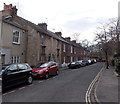
Jericho Footbridge
is a minor waterways place
on the Oxford Canal (Southern Section - Main Line) between
Isis Lock Junction (1¾ furlongs
to the southeast) and
Wolvercote Junction (Junction of Duke's Cut with Oxford Canal) (2 miles and 6¼ furlongs
and 1 lock
to the northwest).
The nearest place in the direction of Isis Lock Junction is Combe Road Wharf (College Cruisers hire base);
½ furlongs
away.
The nearest place in the direction of Wolvercote Junction is Walton Well Road Bridge No 242;
1¾ furlongs
away.
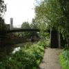
There is access (via steps) to the towpath here.
Mooring here is impossible (it may be physically impossible, forbidden, or allowed only for specific short-term purposes).
There is a bridge here which takes pedestrian traffic over the canal.
Isis Sanitary Station | 2 furlongs | |
Isis Lock Junction | 1¾ furlongs | |
Hythe Bridge Arm Winding Hole | 1¾ furlongs | |
Jericho Canal Wharf | 1 furlong | |
Combe Road Wharf | ½ furlongs | |
Jericho Footbridge | ||
Walton Well Road Bridge No 242 | 1¾ furlongs | |
Aristotle Lane 48 hour Visitor Moorings | 4¾ furlongs | |
Aristotle Bridge No 240 | 5 furlongs | |
Heyfield Hut Wharf | 5¼ furlongs | |
Frenchay Bridge No 239A | 6½ furlongs |
Amenities here
Amenities nearby at Combe Road Wharf
Amenities nearby at Walton Well Road Bridge No 242
Amenities in City of Oxford
Amenities at other places in City of Oxford
at
at
at
at
at
at
at
at
at
at
at
at
at
at
at
at
at
at
at
at
at
at
at
at
at
at
at
at
at
at
at
at
at
at
at
at
at
at
at
at
at
at
at
at
at
at
at
at
at
at
at
at
at
at
at
at
at
at
at
at
at
at
at
at
at
at
at
at
at
at
at
at
at
at
at
at
at
Dreadful place for an overnight. It may be very close to the city centre & the train station but it is a very busy section with boats moored both sides and there's a train marshalling yard close by - we had diesels revving up all through the night!! Go on for 2.5 hrs just beyond Kidlington Green lock
- Oxford Canal Walk - Part One - Oxford to Thrupp - YouTube — associated with Oxford Canal
- A walk along the Oxford Canal (Southern Section) from Oxford to Thrupp Wide
Mouseover for more information or show routes to facility
Nearest water point
In the direction of Napton Junction
St Edwards Lift Bridge No 238 — 1 mile, 2 furlongs away
On this waterway in the direction of Napton Junction
Wolvercote Sanitary Station — 2 miles, 2¾ furlongs and 1 lock away
On this waterway in the direction of Napton Junction
Wolvercote Junction Water Point — 2 miles, 7 furlongs and 2 locks away
On this waterway in the direction of Napton Junction
Eynsham Lock — 6 miles, 1 furlong and 2 locks away
Travel to Wolvercote Junction, then on the Oxford Canal (Duke's Cut) to Duke's Cut Junction, then on the River Thames (above Oxford) to Eynsham Lock
Langford Lane Bridge No 224 — 5 miles, 6¾ furlongs and 4 locks away
On this waterway in the direction of Napton Junction
Aubreys Lift Bridge No 221 — 6 miles, 4¼ furlongs and 4 locks away
On this waterway in the direction of Napton Junction
Thrupp Cruising Club — 6 miles, 4½ furlongs and 4 locks away
On this waterway in the direction of Napton Junction
Shifford Lock — 16 miles, 1¾ furlongs and 5 locks away
Travel to Wolvercote Junction, then on the Oxford Canal (Duke's Cut) to Duke's Cut Junction, then on the River Thames (above Oxford) to Shifford Lock
Heyford Wharf Bridge No 206 — 14 miles, ¾ furlongs and 9 locks away
On this waterway in the direction of Napton Junction
Heyford Wharf — 14 miles, ¾ furlongs and 9 locks away
On this waterway in the direction of Napton Junction
In the direction of End of Hythe Bridge Arm
Oxford Visitor Moorings — 2½ furlongs away
On this waterway in the direction of End of Hythe Bridge Arm
Abingdon Lock — 9 miles, 1½ furlongs and 4 locks away
Travel to Isis Lock Junction, then on the River Thames (Sheepwash Channel) to Sheepwash Channel Junction, then on the River Thames (above Oxford) to Osney Bridge, then on the River Thames (below Oxford) to Abingdon Lock
Abingdon Bridge Marine — 9 miles, 5¼ furlongs and 5 locks away
Travel to Isis Lock Junction, then on the River Thames (Sheepwash Channel) to Sheepwash Channel Junction, then on the River Thames (above Oxford) to Osney Bridge, then on the River Thames (below Oxford) to Abingdon Bridge MarineNearest rubbish disposal
In the direction of Napton Junction
Wolvercote Sanitary Station — 2 miles, 2¾ furlongs and 1 lock away
On this waterway in the direction of Napton Junction
Eynsham Lock — 6 miles, 1 furlong and 2 locks away
Travel to Wolvercote Junction, then on the Oxford Canal (Duke's Cut) to Duke's Cut Junction, then on the River Thames (above Oxford) to Eynsham Lock
Aubreys Lift Bridge No 221 — 6 miles, 4¼ furlongs and 4 locks away
On this waterway in the direction of Napton Junction
Thrupp Cruising Club — 6 miles, 4½ furlongs and 4 locks away
On this waterway in the direction of Napton Junction
Heyford Wharf Bridge No 206 — 14 miles, ¾ furlongs and 9 locks away
On this waterway in the direction of Napton Junction
Heyford Wharf — 14 miles, ¾ furlongs and 9 locks away
On this waterway in the direction of Napton Junction
In the direction of End of Hythe Bridge Arm
Abingdon Lock — 9 miles, 1½ furlongs and 4 locks away
Travel to Isis Lock Junction, then on the River Thames (Sheepwash Channel) to Sheepwash Channel Junction, then on the River Thames (above Oxford) to Osney Bridge, then on the River Thames (below Oxford) to Abingdon Lock
Day's Lock — 17 miles, 3½ furlongs and 7 locks away
Travel to Isis Lock Junction, then on the River Thames (Sheepwash Channel) to Sheepwash Channel Junction, then on the River Thames (above Oxford) to Osney Bridge, then on the River Thames (below Oxford) to Day's LockNearest chemical toilet disposal
In the direction of Napton Junction
Wolvercote Sanitary Station — 2 miles, 2¾ furlongs and 1 lock away
On this waterway in the direction of Napton Junction
Eynsham Lock — 6 miles, 1 furlong and 2 locks away
Travel to Wolvercote Junction, then on the Oxford Canal (Duke's Cut) to Duke's Cut Junction, then on the River Thames (above Oxford) to Eynsham Lock
Thrupp Cruising Club — 6 miles, 4½ furlongs and 4 locks away
On this waterway in the direction of Napton Junction
In the direction of End of Hythe Bridge Arm
Abingdon Lock — 9 miles, 1½ furlongs and 4 locks away
Travel to Isis Lock Junction, then on the River Thames (Sheepwash Channel) to Sheepwash Channel Junction, then on the River Thames (above Oxford) to Osney Bridge, then on the River Thames (below Oxford) to Abingdon Lock
Day's Lock — 17 miles, 3½ furlongs and 7 locks away
Travel to Isis Lock Junction, then on the River Thames (Sheepwash Channel) to Sheepwash Channel Junction, then on the River Thames (above Oxford) to Osney Bridge, then on the River Thames (below Oxford) to Day's LockNearest place to turn
In the direction of Napton Junction
Wolvercote Junction — 2 miles, 6¼ furlongs and 1 lock away
On this waterway in the direction of Napton Junction
Bypass Reservoir Junction — 3 miles and 2 locks away
Travel to Wolvercote Junction, then on the Oxford Canal (Duke's Cut) to Bypass Reservoir Junction
Duke's Cut Junction — 3 miles, 4½ furlongs and 2 locks away
Travel to Wolvercote Junction, then on the Oxford Canal (Duke's Cut) to Duke's Cut Junction
Thames - Wharf Stream Junction — 5 miles, 7¼ furlongs and 2 locks away
Travel to Wolvercote Junction, then on the Oxford Canal (Duke's Cut) to Duke's Cut Junction, then on the River Thames (above Oxford) to Thames - Wharf Stream Junction
Pinkhill Lock Weir Exit — 7 miles, 3¼ furlongs and 3 locks away
Travel to Wolvercote Junction, then on the Oxford Canal (Duke's Cut) to Duke's Cut Junction, then on the River Thames (above Oxford) to Pinkhill Lock Weir Exit
Thrupp Wide — 6 miles, 4½ furlongs and 4 locks away
On this waterway in the direction of Napton Junction
Shipton Weir Junction — 7 miles, 4¾ furlongs and 5 locks away
On this waterway in the direction of Napton Junction
In the direction of End of Hythe Bridge Arm
Hythe Bridge Arm Winding Hole — 1¾ furlongs away
On this waterway in the direction of End of Hythe Bridge Arm
End of Hythe Bridge Arm — 2½ furlongs away
On this waterway in the direction of End of Hythe Bridge Arm
Castle Mill Stream Junction — 2 furlongs and 1 lock away
Travel to Isis Lock Junction, then on the River Thames (Sheepwash Channel) to Castle Mill Stream Junction
Sheepwash Channel Junction — 2¾ furlongs and 1 lock away
Travel to Isis Lock Junction, then on the River Thames (Sheepwash Channel) to Sheepwash Channel Junction
Bossoms Boat Yard — 1 mile, ¾ furlongs and 1 lock away
Travel to Isis Lock Junction, then on the River Thames (Sheepwash Channel) to Sheepwash Channel Junction, then on the River Thames (above Oxford) to Bossoms Boat Yard
Osney Lock Weir Exit — 5¾ furlongs and 2 locks away
Travel to Isis Lock Junction, then on the River Thames (Sheepwash Channel) to Sheepwash Channel Junction, then on the River Thames (above Oxford) to Osney Bridge, then on the River Thames (below Oxford) to Osney Lock Weir Exit
Thames - Cherwell Junction — 1 mile, 7¾ furlongs and 2 locks away
Travel to Isis Lock Junction, then on the River Thames (Sheepwash Channel) to Sheepwash Channel Junction, then on the River Thames (above Oxford) to Osney Bridge, then on the River Thames (below Oxford) to Thames - Cherwell Junction
Iffley Lock Weir Entrance No 1 — 2 miles, 7 furlongs and 2 locks away
Travel to Isis Lock Junction, then on the River Thames (Sheepwash Channel) to Sheepwash Channel Junction, then on the River Thames (above Oxford) to Osney Bridge, then on the River Thames (below Oxford) to Iffley Lock Weir Entrance No 1
Iffley Lock Weir Exit No 1 — 3 miles, ¼ furlongs and 3 locks away
Travel to Isis Lock Junction, then on the River Thames (Sheepwash Channel) to Sheepwash Channel Junction, then on the River Thames (above Oxford) to Osney Bridge, then on the River Thames (below Oxford) to Iffley Lock Weir Exit No 1
Sandford Lock Weir Exit (Thames) — 4 miles, 6 furlongs and 4 locks away
Travel to Isis Lock Junction, then on the River Thames (Sheepwash Channel) to Sheepwash Channel Junction, then on the River Thames (above Oxford) to Osney Bridge, then on the River Thames (below Oxford) to Sandford Lock Weir Exit (Thames)
Abingdon Lock Weir Exit No 1 — 9 miles, 2 furlongs and 5 locks away
Travel to Isis Lock Junction, then on the River Thames (Sheepwash Channel) to Sheepwash Channel Junction, then on the River Thames (above Oxford) to Osney Bridge, then on the River Thames (below Oxford) to Abingdon Lock Weir Exit No 1
Abingdon Bridge Winding Hole — 9 miles, 5¼ furlongs and 5 locks away
Travel to Isis Lock Junction, then on the River Thames (Sheepwash Channel) to Sheepwash Channel Junction, then on the River Thames (above Oxford) to Osney Bridge, then on the River Thames (below Oxford) to Abingdon Bridge Winding Hole
Culham Lock Weir Entrance — 9 miles, 7¼ furlongs and 5 locks away
Travel to Isis Lock Junction, then on the River Thames (Sheepwash Channel) to Sheepwash Channel Junction, then on the River Thames (above Oxford) to Osney Bridge, then on the River Thames (below Oxford) to Culham Lock Weir EntranceNearest self-operated pump-out
In the direction of Napton Junction
Eynsham Lock — 6 miles, 1 furlong and 2 locks away
Travel to Wolvercote Junction, then on the Oxford Canal (Duke's Cut) to Duke's Cut Junction, then on the River Thames (above Oxford) to Eynsham Lock
Aubreys Lift Bridge No 221 — 6 miles, 4¼ furlongs and 4 locks away
On this waterway in the direction of Napton Junction
Thrupp Cruising Club — 6 miles, 4½ furlongs and 4 locks away
On this waterway in the direction of Napton Junction
In the direction of End of Hythe Bridge Arm
Abingdon Lock — 9 miles, 1½ furlongs and 4 locks away
Travel to Isis Lock Junction, then on the River Thames (Sheepwash Channel) to Sheepwash Channel Junction, then on the River Thames (above Oxford) to Osney Bridge, then on the River Thames (below Oxford) to Abingdon LockNearest boatyard pump-out
In the direction of Napton Junction
Oxford Cruisers Marina — 7 miles, ¾ furlongs and 3 locks away
Travel to Wolvercote Junction, then on the Oxford Canal (Duke's Cut) to Duke's Cut Junction, then on the River Thames (above Oxford) to Oxford Cruisers Marina
Enslow Wharf — 8 miles, 7¾ furlongs and 6 locks away
On this waterway in the direction of Napton Junction
Heyford Wharf — 14 miles, ¾ furlongs and 9 locks away
On this waterway in the direction of Napton Junction
In the direction of End of Hythe Bridge Arm
Abingdon Bridge Marine — 9 miles, 5¼ furlongs and 5 locks away
Travel to Isis Lock Junction, then on the River Thames (Sheepwash Channel) to Sheepwash Channel Junction, then on the River Thames (above Oxford) to Osney Bridge, then on the River Thames (below Oxford) to Abingdon Bridge MarineDirection of TV transmitter (From Wolfbane Cybernetic)
There is no page on Wikipedia called “Jericho Footbridge”
Wikipedia pages that might relate to Jericho Footbridge
[British Museum]
material was strengthened by the work of Kathleen Kenyon at Tell es-Sultan (Jericho) in the 1950s and the acquisition in 1980 of around 17,000 objects found
[First Transjordan attack on Amman]
the successful Battle of Tell 'Asur which occurred after the Capture of Jericho in February and the Occupation of the Jordan Valley began, during the Sinai
[Osney]
Oxford Mail. Osney Abbey Osney Bridge (1885) Osney Cemetery (1848) Osney footbridge (Wikidata) Osney Rail Bridge Osney Lock Osney Marina Osney Mill Canterbury
[Sibagat]
Poblacion-Tag-oyango Hanging Bridge - a beautifully designed suspended 200-meter hanging footbridge worth PhP 11 Million that connects Barangay Poblacion to Brgys. Tag-oyango
[Port Meadow, Oxford]
Domesday Book of 1086 and has been exercised ever since. The meadow runs from Jericho to Wolvercote (where north of the Shiplake Ditch it becomes Wolvercote
[Amiens]
films or scenes from films were shot in Amiens and its surroundings. 1946: Jéricho by Henri Calef with Nadine Alari, Pierre Brasseur and Jacques Charon 1959:
[Timeline of Oxford]
the Thames against Harvard University. 19 October: St Barnabas Church, Jericho, designed by Arthur Blomfield for Thomas Combe, consecrated. Oxford University
[1st Middlesex Engineers]
pause in operations. Early in February the division began advancing on Jericho, advancing as three independent brigade groups with their usual RE companies
[Cotswold Line]
built up area east of the railway, visible across the Oxford Canal, is Jericho, a district which originated as lodgings outside the city walls where travellers
[List of covered bridges in Vermont]
Island Pond Footbridge Essex Island Pond 44°48′59″N 71°52′52″W / 44.816295°N 71.88105°W / 44.816295; -71.88105 (Island Pond Covered Footbridge) 2003 242'
Results of Google Search
A footbridge returns, slowly, to JerichoJul 21, 2014 ... Crews break ground today for the replacement of a popular pedestrian bridge in Jericho.
Jericho Historical Society News CONSTRUCTION OF FOOTBRIDGE HAS BEEN COMPLETED The state of Vermont began the process of replacing the ...
Download this stock image: Footbridge in Jericho Park - A9AFN9 from Alamy's library of millions of high resolution stock photos, illustrations and vectors.
Jan 29, 2018 - At Footbridge Over Creek (run) In Pa.: AT footbridge. Trail + Blazes in ... www.waitephoto.com Bridge over Hurricane Creek in the Walls of Jericho.
Download the perfect footbridge pictures. Find over 60 of the best free footbridge images. Free for commercial use ... Go to Jericho Cervantes's profile. Jericho ...
Feb 18, 2015 ... Barnabas Church along with a winding hole for boats on the canal and a fully- accessible, pedestrian footbridge to link Jericho to Rawley Road ...
May 9, 2013 ... Jericho is composed of four primary sections: East Birchwood and West Birchwood, Oakwood/Princeton Park and White Birch. Some homes in ...
Apr 18, 2006 ... Speaking of the footbridge, here is what it looks like. ... the Walls of Jericho site and the nearby cache, then take the footbridge on the way out.
Feb 5, 2019 ... The extent of the new ward - though Jericho and Carfax might sound ... once the development at Jericho Wharf with its proposed footbridge is ...