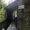
Llangollen Narrows Section (300m)
is a minor waterways place
on the Shropshire Union Canal (Llangollen Canal - Main Line) between
Llangollen Wharf (2 miles and ¼ furlongs
to the west) and
Ruabon Branch Junction (2 miles and 5½ furlongs
to the east).
The nearest place in the direction of Llangollen Wharf is Wenffrwd Bridge No 42W;
2½ furlongs
away.
The nearest place in the direction of Ruabon Branch Junction is Sun Trevor Bridge No 41W;
a few yards
away.
Mooring here is impossible (it may be physically impossible, forbidden, or allowed only for specific short-term purposes). The Canal is ONE boat wide through this section, obviously you cannot moor here.
| Llangollen Narrows Section (500m) | 1 mile, 2¾ furlongs | |
| Llangollen Road Moorings | 1 mile, 1 furlong | |
| Llanddyn No 2 Lift Bridge No 44W | 1 mile, ¼ furlongs | |
| Llanddyn No 1 Bridge No 43W | 5½ furlongs | |
| Wenffrwd Bridge No 42W | 2½ furlongs | |
| Llangollen Narrows Section (300m) | ||
| Sun Trevor Bridge No 41W | a few yards | |
| The Sun Trevor PH & Restaurant | ½ furlongs | |
| Sun Trevor Visitor Moorings | ¾ furlongs | |
| Plas Ifan Bridge No 40W | 4 furlongs | |
| Plas Ifan Pipe Bridge | 4¾ furlongs | |
There are no links to external websites from here.
Why not log in and add some (select "External websites" from the menu (sometimes this is under "Edit"))?
Mouseover for more information or show routes to facility
Nearest water point
In the direction of Hurleston Junction
The Old Wharf — 2 miles, 5¾ furlongs away
Travel to Ruabon Branch Junction, then on the Shropshire Union Canal (Llangollen Canal - Ruabon Branch) to The Old Wharf
Trevor Basin — 2 miles, 6½ furlongs away
Travel to Ruabon Branch Junction, then on the Shropshire Union Canal (Llangollen Canal - Ruabon Branch) to Trevor Basin
Coedfryn Water Point — 3 miles, ½ furlongs away
On this waterway in the direction of Hurleston Junction
Chirk Marina — 4 miles, 7 furlongs away
On this waterway in the direction of Hurleston Junction
New Marton Water Points — 9 miles, 6¾ furlongs away
On this waterway in the direction of Hurleston Junction
Ellesmere Services — 16 miles, 5½ furlongs and 2 locks away
On this waterway in the direction of Hurleston Junction
Blackwater Meadow Marina — 16 miles, 6¾ furlongs and 2 locks away
On this waterway in the direction of Hurleston Junction
Weston Arm Services (C&RT) — 13 miles, 7½ furlongs and 6 locks away
Travel to Frankton Junction, then on the Shropshire Union Canal (Montgomery Canal - connected and navigable) to Weston Arm Junction, then on the Shropshire Union Canal (Weston Branch) to Weston Arm Services (C&RT)
Maesbury Wharf — 19 miles, 3½ furlongs and 10 locks away
Travel to Frankton Junction, then on the Shropshire Union Canal (Montgomery Canal - connected and navigable) to Maesbury Wharf
In the direction of Llantisilio - Horseshoe Falls
Llangollen Services — 1 mile, 6¼ furlongs away
On this waterway in the direction of Llantisilio - Horseshoe Falls
Llangollen Basin — 2 miles, 1¼ furlongs away
On this waterway in the direction of Llantisilio - Horseshoe FallsNearest rubbish disposal
In the direction of Hurleston Junction
Ellesmere Services — 16 miles, 5½ furlongs and 2 locks away
On this waterway in the direction of Hurleston Junction
Weston Arm Services (C&RT) — 13 miles, 7½ furlongs and 6 locks away
Travel to Frankton Junction, then on the Shropshire Union Canal (Montgomery Canal - connected and navigable) to Weston Arm Junction, then on the Shropshire Union Canal (Weston Branch) to Weston Arm Services (C&RT)
In the direction of Llantisilio - Horseshoe Falls
Llangollen Services — 1 mile, 6¼ furlongs away
On this waterway in the direction of Llantisilio - Horseshoe Falls
Llangollen Basin — 2 miles, 1¼ furlongs away
On this waterway in the direction of Llantisilio - Horseshoe FallsNearest chemical toilet disposal
In the direction of Hurleston Junction
Chirk Marina — 4 miles, 7 furlongs away
On this waterway in the direction of Hurleston Junction
Whittington Wharf Narrowboats — 12 miles, 1¼ furlongs and 2 locks away
On this waterway in the direction of Hurleston Junction
Ellesmere Services — 16 miles, 5½ furlongs and 2 locks away
On this waterway in the direction of Hurleston Junction
Weston Arm Services (C&RT) — 13 miles, 7½ furlongs and 6 locks away
Travel to Frankton Junction, then on the Shropshire Union Canal (Montgomery Canal - connected and navigable) to Weston Arm Junction, then on the Shropshire Union Canal (Weston Branch) to Weston Arm Services (C&RT)
Maesbury Wharf — 19 miles, 3½ furlongs and 10 locks away
Travel to Frankton Junction, then on the Shropshire Union Canal (Montgomery Canal - connected and navigable) to Maesbury Wharf
In the direction of Llantisilio - Horseshoe Falls
Llangollen Services — 1 mile, 6¼ furlongs away
On this waterway in the direction of Llantisilio - Horseshoe FallsNearest place to turn
In the direction of Hurleston Junction
Bryn Howel Winding Hole — 7 furlongs away
On this waterway in the direction of Hurleston Junction
Ruabon Branch Junction — 2 miles, 5½ furlongs away
On this waterway in the direction of Hurleston Junction
Trevor Basin — 2 miles, 6½ furlongs away
Travel to Ruabon Branch Junction, then on the Shropshire Union Canal (Llangollen Canal - Ruabon Branch) to Trevor Basin
Coedfryn Winding Hole — 3 miles, 1½ furlongs away
On this waterway in the direction of Hurleston Junction
Chirk Marina — 4 miles, 7 furlongs away
On this waterway in the direction of Hurleston Junction
Chirk Golf Course Winding Hole — 5 miles, 2 furlongs away
On this waterway in the direction of Hurleston Junction
Chirk Pool — 6 miles, 2 furlongs away
On this waterway in the direction of Hurleston Junction
Rhoswiel Bridge Winding Hole — 7 miles, 2¾ furlongs away
On this waterway in the direction of Hurleston Junction
Polletts Bridge Winding Hole — 11 miles, 6¼ furlongs and 2 locks away
On this waterway in the direction of Hurleston Junction
Frankton Junction — 13 miles, 2½ furlongs and 2 locks away
On this waterway in the direction of Hurleston Junction
Sewage Works Winding Hole — 16 miles, 1½ furlongs and 2 locks away
On this waterway in the direction of Hurleston Junction
Ellesmere Branch Junction — 16 miles, 5¾ furlongs and 2 locks away
On this waterway in the direction of Hurleston Junction
Ellesmere Town Wharf — 16 miles, 7¾ furlongs and 2 locks away
Travel to Ellesmere Branch Junction, then on the Shropshire Union Canal (Llangollen Canal - Ellesmere Branch) to Ellesmere Town Wharf
Weston Arm Junction — 13 miles, 6½ furlongs and 6 locks away
Travel to Frankton Junction, then on the Shropshire Union Canal (Montgomery Canal - connected and navigable) to Weston Arm Junction
Baysil Wood Winding Hole — 18 miles, 3½ furlongs and 2 locks away
On this waterway in the direction of Hurleston Junction
Hawkswood Winding Hole — 14 miles, 5¼ furlongs and 7 locks away
Travel to Frankton Junction, then on the Shropshire Union Canal (Montgomery Canal - connected and navigable) to Hawkswood Winding Hole
Queen's Head Winding Hole — 17 miles, 1½ furlongs and 7 locks away
Travel to Frankton Junction, then on the Shropshire Union Canal (Montgomery Canal - connected and navigable) to Queen's Head Winding Hole
Park Mill Bridge Winding Hole — 18 miles, 7¼ furlongs and 10 locks away
Travel to Frankton Junction, then on the Shropshire Union Canal (Montgomery Canal - connected and navigable) to Park Mill Bridge Winding Hole
In the direction of Llantisilio - Horseshoe Falls
Llangollen Basin — 2 miles, 1¼ furlongs away
On this waterway in the direction of Llantisilio - Horseshoe FallsNearest self-operated pump-out
In the direction of Hurleston Junction
Maesbury Wharf — 19 miles, 3½ furlongs and 10 locks away
Travel to Frankton Junction, then on the Shropshire Union Canal (Montgomery Canal - connected and navigable) to Maesbury WharfNearest boatyard pump-out
In the direction of Hurleston Junction
The Old Wharf — 2 miles, 5¾ furlongs away
Travel to Ruabon Branch Junction, then on the Shropshire Union Canal (Llangollen Canal - Ruabon Branch) to The Old Wharf
Chirk Marina — 4 miles, 7 furlongs away
On this waterway in the direction of Hurleston Junction
Whittington Wharf Narrowboats — 12 miles, 1¼ furlongs and 2 locks away
On this waterway in the direction of Hurleston Junction
Blackwater Meadow Marina — 16 miles, 6¾ furlongs and 2 locks away
On this waterway in the direction of Hurleston JunctionDirection of TV transmitter (From Wolfbane Cybernetic)
In to, and out of, Llangollen from Scribblings from the Mintball posted Sunday the 17th of September, 2017
There is no page on Wikipedia called “Llangollen Narrows Section”
Wikipedia pages that might relate to Llangollen Narrows Section
[Llangollen Canal]
The Llangollen Canal (Welsh: Camlas Llangollen) is a navigable canal crossing the border between England and Wales. The waterway links Llangollen in Denbighshire
[Shropshire Union Railways and Canal Company]
Autherley section and the branch to Middlewich remained open, and have since been named the Shropshire Union Canal. The branch to Llangollen, which was
Results of Google Search
On the the Shropshire Union Canal (Llangollen Canal - Main Line), at Jackson's Bridge No 26. ... Llangollen Narrows Section (300m) [see navigational note 2.
The Llangollen Canal (Welsh: Camlas Llangollen) is a navigable canal crossing the border ... Llangollen canal: The final narrows before Llangollen ... The northern section ran from Ellesmere Port on the River Mersey to Chester, where it ... Opened in 1805, the aqueduct is more than 300 metres (980 ft) long and 38 metres ...
<br /> <br /> The 300 metres long Pontcysyllte aqueduct takes the Llangollen Canal in a narrow cast-iron trough across the River Dee. ... engineering to tackle a particularly difficult section of the route where the water level rises by 100 meters.
Horseshoe Falls · Liquor Store. 4. Gales Of Llangollen. 18 Bridge Street · Canal. 5. Llangollen Canal Narrows · Establishment. 6. Llangollen Wharf · Music Venue.
<br /> <br /> The 300 metres long Pontcysyllte aqueduct takes the Llangollen Canal in a narrow cast-iron trough across the River Dee. The structure was finished ...
Llangollen Canal: Narrow boats are great fun - See 349 traveler reviews, 271 candid photos, and great deals for North ... It is over 300m Long and 38m high.

![Canal side maintenance. Contractors trimming trees beside bridge 41W on the Shropshire Union Canal (Llangollen Branch).[[[3299214]]] by John Haynes – 16 January 2013](https://s0.geograph.org.uk/geophotos/03/29/92/3299224_f8db6f08_120x120.jpg)
![Bridge 41 at The Sun Inn, Trevor. Grade II listed https://www.britishlistedbuildings.co.uk/300001324-bridge-no-41-llangollen in January 1990, this bridge carries a track across the canal, at a location where there was once a wharf for loading goods onto barges from the quarries above Trevor - probably a combination of limestone and burnt lime for agricultural use. The bricked-up archway seen in [[811581]] is hidden here by vegetation. by Richard Law – 19 September 2017](https://s0.geograph.org.uk/geophotos/05/61/38/5613888_68ed0e6e_120x120.jpg)


![Bridge 41 at The Sun Inn, Trevor. Seen here from the east, in better light than [[5613888]], this is a Grade II listed bridge https://www.britishlistedbuildings.co.uk/300001324-bridge-no-41-llangollen#.Wh8fftSLTGg which, amongst other things, connected the village of Trevor with the now-defunct railway at Sun Bank Halt. by Richard Law – 19 September 2017](https://s3.geograph.org.uk/geophotos/05/61/38/5613895_a40932c3_120x120.jpg)


![Essential winter maintenance. On one of the busiest canals in England & Wales, The Canal & Waterways Trust has to squeeze most of the winter maintenance in the small window between New Year and the schools half term in February. Contractors are busy trimming canal side trees on the section from Llangollen to Trevor Basin. Here they are working at The Sun Trevor Inn moorings. Small branches are put through the shredder and the bigger cords are laid ready for gathering by the crews of residential boats that often have wood burning stoves.[[[3299061]]] by John Haynes – 16 January 2013](https://s2.geograph.org.uk/geophotos/03/29/92/3299214_6c1cf379_120x120.jpg)