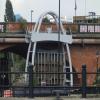
Ouseburn Barrage
Outer gate
Glasshouse Bridge, Maling Street, Newcastle upon Tyne NE6 1LP, United Kingdom

Ouseburn Barrage
is a minor waterways place
on the River Ouseburn between
Ouseburn Footbridge (Head of navigation) (2¼ furlongs
to the northwest) and
Tyne - Ouseburn Junction (Junction of the River Tyne and the River Ouseburn ) (¾ furlongs
and 1 lock
to the south).
The nearest place in the direction of Ouseburn Footbridge is Walker Road Bridge (The Ouseburn Barrage is located underneath this bridge.);
a few yards
away.
The nearest place in the direction of Tyne - Ouseburn Junction is Quayside Bridge;
¼ furlongs
away.
Mooring here is unrated.
This is a lock, the rise of which is not known.
| The Cluny Slipway | 2¼ furlongs | |
| Seven Stories Corner | 2 furlongs | |
| Byker Boatyard Slipway | 1¼ furlongs | |
| Byker Bank Bridge | 1 furlong | |
| Walker Road Bridge | a few yards | |
| Ouseburn Barrage | ||
| Quayside Bridge | ¼ furlongs | |
| Tyne - Ouseburn Junction | ¾ furlongs | |
Amenities nearby at Walker Road Bridge
There are no links to external websites from here.
Why not log in and add some (select "External websites" from the menu (sometimes this is under "Edit"))?
Why not log in and add some (select "External websites" from the menu (sometimes this is under "Edit"))?
Mouseover for more information or show routes to facility
No information
CanalPlan has no information on any of the following facilities within range:water point
rubbish disposal
chemical toilet disposal
place to turn
self-operated pump-out
boatyard pump-out
Direction of TV transmitter (From Wolfbane Cybernetic)
There is no page on Wikipedia called “Ouseburn Barrage”
Wikipedia pages that might relate to Ouseburn Barrage
[Ouseburn]
mud at low tide. However, since 2009 a tidal barrage at the river mouth retains high water in the Ouseburn at low tide, with the objective of providing
[List of Statutory Instruments of the United Kingdom, 2007]
(Construction Industry Training Board) Order 2007 (S.I. 2007/607) Ouseburn Barrage Order 2007 (S.I. 2007/608) Industrial Training Levy (Engineering Construction
[List of bridges in the United Kingdom]
River Tyne Byker Bridge Tyne and Wear Newcastle upon Tyne 1878 crosses the Ouseburn Cambeck Bridge Cumbria Cambeck Bridge C19 II crosses the River Irthing
Results of Google Search
Ouseburn Barrage | Ouseburn TrustNov 3, 2016 ... Dave Cross has been trawling the depths of the Ouseburn River to find out why the Ouseburn Barrage has been out of use for most of its life, ...
The Ouseburn is a small river in Tyne and Wear, England that flows through the city of ... Despite the expense of its construction, the Ouseburn barrage has had operational problems and was left open for a length of time while they were ...
This Order, which is made under section 3(1)(b) of the Transport and Works Act 1992, empowers the Council of the City of Newcastle upon Tyne to construct a ...
Jun 13, 2017 ... Family; Unfollow. Ouseburn Barrage. Mixed media in A4 sketchbook. Done. Comment. 468 views. 6 faves. 0 comments. Uploaded on June 13, ...
May 2, 2008 ... Newcastle City Council wants to continue regenerating the area and create a vibrant urban village but the current state of the river, with a large ...
Mar 29, 2016 ... The Ouseburn Barrage was constructed in 2009 to control the flow of water, to alleviate flooding and to maintain a more stable water depth and ...
Sep 29, 2009 ... File:Ouseburn barrage, looking towards the Tyne - geograph.org.uk ... (required by the license), hayley green / Ouseburn barrage, looking ...
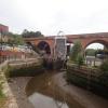
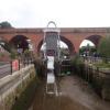
Feb 6, 2016 ... Looking downstream towards the Ouseburn barrage. The intention of the barrage was to retain water in the Ouseburn at low tide, however in ...
Sep 29, 2009 ... English: Ouseburn Barrage, looking up the Ouseburn Recently opened, the barrage controls the flow of the Ouseburn into the Tyne. These are ...
One of the main obstacles to overcome in regenerating the Lower Ouseburn Valley is the River ... It was decided to construct a tidal barrage and navigation lock.




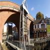










![Through an arch of Glasshouse Bridge by Tyne Bar. View of Maling Street (with the Malings apartments on the left) and the cranes of Ward Brothers Steel Ltd. (formerly Shepherd's [[1777668]]) beyond. by Andrew Curtis – 03 June 2021](https://s1.geograph.org.uk/geophotos/06/86/06/6860613_37b14d47_120x120.jpg)


