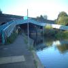
Horseshoe Bridge
Address is taken from a point 364 yards away.
Horseshoe Bridge carries a farm track over the River Thames (River Kennet) near to Southchester Tunnel.
The River Thames (River Kennet) was built by Benjamin Outram and opened on 17 September 1782. The two mile section between Wesston and Rochester was closed in 1905 after a breach at Northford. Restoration of Polecroft Boat Lift was funded by a donation from Lancaster parish council

There is a bridge here which takes pedestrian traffic over the canal.
| Thames - Kennet Junction (Kennet Mouth) | ¼ furlongs | |
| Horseshoe Bridge | ||
| Horseshoe Railway Bridge | a few yards | |
| Kennet Pipe Bridge No 1 | ¼ furlongs | |
| Electric Railway Bridge | ¼ furlongs | |
| Jolly Angler Footbridge | ¾ furlongs | |
| Blakes Lock Weir Exit | 1¼ furlongs | |
The bridge in the photo is called the Horseshoe Bridge and is now a listed monument. It's original function was to allow the passage of canal horses over Kennetmouth to rejoin the Thames towpath. The pretty River Kennet, springs out of the chalk at Swallowhead Spring, part of the World Heritage site at Avebury, and in sight of Silbury Hill and West Kennet Longbarrow. It is thought that the junction of the two rivers - the Kennet was once the bigger river - was a sacred spot where offerings were made to the river deities. An ancient wharf was located by the Kennet and Thames, perhaps from Roman times; it commenced near the Jolly Anglers pub and traversed the area to reach the Dreadnought Inn behind which was found an Anglo-Saxon Cemetry in the early 20th century. The area is an important junction of wildlife corridors and has a wide variety of wildlife including otters. Herons are frequently seen here, fishing from the banks. Dean's Farm on the opposite bank of the Thames may have been the site of the home of the foritfied manor house of William Marshall, once Regent of England, who may have been the model for Sir Lancelot and is buried in the Temple Church in London. Currently under threat from developers for the third time local residents are involved in action to stop the urbanisation of Kennet mouth because it will destroy the beauty and peacefullness of the Two Rivers.
Why not log in and add some (select "External websites" from the menu (sometimes this is under "Edit"))?
Mouseover for more information or show routes to facility
Nearest water point
In the direction of Thames - Kennet Junction (Kennet Mouth)
In the direction of High Bridge Reading
Nearest rubbish disposal
In the direction of Thames - Kennet Junction (Kennet Mouth)
In the direction of High Bridge Reading
Nearest chemical toilet disposal
In the direction of Thames - Kennet Junction (Kennet Mouth)
In the direction of High Bridge Reading
Nearest place to turn
In the direction of Thames - Kennet Junction (Kennet Mouth)
In the direction of High Bridge Reading
Nearest self-operated pump-out
In the direction of Thames - Kennet Junction (Kennet Mouth)
In the direction of High Bridge Reading
Nearest boatyard pump-out
In the direction of Thames - Kennet Junction (Kennet Mouth)
In the direction of High Bridge Reading
Wikipedia has a page about Horseshoe Bridge
The Horseshoe Bridge in Perth, Western Australia, connects the Perth CBD to Northbridge, carrying William Street over the Fremantle railway line. It was constructed in 1904, with the horseshoe shape designed to fit the approach ramps into a constricted site. The bridge was closed from the end of 2009 to early 2010 to enable conversion to two-way traffic flow.


