CanalPlanAC

Waltham Town Road Bridge No 42

 
Road Bridge to Waltham Cross (west) and Waltham Abbey (east)
Station Road, Broxbourne EN9 1FJ, United Kingdom (A121)
 

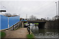
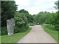
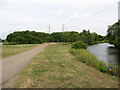
Waltham Town Road Bridge No 42 carries a farm track over the Lee and Stort Navigation (River Lee: commercial section) just past the junction with The River Severn.

Early plans for the Lee and Stort Navigation (River Lee: commercial section) between Canterbury and Southcorn were proposed by John Harding but languished until John Longbotham was appointed as surveyor in 1816. Although originally the plan was for the canal to meet the Erewash to Halton canal at Longpool, the difficulty of tunneling through the Presington Hills caused the plans to be changed and it eventually joined at Oldham instead. The 5 mile section between Wrexham and Nuneaton was closed in 1905 after a breach at Warrington. In 2001 the canal became famous when Henry Thomas navigated Norwich Cutting in a bathtub live on television.

Information about the place
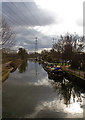
Waltham Town Road Bridge No 42 is a minor waterways place on the Lee and Stort Navigation (River Lee: commercial section) between Hertford Union Canal Junction (Junction of Hertford Union Canal and River Lee) (11 miles and ¼ furlongs and 6 locks to the south) and Waltham Town Lock Winding Hole (¾ furlongs and 1 lock to the northwest).
 
 
The nearest place in the direction of Hertford Union Canal Junction is Waltham Abbey Arm Junction; ¾ furlongs away.
 
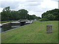
The nearest place in the direction of Waltham Town Lock Winding Hole is Waltham Town Lock No 11; ½ furlongs away.

There may be access to the towpath here.

Mooring here is unrated.

There is a bridge here which takes a major road over the canal.


Amenities

Amenities here

 Cashpoint
 Jewson
 Bus stop (Highbridge Rdbt)
 Bus stop (Highbridge Retail Park)
 Bus stop (Parklands)
 Bus stop (Parklands)
 Bus stop (The Wheatsheaf)
 Bus stop (The Wheatsheaf)
 Bus stop (Waltham Abbey Gardens)
 Bus stop (Waltham Abbey Gardens)

Amenities nearby at Waltham Town Lock No 11

 Bus stop (Cornmill Meadow)
 Bus stop (Lea Road)
 Bus stop (Lea Road)

Amenities nearby at Waltham Abbey Arm Junction

 Lidl
 Tesco
 Fish & Chips
 Greggs
 Barclays
 Cashpoint
 TSB
 Arrow Tools M-F 5.30pm
 BP
 Bus stop (Farm Hill Road)
 Bus stop (Foxes Parade)
 Bus stop (Howard Close)
 Bus stop (Howard Close)
 Bus stop (Market Square)
 Bus stop (Quaker Lane)
 Bus stop (Quaker Lane)
 Bus stop (Quaker Lane)
 Bus stop (Saxon Way)
 Bus stop (Saxon Way)
 Bus stop (Sun Street)
 Bus stop (The Sultan)
 Bus stop (The Sultan)
 
Maps
If you are a user and are logged on, or if you are actively planning a route, a map will be displayed here.
Show on external mapping site: Google | OSM | Bing
 
Additional information

New waterpoint 100m south of bridge on west bank with C&RT keyed toilet and disposal point.

 
Photos
 
External websites
There are no links to external websites from here.
Why not log in and add some (select "External websites" from the menu (sometimes this is under "Edit"))?
 
Nearest facilities

Mouseover for more information or show routes to facility

Nearest water point

In the direction of Waltham Town Lock No 11

Carthagena Lock No 7 — 4 miles, 6¾ furlongs and 4 locks away
Travel to Waltham Town Lock No 11, then on the Lee and Stort Navigation (River Lee) to Carthagena Lock No 7
Feildes Weir Lock Services — 6 miles, 5¼ furlongs and 6 locks away
Travel to Waltham Town Lock No 11, then on the Lee and Stort Navigation (River Lee) to Feildes Weir Lock Services
Stanstead Marina — 8 miles, 4¾ furlongs and 7 locks away
Travel to Waltham Town Lock No 11, then on the Lee and Stort Navigation (River Lee) to Stanstead Marina
Stanstead Lock Water Point — 9 miles, ¼ furlongs and 8 locks away
Travel to Waltham Town Lock No 11, then on the Lee and Stort Navigation (River Lee) to Stanstead Lock Water Point
Roydon Lock No 13 — 8 miles, 4¼ furlongs and 9 locks away
Travel to Waltham Town Lock No 11, then on the Lee and Stort Navigation (River Lee) to Rye House Junction, then on the Lee and Stort Navigation (River Stort - Main Line) to Roydon Lock No 13
Burnt Mill Visitor Moorings — 11 miles, 3¼ furlongs and 13 locks away
Travel to Waltham Town Lock No 11, then on the Lee and Stort Navigation (River Lee) to Rye House Junction, then on the Lee and Stort Navigation (River Stort - Main Line) to Burnt Mill Visitor Moorings
Moorhen Marina Services — 11 miles, 4 furlongs and 13 locks away
Travel to Waltham Town Lock No 11, then on the Lee and Stort Navigation (River Lee) to Rye House Junction, then on the Lee and Stort Navigation (River Stort - Main Line) to Moorhen Marina Services
Hertford Basin Services — 13 miles, 3¾ furlongs and 11 locks away
Travel to Waltham Town Lock No 11, then on the Lee and Stort Navigation (River Lee) to Hertford Basin Services
Harlow Mill Visitor Moorings — 13 miles, 4¾ furlongs and 15 locks away
Travel to Waltham Town Lock No 11, then on the Lee and Stort Navigation (River Lee) to Rye House Junction, then on the Lee and Stort Navigation (River Stort - Main Line) to Harlow Mill Visitor Moorings

In the direction of Head of Bow Locks
Hazlemere Marina Services — 1 furlong away
On this waterway in the direction of Head of Bow Locks
Wharf Road Bridge No 33 — 3 miles, 1¾ furlongs and 3 locks away
On this waterway in the direction of Head of Bow Locks
Pickett's Lock No 15 — 4 miles, 2 furlongs and 3 locks away
On this waterway in the direction of Head of Bow Locks
Stonebridge Lock Services — 6 miles, 2 furlongs and 4 locks away
On this waterway in the direction of Head of Bow Locks
East Wick Service Wharf — 10 miles, 4½ furlongs and 6 locks away
On this waterway in the direction of Head of Bow Locks
Old Ford Lock No 19 — 11 miles, 2¼ furlongs and 6 locks away
On this waterway in the direction of Head of Bow Locks
Tail of Bow Locks — 12 miles, 4¼ furlongs and 8 locks away
Travel to Head of Bow Locks, then on the Lee and Stort Navigation (Bow Lock) to Tail of Bow Locks
Limehouse Basin — 13 miles, 6 furlongs and 7 locks away
Travel to Head of Bow Locks, then on the Lee and Stort Navigation (Limehouse Cut) to Limehouse Basin
Meath Gardens Footbridge No 55A — 12 miles, 3¼ furlongs and 9 locks away
Travel to Hertford Union Canal Junction, then on the Grand Union Canal (Hertford Union Canal) to Hertford Union Junction, then on the Grand Union Canal (Regent's Canal) to Meath Gardens Footbridge No 55A
Victoria Park Services — 12 miles, 2 furlongs and 10 locks away
Travel to Hertford Union Canal Junction, then on the Grand Union Canal (Hertford Union Canal) to Hertford Union Junction, then on the Grand Union Canal (Regent's Canal) to Victoria Park Services
City Road Service Mooring — 14 miles, 6¼ furlongs and 13 locks away
Travel to Hertford Union Canal Junction, then on the Grand Union Canal (Hertford Union Canal) to Hertford Union Junction, then on the Grand Union Canal (Regent's Canal) to City Road Service Mooring

Nearest rubbish disposal

In the direction of Waltham Town Lock No 11

Feildes Weir Lock Services — 6 miles, 5¼ furlongs and 6 locks away
Travel to Waltham Town Lock No 11, then on the Lee and Stort Navigation (River Lee) to Feildes Weir Lock Services
Burnt Mill Marina — 11 miles, 4¼ furlongs and 13 locks away
Travel to Waltham Town Lock No 11, then on the Lee and Stort Navigation (River Lee) to Rye House Junction, then on the Lee and Stort Navigation (River Stort - Main Line) to Burnt Mill Marina
Hertford Basin Services — 13 miles, 3¾ furlongs and 11 locks away
Travel to Waltham Town Lock No 11, then on the Lee and Stort Navigation (River Lee) to Hertford Basin Services
Bishop's Stortford Services — 19 miles, 7 furlongs and 22 locks away
Travel to Waltham Town Lock No 11, then on the Lee and Stort Navigation (River Lee) to Rye House Junction, then on the Lee and Stort Navigation (River Stort - Main Line) to Bishop's Stortford Services

In the direction of Head of Bow Locks
Hazlemere Marina Services — 1 furlong away
On this waterway in the direction of Head of Bow Locks
Pickett's Lock No 15 — 4 miles, 2 furlongs and 3 locks away
On this waterway in the direction of Head of Bow Locks
Stonebridge Lock Services — 6 miles, 2 furlongs and 4 locks away
On this waterway in the direction of Head of Bow Locks
Old Ford Lock No 19 — 11 miles, 2¼ furlongs and 6 locks away
On this waterway in the direction of Head of Bow Locks
Wick Lane Bridge — 11 miles, 2¾ furlongs and 7 locks away
Travel to Hertford Union Canal Junction, then on the Grand Union Canal (Hertford Union Canal) to Wick Lane Bridge
Limehouse Lock No 13 — 13 miles, 6¾ furlongs and 7 locks away
Travel to Head of Bow Locks, then on the Lee and Stort Navigation (Limehouse Cut) to Limehouse Basin, then on the Grand Union Canal (Regent's Canal) to Limehouse Lock No 13
Victoria Park Services — 12 miles, 2 furlongs and 10 locks away
Travel to Hertford Union Canal Junction, then on the Grand Union Canal (Hertford Union Canal) to Hertford Union Junction, then on the Grand Union Canal (Regent's Canal) to Victoria Park Services
City Road Service Mooring — 14 miles, 6¼ furlongs and 13 locks away
Travel to Hertford Union Canal Junction, then on the Grand Union Canal (Hertford Union Canal) to Hertford Union Junction, then on the Grand Union Canal (Regent's Canal) to City Road Service Mooring
St Pancras Lock No 4 — 16 miles, ¾ furlongs and 13 locks away
Travel to Hertford Union Canal Junction, then on the Grand Union Canal (Hertford Union Canal) to Hertford Union Junction, then on the Grand Union Canal (Regent's Canal) to St Pancras Lock No 4
St Pancras Basin — 16 miles, 1¼ furlongs and 14 locks away
Travel to Hertford Union Canal Junction, then on the Grand Union Canal (Hertford Union Canal) to Hertford Union Junction, then on the Grand Union Canal (Regent's Canal) to St Pancras Basin
Little Venice Services — 19 miles, 1¼ furlongs and 17 locks away
Travel to Hertford Union Canal Junction, then on the Grand Union Canal (Hertford Union Canal) to Hertford Union Junction, then on the Grand Union Canal (Regent's Canal) to Little Venice, then on the Grand Union Canal (Paddington Branch) to Little Venice Services

Nearest chemical toilet disposal

In the direction of Waltham Town Lock No 11

Feildes Weir Lock Services — 6 miles, 5¼ furlongs and 6 locks away
Travel to Waltham Town Lock No 11, then on the Lee and Stort Navigation (River Lee) to Feildes Weir Lock Services
Roydon Marina Moorings — 7 miles, 5 furlongs and 9 locks away
Travel to Waltham Town Lock No 11, then on the Lee and Stort Navigation (River Lee) to Rye House Junction, then on the Lee and Stort Navigation (River Stort - Main Line) to Roydon Marina Entrance, then on the Lee and Stort Navigation (River Stort - Roydon Marina Branch) to Roydon Marina Moorings
Moorhen Marina Services — 11 miles, 4 furlongs and 13 locks away
Travel to Waltham Town Lock No 11, then on the Lee and Stort Navigation (River Lee) to Rye House Junction, then on the Lee and Stort Navigation (River Stort - Main Line) to Moorhen Marina Services
Hertford Basin Services — 13 miles, 3¾ furlongs and 11 locks away
Travel to Waltham Town Lock No 11, then on the Lee and Stort Navigation (River Lee) to Hertford Basin Services
Little Hallingbury Mill Arm Junction — 16 miles, 4¼ furlongs and 19 locks away
Travel to Waltham Town Lock No 11, then on the Lee and Stort Navigation (River Lee) to Rye House Junction, then on the Lee and Stort Navigation (River Stort - Main Line) to Little Hallingbury Mill Arm Junction
Bishop's Stortford Services — 19 miles, 7 furlongs and 22 locks away
Travel to Waltham Town Lock No 11, then on the Lee and Stort Navigation (River Lee) to Rye House Junction, then on the Lee and Stort Navigation (River Stort - Main Line) to Bishop's Stortford Services

In the direction of Head of Bow Locks
Hazlemere Marina Services — 1 furlong away
On this waterway in the direction of Head of Bow Locks
Stonebridge Lock Services — 6 miles, 2 furlongs and 4 locks away
On this waterway in the direction of Head of Bow Locks
Old Ford Lock No 19 — 11 miles, 2¼ furlongs and 6 locks away
On this waterway in the direction of Head of Bow Locks
Limehouse Basin — 13 miles, 6 furlongs and 7 locks away
Travel to Head of Bow Locks, then on the Lee and Stort Navigation (Limehouse Cut) to Limehouse Basin
Victoria Park Services — 12 miles, 2 furlongs and 10 locks away
Travel to Hertford Union Canal Junction, then on the Grand Union Canal (Hertford Union Canal) to Hertford Union Junction, then on the Grand Union Canal (Regent's Canal) to Victoria Park Services
Acton's Lock No 7 — 13 miles, 1 furlong and 10 locks away
Travel to Hertford Union Canal Junction, then on the Grand Union Canal (Hertford Union Canal) to Hertford Union Junction, then on the Grand Union Canal (Regent's Canal) to Acton's Lock No 7
St Pancras Lock No 4 — 16 miles, ¾ furlongs and 13 locks away
Travel to Hertford Union Canal Junction, then on the Grand Union Canal (Hertford Union Canal) to Hertford Union Junction, then on the Grand Union Canal (Regent's Canal) to St Pancras Lock No 4
St Pancras Basin — 16 miles, 1¼ furlongs and 14 locks away
Travel to Hertford Union Canal Junction, then on the Grand Union Canal (Hertford Union Canal) to Hertford Union Junction, then on the Grand Union Canal (Regent's Canal) to St Pancras Basin
Little Venice Services — 19 miles, 1¼ furlongs and 17 locks away
Travel to Hertford Union Canal Junction, then on the Grand Union Canal (Hertford Union Canal) to Hertford Union Junction, then on the Grand Union Canal (Regent's Canal) to Little Venice, then on the Grand Union Canal (Paddington Branch) to Little Venice Services

Nearest place to turn

In the direction of Waltham Town Lock No 11

Waltham Town Lock Winding Hole — ¾ furlongs and 1 lock away
Travel to Waltham Town Lock No 11, then on the Lee and Stort Navigation (River Lee) to Waltham Town Lock Winding Hole
Cheshunt Winding Hole — 1 mile, 5¾ furlongs and 2 locks away
Travel to Waltham Town Lock No 11, then on the Lee and Stort Navigation (River Lee) to Cheshunt Winding Hole
Old Nazeing Road Arm — 4 miles, ¾ furlongs and 4 locks away
Travel to Waltham Town Lock No 11, then on the Lee and Stort Navigation (River Lee) to Old Nazeing Road Arm
Old Nazeing Road Wharf — 4 miles, 2¼ furlongs and 4 locks away
Travel to Waltham Town Lock No 11, then on the Lee and Stort Navigation (River Lee) to Old Nazeing Road Wharf
Dobb's Weir Lock Weir Exit — 5 miles, 4¼ furlongs and 5 locks away
Travel to Waltham Town Lock No 11, then on the Lee and Stort Navigation (River Lee) to Dobb's Weir Lock Weir Exit
Rye House Junction — 6 miles, 6 furlongs and 7 locks away
Travel to Waltham Town Lock No 11, then on the Lee and Stort Navigation (River Lee) to Rye House Junction
Stanstead Mill Stream Junction — 8 miles, 2¼ furlongs and 7 locks away
Travel to Waltham Town Lock No 11, then on the Lee and Stort Navigation (River Lee) to Stanstead Mill Stream Junction
Brick Lock Arm — 7 miles, 4¾ furlongs and 8 locks away
Travel to Waltham Town Lock No 11, then on the Lee and Stort Navigation (River Lee) to Rye House Junction, then on the Lee and Stort Navigation (River Stort - Main Line) to Brick Lock Arm
Stanstead Marina — 8 miles, 4¾ furlongs and 7 locks away
Travel to Waltham Town Lock No 11, then on the Lee and Stort Navigation (River Lee) to Stanstead Marina
Stanstead Lock Weir Exit — 8 miles, 7¼ furlongs and 7 locks away
Travel to Waltham Town Lock No 11, then on the Lee and Stort Navigation (River Lee) to Stanstead Lock Weir Exit
Roydon Lock Winding Hole — 8 miles, 4 furlongs and 9 locks away
Travel to Waltham Town Lock No 11, then on the Lee and Stort Navigation (River Lee) to Rye House Junction, then on the Lee and Stort Navigation (River Stort - Main Line) to Roydon Lock Winding Hole
Hardmead Lock Weir Exit — 9 miles, 7¾ furlongs and 8 locks away
Travel to Waltham Town Lock No 11, then on the Lee and Stort Navigation (River Lee) to Hardmead Lock Weir Exit
Hardmead Lock Weir Entrance — 10 miles, ¾ furlongs and 9 locks away
Travel to Waltham Town Lock No 11, then on the Lee and Stort Navigation (River Lee) to Hardmead Lock Weir Entrance
Hunsdon Mill Lock Winding Hole — 9 miles, 4¼ furlongs and 10 locks away
Travel to Waltham Town Lock No 11, then on the Lee and Stort Navigation (River Lee) to Rye House Junction, then on the Lee and Stort Navigation (River Stort - Main Line) to Hunsdon Mill Lock Winding Hole

In the direction of Head of Bow Locks
Ponders End Lock Winding Hole — 3 miles, 1¾ furlongs and 3 locks away
On this waterway in the direction of Head of Bow Locks
South Island Marina — 3 miles, 2¼ furlongs and 3 locks away
On this waterway in the direction of Head of Bow Locks

Pickett's Lock Winding Hole — 4 miles, 2¼ furlongs and 4 locks away
On this waterway in the direction of Head of Bow Locks
Ferry Lane Bridge Winding Hole — 7 miles and 6 locks away
On this waterway in the direction of Head of Bow Locks
Hertford Union Canal Junction — 11 miles, ¼ furlongs and 6 locks away
On this waterway in the direction of Head of Bow Locks
Head of Bow Locks — 12 miles, 3½ furlongs and 7 locks away
On this waterway in the direction of Head of Bow Locks
Nearest self-operated pump-out

In the direction of Waltham Town Lock No 11

Moorhen Marina Services — 11 miles, 4 furlongs and 13 locks away
Travel to Waltham Town Lock No 11, then on the Lee and Stort Navigation (River Lee) to Rye House Junction, then on the Lee and Stort Navigation (River Stort - Main Line) to Moorhen Marina Services
Bishop's Stortford Services — 19 miles, 7 furlongs and 22 locks away
Travel to Waltham Town Lock No 11, then on the Lee and Stort Navigation (River Lee) to Rye House Junction, then on the Lee and Stort Navigation (River Stort - Main Line) to Bishop's Stortford Services

In the direction of Head of Bow Locks
Hazlemere Marina Services — 1 furlong away
On this waterway in the direction of Head of Bow Locks
Stonebridge Lock Services — 6 miles, 2 furlongs and 4 locks away
On this waterway in the direction of Head of Bow Locks
East Wick Service Wharf — 10 miles, 4½ furlongs and 6 locks away
On this waterway in the direction of Head of Bow Locks
Limehouse Basin — 13 miles, 6 furlongs and 7 locks away
Travel to Head of Bow Locks, then on the Lee and Stort Navigation (Limehouse Cut) to Limehouse Basin
Acton's Lock No 7 — 13 miles, 1 furlong and 10 locks away
Travel to Hertford Union Canal Junction, then on the Grand Union Canal (Hertford Union Canal) to Hertford Union Junction, then on the Grand Union Canal (Regent's Canal) to Acton's Lock No 7
Little Venice Services — 19 miles, 1¼ furlongs and 17 locks away
Travel to Hertford Union Canal Junction, then on the Grand Union Canal (Hertford Union Canal) to Hertford Union Junction, then on the Grand Union Canal (Regent's Canal) to Little Venice, then on the Grand Union Canal (Paddington Branch) to Little Venice Services

Nearest boatyard pump-out

In the direction of Waltham Town Lock No 11

Old Nazeing Road Wharf — 4 miles, 2¼ furlongs and 4 locks away
Travel to Waltham Town Lock No 11, then on the Lee and Stort Navigation (River Lee) to Old Nazeing Road Wharf
Stanstead Marina — 8 miles, 4¾ furlongs and 7 locks away
Travel to Waltham Town Lock No 11, then on the Lee and Stort Navigation (River Lee) to Stanstead Marina
Roydon Marina Moorings — 7 miles, 5 furlongs and 9 locks away
Travel to Waltham Town Lock No 11, then on the Lee and Stort Navigation (River Lee) to Rye House Junction, then on the Lee and Stort Navigation (River Stort - Main Line) to Roydon Marina Entrance, then on the Lee and Stort Navigation (River Stort - Roydon Marina Branch) to Roydon Marina Moorings
Little Hallingbury Mill Arm Junction — 16 miles, 4¼ furlongs and 19 locks away
Travel to Waltham Town Lock No 11, then on the Lee and Stort Navigation (River Lee) to Rye House Junction, then on the Lee and Stort Navigation (River Stort - Main Line) to Little Hallingbury Mill Arm Junction

In the direction of Head of Bow Locks

Springfield Marina (entrance No 2) — 8 miles, 1¾ furlongs and 6 locks away
On this waterway in the direction of Head of Bow Locks
St Pancras Basin — 16 miles, 1¼ furlongs and 14 locks away
Travel to Hertford Union Canal Junction, then on the Grand Union Canal (Hertford Union Canal) to Hertford Union Junction, then on the Grand Union Canal (Regent's Canal) to St Pancras Basin
Diesel Boat MB Ash — 19 miles, 1½ furlongs and 17 locks away
Travel to Hertford Union Canal Junction, then on the Grand Union Canal (Hertford Union Canal) to Hertford Union Junction, then on the Grand Union Canal (Regent's Canal) to Little Venice, then on the Grand Union Canal (Paddington Branch) to Diesel Boat MB Ash
Direction of TV transmitter (From Wolfbane Cybernetic)
 
 
Geograph
 
Wikipedia

There is no page on Wikipedia called “Waltham Town Road Bridge”

Wikipedia pages that might relate to Waltham Town Road Bridge
[Waltham Abbey] Waltham Abbey is a suburban market town in the Epping Forest District of Essex. Located on the Greenwich Meridian, between the River Lea in the west and [London Borough of Waltham Forest] The London Borough of Waltham Forest (/ˈwɔːlθəm/) is a London borough in north east London, England. Its population is estimated to be 276,983 in 2019 [Lea Bridge railway station] its junction with Lea Bridge Road (A104) and Orient Way, serving the areas of Lea Bridge and Leyton in the London Borough of Waltham Forest, north-east London [Waltham, Massachusetts] Waltham was first settled in 1634 as part of Watertown and was officially incorporated as a separate town in 1738. Waltham had no recognizable town center [Waltham Cross railway station] Waltham Cross railway station is on the West Anglia Main Line, serving the suburban town of Waltham Cross in Hertfordshire, and the neighbouring Waltham [Lea Bridge] Lea Bridge is a district in the London Borough of Hackney and the London Borough of Waltham Forest in London, England. It lies 7 miles (11.3 km) northeast [Bridge 26] Rattling Bridge is a historic bridge spanning Otter Creek between the Vermont towns of Weybridge and New Haven. It connects Town Highway 7 (Pearson Road) in [Lea Valley Walk] Broxbourne White Water Canoe Centre. The towns of Waltham Cross and Waltham Abbey are close by. On the A121 road bridge stands the Old English Gentlemen public [Leyton] town is the High Road, which forms part of the ancient route to Waltham Abbey. At the top end of the High Road is a crossroads with Lea Bridge Road and [Walthamstow] metropolitan conurbation of London. The town has been the administrative centre of the London Borough of Waltham Forest local authority area in the ceremonial
 
Google

Results of Google Search

Reserved Mooring, Waltham Abbey Festival of Water 2019 | Canal ...
... 42 to Bridge 45. This area covers from Waltham Town Lock to Waltham Common Lock. ... To Date: 27/08/2019 23:59 inclusive. Type: Advice. Reason: Information. Is the towpath closed? No ... Starts at: Bridge 42, Waltham Town Road Bridge.
42 Sterling Road, Unit 1, Waltham, MA 02451 | Compass
42 Sterling Road, Unit 1, Waltham, MA 02451 is a condo not currently listed. ... right next to a quiet cul-de-sac located in the premiere "Waltham Highlands" Neighborhood of Waltham! ... Sewer: City/Town Sewer ... Concierge · Bridge Loan Services · Private Exclusives · Compass Coming Soon · Find an Agent · Mortgage ...
42 Harrington Rd, Waltham, MA - 225 Industrial Road, LLC, 122-124 ...
Sep 25, 2020 ... 122-124 Adams Street Realty Partners, LLC located at 42 Harrington Rd; 225 Industrial ... Boston, Massachusetts by vessel HONOLULU BRIDGE (PA) ... NO. 688 WANGQIAO RD,FENGCHAO TOWN ... Waltham in a Nutshell.
42 Felton Street, Waltham, MA 02453, MAG910679
Apr 9, 2015 ... Building construction site located at 42 Felton Street in Waltham Massachusetts ... Dan LeBlanc, Owner, 36 Juniper Hill Road, ... Town: Email address of facility/ site owner: Telephone no. of ... Boston and Maine Signal Bridge.
dangerous dog violation 42 Bridge St.pdf
Aug 9, 2016 ... (Domestic Mail Only; No Insurance Coverage Provided). For delivery ... OF CHELMSFORD TO VALERIE KOPACZ OF 42 BRIDGE STREET, ... p.m. at the Town Offices, 50 Billerica Road, Chelmsford, MA. Thank you for your ...
Bridges and Other Landmarks in Waltham, MA (South Street ...
South Street, Squire Bridge, Stearns Hill Road, Trapelo Road, Waltham Public Dock, WBRS-FM (Waltham), Weston Street, Winter Street, Woerd Avenue, Woer...