CanalPlanAC

Northern Outfall Sewer (Bridge No 9)

 
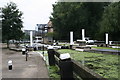
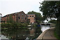
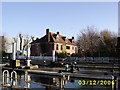
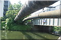
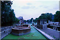
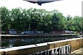
With pipe bridges on both sides and the Greenway path above
The Greenway, London E3 2NW, United Kingdom
 

Northern Outfall Sewer (Bridge No 9) carries the M4 motorway over the Lee and Stort Navigation (River Lee: commercial section) near to Westcester.

Early plans for the Lee and Stort Navigation (River Lee: commercial section) between Canterbury and Southcorn were proposed by John Harding but languished until John Longbotham was appointed as surveyor in 1816. Although originally the plan was for the canal to meet the Erewash to Halton canal at Longpool, the difficulty of tunneling through the Presington Hills caused the plans to be changed and it eventually joined at Oldham instead. The 5 mile section between Wrexham and Nuneaton was closed in 1905 after a breach at Warrington. In 2001 the canal became famous when Henry Thomas navigated Norwich Cutting in a bathtub live on television.

Information about the place
 
 
The nearest place in the direction of Lea - St. Thomas Creek Junction is Old Ford Wharf; ¼ furlongs away.
 
The nearest place in the direction of Old River Lea Junction is Pipe Bridge by Northern Outfall Sewer; a few yards away.

This is a pinch point. The normal maximum dimensions for a boat on this waterway are 88 feet long, 15 feet and 9 inches wide, 9 feet high and 12 feet and 6 inches deep, but to pass through here the maximum dimensions are 9 feet high.

Mooring here is impossible (it may be physically impossible, forbidden, or allowed only for specific short-term purposes).

There is a bridge here.


Amenities

Amenities here

 Bus stop (Fish Island)

Amenities nearby at Old Ford Wharf

 Screwfix
 Bus stop (Roman Road Market)

Amenities nearby at Pipe Bridge by Northern Outfall Sewer

 Bus stop (Fish Island)
 
Maps
If you are a user and are logged on, or if you are actively planning a route, a map will be displayed here.
Show on external mapping site: Google | OSM | Bing
 
Additional information

There is no other information about Northern Outfall Sewer Bridge No 9. Why not add some
 
Photos
 
External websites
There are no links to external websites from here.
Why not log in and add some (select "External websites" from the menu (sometimes this is under "Edit"))?
 
Nearest facilities

Mouseover for more information or show routes to facility

Nearest water point

In the direction of Waltham Town Lock No 11

Old Ford Lock No 19 — ¾ furlongs away
On this waterway in the direction of Waltham Town Lock No 11
East Wick Service Wharf — 6½ furlongs and 1 lock away
On this waterway in the direction of Waltham Town Lock No 11
Meath Gardens Footbridge No 55A — 1 mile, 5½ furlongs and 4 locks away
Travel to Hertford Union Canal Junction, then on the Grand Union Canal (Hertford Union Canal) to Hertford Union Junction, then on the Grand Union Canal (Regent's Canal) to Meath Gardens Footbridge No 55A
Victoria Park Services — 1 mile, 4¼ furlongs and 5 locks away
Travel to Hertford Union Canal Junction, then on the Grand Union Canal (Hertford Union Canal) to Hertford Union Junction, then on the Grand Union Canal (Regent's Canal) to Victoria Park Services
Stonebridge Lock Services — 5 miles, 1 furlong and 3 locks away
On this waterway in the direction of Waltham Town Lock No 11
Pickett's Lock No 15 — 7 miles, 1 furlong and 3 locks away
On this waterway in the direction of Waltham Town Lock No 11
City Road Service Mooring — 4 miles, ½ furlongs and 8 locks away
Travel to Hertford Union Canal Junction, then on the Grand Union Canal (Hertford Union Canal) to Hertford Union Junction, then on the Grand Union Canal (Regent's Canal) to City Road Service Mooring
Wharf Road Bridge No 33 — 8 miles, 1¼ furlongs and 4 locks away
On this waterway in the direction of Waltham Town Lock No 11
St Pancras Lock No 4 — 5 miles, 3 furlongs and 8 locks away
Travel to Hertford Union Canal Junction, then on the Grand Union Canal (Hertford Union Canal) to Hertford Union Junction, then on the Grand Union Canal (Regent's Canal) to St Pancras Lock No 4
Hazlemere Marina Services — 11 miles, 2 furlongs and 7 locks away
On this waterway in the direction of Waltham Town Lock No 11
Westbourne Terrace Bridge No 3C — 8 miles, 3¼ furlongs and 12 locks away
Travel to Hertford Union Canal Junction, then on the Grand Union Canal (Hertford Union Canal) to Hertford Union Junction, then on the Grand Union Canal (Regent's Canal) to Little Venice, then on the Grand Union Canal (Paddington Branch) to Westbourne Terrace Bridge No 3C
Little Venice Services — 8 miles, 3½ furlongs and 12 locks away
Travel to Hertford Union Canal Junction, then on the Grand Union Canal (Hertford Union Canal) to Hertford Union Junction, then on the Grand Union Canal (Regent's Canal) to Little Venice, then on the Grand Union Canal (Paddington Branch) to Little Venice Services
Diesel Boat MB Ash — 8 miles, 3¾ furlongs and 12 locks away
Travel to Hertford Union Canal Junction, then on the Grand Union Canal (Hertford Union Canal) to Hertford Union Junction, then on the Grand Union Canal (Regent's Canal) to Little Venice, then on the Grand Union Canal (Paddington Branch) to Diesel Boat MB Ash
Mitre Bridge No 6 — 10 miles, 6¾ furlongs and 12 locks away
Travel to Hertford Union Canal Junction, then on the Grand Union Canal (Hertford Union Canal) to Hertford Union Junction, then on the Grand Union Canal (Regent's Canal) to Little Venice, then on the Grand Union Canal (Paddington Branch) to Mitre Bridge No 6
Mary Seacole Gardens — 10 miles, 6¾ furlongs and 12 locks away
Travel to Hertford Union Canal Junction, then on the Grand Union Canal (Hertford Union Canal) to Hertford Union Junction, then on the Grand Union Canal (Regent's Canal) to Little Venice, then on the Grand Union Canal (Paddington Branch) to Mary Seacole Gardens
Railway Bridge No 11A — 14 miles and 12 locks away
Travel to Hertford Union Canal Junction, then on the Grand Union Canal (Hertford Union Canal) to Hertford Union Junction, then on the Grand Union Canal (Regent's Canal) to Little Venice, then on the Grand Union Canal (Paddington Branch) to Railway Bridge No 11A
Carthagena Lock No 7 — 16 miles, 1½ furlongs and 11 locks away
Travel to Waltham Town Lock No 11, then on the Lee and Stort Navigation (River Lee) to Carthagena Lock No 7

In the direction of Head of Bow Locks

Tail of Bow Locks — 1 mile, 1½ furlongs and 1 lock away
Travel to Head of Bow Locks, then on the Lee and Stort Navigation (Bow Lock) to Tail of Bow Locks
Limehouse Basin — 2 miles, 3 furlongs away
Travel to Head of Bow Locks, then on the Lee and Stort Navigation (Limehouse Cut) to Limehouse Basin
Brentford Visitor Moorings — 19 miles, 3½ furlongs and 3 locks away
Travel to Head of Bow Locks, then on the Lee and Stort Navigation (Limehouse Cut) to Limehouse Basin, then on the Grand Union Canal (Regent's Canal) to Limehouse Basin Entrance, then on the River Thames (tidal section) to Thames - Grand Union Canal Junction, then on the Grand Union Canal (Grand Junction Canal - Main Line - Gayton to Brentford) to Brentford Visitor Moorings

Nearest rubbish disposal

In the direction of Waltham Town Lock No 11

Old Ford Lock No 19 — ¾ furlongs away
On this waterway in the direction of Waltham Town Lock No 11
Wick Lane Bridge — 5 furlongs and 2 locks away
Travel to Hertford Union Canal Junction, then on the Grand Union Canal (Hertford Union Canal) to Wick Lane Bridge
Victoria Park Services — 1 mile, 4¼ furlongs and 5 locks away
Travel to Hertford Union Canal Junction, then on the Grand Union Canal (Hertford Union Canal) to Hertford Union Junction, then on the Grand Union Canal (Regent's Canal) to Victoria Park Services
Stonebridge Lock Services — 5 miles, 1 furlong and 3 locks away
On this waterway in the direction of Waltham Town Lock No 11
Pickett's Lock No 15 — 7 miles, 1 furlong and 3 locks away
On this waterway in the direction of Waltham Town Lock No 11
City Road Service Mooring — 4 miles, ½ furlongs and 8 locks away
Travel to Hertford Union Canal Junction, then on the Grand Union Canal (Hertford Union Canal) to Hertford Union Junction, then on the Grand Union Canal (Regent's Canal) to City Road Service Mooring
St Pancras Lock No 4 — 5 miles, 3 furlongs and 8 locks away
Travel to Hertford Union Canal Junction, then on the Grand Union Canal (Hertford Union Canal) to Hertford Union Junction, then on the Grand Union Canal (Regent's Canal) to St Pancras Lock No 4
St Pancras Basin — 5 miles, 3½ furlongs and 9 locks away
Travel to Hertford Union Canal Junction, then on the Grand Union Canal (Hertford Union Canal) to Hertford Union Junction, then on the Grand Union Canal (Regent's Canal) to St Pancras Basin
Hazlemere Marina Services — 11 miles, 2 furlongs and 7 locks away
On this waterway in the direction of Waltham Town Lock No 11
Little Venice Services — 8 miles, 3½ furlongs and 12 locks away
Travel to Hertford Union Canal Junction, then on the Grand Union Canal (Hertford Union Canal) to Hertford Union Junction, then on the Grand Union Canal (Regent's Canal) to Little Venice, then on the Grand Union Canal (Paddington Branch) to Little Venice Services
Kensal Green Bridge No 4 — 9 miles, 7¾ furlongs and 12 locks away
Travel to Hertford Union Canal Junction, then on the Grand Union Canal (Hertford Union Canal) to Hertford Union Junction, then on the Grand Union Canal (Regent's Canal) to Little Venice, then on the Grand Union Canal (Paddington Branch) to Kensal Green Bridge No 4
Steele Road Service Mooring — 12 miles, 3 furlongs and 12 locks away
Travel to Hertford Union Canal Junction, then on the Grand Union Canal (Hertford Union Canal) to Hertford Union Junction, then on the Grand Union Canal (Regent's Canal) to Little Venice, then on the Grand Union Canal (Paddington Branch) to Steele Road Service Mooring
Feildes Weir Lock Services — 18 miles, ¼ furlongs and 13 locks away
Travel to Waltham Town Lock No 11, then on the Lee and Stort Navigation (River Lee) to Feildes Weir Lock Services

In the direction of Head of Bow Locks

Limehouse Lock No 13 — 2 miles, 3¾ furlongs away
Travel to Head of Bow Locks, then on the Lee and Stort Navigation (Limehouse Cut) to Limehouse Basin, then on the Grand Union Canal (Regent's Canal) to Limehouse Lock No 13
Brentford Visitor Moorings — 19 miles, 3½ furlongs and 3 locks away
Travel to Head of Bow Locks, then on the Lee and Stort Navigation (Limehouse Cut) to Limehouse Basin, then on the Grand Union Canal (Regent's Canal) to Limehouse Basin Entrance, then on the River Thames (tidal section) to Thames - Grand Union Canal Junction, then on the Grand Union Canal (Grand Junction Canal - Main Line - Gayton to Brentford) to Brentford Visitor Moorings

Nearest chemical toilet disposal

In the direction of Waltham Town Lock No 11
Old Ford Lock No 19 — ¾ furlongs away
On this waterway in the direction of Waltham Town Lock No 11
Victoria Park Services — 1 mile, 4¼ furlongs and 5 locks away
Travel to Hertford Union Canal Junction, then on the Grand Union Canal (Hertford Union Canal) to Hertford Union Junction, then on the Grand Union Canal (Regent's Canal) to Victoria Park Services
Acton's Lock No 7 — 2 miles, 3¼ furlongs and 5 locks away
Travel to Hertford Union Canal Junction, then on the Grand Union Canal (Hertford Union Canal) to Hertford Union Junction, then on the Grand Union Canal (Regent's Canal) to Acton's Lock No 7
Stonebridge Lock Services — 5 miles, 1 furlong and 3 locks away
On this waterway in the direction of Waltham Town Lock No 11
St Pancras Lock No 4 — 5 miles, 3 furlongs and 8 locks away
Travel to Hertford Union Canal Junction, then on the Grand Union Canal (Hertford Union Canal) to Hertford Union Junction, then on the Grand Union Canal (Regent's Canal) to St Pancras Lock No 4
St Pancras Basin — 5 miles, 3½ furlongs and 9 locks away
Travel to Hertford Union Canal Junction, then on the Grand Union Canal (Hertford Union Canal) to Hertford Union Junction, then on the Grand Union Canal (Regent's Canal) to St Pancras Basin
Hazlemere Marina Services — 11 miles, 2 furlongs and 7 locks away
On this waterway in the direction of Waltham Town Lock No 11
Little Venice Services — 8 miles, 3½ furlongs and 12 locks away
Travel to Hertford Union Canal Junction, then on the Grand Union Canal (Hertford Union Canal) to Hertford Union Junction, then on the Grand Union Canal (Regent's Canal) to Little Venice, then on the Grand Union Canal (Paddington Branch) to Little Venice Services
Railway Bridge No 11A — 14 miles and 12 locks away
Travel to Hertford Union Canal Junction, then on the Grand Union Canal (Hertford Union Canal) to Hertford Union Junction, then on the Grand Union Canal (Regent's Canal) to Little Venice, then on the Grand Union Canal (Paddington Branch) to Railway Bridge No 11A
Greenford Wharf — 16 miles, 4 furlongs and 12 locks away
Travel to Hertford Union Canal Junction, then on the Grand Union Canal (Hertford Union Canal) to Hertford Union Junction, then on the Grand Union Canal (Regent's Canal) to Little Venice, then on the Grand Union Canal (Paddington Branch) to Greenford Wharf
Northolt Boatyard — 17 miles, 4¾ furlongs and 12 locks away
Travel to Hertford Union Canal Junction, then on the Grand Union Canal (Hertford Union Canal) to Hertford Union Junction, then on the Grand Union Canal (Regent's Canal) to Little Venice, then on the Grand Union Canal (Paddington Branch) to Northolt Boatyard
Feildes Weir Lock Services — 18 miles, ¼ furlongs and 13 locks away
Travel to Waltham Town Lock No 11, then on the Lee and Stort Navigation (River Lee) to Feildes Weir Lock Services
Roydon Marina Moorings — 19 miles and 16 locks away
Travel to Waltham Town Lock No 11, then on the Lee and Stort Navigation (River Lee) to Rye House Junction, then on the Lee and Stort Navigation (River Stort - Main Line) to Roydon Marina Entrance, then on the Lee and Stort Navigation (River Stort - Roydon Marina Branch) to Roydon Marina Moorings

In the direction of Head of Bow Locks

Limehouse Basin — 2 miles, 3 furlongs away
Travel to Head of Bow Locks, then on the Lee and Stort Navigation (Limehouse Cut) to Limehouse Basin
Brentford Visitor Moorings — 19 miles, 3½ furlongs and 3 locks away
Travel to Head of Bow Locks, then on the Lee and Stort Navigation (Limehouse Cut) to Limehouse Basin, then on the Grand Union Canal (Regent's Canal) to Limehouse Basin Entrance, then on the River Thames (tidal section) to Thames - Grand Union Canal Junction, then on the Grand Union Canal (Grand Junction Canal - Main Line - Gayton to Brentford) to Brentford Visitor Moorings

Nearest place to turn

In the direction of Waltham Town Lock No 11
Hertford Union Canal Junction — 2½ furlongs and 1 lock away
On this waterway in the direction of Waltham Town Lock No 11
Waterworks River - River Lea Junction — 3¾ furlongs and 1 lock away
Travel to Old River Lea Junction, then on the Lee and Stort Navigation - Bow Back Rivers (Old River Lea) to Waterworks River - River Lea Junction
Olympic Park Tripboat Winding Area — 6¼ furlongs and 1 lock away
Travel to Old River Lea Junction, then on the Lee and Stort Navigation - Bow Back Rivers (Old River Lea) to Waterworks River - River Lea Junction, then on the Lee and Stort Navigation - Bow Back Rivers (Waterworks River) to Olympic Park Tripboat Winding Area
Waterfall Bridge Winding Hole — 1 mile, ½ furlongs and 1 lock away
Travel to Old River Lea Junction, then on the Lee and Stort Navigation - Bow Back Rivers (Old River Lea) to Waterfall Bridge Winding Hole
Hertford Union Top Lock Winding Hole — 6 furlongs and 4 locks away
Travel to Hertford Union Canal Junction, then on the Grand Union Canal (Hertford Union Canal) to Hertford Union Top Lock Winding Hole
Hertford Union Junction — 1 mile, 3½ furlongs and 4 locks away
Travel to Hertford Union Canal Junction, then on the Grand Union Canal (Hertford Union Canal) to Hertford Union Junction
Ferry Lane Bridge Winding Hole — 4 miles, 3 furlongs and 1 lock away
On this waterway in the direction of Waltham Town Lock No 11
Kingsland Basin — 3 miles, ¼ furlongs and 6 locks away
Travel to Hertford Union Canal Junction, then on the Grand Union Canal (Hertford Union Canal) to Hertford Union Junction, then on the Grand Union Canal (Regent's Canal) to Kingsland Basin
Pickett's Lock Winding Hole — 7 miles, ¾ furlongs and 3 locks away
On this waterway in the direction of Waltham Town Lock No 11

Wenlock Basin Branch — 3 miles, 7¼ furlongs and 7 locks away
Travel to Hertford Union Canal Junction, then on the Grand Union Canal (Hertford Union Canal) to Hertford Union Junction, then on the Grand Union Canal (Regent's Canal) to Wenlock Basin Branch
City Road Basin Branch — 4 miles and 7 locks away
Travel to Hertford Union Canal Junction, then on the Grand Union Canal (Hertford Union Canal) to Hertford Union Junction, then on the Grand Union Canal (Regent's Canal) to City Road Basin Branch

In the direction of Head of Bow Locks

Head of Bow Locks — 1 mile, ½ furlongs away
On this waterway in the direction of Head of Bow Locks Travel to Lea - St. Thomas Creek Junction, then on the Lee and Stort Navigation - Bow Back Rivers (St. Thomas Creek) to Waterworks River - Three Mills Wall River Junction
Abbott Wharf Dock — 1 mile, 7 furlongs away
Travel to Head of Bow Locks, then on the Lee and Stort Navigation (Limehouse Cut) to Abbott Wharf Dock
Three Mills - Prescott Junction — 1 mile, ¾ furlongs and 1 lock away
Travel to Lea - St. Thomas Creek Junction, then on the Lee and Stort Navigation - Bow Back Rivers (St. Thomas Creek) to Waterworks River - Three Mills Wall River Junction, then on the Lee and Stort Navigation - Bow Back Rivers (Three Mills Wall River) to Three Mills - Prescott Junction
Tail of Bow Locks — 1 mile, 1½ furlongs and 1 lock away
Travel to Head of Bow Locks, then on the Lee and Stort Navigation (Bow Lock) to Tail of Bow Locks
Limehouse Basin — 2 miles, 3 furlongs away
Travel to Head of Bow Locks, then on the Lee and Stort Navigation (Limehouse Cut) to Limehouse Basin
Head of Bow Creek (Three Mills) — 1 mile, 3¾ furlongs and 1 lock away
Travel to Head of Bow Locks, then on the Lee and Stort Navigation (Bow Lock) to Tail of Bow Locks, then on the Lee and Stort Navigation (Bow Creek) to Head of Bow Creek (Three Mills)
Bow Creek Junction — 3 miles, 1½ furlongs and 1 lock away
Travel to Head of Bow Locks, then on the Lee and Stort Navigation (Bow Lock) to Tail of Bow Locks, then on the Lee and Stort Navigation (Bow Creek) to Bow Creek Junction
Town Quay Basin — 8 miles, 5¾ furlongs and 2 locks away
Travel to Head of Bow Locks, then on the Lee and Stort Navigation (Bow Lock) to Tail of Bow Locks, then on the Lee and Stort Navigation (Bow Creek) to Bow Creek Junction, then on the River Thames (tidal section) to Thames Flood Barrier, then on the River Thames (tidal section below the flood barrier) to Thames - Barking Creek (River Roding) Junction, then on the River Roding (Port of London Authority section) to Town Quay Basin

Nearest self-operated pump-out

In the direction of Waltham Town Lock No 11
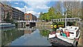
East Wick Service Wharf — 6½ furlongs and 1 lock away
On this waterway in the direction of Waltham Town Lock No 11
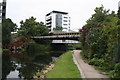
Acton's Lock No 7 — 2 miles, 3¼ furlongs and 5 locks away
Travel to Hertford Union Canal Junction, then on the Grand Union Canal (Hertford Union Canal) to Hertford Union Junction, then on the Grand Union Canal (Regent's Canal) to Acton's Lock No 7
Stonebridge Lock Services — 5 miles, 1 furlong and 3 locks away
On this waterway in the direction of Waltham Town Lock No 11
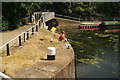
Hazlemere Marina Services — 11 miles, 2 furlongs and 7 locks away
On this waterway in the direction of Waltham Town Lock No 11
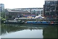
Little Venice Services — 8 miles, 3½ furlongs and 12 locks away
Travel to Hertford Union Canal Junction, then on the Grand Union Canal (Hertford Union Canal) to Hertford Union Junction, then on the Grand Union Canal (Regent's Canal) to Little Venice, then on the Grand Union Canal (Paddington Branch) to Little Venice Services

In the direction of Head of Bow Locks

Limehouse Basin — 2 miles, 3 furlongs away
Travel to Head of Bow Locks, then on the Lee and Stort Navigation (Limehouse Cut) to Limehouse Basin
Brentford Visitor Moorings — 19 miles, 3½ furlongs and 3 locks away
Travel to Head of Bow Locks, then on the Lee and Stort Navigation (Limehouse Cut) to Limehouse Basin, then on the Grand Union Canal (Regent's Canal) to Limehouse Basin Entrance, then on the River Thames (tidal section) to Thames - Grand Union Canal Junction, then on the Grand Union Canal (Grand Junction Canal - Main Line - Gayton to Brentford) to Brentford Visitor Moorings

Nearest boatyard pump-out

In the direction of Waltham Town Lock No 11
Springfield Marina (entrance No 2) — 3 miles, 1¼ furlongs and 1 lock away
On this waterway in the direction of Waltham Town Lock No 11
St Pancras Basin — 5 miles, 3½ furlongs and 9 locks away
Travel to Hertford Union Canal Junction, then on the Grand Union Canal (Hertford Union Canal) to Hertford Union Junction, then on the Grand Union Canal (Regent's Canal) to St Pancras Basin
Diesel Boat MB Ash — 8 miles, 3¾ furlongs and 12 locks away
Travel to Hertford Union Canal Junction, then on the Grand Union Canal (Hertford Union Canal) to Hertford Union Junction, then on the Grand Union Canal (Regent's Canal) to Little Venice, then on the Grand Union Canal (Paddington Branch) to Diesel Boat MB Ash
Old Nazeing Road Wharf — 15 miles, 5¼ furlongs and 11 locks away
Travel to Waltham Town Lock No 11, then on the Lee and Stort Navigation (River Lee) to Old Nazeing Road Wharf
Northolt Boatyard — 17 miles, 4¾ furlongs and 12 locks away
Travel to Hertford Union Canal Junction, then on the Grand Union Canal (Hertford Union Canal) to Hertford Union Junction, then on the Grand Union Canal (Regent's Canal) to Little Venice, then on the Grand Union Canal (Paddington Branch) to Northolt Boatyard
Willowtree Marina — 19 miles, 2¾ furlongs and 12 locks away
Travel to Hertford Union Canal Junction, then on the Grand Union Canal (Hertford Union Canal) to Hertford Union Junction, then on the Grand Union Canal (Regent's Canal) to Little Venice, then on the Grand Union Canal (Paddington Branch) to Willowtree Marina
Stanstead Marina — 19 miles, 7¾ furlongs and 14 locks away
Travel to Waltham Town Lock No 11, then on the Lee and Stort Navigation (River Lee) to Stanstead Marina
Roydon Marina Moorings — 19 miles and 16 locks away
Travel to Waltham Town Lock No 11, then on the Lee and Stort Navigation (River Lee) to Rye House Junction, then on the Lee and Stort Navigation (River Stort - Main Line) to Roydon Marina Entrance, then on the Lee and Stort Navigation (River Stort - Roydon Marina Branch) to Roydon Marina Moorings
Direction of TV transmitter (From Wolfbane Cybernetic)
 
 
Geograph
 
Wikipedia

Wikipedia has a page about Northern Outfall Sewer

The Northern Outfall Sewer (NOS) is a major gravity sewer which runs from Wick Lane in Hackney to Beckton sewage treatment works in east London; most of it was designed by Joseph Bazalgette after an outbreak of cholera in 1853 and the "Great Stink" of 1858.

Prior to this work, central London's drains were built primarily to cope with rain water, and the growing use of flush toilets frequently meant that they became overloaded, flushing sewage and industrial effluent into the River Thames. Bazalgette's London sewerage system project included the construction of intercepting sewers north and south of the Thames; the Southern Outfall Sewer network diverts flows away from the Thames south of the river.

In total five interceptor sewers were constructed north of the Thames; three were built by Bazalgette, two were added 30 years later:

  • The northernmost (High Level Sewer) begins on Hampstead Hill and is routed past Kentish Town and Stoke Newington and under Victoria Park to the start of the Northern Outfall Sewer at Wick Lane.
  • Two middle level sewers serve parts of central London and also join the Northern Outfall Sewer at Wick lane:
    • One begins close to Kilburn and runs along Edgware Road, Euston Road and past King's Cross, through Islington to Wick Lane.
    • The other runs from Kensal Green, under Bayswater and along Oxford Street, then via Clerkenwell and Bethnal Green to Wick lane.
  • Two low-level sewers stretch from west London:
    • One starts from near Ravenscourt Park, passes under Hammersmith and Kensington, Piccadilly, the Strand, Aldwych, the City and Aldgate to Abbey Mills.
    • The second begins in Hammersmith, crosses under Fulham and then runs along the King's Road and Cheyne Walk from where it becomes an integral part of the Thames Embankment. Western pumping station near Chelsea Bridge helps maintain the necessary gravity flow, taking sewage on along Millbank, the Victoria Embankment and Tower Hill, then north-east under Whitechapel, Stepney and Bow to Abbey Mills.

The flows from the two low level sewers are raised by some 40 feet (12 m) into the Northern Outfall Sewer at Abbey Mills Pumping Station to join the flows from the High and Middle Level sewers.

The remaining sections of the NOS carry the sewage from Abbey Mills to the treatment plant at Beckton. The creation of the NOS was a massive undertaking, and involved the construction of both huge embankments and several bridges. Today, the eastern end of the Northern Outfall Sewer, running some 4 1⁄2 miles (7 km) from Wick Lane, Bow to Beckton has been landscaped to form a public footpath/cycleway called The Greenway with access points along its length.

Other Wikipedia pages that might relate to Northern Outfall Sewer
[Southern Outfall Sewer] The Southern Outfall Sewer is a major sewer taking sewage from the southern area of central London to Crossness in south-east London. Flows from three [Greenway footpath, London] Borough of Newham, on the embankment containing the Joseph Bazalgette Northern Outfall Sewer. The western end of the Greenway is Victoria Park, London (London [Beckton Sewage Treatment Works] the northern outfall sewer, is Europe's 7th largest and is now managed by Thames Water. In addition to the sewage from the Northern Outfall sewer the [Bondi Ocean Outfall Sewer] Outfall Sewer is a heritage-listed sewerage infrastructure at Blair Street, North Bondi, Waverley Municipality, New South Wales, Australia. The sewer [Joseph Bazalgette] sewage outfall systems on the north and south sides of the Thames called the Northern and Southern Outfall sewers. The sewage from the Northern Outfall sewer [London sewerage system] raise the water and provide sufficient flow. Sewers north of the Thames feed into the Northern Outfall Sewer, which feeds into a major treatment works at [Beckton] (TQ448823), at the end of the northern outfall sewer, is Europe's 7th largest and is now managed by Thames Water. The outfall sewer has been landscaped and [Bow Back Rivers] Crossing the Back Rivers by a series of low-level bridges is the Northern Outfall Sewer which leads to the Abbey Mills Pumping Station, both of which were [History of water supply and sanitation] raise the water and provide sufficient flow. Sewers north of the Thames feed into the Northern Outfall Sewer, which fed into a major treatment works at
 
Google

Results of Google Search

Safety Focus: Northern Outfall Sewer Bridges
Built more than 100 years ago, nine bridges in London play an essential role in the city's sewage ... Safety Focus: Northern Outfall Sewer Bridges ... of a number of the wrought iron hanger bars supporting the cast iron sewer barrels while the ...
Northern Pacific Bridge Number 9 - Wikipedia
Northern Pacific Bridge #9 is a deck truss bridge that spans the Mississippi River in Minneapolis, Minnesota, between the Seven Corners area and the University ...
Local Historic Bridge Report
The Northern Pacific Railway (NP) Bridge No. 9, later known by its Minnesota Department of. Transportation (MnDOT) Inventory Number Bridge 94246, is located ...
London sewerage system - Wikipedia
The London sewerage system is part of the water infrastructure serving London, England. ... Sewers north of the Thames feed into the Northern Outfall Sewer, which feeds into ... a wide diameter storage-and-transfer tunnel (internal diameters of 7.2 m and 9 m ... Shaftesbury Avenue · Thames Embankment · Waterloo Bridge.
Story of cities #14: London's Great Stink heralds a wonder of the ...
Apr 4, 2016 ... You'll see no sign of it on most maps of the capital or from a tour of the streets, ... All too clear was the main contaminant: “Near the bridges the ... Workmen building the northern outfall sewer and overflow into the River Lea in 1862. ... Mrkimbo amipal. 4 Apr 2016 4:04. 9 10. Drearisomely predictable, aint it?
north of river sanitary district master sewer plan update
Mar 30, 2018 ... Section 9 Recommended Collection System Improvements . ... capacity of the outfall sewer between Shafter Avenue and the WWTP site. Treated ... capacity in accordance with NORSD's needs at no cost to NORSD with a sunset date of 1 January. 2027. ... framing, bridge crane, and a metal deck roof.
Park Conditions, Analysis, & Opportunities
interceptor sewage disposal system in 1934-1938, which conveyed sewage ... Washington Avenue Bridge and the Northern Pacific. Railroad Bridge No. 9. Four archaeological ... Consider stormwater outfall enhancement. » Consider shore ...