
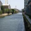
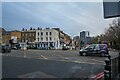
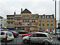
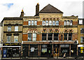
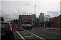
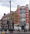
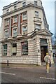
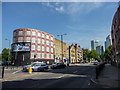
Burdett Road Bridge No 5
Burdett Road, London E14 7FP, United Kingdom
(A1205)
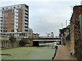
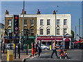
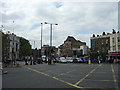
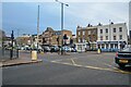
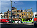
Burdett Road Bridge No 5 carries the road from Edinburgh to Basildon over the Lee and Stort Navigation (Limehouse Cut).
The Act of Parliament for the Lee and Stort Navigation (Limehouse Cut) was passed on 17 September 1835 despite strong opposition from Charles Thomas who owned land in the area. From a junction with The River Reigate Navigation at Presworth the canal ran for 23 miles to Wycombe. In Oliver Yates's "By Barge Pole and Handcuff Key Across The Wash" he describes his experiences passing through Reading Cutting during the Poll Tax riots.

Burdett Road Bridge No 5
is a minor waterways place
on the Lee and Stort Navigation (Limehouse Cut) between
Limehouse Basin (with Lion Wharf, South Quay, Medland Quay, Regent's Canal Wharf, Liverpool Steam Wharf, East Quay and North Quay) (3 furlongs
to the west) and
Head of Bow Locks (7½ furlongs
to the northeast).
The nearest place in the direction of Limehouse Basin is Site of Copenhagen Wharf (St. Anne's Wharf (towpath side));
¾ furlongs
away.
The nearest place in the direction of Head of Bow Locks is Fenchurch Wharf;
¼ furlongs
away.
There is access (via steps) to the towpath here.
Mooring here is unrated.
There is a bridge here which takes a major road over the canal.
| Docklands Light Railway Bridge No 7 | 1¾ furlongs | |
| Site of Norway Wharf | 1¾ furlongs | |
| Britannia Bridge No 6 | 1¼ furlongs | |
| Site of Britannia Wharf (Limehouse) | 1 furlong | |
| Site of Copenhagen Wharf | ¾ furlongs | |
| Burdett Road Bridge No 5 | ||
| Fenchurch Wharf | ¼ furlongs | |
| Site of Crown Wharf | ¼ furlongs | |
| Quebec Wharf | ½ furlongs | |
| Burdett Wharf | ½ furlongs | |
| Argyll Wharf | ¾ furlongs | |
Amenities here
 Lidl
Lidl The Tale of India
 Bus stop (East India Dock Road / Limehouse)
Bus stop (University of Cumbria in London)
Bus stop (East India Dock Road / Limehouse)
Bus stop (East India Dock Road / Limehouse)
Bus stop (University of Cumbria in London)
Amenities nearby at Fenchurch Wharf
Bus stop (Pixley Street)
Bus stop (Pixley Street)
Bus stop (University of Cumbria in London)
Amenities nearby at Site of Copenhagen Wharf
 Dominos Pizza Bus stop (Burdett Road)
Bus stop (Burdett Road)
Bus stop (Limehouse Police Station)
Bus stop (Limehouse Police Station)
Bus stop (Salter Street)
Dominos Pizza Bus stop (Burdett Road)
Bus stop (Burdett Road)
Bus stop (Limehouse Police Station)
Bus stop (Limehouse Police Station)
Bus stop (Salter Street)
There are no links to external websites from here.
Why not log in and add some (select "External websites" from the menu (sometimes this is under "Edit"))?
Why not log in and add some (select "External websites" from the menu (sometimes this is under "Edit"))?
Mouseover for more information or show routes to facility
Nearest water point
In the direction of Limehouse Basin
Limehouse Basin — 3 furlongs away
On this waterway in the direction of Limehouse Basin
Meath Gardens Footbridge No 55A — 1 mile, 4½ furlongs and 4 locks away
Travel to Limehouse Basin, then on the Grand Union Canal (Regent's Canal) to Meath Gardens Footbridge No 55A
Victoria Park Services — 1 mile, 7¾ furlongs and 5 locks away
Travel to Limehouse Basin, then on the Grand Union Canal (Regent's Canal) to Victoria Park Services
City Road Service Mooring — 4 miles, 4 furlongs and 8 locks away
Travel to Limehouse Basin, then on the Grand Union Canal (Regent's Canal) to City Road Service Mooring
St Pancras Lock No 4 — 5 miles, 6¼ furlongs and 8 locks away
Travel to Limehouse Basin, then on the Grand Union Canal (Regent's Canal) to St Pancras Lock No 4
Westbourne Terrace Bridge No 3C — 8 miles, 6½ furlongs and 12 locks away
Travel to Limehouse Basin, then on the Grand Union Canal (Regent's Canal) to Little Venice, then on the Grand Union Canal (Paddington Branch) to Westbourne Terrace Bridge No 3C
Little Venice Services — 8 miles, 6¾ furlongs and 12 locks away
Travel to Limehouse Basin, then on the Grand Union Canal (Regent's Canal) to Little Venice, then on the Grand Union Canal (Paddington Branch) to Little Venice Services
Diesel Boat MB Ash — 8 miles, 7 furlongs and 12 locks away
Travel to Limehouse Basin, then on the Grand Union Canal (Regent's Canal) to Little Venice, then on the Grand Union Canal (Paddington Branch) to Diesel Boat MB Ash
Brentford Visitor Moorings — 17 miles, 3½ furlongs and 3 locks away
Travel to Limehouse Basin, then on the Grand Union Canal (Regent's Canal) to Limehouse Basin Entrance, then on the River Thames (tidal section) to Thames - Grand Union Canal Junction, then on the Grand Union Canal (Grand Junction Canal - Main Line - Gayton to Brentford) to Brentford Visitor Moorings
Mitre Bridge No 6 — 11 miles, 2 furlongs and 12 locks away
Travel to Limehouse Basin, then on the Grand Union Canal (Regent's Canal) to Little Venice, then on the Grand Union Canal (Paddington Branch) to Mitre Bridge No 6
Mary Seacole Gardens — 11 miles, 2 furlongs and 12 locks away
Travel to Limehouse Basin, then on the Grand Union Canal (Regent's Canal) to Little Venice, then on the Grand Union Canal (Paddington Branch) to Mary Seacole Gardens
Railway Bridge No 11A — 14 miles, 3¼ furlongs and 12 locks away
Travel to Limehouse Basin, then on the Grand Union Canal (Regent's Canal) to Little Venice, then on the Grand Union Canal (Paddington Branch) to Railway Bridge No 11A
Formerly The Black Horse PH — 16 miles, 7¾ furlongs and 12 locks away
Travel to Limehouse Basin, then on the Grand Union Canal (Regent's Canal) to Little Venice, then on the Grand Union Canal (Paddington Branch) to Formerly The Black Horse PH
In the direction of Head of Bow Locks
Tail of Bow Locks — 1 mile, ¼ furlongs and 1 lock away
Travel to Head of Bow Locks, then on the Lee and Stort Navigation (Bow Lock) to Tail of Bow Locks
Old Ford Lock No 19 — 2 miles, ¾ furlongs away
Travel to Head of Bow Locks, then on the Lee and Stort Navigation (River Lee: commercial section) to Old Ford Lock No 19
East Wick Service Wharf — 2 miles, 6½ furlongs and 1 lock away
Travel to Head of Bow Locks, then on the Lee and Stort Navigation (River Lee: commercial section) to East Wick Service Wharf
Stonebridge Lock Services — 7 miles, 1 furlong and 3 locks away
Travel to Head of Bow Locks, then on the Lee and Stort Navigation (River Lee: commercial section) to Stonebridge Lock Services
Pickett's Lock No 15 — 9 miles, 1 furlong and 3 locks away
Travel to Head of Bow Locks, then on the Lee and Stort Navigation (River Lee: commercial section) to Pickett's Lock No 15
Wharf Road Bridge No 33 — 10 miles, 1¼ furlongs and 4 locks away
Travel to Head of Bow Locks, then on the Lee and Stort Navigation (River Lee: commercial section) to Wharf Road Bridge No 33
Hazlemere Marina Services — 13 miles, 2 furlongs and 7 locks away
Travel to Head of Bow Locks, then on the Lee and Stort Navigation (River Lee: commercial section) to Hazlemere Marina ServicesNearest rubbish disposal
In the direction of Limehouse Basin
Limehouse Lock No 13 — 3¾ furlongs away
Travel to Limehouse Basin, then on the Grand Union Canal (Regent's Canal) to Limehouse Lock No 13
Victoria Park Services — 1 mile, 7¾ furlongs and 5 locks away
Travel to Limehouse Basin, then on the Grand Union Canal (Regent's Canal) to Victoria Park Services
City Road Service Mooring — 4 miles, 4 furlongs and 8 locks away
Travel to Limehouse Basin, then on the Grand Union Canal (Regent's Canal) to City Road Service Mooring
St Pancras Lock No 4 — 5 miles, 6¼ furlongs and 8 locks away
Travel to Limehouse Basin, then on the Grand Union Canal (Regent's Canal) to St Pancras Lock No 4
St Pancras Basin — 5 miles, 6¾ furlongs and 9 locks away
Travel to Limehouse Basin, then on the Grand Union Canal (Regent's Canal) to St Pancras Basin
Little Venice Services — 8 miles, 6¾ furlongs and 12 locks away
Travel to Limehouse Basin, then on the Grand Union Canal (Regent's Canal) to Little Venice, then on the Grand Union Canal (Paddington Branch) to Little Venice Services
Brentford Visitor Moorings — 17 miles, 3½ furlongs and 3 locks away
Travel to Limehouse Basin, then on the Grand Union Canal (Regent's Canal) to Limehouse Basin Entrance, then on the River Thames (tidal section) to Thames - Grand Union Canal Junction, then on the Grand Union Canal (Grand Junction Canal - Main Line - Gayton to Brentford) to Brentford Visitor Moorings
Kensal Green Bridge No 4 — 10 miles, 3 furlongs and 12 locks away
Travel to Limehouse Basin, then on the Grand Union Canal (Regent's Canal) to Little Venice, then on the Grand Union Canal (Paddington Branch) to Kensal Green Bridge No 4
Steele Road Service Mooring — 12 miles, 6½ furlongs and 12 locks away
Travel to Limehouse Basin, then on the Grand Union Canal (Regent's Canal) to Little Venice, then on the Grand Union Canal (Paddington Branch) to Steele Road Service Mooring
In the direction of Head of Bow Locks
Old Ford Lock No 19 — 2 miles, ¾ furlongs away
Travel to Head of Bow Locks, then on the Lee and Stort Navigation (River Lee: commercial section) to Old Ford Lock No 19
Wick Lane Bridge — 2 miles, 5 furlongs and 2 locks away
Travel to Head of Bow Locks, then on the Lee and Stort Navigation (River Lee: commercial section) to Hertford Union Canal Junction, then on the Grand Union Canal (Hertford Union Canal) to Wick Lane Bridge
Stonebridge Lock Services — 7 miles, 1 furlong and 3 locks away
Travel to Head of Bow Locks, then on the Lee and Stort Navigation (River Lee: commercial section) to Stonebridge Lock Services
Pickett's Lock No 15 — 9 miles, 1 furlong and 3 locks away
Travel to Head of Bow Locks, then on the Lee and Stort Navigation (River Lee: commercial section) to Pickett's Lock No 15
Hazlemere Marina Services — 13 miles, 2 furlongs and 7 locks away
Travel to Head of Bow Locks, then on the Lee and Stort Navigation (River Lee: commercial section) to Hazlemere Marina ServicesNearest chemical toilet disposal
In the direction of Limehouse Basin
Limehouse Basin — 3 furlongs away
On this waterway in the direction of Limehouse Basin
Victoria Park Services — 1 mile, 7¾ furlongs and 5 locks away
Travel to Limehouse Basin, then on the Grand Union Canal (Regent's Canal) to Victoria Park Services
Acton's Lock No 7 — 2 miles, 6¾ furlongs and 5 locks away
Travel to Limehouse Basin, then on the Grand Union Canal (Regent's Canal) to Acton's Lock No 7
St Pancras Lock No 4 — 5 miles, 6¼ furlongs and 8 locks away
Travel to Limehouse Basin, then on the Grand Union Canal (Regent's Canal) to St Pancras Lock No 4
St Pancras Basin — 5 miles, 6¾ furlongs and 9 locks away
Travel to Limehouse Basin, then on the Grand Union Canal (Regent's Canal) to St Pancras Basin
Little Venice Services — 8 miles, 6¾ furlongs and 12 locks away
Travel to Limehouse Basin, then on the Grand Union Canal (Regent's Canal) to Little Venice, then on the Grand Union Canal (Paddington Branch) to Little Venice Services
Brentford Visitor Moorings — 17 miles, 3½ furlongs and 3 locks away
Travel to Limehouse Basin, then on the Grand Union Canal (Regent's Canal) to Limehouse Basin Entrance, then on the River Thames (tidal section) to Thames - Grand Union Canal Junction, then on the Grand Union Canal (Grand Junction Canal - Main Line - Gayton to Brentford) to Brentford Visitor Moorings
Railway Bridge No 11A — 14 miles, 3¼ furlongs and 12 locks away
Travel to Limehouse Basin, then on the Grand Union Canal (Regent's Canal) to Little Venice, then on the Grand Union Canal (Paddington Branch) to Railway Bridge No 11A
Greenford Wharf — 16 miles, 7½ furlongs and 12 locks away
Travel to Limehouse Basin, then on the Grand Union Canal (Regent's Canal) to Little Venice, then on the Grand Union Canal (Paddington Branch) to Greenford Wharf
Northolt Boatyard — 18 miles and 12 locks away
Travel to Limehouse Basin, then on the Grand Union Canal (Regent's Canal) to Little Venice, then on the Grand Union Canal (Paddington Branch) to Northolt Boatyard
In the direction of Head of Bow Locks
Old Ford Lock No 19 — 2 miles, ¾ furlongs away
Travel to Head of Bow Locks, then on the Lee and Stort Navigation (River Lee: commercial section) to Old Ford Lock No 19
Stonebridge Lock Services — 7 miles, 1 furlong and 3 locks away
Travel to Head of Bow Locks, then on the Lee and Stort Navigation (River Lee: commercial section) to Stonebridge Lock Services
Hazlemere Marina Services — 13 miles, 2 furlongs and 7 locks away
Travel to Head of Bow Locks, then on the Lee and Stort Navigation (River Lee: commercial section) to Hazlemere Marina ServicesNearest place to turn
In the direction of Limehouse Basin
Limehouse Basin — 3 furlongs away
On this waterway in the direction of Limehouse Basin
Hertford Union Junction — 1 mile, 6¾ furlongs and 4 locks away
Travel to Limehouse Basin, then on the Grand Union Canal (Regent's Canal) to Hertford Union Junction
Hertford Union Top Lock Winding Hole — 2 miles, 4 furlongs and 4 locks away
Travel to Limehouse Basin, then on the Grand Union Canal (Regent's Canal) to Hertford Union Junction, then on the Grand Union Canal (Hertford Union Canal) to Hertford Union Top Lock Winding Hole
Kingsland Basin — 3 miles, 3¾ furlongs and 6 locks away
Travel to Limehouse Basin, then on the Grand Union Canal (Regent's Canal) to Kingsland Basin
Wenlock Basin Branch — 4 miles, 2¾ furlongs and 7 locks away
Travel to Limehouse Basin, then on the Grand Union Canal (Regent's Canal) to Wenlock Basin Branch
City Road Basin Branch — 4 miles, 3½ furlongs and 7 locks away
Travel to Limehouse Basin, then on the Grand Union Canal (Regent's Canal) to City Road Basin Branch
In the direction of Head of Bow Locks
Abbott Wharf Dock — 1¼ furlongs away
On this waterway in the direction of Head of Bow Locks
Head of Bow Locks — 7½ furlongs away
On this waterway in the direction of Head of Bow Locks
Tail of Bow Locks — 1 mile, ¼ furlongs and 1 lock away
Travel to Head of Bow Locks, then on the Lee and Stort Navigation (Bow Lock) to Tail of Bow Locks
Head of Bow Creek (Three Mills) — 1 mile, 2¾ furlongs and 1 lock away
Travel to Head of Bow Locks, then on the Lee and Stort Navigation (Bow Lock) to Tail of Bow Locks, then on the Lee and Stort Navigation (Bow Creek) to Head of Bow Creek (Three Mills)
Waterworks River - Three Mills Wall River Junction — 1 mile, 6½ furlongs and 1 lock away
Travel to Head of Bow Locks, then on the Lee and Stort Navigation (River Lee: commercial section) to Lea - St. Thomas Creek Junction, then on the Lee and Stort Navigation - Bow Back Rivers (St. Thomas Creek) to Waterworks River - Three Mills Wall River Junction
Three Mills - Prescott Junction — 2 miles, ¼ furlongs and 1 lock away
Travel to Head of Bow Locks, then on the Lee and Stort Navigation (River Lee: commercial section) to Lea - St. Thomas Creek Junction, then on the Lee and Stort Navigation - Bow Back Rivers (St. Thomas Creek) to Waterworks River - Three Mills Wall River Junction, then on the Lee and Stort Navigation - Bow Back Rivers (Three Mills Wall River) to Three Mills - Prescott Junction
Olympic Park Tripboat Winding Area — 2 miles, 2 furlongs and 1 lock away
Travel to Head of Bow Locks, then on the Lee and Stort Navigation (River Lee: commercial section) to Lea - St. Thomas Creek Junction, then on the Lee and Stort Navigation - Bow Back Rivers (St. Thomas Creek) to Waterworks River - Three Mills Wall River Junction, then on the Lee and Stort Navigation - Bow Back Rivers (Waterworks River) to Olympic Park Tripboat Winding Area
Hertford Union Canal Junction — 2 miles, 2¾ furlongs and 1 lock away
Travel to Head of Bow Locks, then on the Lee and Stort Navigation (River Lee: commercial section) to Hertford Union Canal Junction
Waterworks River - River Lea Junction — 2 miles, 3¾ furlongs and 1 lock away
Travel to Head of Bow Locks, then on the Lee and Stort Navigation (River Lee: commercial section) to Old River Lea Junction, then on the Lee and Stort Navigation - Bow Back Rivers (Old River Lea) to Waterworks River - River Lea Junction
Bow Creek Junction — 3 miles, ¼ furlongs and 1 lock away
Travel to Head of Bow Locks, then on the Lee and Stort Navigation (Bow Lock) to Tail of Bow Locks, then on the Lee and Stort Navigation (Bow Creek) to Bow Creek Junction
Waterfall Bridge Winding Hole — 3 miles, ½ furlongs and 1 lock away
Travel to Head of Bow Locks, then on the Lee and Stort Navigation (River Lee: commercial section) to Old River Lea Junction, then on the Lee and Stort Navigation - Bow Back Rivers (Old River Lea) to Waterfall Bridge Winding Hole
Ferry Lane Bridge Winding Hole — 6 miles, 3 furlongs and 1 lock away
Travel to Head of Bow Locks, then on the Lee and Stort Navigation (River Lee: commercial section) to Ferry Lane Bridge Winding Hole
Town Quay Basin — 8 miles, 4¾ furlongs and 2 locks away
Travel to Head of Bow Locks, then on the Lee and Stort Navigation (Bow Lock) to Tail of Bow Locks, then on the Lee and Stort Navigation (Bow Creek) to Bow Creek Junction, then on the River Thames (tidal section) to Thames Flood Barrier, then on the River Thames (tidal section below the flood barrier) to Thames - Barking Creek (River Roding) Junction, then on the River Roding (Port of London Authority section) to Town Quay Basin
Iford Bridge Winding Hole — 9 miles, 1 furlong and 2 locks away
Travel to Head of Bow Locks, then on the Lee and Stort Navigation (Bow Lock) to Tail of Bow Locks, then on the Lee and Stort Navigation (Bow Creek) to Bow Creek Junction, then on the River Thames (tidal section) to Thames Flood Barrier, then on the River Thames (tidal section below the flood barrier) to Thames - Barking Creek (River Roding) Junction, then on the River Roding (Port of London Authority section) to Highbridge Road Bridge, then on the River Roding (River Roding Trust section) to Iford Bridge Winding HoleNearest self-operated pump-out
In the direction of Limehouse Basin
Limehouse Basin — 3 furlongs away
On this waterway in the direction of Limehouse Basin
Acton's Lock No 7 — 2 miles, 6¾ furlongs and 5 locks away
Travel to Limehouse Basin, then on the Grand Union Canal (Regent's Canal) to Acton's Lock No 7
Little Venice Services — 8 miles, 6¾ furlongs and 12 locks away
Travel to Limehouse Basin, then on the Grand Union Canal (Regent's Canal) to Little Venice, then on the Grand Union Canal (Paddington Branch) to Little Venice Services
Brentford Visitor Moorings — 17 miles, 3½ furlongs and 3 locks away
Travel to Limehouse Basin, then on the Grand Union Canal (Regent's Canal) to Limehouse Basin Entrance, then on the River Thames (tidal section) to Thames - Grand Union Canal Junction, then on the Grand Union Canal (Grand Junction Canal - Main Line - Gayton to Brentford) to Brentford Visitor Moorings
In the direction of Head of Bow Locks
East Wick Service Wharf — 2 miles, 6½ furlongs and 1 lock away
Travel to Head of Bow Locks, then on the Lee and Stort Navigation (River Lee: commercial section) to East Wick Service Wharf
Stonebridge Lock Services — 7 miles, 1 furlong and 3 locks away
Travel to Head of Bow Locks, then on the Lee and Stort Navigation (River Lee: commercial section) to Stonebridge Lock Services
Hazlemere Marina Services — 13 miles, 2 furlongs and 7 locks away
Travel to Head of Bow Locks, then on the Lee and Stort Navigation (River Lee: commercial section) to Hazlemere Marina ServicesNearest boatyard pump-out
In the direction of Limehouse Basin
St Pancras Basin — 5 miles, 6¾ furlongs and 9 locks away
Travel to Limehouse Basin, then on the Grand Union Canal (Regent's Canal) to St Pancras Basin
Diesel Boat MB Ash — 8 miles, 7 furlongs and 12 locks away
Travel to Limehouse Basin, then on the Grand Union Canal (Regent's Canal) to Little Venice, then on the Grand Union Canal (Paddington Branch) to Diesel Boat MB Ash
Northolt Boatyard — 18 miles and 12 locks away
Travel to Limehouse Basin, then on the Grand Union Canal (Regent's Canal) to Little Venice, then on the Grand Union Canal (Paddington Branch) to Northolt Boatyard
Willowtree Marina — 19 miles, 6 furlongs and 12 locks away
Travel to Limehouse Basin, then on the Grand Union Canal (Regent's Canal) to Little Venice, then on the Grand Union Canal (Paddington Branch) to Willowtree Marina
In the direction of Head of Bow Locks
Springfield Marina (entrance No 2) — 5 miles, 1¼ furlongs and 1 lock away
Travel to Head of Bow Locks, then on the Lee and Stort Navigation (River Lee: commercial section) to Springfield Marina (entrance No 2)
Old Nazeing Road Wharf — 17 miles, 5¼ furlongs and 11 locks away
Travel to Head of Bow Locks, then on the Lee and Stort Navigation (River Lee: commercial section) to Waltham Town Lock No 11, then on the Lee and Stort Navigation (River Lee) to Old Nazeing Road WharfDirection of TV transmitter (From Wolfbane Cybernetic)
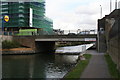
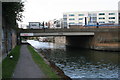
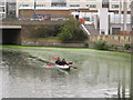





There is no page on Wikipedia called “Burdett Road Bridge”
Wikipedia pages that might relate to Burdett Road Bridge
[A1205 road]
popular in the Mile End area. Burdett Road was the site of Burdett Road railway station, closed in 1941. Burdett Road is part of the North and East London
[Limehouse Cut]
the "Victoria Park Approach Road" — soon re-named Burdett Road after philanthropist Angela Burdett-Coutts. A new bridge had to be made over the Cut.
[Burdett Road railway station]
Burdett Road is a disused railway station located in Bow Common, east London. It was opened in 1871 by the Great Eastern Railway and closed in 1941. The
[London Bridge]
Bridge opened in 1729, London Bridge was the only road-crossing of the Thames downstream of Kingston upon Thames. London Bridge has been depicted in its several
[Burdett, South Australia]
Murray Bridge and about 74 kilometres (46 miles) east south-east of the Adelaide city centre. Its name is derived from the Hundred of Burdett. While the
[Edmund Pettus Bridge]
The Edmund Pettus Bridge carries U.S. Route 80 Business (US 80 Bus.) across the Alabama River in Selma, Alabama. Built in 1940, it is named after Edmund
[Murray Bridge, South Australia]
road bridge across the lower Murray was known as The Murray Bridge and completed at Edwards's Crossing in 1879. The bridge also became a shared road and
[A roads in Zone 1 of the Great Britain numbering scheme]
List of A roads in zone 1 in Great Britain beginning north of the River Thames, east of the A1 (roads beginning with 1). "Old Stoke Bridge, Ipswich". www
[East India Dock Road]
at Burdett Road and continues to the River Lea bridge in the east at Bow Creek. It was built in order to connect the newly built Commercial Road at Limehouse
[Mile End]
are in London fare zone 2. There are bus stops on Mile End Road, Burdett Road and Grove Road. London Bus routes 25, 205, 277, 309, 323, 339, 425, D6, D7
Results of Google Search
Jan 6, 2020 ... SA7600000000019, MCCULLUM ROAD, DITCH NO 6, SEC 5 T15N ... SA7600000000167, BURDETT ROAD, DITCH NO 1, SEC 5 T17N R 7W.
Apr 5, 2017 ... H. C. R. 5, U. S. Navy Rear Admiral Frederick Burdett Warder ... H. C. R. 5 – “ Requesting the Division of Highways to name Bridge Number ... and prohibiting future transfers of certain tax collections to the State Road Fund.â€.
4001 County Road 5, Burdett, NY 14818 is a 1512 sqft, 3 bed, 2 bath home sold in 2017. ... 20 Bridge St ... This property is no longer available to rent or to buy.
NBI report, BURDETTE ROAD, DITCH NO 2, SEC 5 T17N R 7W, Concrete Channel beam (3 spans), Closed, 1970, --, 19.0, 57.1, Poor, 39.9, SA7600000000168.
Real Time Arrivals for May 5, 2020. proximity; real time ... 15th St & RPI Walk Over Bridge ... 1950 Burdett Ave (Troy High School) ... Burdett Ave & Sherry Rd.
Jun 19, 2014 ... WIDENING and bridge rehabilitation over dulles toll road and airport access highway. sTATE pROJECT nO.: 0007-029-139, P101, R201,. C501Â ...
The Old H&E, Burdett: Address, Phone Number, The Old H&E Reviews: 5/5 ... Sorry, there are no tours or activities available to book online for the date(s) you ...
The Limehouse Cut is a largely straight, broad canal in the East End of London, England, which ... The Cut had no locks except at either end—despite the fall in the land, which was 17½ feet. ... Dod Street, on the corner by Burdett Road Bridge and whose factories overlooked the Cut, was built and named by 1861.
Number. Nino. COUNTY. 34. Hey in. Depo-. Write. RBE. End St. Ha noot. 57..6 ... BURDETTE. Pap. 1. 1. Flatar. Landing. TELLIER. · ISLAND. Sodla Les Landing. Double. Bridges. Eu st.thry. Tolued. O'Donnell. Bend. FORRED DEER. SLAND ene ... 4.5. 9. 1 5 NR 2 E sty. NO. 20. End. ISLAND. Y. LAUDERDALEN. SUNRISE.