CanalPlanAC

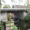
Leverton Road Bridge No 58

 
Leverton Road, Bassetlaw DN22 6QQ, United Kingdom
 
Information about the place
Leverton Road Bridge No 58 is a minor waterways place on the Chesterfield Canal (Retford to the Trent) between Wiseton Top Bridge No 70 (6 miles and 5¼ furlongs and 1 lock to the north) and West Retford Lock No 58 (Wharf Bridge) (1 mile and 1¾ furlongs and 1 lock to the west).
 
 
The nearest place in the direction of Wiseton Top Bridge No 70 is Hop Pole Bridge No 59; 3 furlongs away.
 
The nearest place in the direction of West Retford Lock No 58 is Grove Mill Bridge Winding Hole; 3¼ furlongs away.

There may be access to the towpath here.

Mooring here is unrated.

There is a bridge here which takes a minor road over the canal.


Amenities

Amenities nearby at Grove Mill Bridge Winding Hole

 SEE ADDRESS
 Yates's
 Fish & Chips
 Cashpoint
 Morrisons Fuel
 Total
 Wm Morrison Supermarkets Retford 114
 
Maps
If you are a user and are logged on, or if you are actively planning a route, a map will be displayed here.
Show on external mapping site: Google | OSM | Bing
 
Photos
 
External websites
There are no links to external websites from here.
Why not log in and add some (select "External websites" from the menu (sometimes this is under "Edit"))?
 
Nearest facilities

Mouseover for more information or show routes to facility

Nearest water point

In the direction of West Retford Lock No 58

Forest Middle Top Lock No 553 miles, 6¾ furlongs and 4 locks away
Travel to West Retford Lock No 58, then on the Chesterfield Canal (Norwood to Retford) to Forest Middle Top Lock No 55
Forest Middle Top Water Point3 miles, 7 furlongs and 5 locks away
Travel to West Retford Lock No 58, then on the Chesterfield Canal (Norwood to Retford) to Forest Middle Top Water Point
Shireoaks Marina13 miles, 2¾ furlongs and 18 locks away
Travel to West Retford Lock No 58, then on the Chesterfield Canal (Norwood to Retford) to Shireoaks Marina

In the direction of Chesterfield Canal - River Trent Junction

Hop Pole Bridge No 593 furlongs away
On this waterway in the direction of Chesterfield Canal - River Trent Junction
Clayworth CRT Boaters Facilities4 miles, 5¾ furlongs and 1 lock away
On this waterway in the direction of Chesterfield Canal - River Trent Junction
West Stockwith Basin14 miles, 2½ furlongs and 5 locks away
On this waterway in the direction of Chesterfield Canal - River Trent Junction

Nearest rubbish disposal

In the direction of West Retford Lock No 58

Forest Middle Top Lock No 553 miles, 6¾ furlongs and 4 locks away
Travel to West Retford Lock No 58, then on the Chesterfield Canal (Norwood to Retford) to Forest Middle Top Lock No 55
Shireoaks Marina13 miles, 2¾ furlongs and 18 locks away
Travel to West Retford Lock No 58, then on the Chesterfield Canal (Norwood to Retford) to Shireoaks Marina

In the direction of Chesterfield Canal - River Trent Junction

Clayworth CRT Boaters Facilities4 miles, 5¾ furlongs and 1 lock away
On this waterway in the direction of Chesterfield Canal - River Trent Junction
West Stockwith Basin14 miles, 2½ furlongs and 5 locks away
On this waterway in the direction of Chesterfield Canal - River Trent Junction

Nearest chemical toilet disposal

In the direction of West Retford Lock No 58

Forest Middle Top Lock No 553 miles, 6¾ furlongs and 4 locks away
Travel to West Retford Lock No 58, then on the Chesterfield Canal (Norwood to Retford) to Forest Middle Top Lock No 55
Cuckoo Wharf Elsan11 miles, ¾ furlongs and 9 locks away
Travel to West Retford Lock No 58, then on the Chesterfield Canal (Norwood to Retford) to Cuckoo Wharf Elsan
Shireoaks Marina13 miles, 2¾ furlongs and 18 locks away
Travel to West Retford Lock No 58, then on the Chesterfield Canal (Norwood to Retford) to Shireoaks Marina

In the direction of Chesterfield Canal - River Trent Junction

Clayworth CRT Boaters Facilities4 miles, 5¾ furlongs and 1 lock away
On this waterway in the direction of Chesterfield Canal - River Trent Junction
West Stockwith Basin14 miles, 2½ furlongs and 5 locks away
On this waterway in the direction of Chesterfield Canal - River Trent Junction

Nearest place to turn

In the direction of West Retford Lock No 58

Grove Mill Bridge Winding Hole3¼ furlongs away
On this waterway in the direction of West Retford Lock No 58
Retford Winding Hole5 furlongs away
On this waterway in the direction of West Retford Lock No 58
Babworth Winding Hole2 miles, 1¼ furlongs and 2 locks away
Travel to West Retford Lock No 58, then on the Chesterfield Canal (Norwood to Retford) to Babworth Winding Hole
Forest Top Lock Winding Hole4 miles, 1¾ furlongs and 5 locks away
Travel to West Retford Lock No 58, then on the Chesterfield Canal (Norwood to Retford) to Forest Top Lock Winding Hole
Ranby Bridge Winding Hole6 miles, 3½ furlongs and 6 locks away
Travel to West Retford Lock No 58, then on the Chesterfield Canal (Norwood to Retford) to Ranby Bridge Winding Hole
High Hoe Road Bridge Winding Hole10 miles, 3½ furlongs and 8 locks away
Travel to West Retford Lock No 58, then on the Chesterfield Canal (Norwood to Retford) to High Hoe Road Bridge Winding Hole
Morse Lock Winding Hole11 miles, 3½ furlongs and 10 locks away
Travel to West Retford Lock No 58, then on the Chesterfield Canal (Norwood to Retford) to Morse Lock Winding Hole
Junction with former Lady Lee Arm12 miles and 11 locks away
Travel to West Retford Lock No 58, then on the Chesterfield Canal (Norwood to Retford) to Junction with former Lady Lee Arm
Shireoaks Marina13 miles, 2¾ furlongs and 18 locks away
Travel to West Retford Lock No 58, then on the Chesterfield Canal (Norwood to Retford) to Shireoaks Marina
Little Lane Bridge Winding Hole14 miles, 2¼ furlongs and 26 locks away
Travel to West Retford Lock No 58, then on the Chesterfield Canal (Norwood to Retford) to Little Lane Bridge Winding Hole
Manor Road Winding Hole16 miles, 7 furlongs and 41 locks away
Travel to West Retford Lock No 58, then on the Chesterfield Canal (Norwood to Retford) to Manor Road Winding Hole
Kiveton Waters Marina17 miles, 5¾ furlongs and 44 locks away
Travel to West Retford Lock No 58, then on the Chesterfield Canal (Norwood to Retford) to Norwood Tunnel (eastern entrance), then on the Chesterfield Canal (Unnavigable section) to Kiveton Waters Marina
Norwood Winding Hole19 miles, 1¾ furlongs and 67 locks away
Travel to West Retford Lock No 58, then on the Chesterfield Canal (Norwood to Retford) to Norwood Tunnel (eastern entrance), then on the Chesterfield Canal (Unnavigable section) to Norwood Winding Hole

In the direction of Chesterfield Canal - River Trent Junction

Main Street Winding Hole3 miles, ½ furlongs and 1 lock away
On this waterway in the direction of Chesterfield Canal - River Trent Junction
Clayworth Top Bridge Winding Hole4 miles, 6¼ furlongs and 1 lock away
On this waterway in the direction of Chesterfield Canal - River Trent Junction
Otter's Bridge Winding Hole5 miles, 3¼ furlongs and 1 lock away
On this waterway in the direction of Chesterfield Canal - River Trent Junction
Drakeholes Visitor Moorings7 miles, 6½ furlongs and 1 lock away
On this waterway in the direction of Chesterfield Canal - River Trent Junction
Drakeholes Tunnel (southern entrance)7 miles, 6¾ furlongs and 1 lock away
On this waterway in the direction of Chesterfield Canal - River Trent Junction
Manor Farm Winding Hole11 miles, 6½ furlongs and 3 locks away
On this waterway in the direction of Chesterfield Canal - River Trent Junction
West Stockwith Basin14 miles, 2½ furlongs and 5 locks away
On this waterway in the direction of Chesterfield Canal - River Trent Junction

No information

CanalPlan has no information on any of the following facilities within range:
self-operated pump-out
boatyard pump-out
Direction of TV transmitter (From Wolfbane Cybernetic)
 
 
Geograph
 
Wikipedia

There is no page on Wikipedia called “Leverton Road Bridge”

Wikipedia pages that might relate to Leverton Road Bridge
[A52 road] becoming Main Road where it passes All Saints church and the Admiral Nelson, then Leverton where it passes St Helena's church. Near to Leverton Highgate is [Noel Redding] "Anna". The Loving Kind: 1966 with Pete (Kircher) Carter (drums); Jim Leverton (bass); and Derek Knight (vocals). At 17 Redding became a professional [Chilton Foliat] Wiltshire/Berkshire border. In 1895 the Berkshire portion, including the village of Leverton and the Chilton Lodge estate, was transferred to Hungerford civil parish [Grove, Nottinghamshire] the right of the road leading to Leverton; "which road has every appearance of having been Roman, and was continued to North Leverton onward to the Roman [Treswell] awoken from a drunken sleep in a field nearby. Treswell is over the South Leverton oilfield which runs beneath it, and there are four nodding donkey oil pumps [Pinkerton (detective agency)] of Fear, Birdy Edwards is a Pinkerton agent. Another Pinkerton agent, Leverton makes his appearance in the short story The Adventure of the Red Circle [Scampston Hall] Between 1795 and 1801 William Thomas commissioned the architect Thomas Leverton to extensively remodel the hall in the Regency style, with fine Regency [The Crystal Palace] Brunel and Robert Stephenson, renowned architects Charles Barry and Thomas Leverton Donaldson, the Duke of Buccleuch and the Earl of Ellesmere, and chaired [Bennerley Viaduct] Archived from the original on 21 June 2006. Retrieved 21 October 2006. Leverton, N. "Nottingham's Lost Railways". "Ilkeston Town Walks". Archived from [Welham, Nottinghamshire] Clarborough to the north Little Gringley to the south Christone, North Leverton, South Leverton, South Wheatley, Sturton Le Steeple and Westholme to the east Bolham
 
Google

Results of Google Search

Leverton Road Bridge No 58 © Mat Fascione cc-by-sa/2.0 ...
Sep 25, 2016 ... Leverton Road Bridge No 58. taken 4 years ago, near to Retford, Nottinghamshire, Great Britain. More sizes. Leverton Road Bridge No 58.
National Highway 58 (India) - Wikipedia
National Highway 58 (NH 58 NEW) is a National Highway in India connecting Fatehpur and Udaipur in the state of Rajasthan. NH58 route is extended from ...
Township History
Township to raise $250 to be applied in building a bridge across the mouth of south Black River ... Moved and supported that no boar pigs be allowed to run at large in the ... To raise $300 to improve the South Haven Deer-field Highway on the east ... 5/2/58. The Levertons, Tesluks, and Kelloggs were present at the meeting ...
Chilton Foliat | British History Online
Chilton Foliat village was linked to that road by a short north-south road which crossed the river at ... 37) and in 1995 no building clearly earlier than 1700 survived west. ... 58) The Stag's Head was open in 1813, (fn. ... 100 m. east of Chilton Foliat bridge and in Leverton Lane; it had possibly been converted to cottages by c.
ARTHUR W. LEVERTON, UNDERGROUND RAILROAD AGENT ...
Dec 5, 2007 ... 256, No. 8. 3. Kenneth Carroll, Joseph Nichols and the Nicholites, p. 78. 4. ... Arthur's Grandfather, Moses Leverton of Northwest Fork Bridge ... Main Street and the Preston-Harmony Road.1 Two years later, Daniel, and his ... 58. An Act to divide the territory of the United States northwest of the Ohio, into two ...
ARTIFICIAL INTELLIGENCE IN LOGISTICS
of every future software system and soon we will no ... developing along a path that complements AI, namely ... Leverton uses AI on its ... By analyzing 58 different parameters of inter- ... a camera bridge to photograph cargo train wagons,.
Brompton Road: North side | British History Online
No. 168 Brompton Road. Cheval Place and Montpelier Street Area; Brompton Square ... 42–58 even Brompton Road) immediately west of the corner house facing ... 23) The large World's End or Fulham Bridge tavern was the one building here, ... Leverton Donaldson, whose scheme had been selected from several sent in.