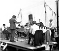
North Dock Entrance
Access to the North Dock via Victoria Lock
Riverside Gardens, Victoria Street, Goole DN14 5EU, United Kingdom
Address is taken from a point 449 yards away.

North Dock Entrance
is a minor waterways place
on the River Ouse : Yorkshire (tidal section - Naburn to Goole) between
Sandhall (5¾ furlongs
to the east) and
Ouse - Aire and Calder Junction (Junction of the River Ouse (Yorkshire) with the Aire and Calder Navigation.) (2½ furlongs
to the south).
Mooring here is unrated.
Howden Dyke | 2 miles, 6¼ furlongs | |
Skelton | 2 miles, ½ furlongs | |
Hook | 1 mile, 7¼ furlongs | |
Sandhall Road Railway Bridge | 1 mile, 2¾ furlongs | |
Sandhall | 5¾ furlongs | |
North Dock Entrance | ||
Ouse - Aire and Calder Junction | 2½ furlongs |
Amenities here
There are no links to external websites from here.
Why not log in and add some (select "External websites" from the menu (sometimes this is under "Edit"))?
Mouseover for more information or show routes to facility
Nearest water point
In the direction of Naburn Lock
Selby Basin — 15 miles, 7¾ furlongs and 1 lock away
Travel to Selby Junction (River Ouse), then on the Aire and Calder Navigation (Selby Section) to Selby Basin
In the direction of Ouse - Aire and Calder Junction
Goole Marina — 1 mile, 1¼ furlongs and 1 lock away
Travel to Ouse - Aire and Calder Junction, then on the Aire and Calder Navigation (Main Line - Goole to Castleford) to Goole Marina
Dutch Riverside — 1 mile, 2¾ furlongs and 1 lock away
Travel to Ouse - Aire and Calder Junction, then on the Aire and Calder Navigation (Main Line - Goole to Castleford) to Dutch Riverside
Pollington Visitor Mooring — 9 miles, 4¾ furlongs and 1 lock away
Travel to Ouse - Aire and Calder Junction, then on the Aire and Calder Navigation (Main Line - Goole to Castleford) to Pollington Visitor Mooring
Pollington Manor Swing Bridge — 9 miles, 5 furlongs and 1 lock away
Travel to Ouse - Aire and Calder Junction, then on the Aire and Calder Navigation (Main Line - Goole to Castleford) to Pollington Manor Swing Bridge
Bramwith Lock No 14 — 13 miles, 2½ furlongs and 2 locks away
Travel to Ouse - Aire and Calder Junction, then on the Aire and Calder Navigation (Main Line - Goole to Castleford) to Sykehouse Junction, then on the Sheffield and South Yorkshire Navigation (New Junction Canal) to Bramwith Junction, then on the Sheffield and South Yorkshire Navigation (Bramwith to Stainforth) to Bramwith Lock No 14
Whitley Lock No 12 — 13 miles, 3¼ furlongs and 2 locks away
Travel to Ouse - Aire and Calder Junction, then on the Aire and Calder Navigation (Main Line - Goole to Castleford) to Whitley Lock No 12
Barnby Dun Lift Bridge — 14 miles, ¾ furlongs and 2 locks away
Travel to Ouse - Aire and Calder Junction, then on the Aire and Calder Navigation (Main Line - Goole to Castleford) to Sykehouse Junction, then on the Sheffield and South Yorkshire Navigation (New Junction Canal) to Bramwith Junction, then on the Sheffield and South Yorkshire Navigation (Main Line) to Barnby Dun Lift Bridge
Bramwith Swing Bridge — 13 miles, 5¼ furlongs and 3 locks away
Travel to Ouse - Aire and Calder Junction, then on the Aire and Calder Navigation (Main Line - Goole to Castleford) to Sykehouse Junction, then on the Sheffield and South Yorkshire Navigation (New Junction Canal) to Bramwith Junction, then on the Sheffield and South Yorkshire Navigation (Bramwith to Stainforth) to Bramwith Swing Bridge
Keadby Visitor Moorings — 17 miles, 3¾ furlongs and 1 lock away
Travel to Ouse - Aire and Calder Junction, then on the River Ouse : Yorkshire (tidal section - Goole to Trent Falls) to Trent Falls, then on the River Trent (tidal section - Keadby to Trent Falls) to Keadby Junction, then on the Sheffield and South Yorkshire Navigation (Stainforth and Keadby Canal) to Keadby Visitor Moorings
Long Sandall Lock No 13 — 16 miles, 2¼ furlongs and 2 locks away
Travel to Ouse - Aire and Calder Junction, then on the Aire and Calder Navigation (Main Line - Goole to Castleford) to Sykehouse Junction, then on the Sheffield and South Yorkshire Navigation (New Junction Canal) to Bramwith Junction, then on the Sheffield and South Yorkshire Navigation (Main Line) to Long Sandall Lock No 13
Bank Dole Lock No 1 — 17 miles, 4½ furlongs and 3 locks away
Travel to Ouse - Aire and Calder Junction, then on the Aire and Calder Navigation (Main Line - Goole to Castleford) to Bank Dole Junction, then on the Aire and Calder Navigation (Selby Section) to Bank Dole Lock No 1
Thorne Visitor Moorings — 17 miles, 7¾ furlongs and 4 locks away
Travel to Ouse - Aire and Calder Junction, then on the Aire and Calder Navigation (Main Line - Goole to Castleford) to Sykehouse Junction, then on the Sheffield and South Yorkshire Navigation (New Junction Canal) to Bramwith Junction, then on the Sheffield and South Yorkshire Navigation (Bramwith to Stainforth) to Stainforth Junction, then on the Sheffield and South Yorkshire Navigation (Stainforth and Keadby Canal) to Thorne Visitor Moorings
Ferrybridge Flood Lock No 11 — 18 miles, 7 furlongs and 3 locks away
Travel to Ouse - Aire and Calder Junction, then on the Aire and Calder Navigation (Main Line - Goole to Castleford) to Ferrybridge Flood Lock No 11
Doncaster Visitor Pontoon Moorings — 19 miles, 3½ furlongs and 3 locks away
Travel to Ouse - Aire and Calder Junction, then on the Aire and Calder Navigation (Main Line - Goole to Castleford) to Sykehouse Junction, then on the Sheffield and South Yorkshire Navigation (New Junction Canal) to Bramwith Junction, then on the Sheffield and South Yorkshire Navigation (Main Line) to Doncaster Visitor Pontoon Moorings
Ferrybridge Flood Lock Footbridge — 18 miles, 7¼ furlongs and 4 locks away
Travel to Ouse - Aire and Calder Junction, then on the Aire and Calder Navigation (Main Line - Goole to Castleford) to Ferrybridge Flood Lock Footbridge
Doncaster Town Lock No 12 — 19 miles, 5¾ furlongs and 3 locks away
Travel to Ouse - Aire and Calder Junction, then on the Aire and Calder Navigation (Main Line - Goole to Castleford) to Sykehouse Junction, then on the Sheffield and South Yorkshire Navigation (New Junction Canal) to Bramwith Junction, then on the Sheffield and South Yorkshire Navigation (Main Line) to Doncaster Town Lock No 12
Beal Bridge — 19 miles, 7 furlongs and 4 locks away
Travel to Ouse - Aire and Calder Junction, then on the Aire and Calder Navigation (Main Line - Goole to Castleford) to Bank Dole Junction, then on the Aire and Calder Navigation (Selby Section) to Beal BridgeNearest rubbish disposal
In the direction of Naburn Lock
Selby Basin — 15 miles, 7¾ furlongs and 1 lock away
Travel to Selby Junction (River Ouse), then on the Aire and Calder Navigation (Selby Section) to Selby Basin
In the direction of Ouse - Aire and Calder Junction
Goole Marina — 1 mile, 1¼ furlongs and 1 lock away
Travel to Ouse - Aire and Calder Junction, then on the Aire and Calder Navigation (Main Line - Goole to Castleford) to Goole Marina
Dutch Riverside — 1 mile, 2¾ furlongs and 1 lock away
Travel to Ouse - Aire and Calder Junction, then on the Aire and Calder Navigation (Main Line - Goole to Castleford) to Dutch Riverside
Whitley Lock No 12 — 13 miles, 3¼ furlongs and 2 locks away
Travel to Ouse - Aire and Calder Junction, then on the Aire and Calder Navigation (Main Line - Goole to Castleford) to Whitley Lock No 12
Barnby Dun Lift Bridge — 14 miles, ¾ furlongs and 2 locks away
Travel to Ouse - Aire and Calder Junction, then on the Aire and Calder Navigation (Main Line - Goole to Castleford) to Sykehouse Junction, then on the Sheffield and South Yorkshire Navigation (New Junction Canal) to Bramwith Junction, then on the Sheffield and South Yorkshire Navigation (Main Line) to Barnby Dun Lift Bridge
Bramwith Swing Bridge — 13 miles, 5¼ furlongs and 3 locks away
Travel to Ouse - Aire and Calder Junction, then on the Aire and Calder Navigation (Main Line - Goole to Castleford) to Sykehouse Junction, then on the Sheffield and South Yorkshire Navigation (New Junction Canal) to Bramwith Junction, then on the Sheffield and South Yorkshire Navigation (Bramwith to Stainforth) to Bramwith Swing Bridge
Keadby Visitor Moorings — 17 miles, 3¾ furlongs and 1 lock away
Travel to Ouse - Aire and Calder Junction, then on the River Ouse : Yorkshire (tidal section - Goole to Trent Falls) to Trent Falls, then on the River Trent (tidal section - Keadby to Trent Falls) to Keadby Junction, then on the Sheffield and South Yorkshire Navigation (Stainforth and Keadby Canal) to Keadby Visitor Moorings
Thorne Visitor Moorings — 17 miles, 7¾ furlongs and 4 locks away
Travel to Ouse - Aire and Calder Junction, then on the Aire and Calder Navigation (Main Line - Goole to Castleford) to Sykehouse Junction, then on the Sheffield and South Yorkshire Navigation (New Junction Canal) to Bramwith Junction, then on the Sheffield and South Yorkshire Navigation (Bramwith to Stainforth) to Stainforth Junction, then on the Sheffield and South Yorkshire Navigation (Stainforth and Keadby Canal) to Thorne Visitor Moorings
Doncaster Visitor Pontoon Moorings — 19 miles, 3½ furlongs and 3 locks away
Travel to Ouse - Aire and Calder Junction, then on the Aire and Calder Navigation (Main Line - Goole to Castleford) to Sykehouse Junction, then on the Sheffield and South Yorkshire Navigation (New Junction Canal) to Bramwith Junction, then on the Sheffield and South Yorkshire Navigation (Main Line) to Doncaster Visitor Pontoon MooringsNearest chemical toilet disposal
In the direction of Naburn Lock
Selby Basin — 15 miles, 7¾ furlongs and 1 lock away
Travel to Selby Junction (River Ouse), then on the Aire and Calder Navigation (Selby Section) to Selby Basin
In the direction of Ouse - Aire and Calder Junction
Goole Marina — 1 mile, 1¼ furlongs and 1 lock away
Travel to Ouse - Aire and Calder Junction, then on the Aire and Calder Navigation (Main Line - Goole to Castleford) to Goole Marina
Dutch Riverside — 1 mile, 2¾ furlongs and 1 lock away
Travel to Ouse - Aire and Calder Junction, then on the Aire and Calder Navigation (Main Line - Goole to Castleford) to Dutch Riverside
Whitley Lock No 12 — 13 miles, 3¼ furlongs and 2 locks away
Travel to Ouse - Aire and Calder Junction, then on the Aire and Calder Navigation (Main Line - Goole to Castleford) to Whitley Lock No 12
Barnby Dun Lift Bridge — 14 miles, ¾ furlongs and 2 locks away
Travel to Ouse - Aire and Calder Junction, then on the Aire and Calder Navigation (Main Line - Goole to Castleford) to Sykehouse Junction, then on the Sheffield and South Yorkshire Navigation (New Junction Canal) to Bramwith Junction, then on the Sheffield and South Yorkshire Navigation (Main Line) to Barnby Dun Lift Bridge
Bramwith Swing Bridge — 13 miles, 5¼ furlongs and 3 locks away
Travel to Ouse - Aire and Calder Junction, then on the Aire and Calder Navigation (Main Line - Goole to Castleford) to Sykehouse Junction, then on the Sheffield and South Yorkshire Navigation (New Junction Canal) to Bramwith Junction, then on the Sheffield and South Yorkshire Navigation (Bramwith to Stainforth) to Bramwith Swing Bridge
Keadby Visitor Moorings — 17 miles, 3¾ furlongs and 1 lock away
Travel to Ouse - Aire and Calder Junction, then on the River Ouse : Yorkshire (tidal section - Goole to Trent Falls) to Trent Falls, then on the River Trent (tidal section - Keadby to Trent Falls) to Keadby Junction, then on the Sheffield and South Yorkshire Navigation (Stainforth and Keadby Canal) to Keadby Visitor Moorings
Thorne Visitor Moorings — 17 miles, 7¾ furlongs and 4 locks away
Travel to Ouse - Aire and Calder Junction, then on the Aire and Calder Navigation (Main Line - Goole to Castleford) to Sykehouse Junction, then on the Sheffield and South Yorkshire Navigation (New Junction Canal) to Bramwith Junction, then on the Sheffield and South Yorkshire Navigation (Bramwith to Stainforth) to Stainforth Junction, then on the Sheffield and South Yorkshire Navigation (Stainforth and Keadby Canal) to Thorne Visitor MooringsNearest place to turn
In the direction of Naburn Lock
Selby Basin — 15 miles, 7¾ furlongs and 1 lock away
Travel to Selby Junction (River Ouse), then on the Aire and Calder Navigation (Selby Section) to Selby Basin
In the direction of Ouse - Aire and Calder Junction
Viking Marina — 1 mile, 2 furlongs and 1 lock away
Travel to Ouse - Aire and Calder Junction, then on the Aire and Calder Navigation (Main Line - Goole to Castleford) to Viking Marina
River Foulness Junction — 14 miles, 4 furlongs and 1 lock away
Travel to Ouse - Aire and Calder Junction, then on the River Ouse : Yorkshire (tidal section - Goole to Trent Falls) to Trent Falls, then on the River Humber to Humber - Market Weighton Junction, then on the Market Weighton Canal to River Foulness Junction
Huddle Grounds Winding Hole — 15 miles, 4½ furlongs and 3 locks away
Travel to Ouse - Aire and Calder Junction, then on the Aire and Calder Navigation (Main Line - Goole to Castleford) to Sykehouse Junction, then on the Sheffield and South Yorkshire Navigation (New Junction Canal) to Bramwith Junction, then on the Sheffield and South Yorkshire Navigation (Bramwith to Stainforth) to Stainforth Junction, then on the Sheffield and South Yorkshire Navigation (Stainforth and Keadby Canal) to Huddle Grounds Winding Hole
Wheatley Hall Road Winding Hole — 17 miles, 2¾ furlongs and 3 locks away
Travel to Ouse - Aire and Calder Junction, then on the Aire and Calder Navigation (Main Line - Goole to Castleford) to Sykehouse Junction, then on the Sheffield and South Yorkshire Navigation (New Junction Canal) to Bramwith Junction, then on the Sheffield and South Yorkshire Navigation (Main Line) to Wheatley Hall Road Winding Hole
Bank Dole Lock Junction — 17 miles, 4¾ furlongs and 4 locks away
Travel to Ouse - Aire and Calder Junction, then on the Aire and Calder Navigation (Main Line - Goole to Castleford) to Bank Dole Junction, then on the Aire and Calder Navigation (Selby Section) to Bank Dole Lock Junction
Gas House Bight — 19 miles, 2 furlongs and 3 locks away
Travel to Ouse - Aire and Calder Junction, then on the Aire and Calder Navigation (Main Line - Goole to Castleford) to Sykehouse Junction, then on the Sheffield and South Yorkshire Navigation (New Junction Canal) to Bramwith Junction, then on the Sheffield and South Yorkshire Navigation (Main Line) to Gas House Bight
Doncaster Visitor Pontoon Moorings — 19 miles, 3½ furlongs and 3 locks away
Travel to Ouse - Aire and Calder Junction, then on the Aire and Calder Navigation (Main Line - Goole to Castleford) to Sykehouse Junction, then on the Sheffield and South Yorkshire Navigation (New Junction Canal) to Bramwith Junction, then on the Sheffield and South Yorkshire Navigation (Main Line) to Doncaster Visitor Pontoon Moorings
Beal Lock No 2 Weir Entrance — 19 miles, 7¼ furlongs and 4 locks away
Travel to Ouse - Aire and Calder Junction, then on the Aire and Calder Navigation (Main Line - Goole to Castleford) to Bank Dole Junction, then on the Aire and Calder Navigation (Selby Section) to Beal Lock No 2 Weir EntranceNearest self-operated pump-out
In the direction of Ouse - Aire and Calder Junction
Long Sandall Lock No 13 — 16 miles, 2¼ furlongs and 2 locks away
Travel to Ouse - Aire and Calder Junction, then on the Aire and Calder Navigation (Main Line - Goole to Castleford) to Sykehouse Junction, then on the Sheffield and South Yorkshire Navigation (New Junction Canal) to Bramwith Junction, then on the Sheffield and South Yorkshire Navigation (Main Line) to Long Sandall Lock No 13Nearest boatyard pump-out
In the direction of Ouse - Aire and Calder Junction
Goole Marina — 1 mile, 1¼ furlongs and 1 lock away
Travel to Ouse - Aire and Calder Junction, then on the Aire and Calder Navigation (Main Line - Goole to Castleford) to Goole Marina
Thorne Swing Bridge — 18 miles, ¼ furlongs and 4 locks away
Travel to Ouse - Aire and Calder Junction, then on the Aire and Calder Navigation (Main Line - Goole to Castleford) to Sykehouse Junction, then on the Sheffield and South Yorkshire Navigation (New Junction Canal) to Bramwith Junction, then on the Sheffield and South Yorkshire Navigation (Bramwith to Stainforth) to Stainforth Junction, then on the Sheffield and South Yorkshire Navigation (Stainforth and Keadby Canal) to Thorne Swing Bridge
Blue Water Marina — 18 miles, 5 furlongs and 4 locks away
Travel to Ouse - Aire and Calder Junction, then on the Aire and Calder Navigation (Main Line - Goole to Castleford) to Sykehouse Junction, then on the Sheffield and South Yorkshire Navigation (New Junction Canal) to Bramwith Junction, then on the Sheffield and South Yorkshire Navigation (Bramwith to Stainforth) to Stainforth Junction, then on the Sheffield and South Yorkshire Navigation (Stainforth and Keadby Canal) to Blue Water MarinaDirection of TV transmitter (From Wolfbane Cybernetic)
There is no page on Wikipedia called “North Dock Entrance”
Wikipedia pages that might relate to North Dock Entrance
[Port of Hull]
18th century. The entrance to Queen's Dock was later built in this area, and two dry docks remain: North Bridge Dry Dock and No. 1 Dry Dock to the north and south
[Suez Port]
Port Tewfik: to the West of the Suez Canal entrance. It uses the enclosed Ibrahim Dock. Petroleum Dock located on the east side of Suez port. Ataka
[East India Docks]
The East India Docks were a group of docks in Blackwall, east London, north-east of the Isle of Dogs. Today only the entrance basin and listed perimeter
[Bramley-Moore Dock]
Half Tide Dock to the north and Nelson Dock to the south. Jesse Hartley was the architect, and the dock opened in 1848. Currently the dock is inaccessible
[Seaforth Dock]
Dock (also known as the Royal Seaforth Dock) is a purpose-built dock and container terminal, on the River Mersey, England, at Seaforth, to the north of
[Suez Canal Area Development Project]
port is 12 million tons yearly. Eastern Port-said Port lies on the north western entrance of the Suez Canal branch which is a unique location because it connects
[Queen Elizabeth II Dock]
in 1949, adjacent to the entrance of the Manchester Ship Canal at Eastham Locks and opening directly onto the river. The dock was built to provide berthing
[Barry Docks]
sea entrance and the docks, the dock walls and quays, coal loading equipment and railways to deliver coal from the mines to the docks. A second dock and
[Royal Albert Dock, Liverpool]
area of land bordered by Salthouse Dock to the east, the entrance channel to Canning Dock to the north and by Duke's Dock to the south. The land earmarked
[Dry dock]
A dry dock (sometimes drydock or dry-dock) is a narrow basin or vessel that can be flooded to allow a load to be floated in, then drained to allow that
Results of Google Search
Accessing the North Loading Dock DirectionsTake the next right into the stadium at the entrance to Lot L ... o Under Gate 5, walk down the tunnel labeled North Dock/North Tunnel and enter through the ...
Loading Dock Entrance. The truck service ... The North Loading Dock contains 9 total bays, 8 of with have levelers; The Dock clearance is 16' high. All bays will ...
RV's are parked at North Dock. ... Guests with a handicapped license plate, state registration or handicapped parking pass is required to gain entrance to the ...
From the Alpine park entrance on U.S. Route 9W, at light about 1 mi. north of Closter Dock Road: Turn east on Alpine Approach Road. Go beneath two overpass ...
As part of the ongoing expansion project at the north end of the Javits Center's campus, a new loading dock entrance has opened on West 40th Street near 12th  ...
Gladstone Dock is a dock on the River Mersey, England, and part of the Port of Liverpool. It is situated in the northern dock system in Bootle. The dock is connected to Seaforth Dock to the north and what remains of ... Gladstone Dock lock entrance is one of the two remaining operational river entrances in the northern dock ...
Event supplies may be delivered directly to Bartle Hall. Loading Docks: North Truck Dock – 7 bays; South Truck Dock – 15 bays; West Truck Dock – 7 bays ...
North 7th St becomes 10th. Street North. Make a right onto Twins Way and stay in the far right lane. Target Field. Parking Lot and Loading Dock Entrance is on your  ...
Deus Ex: Invisible War - You'll find the entrance to the north dock on your immediate left. The large military bots are allied with you. Avoid or drop the lone ...
Sep 18, 2019 ... After being closed for decades and repurposed as a loading dock, the North Entrance to the Philadelphia Museum of Art has been restored and ...