CanalPlanAC

Went Aqueduct (northern end)

 
South Ings Lane, Doncaster DN14 9AH, United Kingdom
Address is taken from a point 433 yards away.
 
Information about the place
 
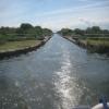
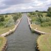
It is at one end of Went Aqueduct.
 
The nearest place in the direction of Sykehouse Lift Bridge is Went Aqueduct (southern end); 1 furlong away.

Mooring here is good (a nice place to moor), mooring rings or bollards are available. Lovely spot. Located between here and the junction. Gravel path runs alongside mooring on the eastern side. Western side moorings are large bollards widely spaced with grass towpath. Only downside is you can get some noise from the Shooting School.


Amenities
 
Maps
If you are a user and are logged on, or if you are actively planning a route, a map will be displayed here.
Show on external mapping site: Google | OSM | Bing
 
Photos
 
External websites
  S&SY navigation info — associated with Sheffield and South Yorkshire Navigation
Sheffield & South Yorkshire navigation info from IWA
 
Nearest facilities

Mouseover for more information or show routes to facility

Nearest water point

In the direction of Sykehouse Junction

Pollington Visitor Mooring2 miles, 1½ furlongs away
Travel to Sykehouse Junction, then on the Aire and Calder Navigation (Main Line - Goole to Castleford) to Pollington Visitor Mooring
Pollington Manor Swing Bridge2 miles, 2 furlongs away
Travel to Sykehouse Junction, then on the Aire and Calder Navigation (Main Line - Goole to Castleford) to Pollington Manor Swing Bridge
Dutch Riverside6 miles, 2¾ furlongs away
Travel to Sykehouse Junction, then on the Aire and Calder Navigation (Main Line - Goole to Castleford) to Dutch Riverside
Goole Marina6 miles, 4¼ furlongs away
Travel to Sykehouse Junction, then on the Aire and Calder Navigation (Main Line - Goole to Castleford) to Goole Marina
Whitley Lock No 126 miles and 1 lock away
Travel to Sykehouse Junction, then on the Aire and Calder Navigation (Main Line - Goole to Castleford) to Whitley Lock No 12
Bank Dole Lock No 110 miles, 1½ furlongs and 2 locks away
Travel to Sykehouse Junction, then on the Aire and Calder Navigation (Main Line - Goole to Castleford) to Bank Dole Junction, then on the Aire and Calder Navigation (Selby Section) to Bank Dole Lock No 1
Ferrybridge Flood Lock No 1111 miles, 4 furlongs and 2 locks away
Travel to Sykehouse Junction, then on the Aire and Calder Navigation (Main Line - Goole to Castleford) to Ferrybridge Flood Lock No 11
Ferrybridge Flood Lock Footbridge11 miles, 4¼ furlongs and 3 locks away
Travel to Sykehouse Junction, then on the Aire and Calder Navigation (Main Line - Goole to Castleford) to Ferrybridge Flood Lock Footbridge
Beal Bridge12 miles, 4 furlongs and 3 locks away
Travel to Sykehouse Junction, then on the Aire and Calder Navigation (Main Line - Goole to Castleford) to Bank Dole Junction, then on the Aire and Calder Navigation (Selby Section) to Beal Bridge
Beal Lock No 212 miles, 5¼ furlongs and 3 locks away
Travel to Sykehouse Junction, then on the Aire and Calder Navigation (Main Line - Goole to Castleford) to Bank Dole Junction, then on the Aire and Calder Navigation (Selby Section) to Beal Lock No 2
Bulholme Lock No 1016 miles, 2 furlongs and 3 locks away
Travel to Sykehouse Junction, then on the Aire and Calder Navigation (Main Line - Goole to Castleford) to Bulholme Lock No 10
Castleford Sanitary Station16 miles, 6¾ furlongs and 4 locks away
Travel to Sykehouse Junction, then on the Aire and Calder Navigation (Main Line - Goole to Castleford) to Castleford Sanitary Station

In the direction of Bramwith Junction

Bramwith Lock No 145 miles, 5 furlongs and 1 lock away
Travel to Bramwith Junction, then on the Sheffield and South Yorkshire Navigation (Bramwith to Stainforth) to Bramwith Lock No 14
Barnby Dun Lift Bridge6 miles, 3¼ furlongs and 1 lock away
Travel to Bramwith Junction, then on the Sheffield and South Yorkshire Navigation (Main Line) to Barnby Dun Lift Bridge
Bramwith Swing Bridge5 miles, 7¾ furlongs and 2 locks away
Travel to Bramwith Junction, then on the Sheffield and South Yorkshire Navigation (Bramwith to Stainforth) to Bramwith Swing Bridge
Long Sandall Lock No 138 miles, 4¾ furlongs and 1 lock away
Travel to Bramwith Junction, then on the Sheffield and South Yorkshire Navigation (Main Line) to Long Sandall Lock No 13
Thorne Visitor Moorings10 miles, 2½ furlongs and 3 locks away
Travel to Bramwith Junction, then on the Sheffield and South Yorkshire Navigation (Bramwith to Stainforth) to Stainforth Junction, then on the Sheffield and South Yorkshire Navigation (Stainforth and Keadby Canal) to Thorne Visitor Moorings
Doncaster Visitor Pontoon Moorings11 miles, 6¼ furlongs and 2 locks away
Travel to Bramwith Junction, then on the Sheffield and South Yorkshire Navigation (Main Line) to Doncaster Visitor Pontoon Moorings
Doncaster Town Lock No 1212 miles, ½ furlongs and 2 locks away
Travel to Bramwith Junction, then on the Sheffield and South Yorkshire Navigation (Main Line) to Doncaster Town Lock No 12
Sprotbrough Lock No 1115 miles, 2½ furlongs and 3 locks away
Travel to Bramwith Junction, then on the Sheffield and South Yorkshire Navigation (Main Line) to Sprotbrough Lock No 11

Nearest rubbish disposal

In the direction of Sykehouse Junction

Dutch Riverside6 miles, 2¾ furlongs away
Travel to Sykehouse Junction, then on the Aire and Calder Navigation (Main Line - Goole to Castleford) to Dutch Riverside
Goole Marina6 miles, 4¼ furlongs away
Travel to Sykehouse Junction, then on the Aire and Calder Navigation (Main Line - Goole to Castleford) to Goole Marina
Whitley Lock No 126 miles and 1 lock away
Travel to Sykehouse Junction, then on the Aire and Calder Navigation (Main Line - Goole to Castleford) to Whitley Lock No 12
Castleford Sanitary Station16 miles, 6¾ furlongs and 4 locks away
Travel to Sykehouse Junction, then on the Aire and Calder Navigation (Main Line - Goole to Castleford) to Castleford Sanitary Station

In the direction of Bramwith Junction

Barnby Dun Lift Bridge6 miles, 3¼ furlongs and 1 lock away
Travel to Bramwith Junction, then on the Sheffield and South Yorkshire Navigation (Main Line) to Barnby Dun Lift Bridge
Bramwith Swing Bridge5 miles, 7¾ furlongs and 2 locks away
Travel to Bramwith Junction, then on the Sheffield and South Yorkshire Navigation (Bramwith to Stainforth) to Bramwith Swing Bridge
Thorne Visitor Moorings10 miles, 2½ furlongs and 3 locks away
Travel to Bramwith Junction, then on the Sheffield and South Yorkshire Navigation (Bramwith to Stainforth) to Stainforth Junction, then on the Sheffield and South Yorkshire Navigation (Stainforth and Keadby Canal) to Thorne Visitor Moorings
Doncaster Visitor Pontoon Moorings11 miles, 6¼ furlongs and 2 locks away
Travel to Bramwith Junction, then on the Sheffield and South Yorkshire Navigation (Main Line) to Doncaster Visitor Pontoon Moorings

Nearest chemical toilet disposal

In the direction of Sykehouse Junction

Dutch Riverside6 miles, 2¾ furlongs away
Travel to Sykehouse Junction, then on the Aire and Calder Navigation (Main Line - Goole to Castleford) to Dutch Riverside
Goole Marina6 miles, 4¼ furlongs away
Travel to Sykehouse Junction, then on the Aire and Calder Navigation (Main Line - Goole to Castleford) to Goole Marina
Whitley Lock No 126 miles and 1 lock away
Travel to Sykehouse Junction, then on the Aire and Calder Navigation (Main Line - Goole to Castleford) to Whitley Lock No 12
Castleford Sanitary Station16 miles, 6¾ furlongs and 4 locks away
Travel to Sykehouse Junction, then on the Aire and Calder Navigation (Main Line - Goole to Castleford) to Castleford Sanitary Station
Fairies Hill Moorings19 miles and 6 locks away
Travel to Sykehouse Junction, then on the Aire and Calder Navigation (Main Line - Goole to Castleford) to Castleford Junction, then on the Aire and Calder Navigation (Wakefield Section) to Fairies Hill Lock Junction, then on the Aire and Calder Navigation (Wakefield Section - Fairies Hill Mooring Arm) to Fairies Hill Moorings

In the direction of Bramwith Junction

Barnby Dun Lift Bridge6 miles, 3¼ furlongs and 1 lock away
Travel to Bramwith Junction, then on the Sheffield and South Yorkshire Navigation (Main Line) to Barnby Dun Lift Bridge
Bramwith Swing Bridge5 miles, 7¾ furlongs and 2 locks away
Travel to Bramwith Junction, then on the Sheffield and South Yorkshire Navigation (Bramwith to Stainforth) to Bramwith Swing Bridge
Thorne Visitor Moorings10 miles, 2½ furlongs and 3 locks away
Travel to Bramwith Junction, then on the Sheffield and South Yorkshire Navigation (Bramwith to Stainforth) to Stainforth Junction, then on the Sheffield and South Yorkshire Navigation (Stainforth and Keadby Canal) to Thorne Visitor Moorings

Nearest place to turn

In the direction of Sykehouse Junction

Viking Marina6 miles, 3½ furlongs away
Travel to Sykehouse Junction, then on the Aire and Calder Navigation (Main Line - Goole to Castleford) to Viking Marina
Bank Dole Lock Junction10 miles, 1¾ furlongs and 3 locks away
Travel to Sykehouse Junction, then on the Aire and Calder Navigation (Main Line - Goole to Castleford) to Bank Dole Junction, then on the Aire and Calder Navigation (Selby Section) to Bank Dole Lock Junction
Beal Lock No 2 Weir Entrance12 miles, 4¼ furlongs and 3 locks away
Travel to Sykehouse Junction, then on the Aire and Calder Navigation (Main Line - Goole to Castleford) to Bank Dole Junction, then on the Aire and Calder Navigation (Selby Section) to Beal Lock No 2 Weir Entrance
Bulholme Lock Weir Exit16 miles, 1½ furlongs and 3 locks away
Travel to Sykehouse Junction, then on the Aire and Calder Navigation (Main Line - Goole to Castleford) to Bulholme Lock Weir Exit
Haddlesey Junction16 miles, 3½ furlongs and 4 locks away
Travel to Sykehouse Junction, then on the Aire and Calder Navigation (Main Line - Goole to Castleford) to Bank Dole Junction, then on the Aire and Calder Navigation (Selby Section) to Haddlesey Junction
Fairies Hill Lock Arm19 miles, 2¾ furlongs and 6 locks away
Travel to Sykehouse Junction, then on the Aire and Calder Navigation (Main Line - Goole to Castleford) to Castleford Junction, then on the Aire and Calder Navigation (Wakefield Section) to Fairies Hill Lock Arm

In the direction of Bramwith Junction

Huddle Grounds Winding Hole7 miles, 7 furlongs and 2 locks away
Travel to Bramwith Junction, then on the Sheffield and South Yorkshire Navigation (Bramwith to Stainforth) to Stainforth Junction, then on the Sheffield and South Yorkshire Navigation (Stainforth and Keadby Canal) to Huddle Grounds Winding Hole
Wheatley Hall Road Winding Hole9 miles, 5¼ furlongs and 2 locks away
Travel to Bramwith Junction, then on the Sheffield and South Yorkshire Navigation (Main Line) to Wheatley Hall Road Winding Hole
Gas House Bight11 miles, 4½ furlongs and 2 locks away
Travel to Bramwith Junction, then on the Sheffield and South Yorkshire Navigation (Main Line) to Gas House Bight
Doncaster Visitor Pontoon Moorings11 miles, 6¼ furlongs and 2 locks away
Travel to Bramwith Junction, then on the Sheffield and South Yorkshire Navigation (Main Line) to Doncaster Visitor Pontoon Moorings
Sprotbrough Lock Weir Exit15 miles, 2 furlongs and 3 locks away
Travel to Bramwith Junction, then on the Sheffield and South Yorkshire Navigation (Main Line) to Sprotbrough Lock Weir Exit

Nearest self-operated pump-out

Direction of TV transmitter (From Wolfbane Cybernetic)
 
 
Geograph
 
Wikipedia

There is no page on Wikipedia called “Went Aqueduct”

Wikipedia pages that might relate to Went Aqueduct
[Navigable aqueduct] cross-section of water than most water-supply aqueducts. Although Roman aqueducts were sometimes used for transport, aqueducts were not generally used until the 17th [Croton Aqueduct] The Croton Aqueduct or Old Croton Aqueduct was a large and complex water distribution system constructed for New York City between 1837 and 1842. The [Washington Aqueduct] The Washington Aqueduct is an aqueduct that provides the public water supply system serving Washington, D.C., and parts of its suburbs. One of the first [Aqueduct of Padre Tembleque] The Aqueduct of Padre Tembleque, or Tembleque Aqueduct, is a Mexican aqueduct located between the towns of Zempoala, Hidalgo, and Otumba in the State [Gadara Aqueduct] The Gadara Aqueduct, also called Qanatir Fir'awn or Qanat Fir'aun (Pharaoh's Watercourse), was a Roman aqueduct supplying water for some of the cities [Aqua Claudia] was called arcus Caelimontani. The aqueduct went through at least two major repairs. Tacitus suggests that the aqueduct was in use by AD 47. An inscription [Aqueducts on the C&O Canal] (C&O) used 11 navigable aqueducts to carry the canal over rivers and streams that were too wide for a culvert to contain. Aqueducts, like locks and other [New York City water supply system] A combination of aqueducts, reservoirs, and tunnels supply fresh water to New York City. With three major water systems (Croton, Catskill, and Delaware) [High Bridge (New York City)] Bridge (originally the Aqueduct Bridge) is the oldest bridge in New York City, having originally opened as part of the Croton Aqueduct in 1848 and reopened [Cosgrove aqueduct] Cosgrove aqueduct is a navigable cast iron trough navigable aqueduct that carries the Grand Union Canal over the River Great Ouse, on the borders between
 
Google