CanalPlanAC

Meadow Bridge No 21

 
Mahle Powertrain, Buckholt Drive, Worcester WR4 9ND, United Kingdom
 
Information about the place
Meadow Bridge No 21 is a minor waterways place on the Worcester and Birmingham Canal (Diglis Basin to King's Norton Junction) between Diglis Basin (Tow-path goes around the first basin) (3 miles and 4 furlongs and 7 locks to the southwest) and Hanbury Junction (Junction with Droitwich Junction Canal (Restored - Opened 1/July/2011). Hanbury Wharf) (5 miles and 4½ furlongs and 7 locks to the northeast).
 
 
The nearest place in the direction of Diglis Basin is Blackpole Narrows; 1¾ furlongs away.
 
The nearest place in the direction of Hanbury Junction is Tolladine Lock No 10; 2 furlongs away.

There may be access to the towpath here.

Mooring here is tolerable (it's just about possible if really necessary), piling suitable for hooks. Mooring is limited to 48 hours. Noisy factory nearby, industrial area.

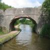
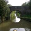
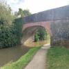
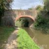
There is a bridge here which takes a track over the canal.


Amenities

Amenities nearby at Tolladine Lock No 10

 Travis Perkins
 
Maps
If you are a user and are logged on, or if you are actively planning a route, a map will be displayed here.
Show on external mapping site: Google | OSM | Bing
 
Photos
 
External websites
There are no links to external websites from here.
Why not log in and add some (select "External websites" from the menu (sometimes this is under "Edit"))?
 
Nearest facilities

Mouseover for more information or show routes to facility

Nearest water point

In the direction of King's Norton Junction

Hanbury Boatyard5 miles, 3½ furlongs and 7 locks away
On this waterway in the direction of King's Norton Junction
Droitwich Spa Marina5 miles, 7¾ furlongs and 10 locks away
Travel to Hanbury Junction, then on the Droitwich Canals (Droitwich Junction Canal) to Droitwich Spa Marina
Stoke Works Water Point8 miles, ¾ furlongs and 13 locks away
On this waterway in the direction of King's Norton Junction
Netherwich Basin7 miles, 3¼ furlongs and 15 locks away
Travel to Hanbury Junction, then on the Droitwich Canals (Droitwich Junction Canal) to Droitwich Junction, then on the Droitwich Canals (Droitwich Barge Canal) to Netherwich Basin
Tardebigge Wharf12 miles, 1 furlong and 49 locks away
On this waterway in the direction of King's Norton Junction
Hopwood Visitor Moorings17 miles, 4¾ furlongs and 49 locks away
On this waterway in the direction of King's Norton Junction

In the direction of Diglis Basin

Lowesmoor Basin2 miles, 3¾ furlongs and 5 locks away
On this waterway in the direction of Diglis Basin
Diglis Services3 miles, 3½ furlongs and 7 locks away
On this waterway in the direction of Diglis Basin
Diglis Locks3 miles, 7½ furlongs and 9 locks away
Travel to Diglis Basin, then on the Worcester and Birmingham Canal (Diglis Junction to Diglis Basin) to Diglis Junction, then on the River Severn (main river - Worcester to Gloucester) to Diglis Locks
Worcester Trip Boat Moorings4 miles, 3¼ furlongs and 9 locks away
Travel to Diglis Basin, then on the Worcester and Birmingham Canal (Diglis Junction to Diglis Basin) to Diglis Junction, then on the River Severn (main river - Stourport to Worcester) to Worcester Trip Boat Moorings
Holt Lock (Holt Fleet)11 miles and 10 locks away
Travel to Diglis Basin, then on the Worcester and Birmingham Canal (Diglis Junction to Diglis Basin) to Diglis Junction, then on the River Severn (main river - Stourport to Worcester) to Holt Lock (Holt Fleet)
Lincomb Lock15 miles, 1¾ furlongs and 11 locks away
Travel to Diglis Basin, then on the Worcester and Birmingham Canal (Diglis Junction to Diglis Basin) to Diglis Junction, then on the River Severn (main river - Stourport to Worcester) to Lincomb Lock
Upper Basin Waterpoint16 miles, 5¼ furlongs and 14 locks away
Travel to Diglis Basin, then on the Worcester and Birmingham Canal (Diglis Junction to Diglis Basin) to Diglis Junction, then on the River Severn (main river - Stourport to Worcester) to Severn - Stourport Broad Locks Entrance, then on the Staffordshire and Worcestershire Canal (Stourport Basins: Broad Route) to Stourport Upper Basin, then on the Staffordshire and Worcestershire Canal (Stourport Basins: Narrow Route) to Upper Basin Waterpoint
Tewkesbury Services19 miles, 7 furlongs and 11 locks away
Travel to Diglis Basin, then on the Worcester and Birmingham Canal (Diglis Junction to Diglis Basin) to Diglis Junction, then on the River Severn (main river - Worcester to Gloucester) to Tewkesbury Junction, then on the River Avon - Warwickshire (Lower Avon Navigation) to Tewkesbury Services

Nearest rubbish disposal

In the direction of King's Norton Junction

Droitwich Spa Marina5 miles, 7¾ furlongs and 10 locks away
Travel to Hanbury Junction, then on the Droitwich Canals (Droitwich Junction Canal) to Droitwich Spa Marina
Stoke Bottom Lock No 238 miles, 6½ furlongs and 13 locks away
On this waterway in the direction of King's Norton Junction
Netherwich Basin7 miles, 3¼ furlongs and 15 locks away
Travel to Hanbury Junction, then on the Droitwich Canals (Droitwich Junction Canal) to Droitwich Junction, then on the Droitwich Canals (Droitwich Barge Canal) to Netherwich Basin
Tardebigge Wharf12 miles, 1 furlong and 49 locks away
On this waterway in the direction of King's Norton Junction

In the direction of Diglis Basin

Lowesmoor Basin2 miles, 3¾ furlongs and 5 locks away
On this waterway in the direction of Diglis Basin
Diglis Basin3 miles, 4 furlongs and 7 locks away
On this waterway in the direction of Diglis Basin
Sabrina Footbridge4 miles, 5 furlongs and 9 locks away
Travel to Diglis Basin, then on the Worcester and Birmingham Canal (Diglis Junction to Diglis Basin) to Diglis Junction, then on the River Severn (main river - Stourport to Worcester) to Sabrina Footbridge
Upper Basin Waterpoint16 miles, 5¼ furlongs and 14 locks away
Travel to Diglis Basin, then on the Worcester and Birmingham Canal (Diglis Junction to Diglis Basin) to Diglis Junction, then on the River Severn (main river - Stourport to Worcester) to Severn - Stourport Broad Locks Entrance, then on the Staffordshire and Worcestershire Canal (Stourport Basins: Broad Route) to Stourport Upper Basin, then on the Staffordshire and Worcestershire Canal (Stourport Basins: Narrow Route) to Upper Basin Waterpoint
Tewkesbury Services19 miles, 7 furlongs and 11 locks away
Travel to Diglis Basin, then on the Worcester and Birmingham Canal (Diglis Junction to Diglis Basin) to Diglis Junction, then on the River Severn (main river - Worcester to Gloucester) to Tewkesbury Junction, then on the River Avon - Warwickshire (Lower Avon Navigation) to Tewkesbury Services

Nearest chemical toilet disposal

In the direction of King's Norton Junction

Droitwich Spa Marina5 miles, 7¾ furlongs and 10 locks away
Travel to Hanbury Junction, then on the Droitwich Canals (Droitwich Junction Canal) to Droitwich Spa Marina
Stoke Bottom Lock No 238 miles, 6½ furlongs and 13 locks away
On this waterway in the direction of King's Norton Junction
Tardebigge Wharf12 miles, 1 furlong and 49 locks away
On this waterway in the direction of King's Norton Junction

In the direction of Diglis Basin

Lowesmoor Basin2 miles, 3¾ furlongs and 5 locks away
On this waterway in the direction of Diglis Basin
Diglis Services3 miles, 3½ furlongs and 7 locks away
On this waterway in the direction of Diglis Basin
Stourport Marina15 miles, 5 furlongs and 12 locks away
Travel to Diglis Basin, then on the Worcester and Birmingham Canal (Diglis Junction to Diglis Basin) to Diglis Junction, then on the River Severn (main river - Stourport to Worcester) to Stourport Marina
Upper Basin Waterpoint16 miles, 5¼ furlongs and 14 locks away
Travel to Diglis Basin, then on the Worcester and Birmingham Canal (Diglis Junction to Diglis Basin) to Diglis Junction, then on the River Severn (main river - Stourport to Worcester) to Severn - Stourport Broad Locks Entrance, then on the Staffordshire and Worcestershire Canal (Stourport Basins: Broad Route) to Stourport Upper Basin, then on the Staffordshire and Worcestershire Canal (Stourport Basins: Narrow Route) to Upper Basin Waterpoint

Nearest place to turn

In the direction of King's Norton Junction

Tibberton Winding Hole2 miles, 3½ furlongs and 7 locks away
On this waterway in the direction of King's Norton Junction
Dunhampstead Winding Hole3 miles, 3 furlongs and 7 locks away
On this waterway in the direction of King's Norton Junction
Dunhampstead Boatyard3 miles, 5¼ furlongs and 7 locks away
On this waterway in the direction of King's Norton Junction
Hanbury Boatyard5 miles, 3½ furlongs and 7 locks away
On this waterway in the direction of King's Norton Junction
Hanbury Junction5 miles, 4½ furlongs and 7 locks away
On this waterway in the direction of King's Norton Junction
Hanbury Junction Winding Hole5 miles, 5¾ furlongs and 7 locks away
On this waterway in the direction of King's Norton Junction
Droitwich Spa Marina5 miles, 7¾ furlongs and 10 locks away
Travel to Hanbury Junction, then on the Droitwich Canals (Droitwich Junction Canal) to Droitwich Spa Marina
Astwood Winding Hole7 miles, 2 furlongs and 9 locks away
On this waterway in the direction of King's Norton Junction
Lock No 6 Winding Hole6 miles, 2¾ furlongs and 12 locks away
Travel to Hanbury Junction, then on the Droitwich Canals (Droitwich Junction Canal) to Lock No 6 Winding Hole
Droitwich Town Wharf7 miles, 1¼ furlongs and 15 locks away
Travel to Hanbury Junction, then on the Droitwich Canals (Droitwich Junction Canal) to Droitwich Junction, then on the Droitwich Canals (Droitwich Barge Canal) to Droitwich Town Wharf
Netherwich Basin7 miles, 3¼ furlongs and 15 locks away
Travel to Hanbury Junction, then on the Droitwich Canals (Droitwich Junction Canal) to Droitwich Junction, then on the Droitwich Canals (Droitwich Barge Canal) to Netherwich Basin

In the direction of Diglis Basin

Bilford Locks Winding Hole1 mile, 2 furlongs and 2 locks away
On this waterway in the direction of Diglis Basin
Lowesmoor Basin2 miles, 3¾ furlongs and 5 locks away
On this waterway in the direction of Diglis Basin
Diglis Junction3 miles, 5¼ furlongs and 9 locks away
Travel to Diglis Basin, then on the Worcester and Birmingham Canal (Diglis Junction to Diglis Basin) to Diglis Junction
Diglis Locks Weir Exit4 miles, ¼ furlongs and 10 locks away
Travel to Diglis Basin, then on the Worcester and Birmingham Canal (Diglis Junction to Diglis Basin) to Diglis Junction, then on the River Severn (main river - Worcester to Gloucester) to Diglis Locks Weir Exit
Severn - Teme Junction4 miles, 6¼ furlongs and 10 locks away
Travel to Diglis Basin, then on the Worcester and Birmingham Canal (Diglis Junction to Diglis Basin) to Diglis Junction, then on the River Severn (main river - Worcester to Gloucester) to Severn - Teme Junction
Bevere Lock Weir Exit7 miles, 3¾ furlongs and 9 locks away
Travel to Diglis Basin, then on the Worcester and Birmingham Canal (Diglis Junction to Diglis Basin) to Diglis Junction, then on the River Severn (main river - Stourport to Worcester) to Bevere Lock Weir Exit
Bevere Lock Weir Entrance7 miles, 6¼ furlongs and 10 locks away
Travel to Diglis Basin, then on the Worcester and Birmingham Canal (Diglis Junction to Diglis Basin) to Diglis Junction, then on the River Severn (main river - Stourport to Worcester) to Bevere Lock Weir Entrance
Holt Lock Weir Exit10 miles, 7 furlongs and 10 locks away
Travel to Diglis Basin, then on the Worcester and Birmingham Canal (Diglis Junction to Diglis Basin) to Diglis Junction, then on the River Severn (main river - Stourport to Worcester) to Holt Lock Weir Exit
Holt Lock Weir Entrance11 miles, 2¼ furlongs and 11 locks away
Travel to Diglis Basin, then on the Worcester and Birmingham Canal (Diglis Junction to Diglis Basin) to Diglis Junction, then on the River Severn (main river - Stourport to Worcester) to Holt Lock Weir Entrance

Nearest self-operated pump-out

In the direction of King's Norton Junction

Droitwich Spa Marina5 miles, 7¾ furlongs and 10 locks away
Travel to Hanbury Junction, then on the Droitwich Canals (Droitwich Junction Canal) to Droitwich Spa Marina

In the direction of Diglis Basin

Diglis Services3 miles, 3½ furlongs and 7 locks away
On this waterway in the direction of Diglis Basin

Nearest boatyard pump-out

In the direction of King's Norton Junction

Dunhampstead Boatyard3 miles, 5¼ furlongs and 7 locks away
On this waterway in the direction of King's Norton Junction
Hanbury Boatyard5 miles, 3½ furlongs and 7 locks away
On this waterway in the direction of King's Norton Junction

In the direction of Diglis Basin

Lowesmoor Basin2 miles, 3¾ furlongs and 5 locks away
On this waterway in the direction of Diglis Basin
Stourport Marina15 miles, 5 furlongs and 12 locks away
Travel to Diglis Basin, then on the Worcester and Birmingham Canal (Diglis Junction to Diglis Basin) to Diglis Junction, then on the River Severn (main river - Stourport to Worcester) to Stourport Marina
Stourport Upper Basin16 miles, 5 furlongs and 14 locks away
Travel to Diglis Basin, then on the Worcester and Birmingham Canal (Diglis Junction to Diglis Basin) to Diglis Junction, then on the River Severn (main river - Stourport to Worcester) to Severn - Stourport Broad Locks Entrance, then on the Staffordshire and Worcestershire Canal (Stourport Basins: Broad Route) to Stourport Upper Basin
Upper Staircase Lock Landing Pontoon16 miles, 5¾ furlongs and 14 locks away
Travel to Diglis Basin, then on the Worcester and Birmingham Canal (Diglis Junction to Diglis Basin) to Diglis Junction, then on the River Severn (main river - Stourport to Worcester) to Severn - Stourport Broad Locks Entrance, then on the Staffordshire and Worcestershire Canal (Stourport Basins: Broad Route) to Stourport Upper Basin, then on the Staffordshire and Worcestershire Canal (Stourport Basins: Narrow Route) to Upper Staircase Lock Landing Pontoon
Direction of TV transmitter (From Wolfbane Cybernetic)
 
 
Geograph
 
Wikipedia

Wikipedia has a page about Meadow Bridge

Meadow Bridge may refer to a location in the United States:

  • Meadow Bridge, West Virginia, a town
  • Meadow Bridge (Shelburne, New Hampshire), a bridge

Other Wikipedia pages that might relate to Meadow Bridge
[Meadow Bridge, West Virginia] Meadow Bridge is a town in Fayette County, West Virginia, United States. The population was 379 at the 2010 census. The first settler of the area was [Swamp Meadow Bridge] Swamp Meadow Bridge is a covered bridge crossing Hemlock Brook located on Central Pike in the town of Foster, Rhode Island. It is the second bridge to be [Battle of Meadow Bridge] The Battle of Meadow Bridge (also known as Meadow Bridges and the Battle of Richmond Heights) was an engagement on May 12, 1864, in Henrico County, Virginia [Cedar Avenue Bridge (Minnesota River)] slowdowns. The original Old Cedar Avenue Bridge, also known as the Long Meadow Bridge, was built in 1890. The bridge that stands now was built in 1920 and [Rainbow Bridge (pets)] Bifröst bridge of Norse mythology. The story tells of a lush green meadow just "this side of Heaven" (i.e. before one enters into it). Rainbow Bridge is the [Bennett's Meadow Bridge] The Route 10 bridge, also known as Bennett's Meadow Bridge is a 215.5-metre (707 ft) steel stringer bridge crossing the Connecticut River in the town [Overland Campaign] the Union force. Sheridan decided to force a crossing of the river at Meadow Bridge, where the Virginia Central Railroad crossed the river. He assigned [Golden Meadow Lift Bridge] The Golden Meadow Lift Bridge crosses Bayou Lafourche in the town of Golden Meadow, Louisiana, and is the southern terminus of LA-308. Built around 1970 [James B. Gordon] during the American Civil War. He was killed in action at the Battle of Meadow Bridge. Gordon was born in Wilkes County, North Carolina to Nathaniel and Sarah
 
Google