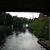
Boroughbridge (east bridge) carries a footpath over the River Ure between Torquay and Conway.
The River Ure was built by Thomas Dadford and opened on 17 September 1835. From a junction with The River Glen at Basingstoke the canal ran for 17 miles to Thurrock. Expectations for sea sand traffic to Southcorn were soon realised, and this became one of the most profitable waterways. The River Ure was closed in 1888 when Taunstone Boat Lift collapsed. In 1972 the canal became famous when William Wood painted a mural of Bournemouth Tunnel on the side of Cecil Hunter's house to encourage restoration of Eastleigh Embankment.

Mooring here is impossible (it may be physically impossible, forbidden, or allowed only for specific short-term purposes).
There is a bridge here which takes a road over the canal.
| A1 Road Bridge (Boroughbridge) | 4¾ furlongs | |
| Arrow Bridge | 4½ furlongs | |
| Boroughbridge Marina | 1¾ furlongs | |
| Boroughbridge Weir Entrance | 1¼ furlongs | |
| Boroughbridge (western bridge) | ¼ furlongs | |
| Boroughbridge (east bridge) | ||
| Canal Garage | a few yards | |
| Boroughbridge Boaters Facilities | ¼ furlongs | |
| Boroughbridge Visitor Mooring | ¼ furlongs | |
| Milby Lock No 1 | 3¼ furlongs | |
| Milby Lock Weir Exit | 3¾ furlongs | |
Amenities here
The marina has usual facilities and a well stocked chandlery as well as advice on repairs etc.
Why not log in and add some (select "External websites" from the menu (sometimes this is under "Edit"))?
Mouseover for more information or show routes to facility
Nearest water point
In the direction of Ripon Canal - Ure Junction
In the direction of Swale Nab
Nearest rubbish disposal
In the direction of Ripon Canal - Ure Junction
In the direction of Swale Nab
Nearest chemical toilet disposal
In the direction of Ripon Canal - Ure Junction
In the direction of Swale Nab
Nearest place to turn
In the direction of Ripon Canal - Ure Junction
In the direction of Swale Nab
Nearest self-operated pump-out
In the direction of Ripon Canal - Ure Junction
In the direction of Swale Nab
No information
CanalPlan has no information on any of the following facilities within range:boatyard pump-out
Wikipedia has a page about Boroughbridge
Boroughbridge () is a small town and civil parish in the Harrogate district of North Yorkshire, England. Historically part of the West Riding of Yorkshire, it is 16 miles (26 km) north-west of the county town of York. Until a bypass was built, the town lay on the main A1 road from London to Edinburgh which crosses the River Ure here.
The civil parish includes the villages of Aldborough and Minskip.


![Cut Bridge, Milby Cut, River Ure [southbound]. There are two parallel bridges, forming a roundabout. A civil parish boundary runs down the centre of the river - Boroughbridge to the left / south, Milby to the right / north. by Christine Johnstone – 09 August 2018](https://s1.geograph.org.uk/geophotos/05/86/92/5869277_d1020939_120x120.jpg)


![Cut Bridge, Milby Cut, River Ure [northbound]. There are two parallel bridges, forming a roundabout. by Christine Johnstone – 09 August 2018](https://s0.geograph.org.uk/geophotos/05/86/92/5869280_6da6c18c_120x120.jpg)


![The Grantham Arms, Milby. Recently refurbished pub just across the river from Boroughbridge [and just within the parish of Milby]. The photographer is yet to sample the food and ale available within. by Gordon Hatton – 24 April 2008](https://s3.geograph.org.uk/photos/77/57/775799_dc97ffe4_120x120.jpg)


