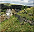
Deanroyd Bridge No 37
is a minor waterways place
on the Rochdale Canal between
Littleborough Lower Lock No 48 (3 miles and 1¾ furlongs
and 16 locks
to the south) and
Hollings Lock No 27 (Walsden) (7½ furlongs
and 4 locks
to the northwest).
The nearest place in the direction of Littleborough Lower Lock No 48 is Sands Lock No 32;
a few yards
away.
The nearest place in the direction of Hollings Lock No 27 is Lightbank Lock Winding Hole;
1¼ furlongs
away.
There may be access to the towpath here.
Mooring here is unrated.
There is a bridge here which takes a minor road over the canal.
Stonehouse Bridge No 39 | 2 furlongs | |
Bottomley Lock No 33 | 1 furlong | |
Lane Bottom Bridge No 38 | ¾ furlongs | |
Bottomley Road Winding Hole | ½ furlongs | |
Sands Lock No 32 | a few yards | |
Deanroyd Bridge No 37 | ||
Lightbank Lock Winding Hole | 1¼ furlongs | |
Lightbank Lock No 31 | 1¾ furlongs | |
Lightbank Bridge No 36 | 1¾ furlongs | |
Winterbutlee Lock No 30 | 3¾ furlongs | |
Winding Hole between Nip Square and Winterbutlee Locks | 4¼ furlongs |
There are no links to external websites from here.
Why not log in and add some (select "External websites" from the menu (sometimes this is under "Edit"))?
Mouseover for more information or show routes to facility
Nearest water point
In the direction of Castlefield Junction
Littleborough Sanitary Station — 2 miles, 7½ furlongs and 15 locks away
On this waterway in the direction of Castlefield Junction
New Islington Marina — 18 miles, 3¼ furlongs and 50 locks away
Travel to New Islington Marina Entrance, then on the Rochdale Canal (Main Line) to Cotton Field Wharf Marina, then on the Rochdale Canal (New Islington Marina Arm) to New Islington Marina
Staffordshire, Kenworthy and other Arms — 19 miles, 6¼ furlongs and 61 locks away
Travel to Castlefield Junction, then on the Bridgewater Canal (Main Line) to Staffordshire, Kenworthy and other Arms
Potato Wharf Arm & The New Basin — 19 miles, 7 furlongs and 61 locks away
Travel to Castlefield Junction, then on the Bridgewater Canal (Main Line) to Potato Wharf Arm & The New Basin
In the direction of Sowerby Bridge Junction
Travis Mill Lock No 28 — 5¾ furlongs and 3 locks away
On this waterway in the direction of Sowerby Bridge Junction
Fielden Wharf & Services — 2 miles, 3 furlongs and 13 locks away
On this waterway in the direction of Sowerby Bridge Junction
Baltimore Marina — 2 miles, 6 furlongs and 14 locks away
On this waterway in the direction of Sowerby Bridge Junction
Hebden Bridge Services — 6 miles, 5½ furlongs and 23 locks away
On this waterway in the direction of Sowerby Bridge Junction
Sowerby Bridge Basin — 12 miles, 3 furlongs and 30 locks away
Travel to Sowerby Bridge Junction, then on the Calder and Hebble Navigation (Main Line) to Sowerby Bridge Basin
Salterhebble Junction — 14 miles, 2¾ furlongs and 30 locks away
Travel to Sowerby Bridge Junction, then on the Calder and Hebble Navigation (Main Line) to Salterhebble Junction
Salterhebble Sanitary Station — 14 miles, 3¼ furlongs and 31 locks away
Travel to Sowerby Bridge Junction, then on the Calder and Hebble Navigation (Main Line) to Salterhebble Junction, then on the Calder and Hebble Navigation (Main Line) to Salterhebble Sanitary Station
Brighouse Basin — 18 miles, 5¼ furlongs and 40 locks away
Travel to Sowerby Bridge Junction, then on the Calder and Hebble Navigation (Main Line) to Salterhebble Junction, then on the Calder and Hebble Navigation (Main Line) to Brighouse BasinNearest rubbish disposal
In the direction of Castlefield Junction
Littleborough Sanitary Station — 2 miles, 7½ furlongs and 15 locks away
On this waterway in the direction of Castlefield Junction
In the direction of Sowerby Bridge Junction
Fielden Wharf & Services — 2 miles, 3 furlongs and 13 locks away
On this waterway in the direction of Sowerby Bridge Junction
Hebden Bridge Services — 6 miles, 5½ furlongs and 23 locks away
On this waterway in the direction of Sowerby Bridge Junction
Sowerby Bridge Basin — 12 miles, 3 furlongs and 30 locks away
Travel to Sowerby Bridge Junction, then on the Calder and Hebble Navigation (Main Line) to Sowerby Bridge Basin
Salterhebble Sanitary Station — 14 miles, 3¼ furlongs and 31 locks away
Travel to Sowerby Bridge Junction, then on the Calder and Hebble Navigation (Main Line) to Salterhebble Junction, then on the Calder and Hebble Navigation (Main Line) to Salterhebble Sanitary Station
Brighouse Lower Basin Visitor Moorings — 18 miles, 5½ furlongs and 41 locks away
Travel to Sowerby Bridge Junction, then on the Calder and Hebble Navigation (Main Line) to Salterhebble Junction, then on the Calder and Hebble Navigation (Main Line) to Brighouse Lower Basin Visitor MooringsNearest chemical toilet disposal
In the direction of Castlefield Junction
Littleborough Sanitary Station — 2 miles, 7½ furlongs and 15 locks away
On this waterway in the direction of Castlefield Junction
In the direction of Sowerby Bridge Junction
Baltimore Marina — 2 miles, 6 furlongs and 14 locks away
On this waterway in the direction of Sowerby Bridge Junction
Hebden Bridge Services — 6 miles, 5½ furlongs and 23 locks away
On this waterway in the direction of Sowerby Bridge Junction
Sowerby Bridge Basin — 12 miles, 3 furlongs and 30 locks away
Travel to Sowerby Bridge Junction, then on the Calder and Hebble Navigation (Main Line) to Sowerby Bridge Basin
Salterhebble Sanitary Station — 14 miles, 3¼ furlongs and 31 locks away
Travel to Sowerby Bridge Junction, then on the Calder and Hebble Navigation (Main Line) to Salterhebble Junction, then on the Calder and Hebble Navigation (Main Line) to Salterhebble Sanitary Station
Brighouse Basin — 18 miles, 5¼ furlongs and 40 locks away
Travel to Sowerby Bridge Junction, then on the Calder and Hebble Navigation (Main Line) to Salterhebble Junction, then on the Calder and Hebble Navigation (Main Line) to Brighouse BasinNearest place to turn
In the direction of Castlefield Junction
Bottomley Road Winding Hole — ½ furlongs and 1 lock away
On this waterway in the direction of Castlefield Junction
Summit Pound Winding Hole — 6¾ furlongs and 5 locks away
On this waterway in the direction of Castlefield Junction
Bent House Bridge Winding Hole — 2 miles, 4¾ furlongs and 14 locks away
On this waterway in the direction of Castlefield Junction
Bent House Winding Hole — 2 miles, 5¾ furlongs and 14 locks away
On this waterway in the direction of Castlefield Junction
Littleborough Winding Hole — 3 miles, 3½ furlongs and 17 locks away
On this waterway in the direction of Castlefield Junction
Moss Upper Lock Winding Hole — 6 miles, 6½ furlongs and 18 locks away
On this waterway in the direction of Castlefield Junction
Rochdale Junction — 6 miles, 7¼ furlongs and 19 locks away
On this waterway in the direction of Castlefield Junction
Dicken Green Winding Hole — 7 miles, 2 furlongs and 19 locks away
On this waterway in the direction of Castlefield Junction
Edinburgh Way Tunnel Winding Hole — 7 miles, 6¼ furlongs and 19 locks away
On this waterway in the direction of Castlefield Junction
In the direction of Sowerby Bridge Junction
Lightbank Lock Winding Hole — 1¼ furlongs away
On this waterway in the direction of Sowerby Bridge Junction
Winding Hole between Nip Square and Winterbutlee Locks — 4¼ furlongs and 2 locks away
On this waterway in the direction of Sowerby Bridge Junction
Todmorden Bridge Winding Hole — 2 miles, 3 furlongs and 13 locks away
On this waterway in the direction of Sowerby Bridge Junction
Baltimore Winding Hole — 2 miles, 6½ furlongs and 14 locks away
On this waterway in the direction of Sowerby Bridge Junction
Lobb Mill Lock Winding Hole — 3 miles, 5½ furlongs and 16 locks away
On this waterway in the direction of Sowerby Bridge Junction
Stoodley Bridge Winding Hole — 4 miles, 2¼ furlongs and 17 locks away
On this waterway in the direction of Sowerby Bridge Junction
Winding Hole below Holmcoat Lock — 4 miles, 4¼ furlongs and 18 locks away
On this waterway in the direction of Sowerby Bridge Junction
Rawden Mill Lock Winding Hole — 5 miles, 3¾ furlongs and 20 locks away
On this waterway in the direction of Sowerby Bridge Junction
Hebden Bridge Wharf — 6 miles, 5¾ furlongs and 23 locks away
On this waterway in the direction of Sowerby Bridge Junction
Walkley's Clog Mill — 7 miles, 3¾ furlongs and 24 locks away
On this waterway in the direction of Sowerby Bridge Junction
Winding Hole below Lock No 5 — 9 miles, 3 furlongs and 27 locks away
On this waterway in the direction of Sowerby Bridge JunctionNearest self-operated pump-out
In the direction of Castlefield Junction
New Islington Marina — 18 miles, 3¼ furlongs and 50 locks away
Travel to New Islington Marina Entrance, then on the Rochdale Canal (Main Line) to Cotton Field Wharf Marina, then on the Rochdale Canal (New Islington Marina Arm) to New Islington Marina
In the direction of Sowerby Bridge Junction
Hebden Bridge Services — 6 miles, 5½ furlongs and 23 locks away
On this waterway in the direction of Sowerby Bridge JunctionNearest boatyard pump-out
In the direction of Sowerby Bridge Junction
Pickwell and Arnold Boatyard — 3 miles, 7¾ furlongs and 17 locks away
On this waterway in the direction of Sowerby Bridge Junction
Sowerby Bridge Basin — 12 miles, 3 furlongs and 30 locks away
Travel to Sowerby Bridge Junction, then on the Calder and Hebble Navigation (Main Line) to Sowerby Bridge BasinDirection of TV transmitter (From Wolfbane Cybernetic)
There is no page on Wikipedia called “Deanroyd Bridge”
Wikipedia pages that might relate to Deanroyd Bridge
[Listed buildings in Todmorden (outer areas)]
"Bridge over Rochdale Canal, Todmorden (1133783)", National Heritage List for England, retrieved 15 February 2020 Historic England, "Deanroyd Bridge,
[Walsden]
commonplace to the region). Warland, Bellhome, Bottomley, Lanebottom, Deanroyd, Bottoms, Allescholes, Birkswood, Ramsden, Henshaw, Hollins and Copprashouse
Results of Google Search
Todmorden is a market town and civil parish in the metropolitan borough of Calderdale, West ... The Rochdale Canal runs through the areas, and the listed buildings associated with it are bridges and locks. ... Bridge No. 37, Deanroyd Bridge 53°41′08″N 2°05′36″W#xfeff; / #xfeff;53.68549°N 2.09325°W#xfeff; / 53.68549; - 2.09325#xfeff; ...
Views from Deanroyd Bridge 37 (Rochdale Canal). Sands Lock 32. A narrow boat waiting to enter Sands Lock No. 32. BUCKINGHAM from Shire Cruises, ...
The Calder Valley line is a railway route in Northern England between the cities of Leeds and ... and Preston/Carlisle. Today, Hebden Bridge and Leeds are the only stations where every service calls, the route description follows. ... Leeds to Manchester. No one was killed but there was extensive damage to rolling stock.
At the Assizes, the gang was acquitted, there being no evidence to show that they contemplated ... He is remembered on the Plymouth Naval Memorial [37 2] on the Memorial at Halifax Town Hall ... Deanroyd Bridge, Walsden: Deanroyd Road.
Lane Bottom Bridge#x200e; (6 F) ... 37, Rochdale Canal.jpg 800 × 512; 160 KB ... Dean Royd, Pennine Bridleway - geograph.org.uk - 1227849.jpg 640 × 470; 148 KB ... Hollins Lock No 27, Rochdale Canal, Walsden, Yorkshire - geograph.org.uk ...