CanalPlanAC

Park Heath Bridge No 48

 
Cheswardine TF9 2NR, United Kingdom
 
Information about the place
Park Heath Bridge No 48 is a minor waterways place on the Shropshire Union Canal (Birmingham and Liverpool Junction Canal - Main Line) between Newport Road Bridge No 45 (Knighton) (1 mile to the east) and Newcastle Road Bridge No 62 (5 miles and 4¾ furlongs and 5 locks to the northwest).
 
 
The nearest place in the direction of Newport Road Bridge No 45 is Black Flat Bridge No 47; 5¼ furlongs away.
 
The nearest place in the direction of Newcastle Road Bridge No 62 is Park Heath Wharf; ¼ furlongs away.

There may be access to the towpath here.

Mooring here is unrated.

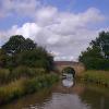
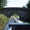
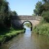
There is a bridge here which takes a minor road over the canal.


Amenities
 
Maps
If you are a user and are logged on, or if you are actively planning a route, a map will be displayed here.
Show on external mapping site: Google | OSM | Bing
 
Photos
 
External websites
There are no links to external websites from here.
Why not log in and add some (select "External websites" from the menu (sometimes this is under "Edit"))?
 
Nearest facilities

Mouseover for more information or show routes to facility

Nearest water point

In the direction of Autherley Junction

Norbury Wharf Boatyard5 miles, 3¾ furlongs away
On this waterway in the direction of Autherley Junction
Norbury Junction Services5 miles, 4¼ furlongs away
On this waterway in the direction of Autherley Junction
The Navigation Inn (Gnosall)7 miles, 7½ furlongs away
On this waterway in the direction of Autherley Junction
Wheaton Aston Services13 miles, 1¼ furlongs away
On this waterway in the direction of Autherley Junction

In the direction of Nantwich Basin Entrance

Goldstone Bridge No 552 miles, 1 furlong away
On this waterway in the direction of Nantwich Basin Entrance
Goldstone Wharf2 miles, 1¼ furlongs away
On this waterway in the direction of Nantwich Basin Entrance
Tyrley Wharf Services4 miles, 1¾ furlongs away
On this waterway in the direction of Nantwich Basin Entrance
Talbot Wharf Services5 miles, 5½ furlongs and 5 locks away
On this waterway in the direction of Nantwich Basin Entrance
Audlem Wharf11 miles, 5¼ furlongs and 22 locks away
On this waterway in the direction of Nantwich Basin Entrance
Audlem Water Point (below Lock No 25)11 miles, 6¼ furlongs and 23 locks away
On this waterway in the direction of Nantwich Basin Entrance
Overwater Marina12 miles, 4¼ furlongs and 25 locks away
On this waterway in the direction of Nantwich Basin Entrance
Nantwich Services17 miles, 7 furlongs and 27 locks away
On this waterway in the direction of Nantwich Basin Entrance

Nearest rubbish disposal

In the direction of Autherley Junction

Norbury Wharf Boatyard5 miles, 3¾ furlongs away
On this waterway in the direction of Autherley Junction
Wheaton Aston Services13 miles, 1¼ furlongs away
On this waterway in the direction of Autherley Junction

In the direction of Nantwich Basin Entrance

Tyrley Wharf Services4 miles, 1¾ furlongs away
On this waterway in the direction of Nantwich Basin Entrance
Audlem Wharf11 miles, 5¼ furlongs and 22 locks away
On this waterway in the direction of Nantwich Basin Entrance
Nantwich Services17 miles, 7 furlongs and 27 locks away
On this waterway in the direction of Nantwich Basin Entrance
Nantwich Basin Entrance17 miles, 7¼ furlongs and 27 locks away
On this waterway in the direction of Nantwich Basin Entrance

Nearest chemical toilet disposal

In the direction of Autherley Junction

Norbury Wharf Boatyard5 miles, 3¾ furlongs away
On this waterway in the direction of Autherley Junction
Norbury Junction Services5 miles, 4¼ furlongs away
On this waterway in the direction of Autherley Junction
Wheaton Aston Services13 miles, 1¼ furlongs away
On this waterway in the direction of Autherley Junction

In the direction of Nantwich Basin Entrance

Talbot Wharf Services5 miles, 5½ furlongs and 5 locks away
On this waterway in the direction of Nantwich Basin Entrance
Audlem Wharf11 miles, 5¼ furlongs and 22 locks away
On this waterway in the direction of Nantwich Basin Entrance
Overwater Marina12 miles, 4¼ furlongs and 25 locks away
On this waterway in the direction of Nantwich Basin Entrance
Nantwich Services17 miles, 7 furlongs and 27 locks away
On this waterway in the direction of Nantwich Basin Entrance

Nearest place to turn

In the direction of Autherley Junction

Shebdon Winding Hole1 mile, 7½ furlongs away
On this waterway in the direction of Autherley Junction
Grub Street Winding Hole3 miles, 6¾ furlongs away
On this waterway in the direction of Autherley Junction
Norbury Wharf Boatyard5 miles, 3¾ furlongs away
On this waterway in the direction of Autherley Junction
Norbury Junction5 miles, 4 furlongs away
On this waterway in the direction of Autherley Junction
High Onn Wharf10 miles, 1¼ furlongs away
On this waterway in the direction of Autherley Junction
Wheaton Aston Winding Hole13 miles, ¾ furlongs away
On this waterway in the direction of Autherley Junction
Stretton Boatyard14 miles, 5¾ furlongs and 1 lock away
On this waterway in the direction of Autherley Junction
Brewood Wharf15 miles, 6 furlongs and 1 lock away
On this waterway in the direction of Autherley Junction
Park Lodge Winding Hole17 miles, 2¼ furlongs and 1 lock away
On this waterway in the direction of Autherley Junction
Lower Hattons Winding Hole18 miles, 1¼ furlongs and 1 lock away
On this waterway in the direction of Autherley Junction
Pendeford Hall Lane Winding hole18 miles, 7¾ furlongs and 1 lock away
On this waterway in the direction of Autherley Junction
Newport Canal Basin9 miles, 5¼ furlongs and 20 locks away
Travel to Norbury Junction, then on the Shropshire Union Canal (Birmingham and Liverpool Junction Canal - Newport Branch - Main Line) to Newport Canal Basin
Kinley Winding Hole15 miles, 5 furlongs and 23 locks away
Travel to Norbury Junction, then on the Shropshire Union Canal (Birmingham and Liverpool Junction Canal - Newport Branch - Main Line) to Kinley Winding Hole

In the direction of Nantwich Basin Entrance

Park Heath Wharf¼ furlongs away
On this waterway in the direction of Nantwich Basin Entrance
Goldstone Wharf2 miles, 1¼ furlongs away
On this waterway in the direction of Nantwich Basin Entrance
Talbot Wharf5 miles, 5¼ furlongs and 5 locks away
On this waterway in the direction of Nantwich Basin Entrance
Adderley Winding Hole8 miles, 5¼ furlongs and 5 locks away
On this waterway in the direction of Nantwich Basin Entrance
Moss Hall Winding Hole12 miles, ½ furlongs and 25 locks away
On this waterway in the direction of Nantwich Basin Entrance
Overwater Marina12 miles, 4¼ furlongs and 25 locks away
On this waterway in the direction of Nantwich Basin Entrance
Hack Green Winding Hole15 miles, ½ furlongs and 27 locks away
On this waterway in the direction of Nantwich Basin Entrance

Nearest self-operated pump-out

In the direction of Autherley Junction

Wheaton Aston Services13 miles, 1¼ furlongs away
On this waterway in the direction of Autherley Junction

In the direction of Nantwich Basin Entrance

Talbot Wharf Services5 miles, 5½ furlongs and 5 locks away
On this waterway in the direction of Nantwich Basin Entrance
Overwater Marina12 miles, 4¼ furlongs and 25 locks away
On this waterway in the direction of Nantwich Basin Entrance

Nearest boatyard pump-out

In the direction of Autherley Junction

Norbury Wharf Boatyard5 miles, 3¾ furlongs away
On this waterway in the direction of Autherley Junction
Brewood Wharf15 miles, 6 furlongs and 1 lock away
On this waterway in the direction of Autherley Junction

In the direction of Nantwich Basin Entrance

Nantwich Marina Wharf17 miles, 6½ furlongs and 27 locks away
On this waterway in the direction of Nantwich Basin Entrance
Nantwich Basin Entrance17 miles, 7¼ furlongs and 27 locks away
On this waterway in the direction of Nantwich Basin Entrance
Direction of TV transmitter (From Wolfbane Cybernetic)
 
 
Geograph
 
Wikipedia

There is no page on Wikipedia called “Park Heath Bridge”

Wikipedia pages that might relate to Park Heath Bridge
[Hampstead Heath] Hampstead Heath (locally known simply as the Heath) is a large, ancient London heath, covering 320 hectares (790 acres). This grassy public space sits [Golders Hill Park] Hampstead Heath, and is part of the Hampstead Heath Site of Metropolitan Importance for Nature Conservation. Unlike the rest of the Heath, Golders Hill Park is [Blackheath, London] traditional reach named after the heath. To its west is the core public green area that is the heath and Greenwich Park, in which sit major London tourist [La Linda International Bridge] International Bridge (also known as the Gerstaker Bridge, Hallie Stillwell Memorial Bridge, Big Bend Crossing Bridge, Puente La Linda, and Heath Crossing is [Haywards Heath railway station] from London Bridge via Redhill and is situated between Balcombe and Wivelsfield. It is managed by Southern. Trains calling at Haywards Heath are operated [Heath Town] constituency. Heath Town ward borders the wards of Bushbury South and Low Hill, Fallings Park, Wednesfield North, Wednesfield South, East Park and St Peter's [Clumber Park] were 100 years old. The bridge was re-opened to foot-traffic only in July 2020 after extensive restorative stonework. Clumber Park is over 3,800 acres (15 km²) [Brighton main line] to Haywards Heath South Junction (outer tracks only); Haywards Heath South Junction to Keymer Junction; Keymer Junction to Preston Park station. At the [Regent's Park] Regent's Park (officially The Regent's Park) is one of the Royal Parks of London. It occupies high ground in north-west Inner London, administratively [List of places in London] Hammersmith Park Hampstead Heath Hampton Court Gardens Hanworth Park Harrow Lodge Park Hillingdon Court Park Holland Park Horniman Gardens Hounslow Heath Inwood
 
Google