CanalPlanAC

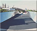
Free Tank Footbridge

 
Linear Park, Floating Harbour, Bristol BS2 0FR, United Kingdom
 
Information about the place
Free Tank Footbridge is a minor waterways place on the River Avon - Bristol (Main River - Bath to Bristol) between Hanham Lock Weir Entrance (Channel leading to the Weir) (4 miles and 4 furlongs and 2 locks to the east) and City Ferry Landing Arm Junction (1 mile and ½ furlongs to the west).
 
 
The nearest place in the direction of Hanham Lock Weir Entrance is Temple Mead Railway Bridge (An 88 yd tunnel); ½ furlongs away.
 
The nearest place in the direction of City Ferry Landing Arm Junction is Meads Reach Footbridge; ½ furlongs away.

Mooring here is unrated.

There is a bridge here which takes pedestrian traffic over the canal.


Amenities

Amenities here

 W H Smith
 Cashpoint
 Cashpoint
 Bristol Temple Meads Station

Amenities nearby at Meads Reach Footbridge

 Starbucks
 Bristol
 Knights Templar
 SEE ADDRESS
 Wetherspoons
 Cashpoint
 Cashpoint
 Cashpoint
 HSBC
 Anglowelsh Waterway Holidays
 Mr Andrew Shearn

Amenities nearby at Temple Mead Railway Bridge

 Bristol Calor Centre
 Bristol Calor Centre M-F 5pm Sa noon
 Frank Bowtell Ltd
 
Maps
If you are a user and are logged on, or if you are actively planning a route, a map will be displayed here.
Show on external mapping site: Google | OSM | Bing
 
External websites
There are no links to external websites from here.
Why not log in and add some (select "External websites" from the menu (sometimes this is under "Edit"))?
 
Nearest facilities

Mouseover for more information or show routes to facility

Nearest water point

In the direction of Cumberland Basin Entrance Lock No 2

Arnolfini Moorings1 mile, 1 furlong away
Travel to City Ferry Landing Arm Junction, then on the River Avon - Bristol (City Ferry Landing Arm) to Arnolfini Moorings
Harbour Inlet1 mile, 3½ furlongs away
On this waterway in the direction of Cumberland Basin Entrance Lock No 2

In the direction of Hanham Lock No 1

Hanham Lock No 14 miles, 3 furlongs and 1 lock away
On this waterway in the direction of Hanham Lock No 1
Wessex Water Services9 miles, 1½ furlongs and 4 locks away
Travel to Hanham Lock No 1, then on the River Avon (Kennet and Avon Navigation) to Wessex Water Services
Bath Top Lock Visitor Moorings16 miles, 1½ furlongs and 13 locks away
Travel to Hanham Lock No 1, then on the River Avon (Kennet and Avon Navigation) to River Avon Junction, then on the Kennet and Avon Canal (Main Line) to Bath Top Lock Visitor Moorings
Bathampton Bridge No 18318 miles, ¼ furlongs and 13 locks away
Travel to Hanham Lock No 1, then on the River Avon (Kennet and Avon Navigation) to River Avon Junction, then on the Kennet and Avon Canal (Main Line) to Bathampton Bridge No 183

Nearest rubbish disposal

In the direction of Hanham Lock No 1

Hanham Lock No 14 miles, 3 furlongs and 1 lock away
On this waterway in the direction of Hanham Lock No 1
Abbey View Lock No 1116 miles, ¼ furlongs and 10 locks away
Travel to Hanham Lock No 1, then on the River Avon (Kennet and Avon Navigation) to River Avon Junction, then on the Kennet and Avon Canal (Main Line) to Abbey View Lock No 11

Nearest chemical toilet disposal

In the direction of Hanham Lock No 1

Wessex Water Services9 miles, 1½ furlongs and 4 locks away
Travel to Hanham Lock No 1, then on the River Avon (Kennet and Avon Navigation) to Wessex Water Services

Nearest place to turn

In the direction of Cumberland Basin Entrance Lock No 2

Bathhurst Parade Marina7¼ furlongs away
On this waterway in the direction of Cumberland Basin Entrance Lock No 2
City Ferry Landing Arm Junction1 mile, ½ furlongs away
On this waterway in the direction of Cumberland Basin Entrance Lock No 2
Baltic Wharf1 mile, 6½ furlongs away
On this waterway in the direction of Cumberland Basin Entrance Lock No 2
Ferry Landings Arm1 mile, 6¾ furlongs away
On this waterway in the direction of Cumberland Basin Entrance Lock No 2

In the direction of Hanham Lock No 1

Hanham Lock Weir Exit4 miles, 2¾ furlongs and 1 lock away
On this waterway in the direction of Hanham Lock No 1
Hanham Lock Weir Entrance4 miles, 4 furlongs and 2 locks away
Travel to Hanham Lock No 1, then on the River Avon (Kennet and Avon Navigation) to Hanham Lock Weir Entrance
Keynsham Lock Weir Entrance6 miles, 4 furlongs and 3 locks away
Travel to Hanham Lock No 1, then on the River Avon (Kennet and Avon Navigation) to Keynsham Lock Weir Entrance
Horseshoe Walk Bridge Winding Hole15 miles, 7¾ furlongs and 10 locks away
Travel to Hanham Lock No 1, then on the River Avon (Kennet and Avon Navigation) to River Avon Junction, then on the Kennet and Avon Canal (Main Line) to Horseshoe Walk Bridge Winding Hole
Pulteney Gardens Winding Hole16 miles, ½ furlongs and 11 locks away
Travel to Hanham Lock No 1, then on the River Avon (Kennet and Avon Navigation) to River Avon Junction, then on the Kennet and Avon Canal (Main Line) to Pulteney Gardens Winding Hole
Sydney Wharf Winding Hole16 miles, 2¾ furlongs and 13 locks away
Travel to Hanham Lock No 1, then on the River Avon (Kennet and Avon Navigation) to River Avon Junction, then on the Kennet and Avon Canal (Main Line) to Sydney Wharf Winding Hole
Bathampton Bridge Winding Hole18 miles, 1 furlong and 13 locks away
Travel to Hanham Lock No 1, then on the River Avon (Kennet and Avon Navigation) to River Avon Junction, then on the Kennet and Avon Canal (Main Line) to Bathampton Bridge Winding Hole
Bathampton Winding Hole18 miles, 3 furlongs and 13 locks away
Travel to Hanham Lock No 1, then on the River Avon (Kennet and Avon Navigation) to River Avon Junction, then on the Kennet and Avon Canal (Main Line) to Bathampton Winding Hole
Claverton Winding Hole19 miles, 5¾ furlongs and 13 locks away
Travel to Hanham Lock No 1, then on the River Avon (Kennet and Avon Navigation) to River Avon Junction, then on the Kennet and Avon Canal (Main Line) to Claverton Winding Hole

Nearest self-operated pump-out

In the direction of Cumberland Basin Entrance Lock No 2

Harbour Inlet1 mile, 3½ furlongs away
On this waterway in the direction of Cumberland Basin Entrance Lock No 2

Nearest boatyard pump-out

In the direction of Cumberland Basin Entrance Lock No 2

Baltic Wharf1 mile, 6½ furlongs away
On this waterway in the direction of Cumberland Basin Entrance Lock No 2
Direction of TV transmitter (From Wolfbane Cybernetic)
 
 
Geograph
 
Wikipedia

There is no page on Wikipedia called “Free Tank Footbridge”

Wikipedia pages that might relate to Free Tank Footbridge
[Footbridge] A footbridge (also a pedestrian bridge, pedestrian overpass, or pedestrian overcrossing) is a bridge designed solely for pedestrians. While the primary [River Don, Yorkshire] Saviour's Church) with Leapings Lane. There is a ford by the side of the footbridge and this can be easily crossed by road vehicles for most of the year. [Taplow railway station] Contactless payment pads were added, and a new footbridge with three lifts were installed to provide step-free access to all platforms. The station previously [Gallagher Group (UK)] of diggers". kentonline.co.uk. Retrieved 10 April 2014. "Ashford M20 footbridge named as the Eureka Skyway". kentonline.co.uk. 17 November 2011. Retrieved [Korean War] bombers had difficulty in finding targets and were reduced to bombing footbridges or jettisoning their bombs into the sea. General Matthew Ridgway said [Battle of Cuito Cuanavale] construct a wooden footbridge in its place which they baptised Patria o Muerte (fatherland or death). They partly buried disabled tanks so that their turrets [Maianbar] of Bundeena, less than kilometre away and linked by a bush track, and footbridge. It lies on the southern side of Port Hacking, opposite the suburbs of [Chelsea Bridge] light-emitting diodes. In 2008 it achieved Grade II listed status. In 2004 a footbridge was opened beneath the southern span, carrying the Thames Path under the [Battle in Berlin] which the mass breakout took place) and crossed by a footbridge, but his group became split. A Tiger tank that spearheaded the first attempt to storm the Weidendammer [101st Airborne Division] Douve River lock at La Barquette (opposite Carentan), capturing two footbridges spanning the Douve at La Porte opposite Brévands, destroying the highway
 
Google

Results of Google Search

woman standing on footbridge photo – Free Smile Image on Unsplash
Download this free HD photo of smile, face, human and person by Dan (@dann) ... woman in black and white striped tank top wearing black framed eyeglasses.
5th Annual Dog Day Afternoon — Footbridge Foundation - San ...
Jun 16, 2019 ... Aspen Animal Shelter's 5th annual Dog Day Afternoon community carnival is a fun-filled event with live music, a bounce house, dunk tank, free ...
Footbridge on storage tanks at night - Stock Photo - Dissolve
Rights. Royalty-free license. Release. No releases required. Stock Photo ID. D145_249_738. Footbridge on storage tanks at night Royalty-free stock photo ...
Events — Footbridge Foundation - San Antonio Animal Rescue and ...
Aspen Animal Shelter's 5th annual Dog Day Afternoon community carnival is a fun-filled event with live music, a bounce house, dunk tank, free food and drinks.
Footbridges around industrial storage tanks. - Stock Photo - Dissolve
Footbridges around industrial storage tanks. ... Editorial. Stock Photo ID. D1539_7_209. Footbridges around industrial storage tanks. Royalty-free stock photo ...
Footbridge Marketing: Direct Print Marketing | Design, Print Services ...
High Quality Print Marketing. Designed and Printed For You! - FREE Shipping on all orders. Get The Best In Contractor Print Marketing.
In foreground is pontoon footbridge, in background pontoon bridge ...
In foreground is pontoon footbridge, in background pontoon bridge carrying men and truck. ... Royalty Free Pictures. Royalty Free Color Pictures of World War II.
Wine Tanks Footbridge Industrial Wine Cellar Stock Photo (Edit Now ...
Find Wine Tanks Footbridge Industrial Wine Cellar stock images in HD and millions of other royalty-free stock photos, illustrations and vectors in the Shutterstock ...