CanalPlanAC

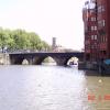
Victoria Street Bridge

 
Also known as: Bristol Bridge
Bristol Bridge, Bristol BS1, United Kingdom
 
Information about the place
Victoria Street Bridge is a minor waterways place on the River Avon - Bristol (Main River - Bath to Bristol) between Hanham Lock Weir Entrance (Channel leading to the Weir) (5 miles and ¼ furlongs and 2 locks to the east) and City Ferry Landing Arm Junction (4¼ furlongs to the southwest).
 
 
The nearest place in the direction of Hanham Lock Weir Entrance is Castle Bridge, Bristol; 1 furlong away.
 
The nearest place in the direction of City Ferry Landing Arm Junction is Redcliffe Way Bridge; 2 furlongs away.

There is no access to the towpath here.

Mooring here is unrated.

There is a bridge here which takes a road over the canal.


Amenities

Amenities here

 Costcutter
 Tesco
 Caffe Nero
 Starbucks
 Bristol, Kalahari Moon
 Pizza Express
 San Carlo Restaurant
 Bank Tavern
 Bay Horse
 Bristol
 Commercial Rooms
 Crown
 Llandoger
 SEE ADDRESS
 SEE ADDRESS
 Wetherspoons
 Cashpoint
 Cashpoint
 Cashpoint
 Lloyds Bank
 NatWest

Amenities nearby at Redcliffe Way Bridge

 Loch Fyne
 Barclays

Amenities nearby at Castle Bridge, Bristol

 Sainsburys
 Tesco
 Tesco
 Costa Coffee
 Costa Coffee
 Patisserie-Valerie
 Starbucks
 La Tasca
 McDonalds
 McDonalds
 Pizza Hut
 Beefeater
 Bell
 Cotham Porter Stores
 SEE ADDRESS
 Bristol, Cabot Circus
 Primark
 W H Smith
 Burger King
 Fish & Chips
 ShakeAway
 Subway Sandwich Shop
 Subway Sandwich Shop
 Subway Sandwich Shop
 Boots Chemist
 Barclays
 Cashpoint
 Cashpoint
 Cashpoint
 Cashpoint
 Cashpoint
 Cashpoint
 Cashpoint
 Cashpoint
 Cashpoint
 Cashpoint
 Cashpoint
 HSBC
 NatWest
 Nationwide
 Santander
 TSB
 Forecourt 24hrs
 Shell
 
Maps
If you are a user and are logged on, or if you are actively planning a route, a map will be displayed here.
Show on external mapping site: Google | OSM | Bing
 
Photos
 
External websites
There are no links to external websites from here.
Why not log in and add some (select "External websites" from the menu (sometimes this is under "Edit"))?
 
Nearest facilities

Mouseover for more information or show routes to facility

Nearest water point

In the direction of Cumberland Basin Entrance Lock No 2

Arnolfini Moorings4¾ furlongs away
Travel to City Ferry Landing Arm Junction, then on the River Avon - Bristol (City Ferry Landing Arm) to Arnolfini Moorings
Harbour Inlet7 furlongs away
On this waterway in the direction of Cumberland Basin Entrance Lock No 2

In the direction of Hanham Lock No 1

Hanham Lock No 14 miles, 7½ furlongs and 1 lock away
On this waterway in the direction of Hanham Lock No 1
Wessex Water Services9 miles, 5¾ furlongs and 4 locks away
Travel to Hanham Lock No 1, then on the River Avon (Kennet and Avon Navigation) to Wessex Water Services
Bath Top Lock Visitor Moorings16 miles, 5¾ furlongs and 13 locks away
Travel to Hanham Lock No 1, then on the River Avon (Kennet and Avon Navigation) to River Avon Junction, then on the Kennet and Avon Canal (Main Line) to Bath Top Lock Visitor Moorings
Bathampton Bridge No 18318 miles, 4½ furlongs and 13 locks away
Travel to Hanham Lock No 1, then on the River Avon (Kennet and Avon Navigation) to River Avon Junction, then on the Kennet and Avon Canal (Main Line) to Bathampton Bridge No 183

Nearest rubbish disposal

In the direction of Hanham Lock No 1

Hanham Lock No 14 miles, 7½ furlongs and 1 lock away
On this waterway in the direction of Hanham Lock No 1
Abbey View Lock No 1116 miles, 4½ furlongs and 10 locks away
Travel to Hanham Lock No 1, then on the River Avon (Kennet and Avon Navigation) to River Avon Junction, then on the Kennet and Avon Canal (Main Line) to Abbey View Lock No 11

Nearest chemical toilet disposal

In the direction of Hanham Lock No 1

Wessex Water Services9 miles, 5¾ furlongs and 4 locks away
Travel to Hanham Lock No 1, then on the River Avon (Kennet and Avon Navigation) to Wessex Water Services

Nearest place to turn

In the direction of Cumberland Basin Entrance Lock No 2

Bathhurst Parade Marina3 furlongs away
On this waterway in the direction of Cumberland Basin Entrance Lock No 2
City Ferry Landing Arm Junction4¼ furlongs away
On this waterway in the direction of Cumberland Basin Entrance Lock No 2
Baltic Wharf1 mile, 2¼ furlongs away
On this waterway in the direction of Cumberland Basin Entrance Lock No 2
Ferry Landings Arm1 mile, 2½ furlongs away
On this waterway in the direction of Cumberland Basin Entrance Lock No 2

In the direction of Hanham Lock No 1

Hanham Lock Weir Exit4 miles, 7 furlongs and 1 lock away
On this waterway in the direction of Hanham Lock No 1
Hanham Lock Weir Entrance5 miles, ¼ furlongs and 2 locks away
Travel to Hanham Lock No 1, then on the River Avon (Kennet and Avon Navigation) to Hanham Lock Weir Entrance
Keynsham Lock Weir Entrance7 miles, ¼ furlongs and 3 locks away
Travel to Hanham Lock No 1, then on the River Avon (Kennet and Avon Navigation) to Keynsham Lock Weir Entrance
Horseshoe Walk Bridge Winding Hole16 miles, 4 furlongs and 10 locks away
Travel to Hanham Lock No 1, then on the River Avon (Kennet and Avon Navigation) to River Avon Junction, then on the Kennet and Avon Canal (Main Line) to Horseshoe Walk Bridge Winding Hole
Pulteney Gardens Winding Hole16 miles, 4¾ furlongs and 11 locks away
Travel to Hanham Lock No 1, then on the River Avon (Kennet and Avon Navigation) to River Avon Junction, then on the Kennet and Avon Canal (Main Line) to Pulteney Gardens Winding Hole
Sydney Wharf Winding Hole16 miles, 7¼ furlongs and 13 locks away
Travel to Hanham Lock No 1, then on the River Avon (Kennet and Avon Navigation) to River Avon Junction, then on the Kennet and Avon Canal (Main Line) to Sydney Wharf Winding Hole
Bathampton Bridge Winding Hole18 miles, 5¼ furlongs and 13 locks away
Travel to Hanham Lock No 1, then on the River Avon (Kennet and Avon Navigation) to River Avon Junction, then on the Kennet and Avon Canal (Main Line) to Bathampton Bridge Winding Hole
Bathampton Winding Hole18 miles, 7¼ furlongs and 13 locks away
Travel to Hanham Lock No 1, then on the River Avon (Kennet and Avon Navigation) to River Avon Junction, then on the Kennet and Avon Canal (Main Line) to Bathampton Winding Hole

Nearest self-operated pump-out

In the direction of Cumberland Basin Entrance Lock No 2

Harbour Inlet7 furlongs away
On this waterway in the direction of Cumberland Basin Entrance Lock No 2

Nearest boatyard pump-out

In the direction of Cumberland Basin Entrance Lock No 2

Baltic Wharf1 mile, 2¼ furlongs away
On this waterway in the direction of Cumberland Basin Entrance Lock No 2
Direction of TV transmitter (From Wolfbane Cybernetic)
 
 
Geograph
 
Wikipedia

There is no page on Wikipedia called “Victoria Street Bridge”

Wikipedia pages that might relate to Victoria Street Bridge
[Richmond, Victoria] Strategy are located in Richmond—the commercial strips of Victoria Street, Bridge Road and Swan Street. The diverse suburb has been the subject of gentrification [Johnson Street Bridge] Four known bridges have spanned the narrows between the Inner Harbour and Upper Harbour of Victoria, British Columbia, connecting Johnson Street on the east [Victoria Bridge (Penrith)] The Victoria Bridge (Penrith), also known as the Victoria Bridge over Nepean River and officially known as The Nepean Bridge, is a heritage-listed former [Victoria Bridge] known as Victoria Street Bridge Victoria Bridge, Cambridge, New Zealand, a road bridge across the Waikato River in Cambridge Victoria Bridge, Hamilton [Victoria Bridge, Brisbane] adjacent to the Victoria Bridge, tentatively named the Adelaide Street Bridge was recommended for a feasibility study. Construction of a bridge across the [Montague Street Bridge] Montague Street Bridge is a railway bridge in South Melbourne, Australia, an inner suburb of Melbourne. The bridge is located at 83 Montague Street, between [Bridge Street Bridge] Bridge Street Bridge may refer to: Bridge Street Bridge (Newark) Bridge Street Bridge (Trenton) Bridge Street Bridge (Connecticut River) Bridge Street [Elora, Ontario] the 1921 bridge; the 1867 stone pier was retained as had been planned. Most parts of another bridge over the river, known as the Victoria Street Pedestrian [Bascule bridge] design Johnson Street Bridge across Victoria Harbour, British Columbia, Canada, built in 1924 The new Johnson Street Bridge in Victoria, British Columbia [Victoria Embankment] Victoria Embankment was one element of a three-part work, the other two parts being the Albert Embankment, from the Lambeth end of Westminster Bridge
 
Google

Results of Google Search

Victoria Street bridge in Kitchener set to close at the end of January ...
Jan 17, 2018 ... The Victoria Street bridge in Kitchener will be closing at the end of the month as the first construction phase to build a new Highway 7 between Kitchener and Guelph begins.
Brace yourself. Victoria Street bridge closes Jan. 29 | TheRecord.com
Jan 16, 2018 ... This will be fun. The busy Victoria Street North bridge across the expressway closes Jan. 29 for almost a year, pushing traffic onto nearby bridges.
Search the List | Victoria Street Bridge | Heritage New Zealand
Victoria Street Bridge. Victoria Square (Bound By Colombo, Armagh, Durham And Kilmore Streets) Crossing The Avon River, Christchurch. Victoria Street Bridge. Image courtesy of www.flickr.com. Copyright: PhilBee NZ - Phil Braithwaite. Taken By: PhilBee NZ - Phil Braithwaite. Date: 28/07/2013. Victoria Street Bridge.
Victoria Bridge, Melbourne - Wikipedia
The Victoria Bridge is a bridge over the Yarra River between Richmond and Hawthorn, Melbourne, Australia. It carries Victoria Street across the Yarra. The bridge is riveted and welded steel Warren truss bridge. It was completed in 1884. The bridge was widened in 1890 by the addition of a third line of truss on new piers on ...
Search the List | Victoria Street Bridge, Leamington | Heritage New ...
Victoria Street Bridge, Leamington. Victoria Street, Cambridge. Victoria Street Bridge. Copyright: Waipa District Council. . Copyright: Waipa District Council. . Copyright: Waipa District Council. Previous; Next ...
Victoria Bridge, Brisbane - Wikipedia
The Victoria Bridge is a vehicular and pedestrian bridge over the Brisbane River. The current bridge, opened in 1969, is the third permanent crossing erected at this location. It is shared by vehicular traffic, pedestrians and cyclists. Victoria Bridge connects South Brisbane near the South Bank Parklands and Queensland ...
Victoria Street Pedestrian Bridge
A public information meeting and special council meeting was held on Wednesday, November 22 at the Elora Community Centre to outline the various design and funding options for the Victoria Street Pedestrian Bridge. Options were showcased to the public for review prior to the special Council meeting that followed.
Victoria Street bridge over expressway now closed until November ...
Jan 17, 2018 ... Starting January 29th, the Victoria Street North bridge will be closed in order to facilitate its full replacement. The project is expected to last until, at least, the end of November. The bridge replacement is part of phase one of a three-phase initiative to improve Highway 7 which connects Kitchener and Guelph.
Victoria Street bridge to be shut down for almost a year | CTV ...
Jan 17, 2018 ... The Victoria Street bridge, a major artery connecting Guelph and Kitchener, will be shut down at the end of this month.
Victoria Street Bridge Lighting - City of Trail BC
The reveal of the lights occured during a special ceremony on Friday, May 6th at 9pm in conjunction with Silver City Days. UPDATE February 15, 2016. The DOAC received $180,220 in sponsorship for the Victoria Street Bridge Lighting Project. The installation of the LED lights for this project is underway with an anticipated ...