Byker Boatyard Slipway 
Ouseburn, Foundry Lane, Newcastle upon Tyne NE1 2PF, United Kingdom

Byker Boatyard Slipway
is a minor waterways place
on the River Ouseburn between
Ouseburn Footbridge (Head of navigation) (1 furlong
to the north) and
Tyne - Ouseburn Junction (Junction of the River Tyne and the River Ouseburn ) (2¼ furlongs
and 2 locks
to the southeast).
The nearest place in the direction of Ouseburn Footbridge is Seven Stories Corner;
¾ furlongs
away.
The nearest place in the direction of Tyne - Ouseburn Junction is Byker Bank Bridge;
¼ furlongs
away.
Mooring here is unrated.
| Ouseburn Footbridge | 1 furlong | |
| The Cluny Slipway | ¾ furlongs | |
| Seven Stories Corner | ¾ furlongs | |
| Byker Boatyard Slipway | ||
| Byker Bank Bridge | ¼ furlongs | |
| Walker Road Bridge | 1¼ furlongs | |
| Ouseburn Barrage | 1¼ furlongs | |
| Quayside Bridge | 1½ furlongs | |
| Tyne - Ouseburn Junction | 2¼ furlongs | |
Amenities nearby at Seven Stories Corner
There are no links to external websites from here.
Why not log in and add some (select "External websites" from the menu (sometimes this is under "Edit"))?
Why not log in and add some (select "External websites" from the menu (sometimes this is under "Edit"))?
Mouseover for more information or show routes to facility
No information
CanalPlan has no information on any of the following facilities within range:water point
rubbish disposal
chemical toilet disposal
place to turn
self-operated pump-out
boatyard pump-out
Direction of TV transmitter (From Wolfbane Cybernetic)
There is no page on Wikipedia called “Byker Boatyard Slipway”


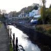
![Small boats, Ouseburn. Access is provided from Lime Street which took its name from a lime kiln shown on Oliver's plan of 1830 but not on later maps. The lime kiln was built into the bank of the Ouseburn and was served by keels for lime and coal. In 1827, the historian Eneas MacKenzie commented that 'the burning of limestone is not only a great nuisance to the neighbourhood but also dangerous to passengers riding past. It is hoped that the Corporation will remove a work so disagreeable and dangerous' http://www.twsitelines.info/Siteline.nsf/SMR/CEE3EF62F197DFC8802576AF003E7412Compare this photo with the Ouseburn water level now controlled by the new barrage [[1777278]] down-river with the previous tidal extremes [[419816]] by Andrew Curtis – 28 March 2010](https://s2.geograph.org.uk/geophotos/01/77/76/1777674_459725c1_120x120.jpg)


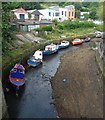
![Lime Street slipway, Ouseburn. In the late C19th, this was one of the busiest sites of lower Ouseburn. Coal was unloaded here from low barges (wherries) and transferred to carts which would ascend the slope behind via a granite lined track-way to Lime Street [[2811489]]. The wherries would then be loaded with waste materials from the Ouseburn Ironworks and heavy machinery from local factories. Today, the slipway is used to repair pleasure boats.Tyne and Wear HER (5577): Ouseburn, Lime Street Slipway http://www.twsitelines.infoThe building alongside the river, just above the slipway, a former garage known as 26 Lime Street, incorporates some old stonework.Tyne and Wear HER (6738): Ouseburn, Lime Street, No. 26 http://www.twsitelines.infoBehind the slipway is [[2986400]] by Andrew Curtis – 28 March 2010](https://s1.geograph.org.uk/geophotos/01/77/76/1777677_8e76e8b3_120x120.jpg)
![Sinking at Lime Street Slipway, Ouseburn. There is another photo here [[1777677]] by Andrew Curtis – 19 February 2012](https://s1.geograph.org.uk/geophotos/02/81/14/2811469_56eeaec8_120x120.jpg)


![Lime Street Slipway, Ouseburn. There is another photo here [[2160782]]The black and white stencilled posters on the outbuilding in the background, facing the river, are credited to the Brooklyn-based street artist, Bast, who had an exhibition in Newcastle in September 2011. They are similar to those shown here http://allcitystreetart.com/2011/03/23/bast-faile-collabs-brooklyn/There is a photo here http://newcastleandnorthumberlanddailyphoto.blogspot.com/2011/10/bast-art-in-ouseburn.html by Andrew Curtis – 19 February 2012](https://s1.geograph.org.uk/geophotos/02/81/14/2811489_3d3fe371_120x120.jpg)


![21 Lime Street, Ouseburn. The same building can be seen here in 2016 [[4817594]] and [[4817601]]For a time a bicycle shop but now looks empty. by Andrew Curtis – 03 June 2021](https://s0.geograph.org.uk/geophotos/06/86/24/6862416_9105ec21_120x120.jpg)


![Development at Ouseburn Quays. Redevelopment by McIvor Homes of the former Quay Timber yard into high quality sustainable housing, comprising 51 apartments, 2 small business units, landscaped courtyard and onsite below deck car parking provision with discreet service areas.https://www.chroniclelive.co.uk/news/north-east-news/ouseburn-flats-riverside-quay-timber-17890227 https://web.archive.org/web/20210604185230if_/https://www.chroniclelive.co.uk/news/north-east-news/ouseburn-flats-riverside-quay-timber-17890227An image of the finished building shown on a poster along the riverside path is shown here: [[6857519]] by Andrew Curtis – 03 June 2021](https://s0.geograph.org.uk/geophotos/06/85/75/6857512_10e57203_120x120.jpg)


