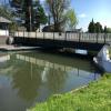
Fretherne Bridge
is a minor waterways place
on the Gloucester and Sharpness Canal between
Sharpness Barge Arm (Junction of old and new lines of canal. Long term private mooring.) (6 miles and 6½ furlongs
to the southwest) and
Saul Junction (Junction of the Gloucester and Sharpness Canal with the Stroudwater Navigation) (6¼ furlongs
to the northeast).
The nearest place in the direction of Sharpness Barge Arm is Splatt Bridge;
1 mile and ¾ furlongs
away.
The nearest place in the direction of Saul Junction is Joe Energy (Diesel & Gas available);
1¼ furlongs
away.
Mooring here is good (a nice place to moor), mooring pins are needed. Good mooring between here and Sandfield bridge.
Facilities: rubbish disposal and water point.
There is a swing bridge here.
Purton Upper Bridge | 5 miles, 2½ furlongs | |
Patch Bridge | 2 miles, 7½ furlongs | |
Cambridge Arms Bridge | 2 miles, 1¾ furlongs | |
Junction with Cambridge Feeder Branch | 2 miles, 1 furlong | |
Splatt Bridge | 1 mile, ¾ furlongs | |
Fretherne Bridge | ||
Joe Energy | 1¼ furlongs | |
Sandfield Bridge | 4¼ furlongs | |
Cotswold Canals Trust Visitor Centre - Saul Junction | 5¼ furlongs | |
Saul Junction Winding Hole | 6 furlongs | |
Saul Junction | 6¼ furlongs |
Amenities here
There are no links to external websites from here.
Why not log in and add some (select "External websites" from the menu (sometimes this is under "Edit"))?
Mouseover for more information or show routes to facility
Nearest water point
The nearest water point is here. Others are at:
In the direction of Gloucester / Sharpness - Severn Junction
Cotswold Canals Trust Visitor Centre - Saul Junction — 5¼ furlongs away
On this waterway in the direction of Gloucester / Sharpness - Severn Junction
Saul Junction Winding Hole — 6 furlongs away
On this waterway in the direction of Gloucester / Sharpness - Severn Junction
Saul Junction Marina — 7½ furlongs away
Travel to Saul Junction, then on the Cotswold Canals (Stroudwater Navigation - Navigable Section) to Saul Junction Marina
Sellars Bridge — 4 miles, 4¼ furlongs away
On this waterway in the direction of Gloucester / Sharpness - Severn Junction
Llanthony Pontoons — 8 miles, 2¼ furlongs away
On this waterway in the direction of Gloucester / Sharpness - Severn Junction
Llanthony Road Bridge — 8 miles, 3¼ furlongs away
On this waterway in the direction of Gloucester / Sharpness - Severn Junction
Gloucester Waterways Museum Arm — 8 miles, 3½ furlongs away
On this waterway in the direction of Gloucester / Sharpness - Severn Junction
Gloucester Dock Lock — 8 miles, 4½ furlongs away
On this waterway in the direction of Gloucester / Sharpness - Severn Junction
In the direction of Sharpness Junction
Splatt Bridge — 1 mile, ¾ furlongs away
On this waterway in the direction of Sharpness Junction
Patch Bridge — 2 miles, 7½ furlongs away
On this waterway in the direction of Sharpness Junction
Purton Lower Bridge — 5 miles, 3¼ furlongs away
On this waterway in the direction of Sharpness JunctionNearest rubbish disposal
The nearest rubbish disposal is here. Others are at:
In the direction of Gloucester / Sharpness - Severn Junction
Saul Junction Winding Hole — 6 furlongs away
On this waterway in the direction of Gloucester / Sharpness - Severn Junction
Saul Junction Marina — 7½ furlongs away
Travel to Saul Junction, then on the Cotswold Canals (Stroudwater Navigation - Navigable Section) to Saul Junction Marina
Parkend Bridge — 2 miles, 3 furlongs away
On this waterway in the direction of Gloucester / Sharpness - Severn Junction
Sellars Bridge — 4 miles, 4¼ furlongs away
On this waterway in the direction of Gloucester / Sharpness - Severn Junction
Llanthony Road Bridge — 8 miles, 3¼ furlongs away
On this waterway in the direction of Gloucester / Sharpness - Severn Junction
In the direction of Sharpness Junction
Splatt Bridge — 1 mile, ¾ furlongs away
On this waterway in the direction of Sharpness Junction
Patch Bridge — 2 miles, 7½ furlongs away
On this waterway in the direction of Sharpness Junction
Purton Lower Bridge — 5 miles, 3¼ furlongs away
On this waterway in the direction of Sharpness Junction
Sharpness Barge Arm — 6 miles, 6½ furlongs away
On this waterway in the direction of Sharpness JunctionNearest chemical toilet disposal
In the direction of Gloucester / Sharpness - Severn Junction
Cotswold Canals Trust Visitor Centre - Saul Junction — 5¼ furlongs away
On this waterway in the direction of Gloucester / Sharpness - Severn Junction
Saul Junction Marina — 7½ furlongs away
Travel to Saul Junction, then on the Cotswold Canals (Stroudwater Navigation - Navigable Section) to Saul Junction Marina
Llanthony Road Bridge — 8 miles, 3¼ furlongs away
On this waterway in the direction of Gloucester / Sharpness - Severn Junction
In the direction of Sharpness Junction
Sharpness Barge Arm — 6 miles, 6½ furlongs away
On this waterway in the direction of Sharpness JunctionNearest place to turn
In the direction of Gloucester / Sharpness - Severn Junction
Saul Junction Winding Hole — 6 furlongs away
On this waterway in the direction of Gloucester / Sharpness - Severn Junction
Pegthorne Bridge Winding Hole — 1 mile, 3¼ furlongs away
On this waterway in the direction of Gloucester / Sharpness - Severn Junction
Quedgeley Oil Depot — 4 miles, 5¾ furlongs away
On this waterway in the direction of Gloucester / Sharpness - Severn Junction
Monk Meadow Dock — 8 miles away
On this waterway in the direction of Gloucester / Sharpness - Severn Junction
Gloucester Docks — 8 miles, 4 furlongs away
On this waterway in the direction of Gloucester / Sharpness - Severn Junction
Waterways Office (South Wales and Severn Waterways) - Canal & River Trust — 8 miles, 4¼ furlongs away
On this waterway in the direction of Gloucester / Sharpness - Severn Junction
Gloucester / Sharpness - Severn Junction — 8 miles, 4¾ furlongs and 1 lock away
On this waterway in the direction of Gloucester / Sharpness - Severn Junction
The Ocean — 4 miles, 5 furlongs and 8 locks away
Travel to Saul Junction, then on the Cotswold Canals (Stroudwater Navigation - Navigable Section) to Walk Bridge, then on the Cotswold Canals (Stroudwater Navigation - Un-navigable Section) to The Ocean
Upper Parting Junction — 11 miles, 1½ furlongs and 1 lock away
Travel to Gloucester / Sharpness - Severn Junction, then on the River Severn (main river - Worcester to Gloucester) to Upper Parting Junction
Over Winding Hole — 10 miles, 4½ furlongs and 2 locks away
Travel to Gloucester / Sharpness - Severn Junction, then on the River Severn (old river navigation) to Lower Parting, then on the River Severn (Maisemore Channel - Southern Section) to Over Junction, then on the Hereford and Gloucester Canal to Over Winding Hole
Ryeford Winding Hole — 5 miles, 4¾ furlongs and 8 locks away
Travel to Saul Junction, then on the Cotswold Canals (Stroudwater Navigation - Navigable Section) to Walk Bridge, then on the Cotswold Canals (Stroudwater Navigation - Un-navigable Section) to Ryeford Winding Hole
Brimscombe Port — 10 miles, 3¼ furlongs and 19 locks away
Travel to Saul Junction, then on the Cotswold Canals (Stroudwater Navigation - Navigable Section) to Walk Bridge, then on the Cotswold Canals (Stroudwater Navigation - Un-navigable Section) to Site of Entrance to Wallbridge Basin, then on the Cotswold Canals (Thames and Severn Canal - Wide section) to Brimscombe Port
In the direction of Sharpness Junction
Sharpness Barge Arm — 6 miles, 6½ furlongs away
On this waterway in the direction of Sharpness JunctionNearest self-operated pump-out
In the direction of Gloucester / Sharpness - Severn Junction
Cotswold Canals Trust Visitor Centre - Saul Junction — 5¼ furlongs away
On this waterway in the direction of Gloucester / Sharpness - Severn Junction
Llanthony Pontoons — 8 miles, 2¼ furlongs away
On this waterway in the direction of Gloucester / Sharpness - Severn Junction
In the direction of Sharpness Junction
Purton Lower Bridge — 5 miles, 3¼ furlongs away
On this waterway in the direction of Sharpness JunctionNearest boatyard pump-out
In the direction of Gloucester / Sharpness - Severn Junction
Saul Junction Marina — 7½ furlongs away
Travel to Saul Junction, then on the Cotswold Canals (Stroudwater Navigation - Navigable Section) to Saul Junction Marina
In the direction of Sharpness Junction
Patch Bridge — 2 miles, 7½ furlongs away
On this waterway in the direction of Sharpness JunctionDirection of TV transmitter (From Wolfbane Cybernetic)
There is no page on Wikipedia called “Fretherne Bridge”
Wikipedia pages that might relate to Fretherne Bridge
[Arlingham]
Dean. Access to Arlingham is across Fretherne bridge over the Gloucester and Sharpness Canal, or Sandfield Bridge at Saul Junction. Having the canal on
[Gloucester and Sharpness Canal]
6 May 2006. In January 2009 a project began to replace the Patch Bridge swing bridge with a motor powered design instead of the former hand-cranked system
[Severn Bridge Railway]
was for the line to cross the Severn by bridge, at Hock Cliffe between Fretherne and Awre. This was strenuously opposed in Parliament in 1845 by interests
[List of places in Gloucestershire]
Framilode, Frampton Cotterell, Frampton Mansell, Frampton-on-Severn, Fretherne, Frocester, Frocester Hill, Fyfield Ganborough, Gloucester, Gorsley, Gotherington
[List of country houses in the United Kingdom]
Dyrham Park Edgeworth Manor Ellenborough Park Elmore Court Frampton Court Fretherne Court Gatcombe Park Hardwicke Court Hasfield Court Highgrove House Highnam
[South Wales Railway]
1845 Act. In the 1846 session of Parliament, and revised bridge crossing of the Severn at Fretherne was proposed, and alternatively a tunnel. Both options
[List of poor law unions in England]
Wheatenhurst PLU Arlingham, Brookthorpe, Eastington, Framfton upon Severn, Fretherne with Saul, Frocester, Hardwicke, Harescombe, Haresfield, Longney, Moreton
[Grade II* listed buildings in Stroud (district)]
365088 (Church of St James) 1090510 More images Church of St Mary Fretherne, Fretherne with Saul, Stroud Gate 13th century 10 January 1955 SO7337209157
[List of United Kingdom locations: Fr-Fz]
Freswick Highland 58°35′N 3°06′W / 58.58°N 03.10°W / 58.58; -03.10 ND3667 Fretherne Gloucestershire 51°46′N 2°23′W / 51.77°N 02.39°W / 51.77; -02.39 SO7309
[Forest of Dean Railway]
of Gloucester, to South Wales. There would have been a bridge across the Severn at Fretherne. However it was argued by opponents that this would impede
Results of Google Search
Fretherne Bridge Gloucester & Sharpness Canal | Canal & River TrustSep 2, 2015 ... ... of road traffic and in accordance with agreed protocols with Gloucestershire County Council. Fretherne Bridge is closed for boat traffic from 8.
Access to the site is via a five bar metal gate (unlocked) which leads onto the towpath from Fretherne Bridge. Nearest Station. Gloucester, Stonehouse or Stroud.
Dec 24, 2019 ... Fretherne Bridge is a bridge across the Gloucester & Sharpness Canal on the B4071 road near Frampton on Severn, Gloucestershire.
Jul 9, 2018 ... Fretherne Bridge near Frampton on Severn in Gloucestershire ... The swing bridge carries traffic over the Gloucester & Sharpness Canal on the ...
Fretherne Bridge also closes 0820 - 0900 on weekdays during school terms. No bridges or locks are user-operated. The table below indicates approximate air ...
Fretherne Bridge House, Saul, Gloucester GL2 7JD. 3 bedrooms; 1 bathroom; 1 reception room. Freehold; Detached house. Save ...
Information and map for Fretherne Bridge in Frampton On Severn and. Within the council area of Stroud District. In the postcode district of GL2 7 including ...
Design, supply, installation and commissioning of a road swing bridge over the Gloucester and Sharpness canal at Fretherne. This work included: Incorporate ...
Feb 25, 2020 ... ... path near Fretherne Bridge View looks north-eastwards along the Gloucester & Sharpness Canal and towards the Fretherne Swing Bridge.