Nottingham Road Bridge No 38 carries a farm track over the Grand Union Canal (Leicester Section - River Soar Navigation).
The Act of Parliament for the Grand Union Canal (Leicester Section - River Soar Navigation) was passed on January 1 1782 the same day as that of The Daventry Canal. "Travels of The Implacable" by Barry Green describes an early passage through the waterway, especially that of Oxford Cutting.

Nottingham Road Bridge No 38
is a minor waterways place
on the Grand Union Canal (Leicester Section - River Soar Navigation) between
Barrow upon Soar Junction (River Soar returns bypassing the Lock) (2 miles and 7 furlongs
and 1 lock
to the southeast) and
Loughborough Branch Junction (5¾ furlongs
to the west).
The nearest place in the direction of Barrow upon Soar Junction is Loughborough CRT Visitor Moorings;
½ furlongs
away.
The nearest place in the direction of Loughborough Branch Junction is Meadow Lane Bridge No 39;
1¾ furlongs
away.
There may be access to the towpath here.
Mooring here is impossible (it may be physically impossible, forbidden, or allowed only for specific short-term purposes).
There is a bridge here which takes a major road over the canal.
| Miller's Bridge No 34 | 1 mile, ¾ furlongs | |
| Moor Lane Bridge No 35 | 4¾ furlongs | |
| Little Moor Lane Bridge No 36 | 3 furlongs | |
| Great Central Railway Bridge (disused) | 1¼ furlongs | |
| Loughborough CRT Visitor Moorings | ½ furlongs | |
| Nottingham Road Bridge No 38 | ||
| Meadow Lane Bridge No 39 | 1¾ furlongs | |
| Boat Inn (Loughborough) | 2 furlongs | |
| Chain Bridge No 39B | 5½ furlongs | |
| Loughborough Branch Junction | 5¾ furlongs | |
| Aqueduct by Belton Road Bridge | 6¾ furlongs | |
Amenities here
- Grand Union Canal Walk — associated with Grand Union Canal
- An illustrated walk along the Grand Union Canal from London to Birmingham
Mouseover for more information or show routes to facility
Nearest water point
In the direction of Trent Junction
Loughborough Basin — 6¾ furlongs away
Travel to Loughborough Branch Junction, then on the Grand Union Canal (Leicester Section - Loughborough Branch) to Loughborough Basin
Bishop Meadow Lock No 54 — 1 mile, 5½ furlongs and 1 lock away
On this waterway in the direction of Trent Junction
Former BW Trent Lock Waterway Office — 9 miles, 7½ furlongs and 8 locks away
Travel to Trent Junction, then on the Grand Union Canal (Erewash Canal) to Former BW Trent Lock Waterway Office
Sawley Locks No 2 — 10 miles, 5½ furlongs and 7 locks away
Travel to Trent Junction, then on the River Trent (Western End) to Sawley Locks No 2
Cranfleet Lock No 3 — 10 miles, 4 furlongs and 8 locks away
Travel to Trent Junction, then on the River Trent (Western End) to Cranfleet Lock No 3
Shardlow — 12 miles, 7¼ furlongs and 10 locks away
Travel to Trent Junction, then on the River Trent (Western End) to Derwent Mouth, then on the Trent and Mersey Canal (Main Line - Derwent Mouth to Burton) to Shardlow
Beeston Lock No 5 — 14 miles, 6½ furlongs and 9 locks away
Travel to Trent Junction, then on the River Trent (Western End) to Beeston Lock No 5
Weston Lock No 4 — 15 miles, 7 furlongs and 12 locks away
Travel to Trent Junction, then on the River Trent (Western End) to Derwent Mouth, then on the Trent and Mersey Canal (Main Line - Derwent Mouth to Burton) to Weston Lock No 4
Swarkestone Lock No 5 — 18 miles, 6¼ furlongs and 13 locks away
Travel to Trent Junction, then on the River Trent (Western End) to Derwent Mouth, then on the Trent and Mersey Canal (Main Line - Derwent Mouth to Burton) to Swarkestone Lock No 5
In the direction of River Soar Junction
Barrow Boating — 3 miles, 2¾ furlongs and 2 locks away
On this waterway in the direction of River Soar Junction
Hope and Anchor Bridge No 19 — 8 miles, 7¾ furlongs and 6 locks away
On this waterway in the direction of River Soar Junction
Friars Mill Visitor Moorings — 14 miles, 7½ furlongs and 11 locks away
On this waterway in the direction of River Soar JunctionNearest rubbish disposal
In the direction of Trent Junction
Loughborough Basin — 6¾ furlongs away
Travel to Loughborough Branch Junction, then on the Grand Union Canal (Leicester Section - Loughborough Branch) to Loughborough Basin
Former BW Trent Lock Waterway Office — 9 miles, 7½ furlongs and 8 locks away
Travel to Trent Junction, then on the Grand Union Canal (Erewash Canal) to Former BW Trent Lock Waterway Office
Sawley Locks No 2 — 10 miles, 5½ furlongs and 7 locks away
Travel to Trent Junction, then on the River Trent (Western End) to Sawley Locks No 2
Cranfleet Lock No 3 — 10 miles, 4 furlongs and 8 locks away
Travel to Trent Junction, then on the River Trent (Western End) to Cranfleet Lock No 3
Beeston Lock No 5 — 14 miles, 6½ furlongs and 9 locks away
Travel to Trent Junction, then on the River Trent (Western End) to Beeston Lock No 5
Swarkestone Lock No 5 — 18 miles, 6¼ furlongs and 13 locks away
Travel to Trent Junction, then on the River Trent (Western End) to Derwent Mouth, then on the Trent and Mersey Canal (Main Line - Derwent Mouth to Burton) to Swarkestone Lock No 5
In the direction of River Soar Junction
Barrow Boating — 3 miles, 2¾ furlongs and 2 locks away
On this waterway in the direction of River Soar Junction
Broome Island — 4 miles, 1 furlong and 2 locks away
On this waterway in the direction of River Soar JunctionNearest chemical toilet disposal
In the direction of Trent Junction
Former BW Trent Lock Waterway Office — 9 miles, 7½ furlongs and 8 locks away
Travel to Trent Junction, then on the Grand Union Canal (Erewash Canal) to Former BW Trent Lock Waterway Office
Sawley Locks No 2 — 10 miles, 5½ furlongs and 7 locks away
Travel to Trent Junction, then on the River Trent (Western End) to Sawley Locks No 2
Sawley Cut Wharf — 10 miles, 7 furlongs and 8 locks away
Travel to Trent Junction, then on the River Trent (Western End) to Sawley Cut Wharf
Beeston Lock No 5 — 14 miles, 6½ furlongs and 9 locks away
Travel to Trent Junction, then on the River Trent (Western End) to Beeston Lock No 5
In the direction of River Soar Junction
Barrow Boating — 3 miles, 2¾ furlongs and 2 locks away
On this waterway in the direction of River Soar Junction
Sileby Mill Mooring Basin — 5 miles, 7 furlongs and 3 locks away
On this waterway in the direction of River Soar JunctionNearest place to turn
In the direction of Trent Junction
Loughborough Branch Junction — 5¾ furlongs away
On this waterway in the direction of Trent Junction
Loughborough Basin — 6¾ furlongs away
Travel to Loughborough Branch Junction, then on the Grand Union Canal (Leicester Section - Loughborough Branch) to Loughborough Basin
Bishops Meadow Junction — 2 miles, ¾ furlongs and 2 locks away
On this waterway in the direction of Trent Junction
Soar Boat Club — 3 miles, 1¾ furlongs and 2 locks away
On this waterway in the direction of Trent Junction
Zouch Road Flood Gate — 3 miles, 4 furlongs and 2 locks away
On this waterway in the direction of Trent Junction
London Road Marina (southern entrance) — 5 miles, 6½ furlongs and 3 locks away
On this waterway in the direction of Trent Junction
London Road Marina (northern entrance) — 5 miles, 7½ furlongs and 3 locks away
On this waterway in the direction of Trent Junction
Station Road Arm — 6 miles, 7½ furlongs and 4 locks away
On this waterway in the direction of Trent Junction
In the direction of River Soar Junction
Pilling's Flood Lock Winding Hole — 1 mile, 7½ furlongs away
On this waterway in the direction of River Soar Junction
Pillings Lock Marina — 1 mile, 7¾ furlongs away
On this waterway in the direction of River Soar Junction
Barrow upon Soar Junction — 2 miles, 7 furlongs and 1 lock away
On this waterway in the direction of River Soar Junction
Barrow Boating — 3 miles, 2¾ furlongs and 2 locks away
On this waterway in the direction of River Soar Junction
Meadow Farm Marina — 3 miles, 7½ furlongs and 2 locks away
On this waterway in the direction of River Soar Junction
Meadow Farm Junction — 4 miles, ¼ furlongs and 2 locks away
On this waterway in the direction of River Soar Junction
Soar Outlet by Mountsorrel Lock — 4 miles, 7¾ furlongs and 2 locks away
On this waterway in the direction of River Soar Junction
Mountsorrel Lock Junction — 5 miles, ½ furlongs and 3 locks away
On this waterway in the direction of River Soar Junction
Sileby Mill Mooring Basin — 5 miles, 7 furlongs and 3 locks away
On this waterway in the direction of River Soar Junction
Sileby Mill — 5 miles, 7½ furlongs and 3 locks away
On this waterway in the direction of River Soar Junction
Loughborough Road Winding Hole — 7 miles, 1¼ furlongs and 4 locks away
On this waterway in the direction of River Soar Junction
Cossington Mill Stream Junction — 7 miles, 2 furlongs and 4 locks away
On this waterway in the direction of River Soar JunctionNearest boatyard pump-out
In the direction of River Soar Junction
Sileby Mill Mooring Basin — 5 miles, 7 furlongs and 3 locks away
On this waterway in the direction of River Soar JunctionNo information
CanalPlan has no information on any of the following facilities within range:self-operated pump-out
Direction of TV transmitter (From Wolfbane Cybernetic)
There is no page on Wikipedia called “Nottingham Road Bridge”
Wikipedia pages that might relate to Nottingham Road Bridge
[Clifton Bridge (Nottingham)]
Clifton Bridge is a road bridge spanning the River Trent and carrying the A52 road to the west of the city of Nottingham, in the county of Nottinghamshire
[Trent Bridge (bridge)]
Trent Bridge is an iron and stone road bridge across the River Trent in Nottingham, England. It is the principal river crossing for entrance to the city
[Trent Bridge]
Nottinghamshire, England, just across the River Trent from the city of Nottingham. Trent Bridge is also the headquarters of Nottinghamshire County Cricket Club
[West Bridgford]
two road bridges and one pedestrianised bridge and one tram bridge with pedestrian access, allowing access from the town to the city of Nottingham. The
[Nottingham]
charming footpath leads over the fields to the highway, where a bridge spans the Trent. … Nottingham … with its high houses, red roofs and church steeples, looks
[Nottingham station]
these were the city centre stations of Nottingham Victoria on the Great Central Railway, and Nottingham London Road on the Great Northern Railway; both of
[Nottingham Express Transit]
Nottingham Express Transit (NET) is a 32-kilometre-long (20 mi) tram system in Nottingham, England. The system opened to the public on 9 March 2004 and
[A52 road]
then the A453) - the Nottingham Ring Road - was opened in 1963 as mostly single carriageway. The section from Clifton Bridge to the A60 roundabout was
[Tunnels of Nottingham]
fanciful reasons. Nottingham is home to many underground structures but only those built for transport are mentioned here. Mansfield Road Tunnel (south portal:
[Wilford Toll Bridge]
Wilford Toll Bridge, locally referred to as the 'Halfpenny Bridge', is a tram, pedestrian and cycle bridge in Nottingham, England. It crosses the River
Results of Google Search
The Nottingham Express Transit System Order 2009High Road, 154, Demolish property (No.38 High Road). ... Queens Road, 877, Construct link bridge to Nottingham Midland Station. Sheriffs Way, 926, Highway  ...
Timetable for 10 - Ruddington to Nottingham, via Loughborough Road, Wolds Estate. ... Trent Bridge, Victoria Embknt · Nottingham Station S5 · City, Victoria ...
Now For Sale: 24 Photos • 2 bed, 2.5 bath house at 36 Nottingham Drive ... Area: 1215 - Old Bridge; Street Number: 36; Street Name: Nottingham; Street Suffix: ...
2 beds, 2.5 baths condo located at 43 Nottingham Dr, Old Bridge, NJ 08857 sold for ... Look no further than this stand alone fully finished move in ready 2 bedroom 2.5 bath condo ..... 38 Nottingham Dr Apartment 4, -, NJ ... This address can also be written as 43 Nottingham Drive Apartment 9, Old Bridge, New Jersey 08857.
The A453 road was formerly the main trunk road connecting the English cities of Nottingham ... When the A38 was dualled, the A453 was moved to the west, to meet at the ... This was not only the meeting point of the Birmingham to Nottingham road, and the .... The interchange was built when the bridge was dualled in 1972.
Broxtowe & Hucknall Local Mental Health Team. The Hope Centre, Dovecote House, 38 Wollaton Road, Beeston, Nottingham, NG9 2NR Tel: 0115 854 1271Â ...
The A38, part of which is also known as the Devon Expressway, is a major A- class trunk road in England. The road runs from Bodmin in Cornwall to Mansfield in Nottinghamshire. ..... Drivers from the south are advised by road signs not to follow the A38 into the city, but to use the A3029 Winterstoke road to enter from the west, ...
4, Tube Number, Tube Location, Eastings, Northings, 2014, 2015, 2016, 2017, 2018 ... 12, 8, 413 Nottingham Road, 455573, 342860, 39, 38, 38, 39, 36. 13, 9, 403 ... 32, 28, Riverbank PH Trent Bridge, 458051, 338328, 42, 37, 38, 41, 36.
Apr 5, 2018 ... 05 Bridges, structures, retaining walls and highway boundary structures. £ 2,200,000 .... Nottingham Drive (No.38 to Setts Way junction).
The property 38 Overhill Dr, Old Bridge, NJ 08857 is currently not for sale. View details, sales history and Zestimate data for this property on Zillow.

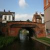



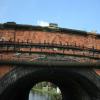
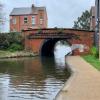


![Grand Union Canal in Loughborough, Leicestershire. This is the Grand Union Canal in Loughborough, looking north-west towards Nottingham Road Bridge, No 38 (counting from Freeman's Lock in Leicester).In this 2013 image the former Victorian mill is still the HQ of 3M Healthcare. In 2018 £M moved out, and the mill is to be transformed into offices, apartments and shops. https://www.leicestermercury.co.uk/news/local-news/old-3m-health-care-hq-1507438[[[5991228]]][[[5991234]]][[[4883055]]] by Roger D Kidd – 26 August 2013](https://s3.geograph.org.uk/geophotos/05/99/12/5991211_5f285432_120x120.jpg)


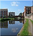


![Former mill in Loughborough in Leicestershire. In this 2013 image taken from the Grand Union Canal the former Victorian mill is still the HQ of 3M Healthcare. In 2018 3M moved out, and the mill is to be transformed into offices, apartments and shops. https://www.leicestermercury.co.uk/news/local-news/old-3m-health-care-hq-1507438 Ahead is Nottingham Road Bridge, No 38.[[[5991228]]][[[5991234]]][[[4883055]]] by Roger D Kidd – 26 August 2013](https://s3.geograph.org.uk/geophotos/05/99/12/5991219_2d45e36a_120x120.jpg)


![Former mill chimney in Loughborough, Leicestershire. Seen from the Grand Union Canal in 2013, this disused chimney is part of the Victorian mill occupied from the early 1950s to 2018 by the 3M Healthcare company.The mill is to be redeveloped into flats, shops and offices, but the chimney will be preserved.[[[5991228]]][[[4883055]]] by Roger D Kidd – 26 August 2013](https://s2.geograph.org.uk/geophotos/05/99/12/5991234_673a2817_120x120.jpg)
![Former mill chimney in Loughborough, Leicestershire. Seen from the Grand Union Canal in 2013, this disused chimney is part of the Victorian mill occupied from the early 1950s to 2018 by the 3M Healthcare company.The mill is to be redeveloped into flats, shops and offices, but the chimney will be preserved.[[[5991234]]][[[4883055]]] by Roger D Kidd – 26 August 2013](https://s0.geograph.org.uk/geophotos/05/99/12/5991228_9b64c0a2_120x120.jpg)


