CanalPlanAC

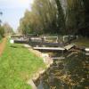
Towney Lock No 97

 
Towney Bridge, Aldermaston Wharf RG7 5FR, United Kingdom
 
Information about the place
Towney Lock No 97 is a minor waterways place on the River Kennet between Burghfield Bridge No 14 (Burghfield) (5 miles and 2½ furlongs and 5 locks to the east) and Newbury Lock No 85 (9 miles and 5¾ furlongs and 11 locks to the west).
 
 
The nearest place in the direction of Burghfield Bridge No 14 is Towney Bridge No 26; ½ furlongs away.
 
The nearest place in the direction of Newbury Lock No 85 is Padworth Swing Bridge No 27; 3 furlongs away.

Mooring here is tolerable (it's just about possible if really necessary).

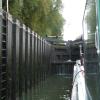
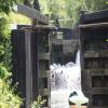
This is a lock with a rise of 9f8.


Amenities

Amenities here

 Total

Amenities nearby at Towney Bridge No 26

 Maxs Cafe & Truckstop
 
Maps
If you are a user and are logged on, or if you are actively planning a route, a map will be displayed here.
Show on external mapping site: Google | OSM | Bing
 
Additional information

A very deep lock

At the time of writing (Sept '10) there are about 4 boats moored between Padworth Swing Bridge and Towney Lock.

It is a nice tranquil area, with a big field for dogs to run in, there are trees both sides, so getting a sat signal can be a challenge and solar is limited.

There is a walk through from Towney lock to the A4 - take care crossing the railway - which comes out next to the comfort inn.

If you have a car, and ask nicely, they may let you use the car park if they are not too busy.

 
Navigational Notes

Useful to know - the downstream lock landing stage is NOT directly part of the lock and is approximately 100 yards downstream.

 
Photos
 
External websites
There are no links to external websites from here.
Why not log in and add some (select "External websites" from the menu (sometimes this is under "Edit"))?
 
Nearest facilities

Mouseover for more information or show routes to facility

Nearest water point

In the direction of Northcroft Lane Arm

Aldermaston Lock No 957½ furlongs and 2 locks away
On this waterway in the direction of Northcroft Lane Arm
Ham Manor Marina8 miles, 5¼ furlongs and 11 locks away
On this waterway in the direction of Northcroft Lane Arm
Kintbury Services15 miles, 6 furlongs and 20 locks away
Travel to Northcroft Lane Arm, then on the Kennet and Avon Canal (Main Line) to Kintbury Services
Station Road Bridge No 8318 miles, 5¾ furlongs and 23 locks away
Travel to Northcroft Lane Arm, then on the Kennet and Avon Canal (Main Line) to Station Road Bridge No 83

In the direction of High Bridge Reading

Tyle Mill Lock C&RT Services1 mile, 3¼ furlongs and 2 locks away
On this waterway in the direction of High Bridge Reading
Thames & Kennet Marina9 miles, 6½ furlongs and 10 locks away
Travel to High Bridge Reading, then on the River Thames (River Kennet) to Thames - Kennet Junction (Kennet Mouth), then on the River Thames (below Oxford) to Thames & Kennet Marina
Shiplake Lock14 miles, 3½ furlongs and 11 locks away
Travel to High Bridge Reading, then on the River Thames (River Kennet) to Thames - Kennet Junction (Kennet Mouth), then on the River Thames (below Oxford) to Shiplake Lock

Nearest rubbish disposal

In the direction of Northcroft Lane Arm

Aldermaston Lock No 957½ furlongs and 2 locks away
On this waterway in the direction of Northcroft Lane Arm
Ham Manor Marina8 miles, 5¼ furlongs and 11 locks away
On this waterway in the direction of Northcroft Lane Arm
Kintbury Services15 miles, 6 furlongs and 20 locks away
Travel to Northcroft Lane Arm, then on the Kennet and Avon Canal (Main Line) to Kintbury Services

In the direction of High Bridge Reading

Tyle Mill Lock C&RT Services1 mile, 3¼ furlongs and 2 locks away
On this waterway in the direction of High Bridge Reading
Shiplake Lock14 miles, 3½ furlongs and 11 locks away
Travel to High Bridge Reading, then on the River Thames (River Kennet) to Thames - Kennet Junction (Kennet Mouth), then on the River Thames (below Oxford) to Shiplake Lock
Mapledurham Lock14 miles, 6¾ furlongs and 11 locks away
Travel to High Bridge Reading, then on the River Thames (River Kennet) to Thames - Kennet Junction (Kennet Mouth), then on the River Thames (below Oxford) to Mapledurham Lock
Marsh Lock17 miles, 1¼ furlongs and 12 locks away
Travel to High Bridge Reading, then on the River Thames (River Kennet) to Thames - Kennet Junction (Kennet Mouth), then on the River Thames (below Oxford) to Marsh Lock

Nearest chemical toilet disposal

In the direction of Northcroft Lane Arm

Aldermaston Lock No 957½ furlongs and 2 locks away
On this waterway in the direction of Northcroft Lane Arm
Ham Manor Marina8 miles, 5¼ furlongs and 11 locks away
On this waterway in the direction of Northcroft Lane Arm
Kintbury Services15 miles, 6 furlongs and 20 locks away
Travel to Northcroft Lane Arm, then on the Kennet and Avon Canal (Main Line) to Kintbury Services
Station Road Bridge No 8318 miles, 5¾ furlongs and 23 locks away
Travel to Northcroft Lane Arm, then on the Kennet and Avon Canal (Main Line) to Station Road Bridge No 83

In the direction of High Bridge Reading

Tyle Mill Lock C&RT Services1 mile, 3¼ furlongs and 2 locks away
On this waterway in the direction of High Bridge Reading
Thames & Kennet Marina9 miles, 6½ furlongs and 10 locks away
Travel to High Bridge Reading, then on the River Thames (River Kennet) to Thames - Kennet Junction (Kennet Mouth), then on the River Thames (below Oxford) to Thames & Kennet Marina
Shiplake Lock14 miles, 3½ furlongs and 11 locks away
Travel to High Bridge Reading, then on the River Thames (River Kennet) to Thames - Kennet Junction (Kennet Mouth), then on the River Thames (below Oxford) to Shiplake Lock
Mapledurham Lock14 miles, 6¾ furlongs and 11 locks away
Travel to High Bridge Reading, then on the River Thames (River Kennet) to Thames - Kennet Junction (Kennet Mouth), then on the River Thames (below Oxford) to Mapledurham Lock

Nearest place to turn

In the direction of Northcroft Lane Arm

Winding Hole below Padworth Lock4¾ furlongs and 1 lock away
On this waterway in the direction of Northcroft Lane Arm
Aldermaston Arm7¼ furlongs and 2 locks away
On this waterway in the direction of Northcroft Lane Arm
Frouds Bridge Marina (entrance)2 miles and 3 locks away
On this waterway in the direction of Northcroft Lane Arm
Winding Hole below Heals Lock3 miles, 5¼ furlongs and 4 locks away
On this waterway in the direction of Northcroft Lane Arm
Winding Hole above Midgham Lock4 miles, 3½ furlongs and 6 locks away
On this waterway in the direction of Northcroft Lane Arm
Winding Hole below Monkey Marsh Lock6 miles and 7 locks away
On this waterway in the direction of Northcroft Lane Arm

In the direction of High Bridge Reading

Winding Hole by Ufton Swing Bridge6¼ furlongs and 1 lock away
On this waterway in the direction of High Bridge Reading
Tyle Mill Winding Hole1 mile, 1 furlong and 1 lock away
On this waterway in the direction of High Bridge Reading
Winding Hole below Tyle Mill Lock1 mile, 3½ furlongs and 2 locks away
On this waterway in the direction of High Bridge Reading
Draper's Osier Bed Stream Leaves1 mile, 6¼ furlongs and 2 locks away
On this waterway in the direction of High Bridge Reading
Winding Hole below Sulhampstead Lock2 miles, 1½ furlongs and 3 locks away
On this waterway in the direction of High Bridge Reading
Sheffield Lock Weir Entrance2 miles, 6 furlongs and 3 locks away
On this waterway in the direction of High Bridge Reading
Winding Hole below Garston Lock3 miles, 4¾ furlongs and 5 locks away
On this waterway in the direction of High Bridge Reading
Burghfield Mill Winding Hole4 miles, 3¾ furlongs and 5 locks away
On this waterway in the direction of High Bridge Reading
Burghfield Lock Weir Exit4 miles, 7¼ furlongs and 6 locks away
On this waterway in the direction of High Bridge Reading
Burghfield Island Entrance No 25 miles, 2¼ furlongs and 6 locks away
On this waterway in the direction of High Bridge Reading
Burghfield Island Entrance No 15 miles, 4¼ furlongs and 6 locks away
On this waterway in the direction of High Bridge Reading
Southcote Lock Weir Exit6 miles, 1 furlong and 7 locks away
On this waterway in the direction of High Bridge Reading
Fobney Lock Weir Entrance6 miles, 3 furlongs and 7 locks away
On this waterway in the direction of High Bridge Reading
Winding Hole above Fobney Lock6 miles, 6¾ furlongs and 7 locks away
On this waterway in the direction of High Bridge Reading

Nearest self-operated pump-out

In the direction of Northcroft Lane Arm

Kintbury Services15 miles, 6 furlongs and 20 locks away
Travel to Northcroft Lane Arm, then on the Kennet and Avon Canal (Main Line) to Kintbury Services

In the direction of High Bridge Reading

Tyle Mill Lock C&RT Services1 mile, 3¼ furlongs and 2 locks away
On this waterway in the direction of High Bridge Reading
Mapledurham Lock14 miles, 6¾ furlongs and 11 locks away
Travel to High Bridge Reading, then on the River Thames (River Kennet) to Thames - Kennet Junction (Kennet Mouth), then on the River Thames (below Oxford) to Mapledurham Lock

Nearest boatyard pump-out

In the direction of Northcroft Lane Arm

Newbury Marina9 miles, 2 furlongs and 12 locks away
On this waterway in the direction of Northcroft Lane Arm

In the direction of High Bridge Reading

Thames & Kennet Marina9 miles, 6½ furlongs and 10 locks away
Travel to High Bridge Reading, then on the River Thames (River Kennet) to Thames - Kennet Junction (Kennet Mouth), then on the River Thames (below Oxford) to Thames & Kennet Marina
Direction of TV transmitter (From Wolfbane Cybernetic)
 
 
Geograph
 
Wikipedia

Wikipedia has a page about Towney Lock

Towney Lock is a lock on the Kennet and Avon Canal, between Aldermaston Wharf and Sulhamstead, Berkshire, England.

Towney Lock was built between 1718 and 1723 under the supervision of the engineer John Hore of Newbury. The canal is administered by the Canal & River Trust. The lock has a rise/fall of 9 ft 8 in (2.95 m).

The lock was deepened during restoration work in the 1970s when Ufton Lock was removed.

Other Wikipedia pages that might relate to Towney Lock
[List of locks on the Kennet and Avon Canal] interest. G Ufton Lock is still extant, but the gates have been removed so that boats go straight through. The next lock above, Towney Lock, was deepened [Ufton Lock] the shallow lock was deemed unpractical and instead the rebuilt Towney Lock was deepened to cater for the difference in level. The lock gates were removed [Townie] Townie, eponym of a resident of a town Townie may refer to: Towney Lock, Berkshire, nicknamed "Townie" Townie, as in town and gown, a term commonly used [Kennet and Avon Canal] second-deepest canal lock. Just above the Deep Lock is another side pound as a reservoir for refilling the lock, followed by Wash House Lock. After a slightly [Padworth Lock] Lock is a lock on the Kennet and Avon Canal, at Aldermaston Wharf in the civil parish of Padworth in the English county of Berkshire. Padworth Lock was [Tyle Mill Lock] Lock (grid reference SU626691) is a lock situated near Tyle Mill and the village of Sulhamstead on the Kennet and Avon Canal, England. Tyle Mill Lock [John Hore] January 2017. "TOWNEY LOCK (Lock 97)". www.heritagegateway.org.uk. Heritage Gateway. Retrieved 14 January 2017. "TYLE MILL LOCK (Lock 99)". www.heritagegateway [Cleverman] avoid capture, she makes her way to the Zone and befriends Alinta. Tysan Towney as Djukara, a young Hairy man, son of Araluen and Boondee, brother to Latani [Ufton Nervet] before subsequently passing over a set of points for the Down Goods Loop at Towney, causing a major derailment. The level crossing, called Ufton (but more
 
Google

Results of Google Search

11 :: Kennet Navigation from Reading to Newbury :: Geograph ...
Towney Lock No.97: Padworth Swing Bridge: Padworth Lock No.96: Aldermaston Wharf: Aldermaston Lock No.95: Aldermaston Lift Bridge:.
Towney Lock (No.97), Kennet & Avon Canal © N Chadwick ...
Apr 1, 2016 ... SU6068 :: Towney Lock (No.97), Kennet & Avon Canal, near to Aldermaston Wharf, West Berkshire, Great Britain by N Chadwick.
10 :: Kennet Navigation from Reading to Newbury :: Geograph ...
Ufton Lock No.98 and Swing Bridge: Towney Lock No.97 and Bridge: 2011. SU6168 : Ufton Bridge by Bill Nicholls. View along the Kennet towards Ufton Bridge ...
4 :: Kennet Navigation from Reading to Newbury :: Geograph Britain ...
Burghfield Island Boat Club: Burghfield Bridge No.14 ... The gates control the flow of water around Southcote Lock. The houses of Southcote to the north of the ...
Tour 2000 BCN + page 32
The bored Blakes Lock keeper was not interested in seeing our Gold licence or the ... We creep into Towney Lock No 97 as the gates were just about open.
DW Race 2nd day Map - Wey Kayak Club
... [No 27]43.844.4445.113/05/200881.280.5679.9Towney Lock (No 97) [L] Towney Bridge [No 26]Ufton Nervet Lock ( No 98 ) (Removed)Ufton swing Bridge [ No ...
List of locks on the Kennet and Avon Canal - Wikipedia
The Kennet and Avon Canal is a canal in southern England. The name may refer to either the ... 97, Towney Lock · SU610680, 9 feet 8 inches (2.95 m). 98, Site of ... The next lock above, Towney Lock, was deepened when rebuilt to allow for the lower downstream water level. Blake's Lock is ... "Bradford on Avon Lock No 14".
24 hours DW Race Map - Wey Kayak Club
45.1 79.9. Towney Lock (No 97) [L]. Towney Bridge [No 26]. Ufton Nervet Lock ( No 98 ) (Removed). Ufton swing Bridge [ No 25A ]. Tyle Mill Lock (No 99) [R].
Lady Hilda - youth and community narrowboat - Posts | Facebook
Julie Myers Is that the A4174 just downstream of Hanham lock? · 3d · Lady Hilda - youth and community ... Lady Hilda - youth and community narrowboat Yes, this is Towney Lock no. 97 near Aldermaston. The narrow part is the remains of the ...
D.A. Townley
D.A. Townley is working hard to serve you even better. ... Non-Destructive Testing Members (NDT); Ironworkers Local 97 Members; Heat & Frost Insulators Local ...