CanalPlanAC

Drawbridge Farm Drawbridge No 28

 
Also known as Drawbridge Farm Lift Bridge No 28
Also known as: Drawbridge Farm Bridge
Drawbridge, Lapworth B94 6AP, United Kingdom
 
Information about the place
Drawbridge Farm Drawbridge No 28 is a minor waterways place on the Stratford-on-Avon Canal (Northern Section) between Lapworth Wharf (1 mile and 2½ furlongs and 11 locks to the east) and King's Norton Junction (Junction of Stratford and Worcester and Birmingham Canals) (10 miles and 5¼ furlongs to the northwest).
 
 
The nearest place in the direction of Lapworth Wharf is Lapworth Top Lock No 2; 1¾ furlongs away.
 
The nearest place in the direction of King's Norton Junction is Wharf Lane Bridge Winding Hole; 2 furlongs away.

Mooring here is excellent (this is a really good mooring).

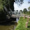
There is a lift bridge here. The bridge requires a windlass to operate it.


Amenities
 
Maps
If you are a user and are logged on, or if you are actively planning a route, a map will be displayed here.
Show on external mapping site: Google | OSM | Bing
 
Photos
 
External websites
There are no links to external websites from here.
Why not log in and add some (select "External websites" from the menu (sometimes this is under "Edit"))?
 
Nearest facilities

Mouseover for more information or show routes to facility

Nearest water point

In the direction of King's Norton Junction

Swallow Wharf2¼ furlongs away
On this waterway in the direction of King's Norton Junction
Waring's Green Wharf2 miles, 7¾ furlongs away
On this waterway in the direction of King's Norton Junction
Earlswood Reservoir Feeder3 miles, 7¾ furlongs away
On this waterway in the direction of King's Norton Junction
Yardley Wood Water Point8 miles, ¾ furlongs away
On this waterway in the direction of King's Norton Junction
King's Norton Water Point10 miles, 6 furlongs away
Travel to King's Norton Junction, then on the Worcester and Birmingham Canal (Diglis Basin to King's Norton Junction) to King's Norton Water Point
Hopwood Visitor Moorings13 miles, 7¼ furlongs away
Travel to King's Norton Junction, then on the Worcester and Birmingham Canal (Diglis Basin to King's Norton Junction) to Hopwood Visitor Moorings
Holliday Wharf15 miles, 7¼ furlongs away
Travel to King's Norton Junction, then on the Worcester and Birmingham Canal (Birmingham to King's Norton) to Holliday Wharf
Worcester Bar16 miles, 1¼ furlongs away
Travel to King's Norton Junction, then on the Worcester and Birmingham Canal (Birmingham to King's Norton) to Worcester Bar
Hawne Basin16 miles, 2 furlongs away
Travel to King's Norton Junction, then on the Worcester and Birmingham Canal (Birmingham to King's Norton) to New Selly Oak Junction, then on the Birmingham Canal Navigations (Dudley Canal No 2 - Lapal Canal - Original Line East End ) to Somery Road Bridge, then on the Birmingham Canal Navigations (Dudley Canal No 2 - Lapal Canal - Abandoned Line ) to Lapal Canal - New line Diverges From Original Route, then on the Birmingham Canal Navigations (Dudley Canal No 2 - Lapal Canal - Original Line West End ) to Coombeswood, then on the Birmingham Canal Navigations (Dudley Canal No 2 - Coombeswood ) to Hawne Basin
Cambrian Wharf Services16 miles, 5½ furlongs away
Travel to King's Norton Junction, then on the Worcester and Birmingham Canal (Birmingham to King's Norton) to Worcester Bar, then on the Birmingham Canal Navigations (Main Line) to Deep Cuttings Junction, then on the Birmingham Canal Navigations (Newhall Branch) to Cambrian Wharf Services
Bumble Hole Visitor Centre18 miles, 7¾ furlongs away
Travel to King's Norton Junction, then on the Worcester and Birmingham Canal (Birmingham to King's Norton) to New Selly Oak Junction, then on the Birmingham Canal Navigations (Dudley Canal No 2 - Lapal Canal - Original Line East End ) to Somery Road Bridge, then on the Birmingham Canal Navigations (Dudley Canal No 2 - Lapal Canal - Abandoned Line ) to Lapal Canal - New line Diverges From Original Route, then on the Birmingham Canal Navigations (Dudley Canal No 2 - Lapal Canal - Original Line West End ) to Coombeswood, then on the Birmingham Canal Navigations (Dudley Canal No 2 - Coombeswood ) to Bumble Hole Visitor Centre
Tardebigge Wharf19 miles, 3 furlongs away
Travel to King's Norton Junction, then on the Worcester and Birmingham Canal (Diglis Basin to King's Norton Junction) to Tardebigge Wharf

In the direction of Kingswood Junction (south)

Old Warwick Road Bridge No 351 mile, 6 furlongs and 17 locks away
On this waterway in the direction of Kingswood Junction (south)
Lapworth Services1 mile, 7¾ furlongs and 19 locks away
Travel to Kingswood Junction (south), then on the Stratford-on-Avon Canal (Southern Section) to Lapworth Services
Turners Green Bridge No 632 miles, 7¼ furlongs and 19 locks away
Travel to Kingswood Junction (north), then on the Stratford-on-Avon Canal (Kingswood Branch) to Kingswood Junction, then on the Grand Union Canal (Warwick and Birmingham Canal: widened section - Main Line) to Turners Green Bridge No 63
Rising Lane Bridge No 663 miles, 1¼ furlongs and 19 locks away
Travel to Kingswood Junction (north), then on the Stratford-on-Avon Canal (Kingswood Branch) to Kingswood Junction, then on the Grand Union Canal (Warwick and Birmingham Canal: widened section - Main Line) to Rising Lane Bridge No 66
Knowle Bottom Lock No 475 miles, 4¼ furlongs and 19 locks away
Travel to Kingswood Junction (north), then on the Stratford-on-Avon Canal (Kingswood Branch) to Kingswood Junction, then on the Grand Union Canal (Warwick and Birmingham Canal: widened section - Main Line) to Knowle Bottom Lock No 47
Hatton Top Lock No 467 miles, 1½ furlongs and 19 locks away
Travel to Kingswood Junction (north), then on the Stratford-on-Avon Canal (Kingswood Branch) to Kingswood Junction, then on the Grand Union Canal (Warwick and Birmingham Canal: widened section - Main Line) to Hatton Top Lock No 46
Knowle Top Lock No 515 miles, 6 furlongs and 23 locks away
Travel to Kingswood Junction (north), then on the Stratford-on-Avon Canal (Kingswood Branch) to Kingswood Junction, then on the Grand Union Canal (Warwick and Birmingham Canal: widened section - Main Line) to Knowle Top Lock No 51
Barston Lane Bridge No 767 miles, 5¼ furlongs and 24 locks away
Travel to Kingswood Junction (north), then on the Stratford-on-Avon Canal (Kingswood Branch) to Kingswood Junction, then on the Grand Union Canal (Warwick and Birmingham Canal: widened section - Main Line) to Barston Lane Bridge No 76

Nearest rubbish disposal

In the direction of King's Norton Junction

Waring's Green Wharf2 miles, 7¾ furlongs away
On this waterway in the direction of King's Norton Junction
Worcester Bar16 miles, 1¼ furlongs away
Travel to King's Norton Junction, then on the Worcester and Birmingham Canal (Birmingham to King's Norton) to Worcester Bar
Hawne Basin16 miles, 2 furlongs away
Travel to King's Norton Junction, then on the Worcester and Birmingham Canal (Birmingham to King's Norton) to New Selly Oak Junction, then on the Birmingham Canal Navigations (Dudley Canal No 2 - Lapal Canal - Original Line East End ) to Somery Road Bridge, then on the Birmingham Canal Navigations (Dudley Canal No 2 - Lapal Canal - Abandoned Line ) to Lapal Canal - New line Diverges From Original Route, then on the Birmingham Canal Navigations (Dudley Canal No 2 - Lapal Canal - Original Line West End ) to Coombeswood, then on the Birmingham Canal Navigations (Dudley Canal No 2 - Coombeswood ) to Hawne Basin
Cambrian Wharf Services16 miles, 5½ furlongs away
Travel to King's Norton Junction, then on the Worcester and Birmingham Canal (Birmingham to King's Norton) to Worcester Bar, then on the Birmingham Canal Navigations (Main Line) to Deep Cuttings Junction, then on the Birmingham Canal Navigations (Newhall Branch) to Cambrian Wharf Services
Tardebigge Wharf19 miles, 3 furlongs away
Travel to King's Norton Junction, then on the Worcester and Birmingham Canal (Diglis Basin to King's Norton Junction) to Tardebigge Wharf
Farmers Bridge Lock No 817 miles, ¾ furlongs and 7 locks away
Travel to King's Norton Junction, then on the Worcester and Birmingham Canal (Birmingham to King's Norton) to Worcester Bar, then on the Birmingham Canal Navigations (Main Line) to Deep Cuttings Junction, then on the Birmingham Canal Navigations (Newhall Branch) to Farmers Bridge Junction, then on the Birmingham Canal Navigations (Birmingham and Fazeley Canal - Main Line) to Farmers Bridge Lock No 8

In the direction of Kingswood Junction (south)

Lapworth Lock No 211 mile, 7 furlongs and 18 locks away
On this waterway in the direction of Kingswood Junction (south)
Hatton Top Lock No 467 miles, 1½ furlongs and 19 locks away
Travel to Kingswood Junction (north), then on the Stratford-on-Avon Canal (Kingswood Branch) to Kingswood Junction, then on the Grand Union Canal (Warwick and Birmingham Canal: widened section - Main Line) to Hatton Top Lock No 46
Knowle Top Lock No 515 miles, 6 furlongs and 23 locks away
Travel to Kingswood Junction (north), then on the Stratford-on-Avon Canal (Kingswood Branch) to Kingswood Junction, then on the Grand Union Canal (Warwick and Birmingham Canal: widened section - Main Line) to Knowle Top Lock No 51
Lowsonford Lock No 314 miles and 28 locks away
Travel to Kingswood Junction (south), then on the Stratford-on-Avon Canal (Southern Section) to Lowsonford Lock No 31
Hill Farm Marina8 miles, 4¾ furlongs and 36 locks away
Travel to Kingswood Junction (south), then on the Stratford-on-Avon Canal (Southern Section) to Hill Farm Marina
Saltisford Canal Trust Services Pontoon9 miles, 4½ furlongs and 40 locks away
Travel to Kingswood Junction (north), then on the Stratford-on-Avon Canal (Kingswood Branch) to Kingswood Junction, then on the Grand Union Canal (Warwick and Birmingham Canal: widened section - Main Line) to Budbrooke Junction, then on the Grand Union Canal (Warwick and Birmingham Canal: widened section - Saltisford Arm) to Saltisford Canal Trust Services Pontoon
Radford Bottom Lock No 2314 miles, 7½ furlongs and 42 locks away
Travel to Kingswood Junction (north), then on the Stratford-on-Avon Canal (Kingswood Branch) to Kingswood Junction, then on the Grand Union Canal (Warwick and Birmingham Canal: widened section - Main Line) to Budbrooke Junction, then on the Grand Union Canal (Warwick and Napton Canal) to Radford Bottom Lock No 23
Old "Valley Cruisers" Base14 miles, 2½ furlongs and 49 locks away
Travel to Kingswood Junction (south), then on the Stratford-on-Avon Canal (Southern Section) to Old "Valley Cruisers" Base
The Old Bathing Place15 miles, 5½ furlongs and 54 locks away
Travel to Kingswood Junction (south), then on the Stratford-on-Avon Canal (Southern Section) to Junction of Stratford Canal and River Avon, then on the River Avon - Warwickshire (Upper Avon Navigation) to The Old Bathing Place
Colin P Witter Lock15 miles, 3¾ furlongs and 54 locks away
Travel to Kingswood Junction (south), then on the Stratford-on-Avon Canal (Southern Section) to Junction of Stratford Canal and River Avon, then on the River Avon - Warwickshire (Upper Avon Navigation) to Colin P Witter Lock
Bascote Bridge No 2718 miles, 4½ furlongs and 52 locks away
Travel to Kingswood Junction (north), then on the Stratford-on-Avon Canal (Kingswood Branch) to Kingswood Junction, then on the Grand Union Canal (Warwick and Birmingham Canal: widened section - Main Line) to Budbrooke Junction, then on the Grand Union Canal (Warwick and Napton Canal) to Bascote Bridge No 27
Weir Brake Lock15 miles, 7½ furlongs and 55 locks away
Travel to Kingswood Junction (south), then on the Stratford-on-Avon Canal (Southern Section) to Junction of Stratford Canal and River Avon, then on the River Avon - Warwickshire (Upper Avon Navigation) to Weir Brake Lock
Luddington Lock Wharf18 miles, 1¾ furlongs and 56 locks away
Travel to Kingswood Junction (south), then on the Stratford-on-Avon Canal (Southern Section) to Junction of Stratford Canal and River Avon, then on the River Avon - Warwickshire (Upper Avon Navigation) to Luddington Lock Wharf

Nearest chemical toilet disposal

In the direction of King's Norton Junction

Swallow Wharf2¼ furlongs away
On this waterway in the direction of King's Norton Junction
Waring's Green Wharf2 miles, 7¾ furlongs away
On this waterway in the direction of King's Norton Junction
Earlswood Reservoir Feeder3 miles, 7¾ furlongs away
On this waterway in the direction of King's Norton Junction
Holliday Wharf15 miles, 7¼ furlongs away
Travel to King's Norton Junction, then on the Worcester and Birmingham Canal (Birmingham to King's Norton) to Holliday Wharf
Worcester Bar16 miles, 1¼ furlongs away
Travel to King's Norton Junction, then on the Worcester and Birmingham Canal (Birmingham to King's Norton) to Worcester Bar
Hawne Basin16 miles, 2 furlongs away
Travel to King's Norton Junction, then on the Worcester and Birmingham Canal (Birmingham to King's Norton) to New Selly Oak Junction, then on the Birmingham Canal Navigations (Dudley Canal No 2 - Lapal Canal - Original Line East End ) to Somery Road Bridge, then on the Birmingham Canal Navigations (Dudley Canal No 2 - Lapal Canal - Abandoned Line ) to Lapal Canal - New line Diverges From Original Route, then on the Birmingham Canal Navigations (Dudley Canal No 2 - Lapal Canal - Original Line West End ) to Coombeswood, then on the Birmingham Canal Navigations (Dudley Canal No 2 - Coombeswood ) to Hawne Basin
Cambrian Wharf Services16 miles, 5½ furlongs away
Travel to King's Norton Junction, then on the Worcester and Birmingham Canal (Birmingham to King's Norton) to Worcester Bar, then on the Birmingham Canal Navigations (Main Line) to Deep Cuttings Junction, then on the Birmingham Canal Navigations (Newhall Branch) to Cambrian Wharf Services
Tardebigge Wharf19 miles, 3 furlongs away
Travel to King's Norton Junction, then on the Worcester and Birmingham Canal (Diglis Basin to King's Norton Junction) to Tardebigge Wharf
Cuckoo Wharf19 miles, 5½ furlongs and 24 locks away
Travel to King's Norton Junction, then on the Worcester and Birmingham Canal (Birmingham to King's Norton) to Worcester Bar, then on the Birmingham Canal Navigations (Main Line) to Deep Cuttings Junction, then on the Birmingham Canal Navigations (Newhall Branch) to Farmers Bridge Junction, then on the Birmingham Canal Navigations (Birmingham and Fazeley Canal - Main Line) to Cuckoo Wharf

In the direction of Kingswood Junction (south)

Lapworth Services1 mile, 7¾ furlongs and 19 locks away
Travel to Kingswood Junction (south), then on the Stratford-on-Avon Canal (Southern Section) to Lapworth Services
Hatton Top Lock No 467 miles, 1½ furlongs and 19 locks away
Travel to Kingswood Junction (north), then on the Stratford-on-Avon Canal (Kingswood Branch) to Kingswood Junction, then on the Grand Union Canal (Warwick and Birmingham Canal: widened section - Main Line) to Hatton Top Lock No 46
Knowle Top Lock No 515 miles, 6 furlongs and 23 locks away
Travel to Kingswood Junction (north), then on the Stratford-on-Avon Canal (Kingswood Branch) to Kingswood Junction, then on the Grand Union Canal (Warwick and Birmingham Canal: widened section - Main Line) to Knowle Top Lock No 51
Saltisford Canal Trust Services Pontoon9 miles, 4½ furlongs and 40 locks away
Travel to Kingswood Junction (north), then on the Stratford-on-Avon Canal (Kingswood Branch) to Kingswood Junction, then on the Grand Union Canal (Warwick and Birmingham Canal: widened section - Main Line) to Budbrooke Junction, then on the Grand Union Canal (Warwick and Birmingham Canal: widened section - Saltisford Arm) to Saltisford Canal Trust Services Pontoon
Warwickshire Narrowboat Hire Base10 miles, 6¼ furlongs and 42 locks away
Travel to Kingswood Junction (north), then on the Stratford-on-Avon Canal (Kingswood Branch) to Kingswood Junction, then on the Grand Union Canal (Warwick and Birmingham Canal: widened section - Main Line) to Budbrooke Junction, then on the Grand Union Canal (Warwick and Napton Canal) to Warwickshire Narrowboat Hire Base
Fosse Wharf15 miles, 7 furlongs and 45 locks away
Travel to Kingswood Junction (north), then on the Stratford-on-Avon Canal (Kingswood Branch) to Kingswood Junction, then on the Grand Union Canal (Warwick and Birmingham Canal: widened section - Main Line) to Budbrooke Junction, then on the Grand Union Canal (Warwick and Napton Canal) to Fosse Wharf
Old "Valley Cruisers" Base14 miles, 2½ furlongs and 49 locks away
Travel to Kingswood Junction (south), then on the Stratford-on-Avon Canal (Southern Section) to Old "Valley Cruisers" Base
Luddington Lock Wharf18 miles, 1¾ furlongs and 56 locks away
Travel to Kingswood Junction (south), then on the Stratford-on-Avon Canal (Southern Section) to Junction of Stratford Canal and River Avon, then on the River Avon - Warwickshire (Upper Avon Navigation) to Luddington Lock Wharf

Nearest place to turn

In the direction of King's Norton Junction

Wharf Lane Bridge Winding Hole2 furlongs away
On this waterway in the direction of King's Norton Junction
Hockley Heath Wharf6¾ furlongs away
On this waterway in the direction of King's Norton Junction On this waterway in the direction of King's Norton Junction
Earlswood Reservoir Feeder3 miles, 7¾ furlongs away
On this waterway in the direction of King's Norton Junction
Tyburn Farm Winding Hole5 miles, 7 furlongs away
On this waterway in the direction of King's Norton Junction
Yardley Wood Winding Hole8 miles, ½ furlongs away
On this waterway in the direction of King's Norton Junction
King's Norton Junction10 miles, 5¼ furlongs away
On this waterway in the direction of King's Norton Junction
Wast Hill Tunnel (east portal)11 miles, 5½ furlongs away
Travel to King's Norton Junction, then on the Worcester and Birmingham Canal (Diglis Basin to King's Norton Junction) to Wast Hill Tunnel (east portal)
Selly Oak Winding Hole12 miles, 7½ furlongs away
Travel to King's Norton Junction, then on the Worcester and Birmingham Canal (Birmingham to King's Norton) to Selly Oak Winding Hole
Hopwood Bridge Winding Hole13 miles, 7 furlongs away
Travel to King's Norton Junction, then on the Worcester and Birmingham Canal (Diglis Basin to King's Norton Junction) to Hopwood Bridge Winding Hole
The Vale Winding Hole14 miles, 6 furlongs away
Travel to King's Norton Junction, then on the Worcester and Birmingham Canal (Birmingham to King's Norton) to The Vale Winding Hole
Crown Meadow Arm15 miles, 5¼ furlongs away
Travel to King's Norton Junction, then on the Worcester and Birmingham Canal (Diglis Basin to King's Norton Junction) to Crown Meadow Arm
Gas Street Basin16 miles, 1 furlong away
Travel to King's Norton Junction, then on the Worcester and Birmingham Canal (Birmingham to King's Norton) to Gas Street Basin
Gas Street Basin (Old Wharf)16 miles, 1½ furlongs away
Travel to King's Norton Junction, then on the Worcester and Birmingham Canal (Birmingham to King's Norton) to Worcester Bar, then on the Birmingham Canal Navigations (Main Line) to Gas Street Basin (Old Wharf)
Hawne Basin16 miles, 2 furlongs away
Travel to King's Norton Junction, then on the Worcester and Birmingham Canal (Birmingham to King's Norton) to New Selly Oak Junction, then on the Birmingham Canal Navigations (Dudley Canal No 2 - Lapal Canal - Original Line East End ) to Somery Road Bridge, then on the Birmingham Canal Navigations (Dudley Canal No 2 - Lapal Canal - Abandoned Line ) to Lapal Canal - New line Diverges From Original Route, then on the Birmingham Canal Navigations (Dudley Canal No 2 - Lapal Canal - Original Line West End ) to Coombeswood, then on the Birmingham Canal Navigations (Dudley Canal No 2 - Coombeswood ) to Hawne Basin
Deep Cuttings Junction16 miles, 3¾ furlongs away
Travel to King's Norton Junction, then on the Worcester and Birmingham Canal (Birmingham to King's Norton) to Worcester Bar, then on the Birmingham Canal Navigations (Main Line) to Deep Cuttings Junction
Scarfield Hill Bridge Winding Hole16 miles, 3¾ furlongs away
Travel to King's Norton Junction, then on the Worcester and Birmingham Canal (Diglis Basin to King's Norton Junction) to Scarfield Hill Bridge Winding Hole
Old Turn Junction16 miles, 4 furlongs away
Travel to King's Norton Junction, then on the Worcester and Birmingham Canal (Birmingham to King's Norton) to Worcester Bar, then on the Birmingham Canal Navigations (Main Line) to Old Turn Junction
Monument Lane Basin17 miles, 1¼ furlongs away
Travel to King's Norton Junction, then on the Worcester and Birmingham Canal (Birmingham to King's Norton) to Worcester Bar, then on the Birmingham Canal Navigations (Main Line) to Monument Lane Basin
Sandy Turn17 miles, 3 furlongs away
Travel to King's Norton Junction, then on the Worcester and Birmingham Canal (Birmingham to King's Norton) to Worcester Bar, then on the Birmingham Canal Navigations (Main Line) to Sandy Turn

Nearest self-operated pump-out

Nearest boatyard pump-out

In the direction of King's Norton Junction

Swallow Wharf2¼ furlongs away
On this waterway in the direction of King's Norton Junction
Waring's Green Wharf2 miles, 7¾ furlongs away
On this waterway in the direction of King's Norton Junction
Earlswood Reservoir Feeder3 miles, 7¾ furlongs away
On this waterway in the direction of King's Norton Junction
Hawne Basin16 miles, 2 furlongs away
Travel to King's Norton Junction, then on the Worcester and Birmingham Canal (Birmingham to King's Norton) to New Selly Oak Junction, then on the Birmingham Canal Navigations (Dudley Canal No 2 - Lapal Canal - Original Line East End ) to Somery Road Bridge, then on the Birmingham Canal Navigations (Dudley Canal No 2 - Lapal Canal - Abandoned Line ) to Lapal Canal - New line Diverges From Original Route, then on the Birmingham Canal Navigations (Dudley Canal No 2 - Lapal Canal - Original Line West End ) to Coombeswood, then on the Birmingham Canal Navigations (Dudley Canal No 2 - Coombeswood ) to Hawne Basin
Sherborne Wharf Services16 miles, 5¾ furlongs away
Travel to King's Norton Junction, then on the Worcester and Birmingham Canal (Birmingham to King's Norton) to Worcester Bar, then on the Birmingham Canal Navigations (Main Line) to Sherborne Wharf Services
Withymoor Island Service Wharf19 miles, 3 furlongs away
Travel to King's Norton Junction, then on the Worcester and Birmingham Canal (Birmingham to King's Norton) to New Selly Oak Junction, then on the Birmingham Canal Navigations (Dudley Canal No 2 - Lapal Canal - Original Line East End ) to Somery Road Bridge, then on the Birmingham Canal Navigations (Dudley Canal No 2 - Lapal Canal - Abandoned Line ) to Lapal Canal - New line Diverges From Original Route, then on the Birmingham Canal Navigations (Dudley Canal No 2 - Lapal Canal - Original Line West End ) to Coombeswood, then on the Birmingham Canal Navigations (Dudley Canal No 2 - Coombeswood ) to Withymoor Island Service Wharf

In the direction of Kingswood Junction (south)

Barston Lane Bridge No 767 miles, 5¼ furlongs and 24 locks away
Travel to Kingswood Junction (north), then on the Stratford-on-Avon Canal (Kingswood Branch) to Kingswood Junction, then on the Grand Union Canal (Warwick and Birmingham Canal: widened section - Main Line) to Barston Lane Bridge No 76
Hill Farm Marina8 miles, 4¾ furlongs and 36 locks away
Travel to Kingswood Junction (south), then on the Stratford-on-Avon Canal (Southern Section) to Hill Farm Marina
Saltisford Canal Trust Services Pontoon9 miles, 4½ furlongs and 40 locks away
Travel to Kingswood Junction (north), then on the Stratford-on-Avon Canal (Kingswood Branch) to Kingswood Junction, then on the Grand Union Canal (Warwick and Birmingham Canal: widened section - Main Line) to Budbrooke Junction, then on the Grand Union Canal (Warwick and Birmingham Canal: widened section - Saltisford Arm) to Saltisford Canal Trust Services Pontoon
Warwickshire Narrowboat Hire Base10 miles, 6¼ furlongs and 42 locks away
Travel to Kingswood Junction (north), then on the Stratford-on-Avon Canal (Kingswood Branch) to Kingswood Junction, then on the Grand Union Canal (Warwick and Birmingham Canal: widened section - Main Line) to Budbrooke Junction, then on the Grand Union Canal (Warwick and Napton Canal) to Warwickshire Narrowboat Hire Base
Delta Marine Services11 miles and 42 locks away
Travel to Kingswood Junction (north), then on the Stratford-on-Avon Canal (Kingswood Branch) to Kingswood Junction, then on the Grand Union Canal (Warwick and Birmingham Canal: widened section - Main Line) to Budbrooke Junction, then on the Grand Union Canal (Warwick and Napton Canal) to Delta Marine Services
Direction of TV transmitter (From Wolfbane Cybernetic)
 
 
Geograph
 
Wikipedia

There is no page on Wikipedia called “Drawbridge Farm Drawbridge”

Wikipedia pages that might relate to Drawbridge Farm Drawbridge
[Walter Drawbridge Crick] Walter Drawbridge Crick (15 Dec. 1857, Hanslope – 23 Dec. 1903) was an English businessman, amateur geologist and palaeontologist. He published with Charles [Drawbridge, Cornwall] Drawbridge is a hamlet in the parish of St Neot (where the 2011 census was included), Cornwall, England, UK. Cornwall portal Ordnance Survey: Landranger [North Station] under the TD Garden arena, with the platforms extending north towards drawbridges over the Charles River. The eponymous subway station, served by the Green [Bay Farm Island Bridge] San Leandro Bay Bridge, better known as the Bay Farm Island Bridge, is a single-leaf bascule drawbridge spanning the San Leandro Channel, the inlet of [Vischering Castle] castle consists of outer defensive courtyard, defensive gateways, moat, drawbridge, main building and chapel. The sandstone walls, the red tile roofs as [The Friendly Giant] his castle, telling them that he'll meet them there after letting the drawbridge down and opening the front doors. The traditional tune "Early One Morning" [Mill Basin, Brooklyn] neighborhood in the 1930s, and it opened in 1940. The construction of a drawbridge along the parkway, traversing Mill Basin, was approved in 1939 and completed [Château de Rully] protective broad, deep moat surrounding the base, as well as a single drawbridge, the location of which is still visible on the southern face. In the 15th [Newburyport/Rockport Line] service curtailments for drawbridge work. The Gloucester Drawbridge over the Annisquam River consists of a steel drawbridge and western approach span [Chelsea Street Bridge] construction project replaced the previous bridge, a single-leaf bascule-type drawbridge. The span is 450 feet (140 m) with a vertical clearance, when opened,
 
Google

Results of Google Search

Stone Bridge Farms is an all-inclusive wedding and event venue ...
See Our Daily Menu Below. Due to current concerns, Stone Bridge Farms is only doing take-out orders and curb-side pickup only. No dine-in orders.
Bay Farm Bike Bridge - 18 Photos & 12 Reviews - Landmarks ...
12 reviews of Bay Farm Bike Bridge "The bike bridge is hot! ... No more one way bike riding on the narrow pedestrian walkway on the Bay Farm ... 12/28/2009.
28 Bridge End Farm Ln, Sandy Hook, CT 06482 - realtor.com®
View 34 photos for 28 Bridge End Farm Ln, Sandy Hook, CT 06482 a 4 bed, 3 bath, 2856 Sq. ... Estimated values are not a substitute for professional expertise.
Covered Bridge Farm | Michigan
Joseph River. Restoration of the main barn, construction of a bathroom building, pavilion, boardwalk, and non-motorized boat launch are expected to be ...
Covered Bridge Farm Table
The Covered Bridge Farm Table Restaurant & Bar in Campton, NH, by Blair Covered Bridge brings delicious food and lots of fun in the bar with live ...
Hickory Bridge Farm's "Music to your Ears"
A wonderful addition to your dining experience at Hickory Bridge Farm – enjoy a ... February 28th – Ed Bower, pianist; March 6th – "Forever Young"; March 13th ...
Committee seeks feedback on ways to bridge sustainability research ...
Jan 28, 2020 ... January 28, 2020. Committee seeks feedback on ways to bridge sustainability research, education and impact ... They are also not making specific recommendations for re-organizing units on campus. ... on Stanford's external engagement · Q-FARM initiative to bolster quantum research at Stanford-SLAC ...
Drawbridge Operation Regulation; San Leandro ... - Federal Register
Dec 20, 2017 ... 24, 25, 26, 27, 28, 29, 30 ... Drawbridge Operation Regulation; San Leandro Bay, Between Alameda and Bay Farm Island, CA ... Effective Date: 01/02/2018; Document Type: Rule; Document Citation: 82 FR 60315; Page: 60315-60316 (2 pages); CFR: 33 CFR 117; Agency/Docket Number: Docket No.
High Bridge Wind
4, 04/08/2020, Motions, Cover Letter, Guilford Coalition of Non-Participating ... Environmental Justice Areas, High Bridge Wind, LLC, 96, Figure 28-1 Update.
Golden Gate Bridge opens - HISTORY
On May 28, the Golden Gate Bridge opened to vehicular traffic. ... as 1872, but it was not until the early 1920s that public opinion in San Francisco began to ... of the Golden Gate Bridge and Highway District voted 3-1 to put their homes, farms,  ...