CanalPlanAC

Saddleworth Aqueduct

 
Saddleworth OL3 6DA, United Kingdom
 
Information about the place
Saddleworth Aqueduct is a minor waterways place on the Huddersfield Narrow Canal between Royal George Aqueduct (2 miles and 3¾ furlongs and 6 locks to the southwest) and Diggle (2 miles and 1¼ furlongs and 9 locks to the northeast).
 
 
The nearest place in the direction of Royal George Aqueduct is Lime Kiln Lock No 23W; a few yards away.
 
The nearest place in the direction of Diggle is Brownhill Bridge No 73; ½ furlongs away.

Mooring here is unrated.

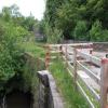
There is a small aqueduct or underbridge here which takes a river under the canal.


Amenities
 
Maps
If you are a user and are logged on, or if you are actively planning a route, a map will be displayed here.
Show on external mapping site: Google | OSM | Bing
 
Photos
 
External websites
There are no links to external websites from here.
Why not log in and add some (select "External websites" from the menu (sometimes this is under "Edit"))?
 
Nearest facilities

Mouseover for more information or show routes to facility

Nearest water point

In the direction of Ashton-under-Lyne Junction

Grove Road Bridge No 965 miles, 6 furlongs and 15 locks away
On this waterway in the direction of Ashton-under-Lyne Junction
Fairfield Junction13 miles, 2 furlongs and 23 locks away
Travel to Ashton-under-Lyne Junction, then on the Ashton Canal (Main Line) to Fairfield Junction
Marple Services18 miles, 7½ furlongs and 39 locks away
Travel to Ashton-under-Lyne Junction, then on the Ashton Canal (Main Line) to Dukinfield Junction, then on the Peak Forest Canal (Lower) to Marple Junction, then on the Macclesfield Canal to Marple Services
New Islington Marina17 miles, 4½ furlongs and 43 locks away
Travel to Ashton-under-Lyne Junction, then on the Ashton Canal (Main Line) to Ducie Street Junction, then on the Rochdale Canal to New Islington Marina Entrance, then on the Rochdale Canal (Main Line) to Cotton Field Wharf Marina, then on the Rochdale Canal (New Islington Marina Arm) to New Islington Marina
Staffordshire, Kenworthy and other Arms18 miles, 2¼ furlongs and 50 locks away
Travel to Ashton-under-Lyne Junction, then on the Ashton Canal (Main Line) to Ducie Street Junction, then on the Rochdale Canal to Castlefield Junction, then on the Bridgewater Canal (Main Line) to Staffordshire, Kenworthy and other Arms
Potato Wharf Arm & The New Basin18 miles, 3 furlongs and 50 locks away
Travel to Ashton-under-Lyne Junction, then on the Ashton Canal (Main Line) to Ducie Street Junction, then on the Rochdale Canal to Castlefield Junction, then on the Bridgewater Canal (Main Line) to Potato Wharf Arm & The New Basin

In the direction of Aspley Basin (Huddersfield)

Wool Road Bridge No 702¼ furlongs away
On this waterway in the direction of Aspley Basin (Huddersfield)
Standedge Tunnel (western entrance)2 miles, 2 furlongs and 9 locks away
On this waterway in the direction of Aspley Basin (Huddersfield)
Standedge Tunnel (eastern entrance)5 miles, 4 furlongs and 9 locks away
On this waterway in the direction of Aspley Basin (Huddersfield)
Slaithwaite Winding Hole8 miles, 7 furlongs and 30 locks away
On this waterway in the direction of Aspley Basin (Huddersfield)
Waterside Lock No 21E8 miles, 7½ furlongs and 30 locks away
On this waterway in the direction of Aspley Basin (Huddersfield)
Aspley Basin (Huddersfield)13 miles, 5¼ furlongs and 51 locks away
On this waterway in the direction of Aspley Basin (Huddersfield)
Brighouse Basin19 miles, 3½ furlongs and 64 locks away
Travel to Aspley Basin (Huddersfield), then on the Huddersfield Broad Canal to Cooper Bridge Junction, then on the Calder and Hebble Navigation (Main Line) to Brighouse Basin

Nearest rubbish disposal

In the direction of Ashton-under-Lyne Junction

Marple Bottom Lock Bridge Winding Hole17 miles, 6¼ furlongs and 23 locks away
Travel to Ashton-under-Lyne Junction, then on the Ashton Canal (Main Line) to Dukinfield Junction, then on the Peak Forest Canal (Lower) to Marple Bottom Lock Bridge Winding Hole
Marple Services18 miles, 7½ furlongs and 39 locks away
Travel to Ashton-under-Lyne Junction, then on the Ashton Canal (Main Line) to Dukinfield Junction, then on the Peak Forest Canal (Lower) to Marple Junction, then on the Macclesfield Canal to Marple Services

In the direction of Aspley Basin (Huddersfield)

Wool Road Visitor Mooring2 furlongs away
On this waterway in the direction of Aspley Basin (Huddersfield)
Pickle Lock No 22E8 miles, 6¼ furlongs and 29 locks away
On this waterway in the direction of Aspley Basin (Huddersfield)
Aspley Basin (Huddersfield)13 miles, 5¼ furlongs and 51 locks away
On this waterway in the direction of Aspley Basin (Huddersfield)
Brighouse Lower Basin Visitor Moorings19 miles, 3¼ furlongs and 63 locks away
Travel to Aspley Basin (Huddersfield), then on the Huddersfield Broad Canal to Cooper Bridge Junction, then on the Calder and Hebble Navigation (Main Line) to Brighouse Lower Basin Visitor Moorings

Nearest chemical toilet disposal

In the direction of Ashton-under-Lyne Junction

Grove Road Bridge No 965 miles, 6 furlongs and 15 locks away
On this waterway in the direction of Ashton-under-Lyne Junction
Fairfield Junction13 miles, 2 furlongs and 23 locks away
Travel to Ashton-under-Lyne Junction, then on the Ashton Canal (Main Line) to Fairfield Junction
Marple Services18 miles, 7½ furlongs and 39 locks away
Travel to Ashton-under-Lyne Junction, then on the Ashton Canal (Main Line) to Dukinfield Junction, then on the Peak Forest Canal (Lower) to Marple Junction, then on the Macclesfield Canal to Marple Services

In the direction of Aspley Basin (Huddersfield)

Wool Road Bridge No 702¼ furlongs away
On this waterway in the direction of Aspley Basin (Huddersfield)
Pickle Lock No 22E8 miles, 6¼ furlongs and 29 locks away
On this waterway in the direction of Aspley Basin (Huddersfield)
Waterside Lock No 21E8 miles, 7½ furlongs and 30 locks away
On this waterway in the direction of Aspley Basin (Huddersfield)
Aspley Basin (Huddersfield)13 miles, 5¼ furlongs and 51 locks away
On this waterway in the direction of Aspley Basin (Huddersfield)
Brighouse Basin19 miles, 3½ furlongs and 64 locks away
Travel to Aspley Basin (Huddersfield), then on the Huddersfield Broad Canal to Cooper Bridge Junction, then on the Calder and Hebble Navigation (Main Line) to Brighouse Basin

Nearest place to turn

In the direction of Ashton-under-Lyne Junction

Saddleworth Visitor Centre Winding Hole4½ furlongs and 2 locks away
On this waterway in the direction of Ashton-under-Lyne Junction
Manns Wharf Bridge Winding Hole1 mile, 7¼ furlongs and 4 locks away
On this waterway in the direction of Ashton-under-Lyne Junction
Roughtown Court Winding Hole3 miles, ¾ furlongs and 9 locks away
On this waterway in the direction of Ashton-under-Lyne Junction
Mossley Bottoms Winding Hole4 miles, ¼ furlongs and 11 locks away
On this waterway in the direction of Ashton-under-Lyne Junction
Knowle Street Winding Hole8 miles, ½ furlongs and 16 locks away
On this waterway in the direction of Ashton-under-Lyne Junction
Staley Wharf Winding Hole9 miles, 2¼ furlongs and 20 locks away
On this waterway in the direction of Ashton-under-Lyne Junction
Ashton-under-Lyne Junction10 miles, 2 furlongs and 23 locks away
On this waterway in the direction of Ashton-under-Lyne Junction
Dukinfield Junction10 miles, 6 furlongs and 23 locks away
Travel to Ashton-under-Lyne Junction, then on the Ashton Canal (Main Line) to Dukinfield Junction
Portland Basin Arm10 miles, 6½ furlongs and 23 locks away
Travel to Ashton-under-Lyne Junction, then on the Ashton Canal (Main Line) to Dukinfield Junction, then on the Peak Forest Canal (Lower) to Portland Basin Arm
Dunkirk Farm Bridge Winding Hole12 miles, 3¼ furlongs and 23 locks away
Travel to Ashton-under-Lyne Junction, then on the Ashton Canal (Main Line) to Dukinfield Junction, then on the Peak Forest Canal (Lower) to Dunkirk Farm Bridge Winding Hole
Lumb Lane Bridge Winding Hole12 miles, 3½ furlongs and 23 locks away
Travel to Ashton-under-Lyne Junction, then on the Ashton Canal (Main Line) to Lumb Lane Bridge Winding Hole
Canal Street Winding Hole13 miles, ¼ furlongs and 23 locks away
Travel to Ashton-under-Lyne Junction, then on the Ashton Canal (Main Line) to Dukinfield Junction, then on the Peak Forest Canal (Lower) to Canal Street Winding Hole
Fairfield Junction13 miles, 2 furlongs and 23 locks away
Travel to Ashton-under-Lyne Junction, then on the Ashton Canal (Main Line) to Fairfield Junction
Unity Mills Winding Hole14 miles, 4¾ furlongs and 23 locks away
Travel to Ashton-under-Lyne Junction, then on the Ashton Canal (Main Line) to Dukinfield Junction, then on the Peak Forest Canal (Lower) to Unity Mills Winding Hole
Urwick Road Winding Hole16 miles, 4 furlongs and 23 locks away
Travel to Ashton-under-Lyne Junction, then on the Ashton Canal (Main Line) to Dukinfield Junction, then on the Peak Forest Canal (Lower) to Urwick Road Winding Hole

In the direction of Aspley Basin (Huddersfield)

Wool Road Winding Hole1½ furlongs away
On this waterway in the direction of Aspley Basin (Huddersfield)
Diggle Winding Hole1 mile, 7½ furlongs and 9 locks away
On this waterway in the direction of Aspley Basin (Huddersfield)
Standedge Tunnel End Winding Hole5 miles, 4¾ furlongs and 9 locks away
On this waterway in the direction of Aspley Basin (Huddersfield)
Booth Lock Winding Hole7 miles, 2 furlongs and 20 locks away
On this waterway in the direction of Aspley Basin (Huddersfield)
Slaithwaite Winding Hole8 miles, 7 furlongs and 30 locks away
On this waterway in the direction of Aspley Basin (Huddersfield)

Nearest self-operated pump-out

In the direction of Ashton-under-Lyne Junction

New Islington Marina17 miles, 4½ furlongs and 43 locks away
Travel to Ashton-under-Lyne Junction, then on the Ashton Canal (Main Line) to Ducie Street Junction, then on the Rochdale Canal to New Islington Marina Entrance, then on the Rochdale Canal (Main Line) to Cotton Field Wharf Marina, then on the Rochdale Canal (New Islington Marina Arm) to New Islington Marina

In the direction of Aspley Basin (Huddersfield)

Wool Road Bridge No 702¼ furlongs away
On this waterway in the direction of Aspley Basin (Huddersfield)
Slaithwaite Winding Hole8 miles, 7 furlongs and 30 locks away
On this waterway in the direction of Aspley Basin (Huddersfield)

Nearest boatyard pump-out

In the direction of Ashton-under-Lyne Junction

Portland Basin Arm10 miles, 6½ furlongs and 23 locks away
Travel to Ashton-under-Lyne Junction, then on the Ashton Canal (Main Line) to Dukinfield Junction, then on the Peak Forest Canal (Lower) to Portland Basin Arm

In the direction of Aspley Basin (Huddersfield)

Aspley Basin (Huddersfield)13 miles, 5¼ furlongs and 51 locks away
On this waterway in the direction of Aspley Basin (Huddersfield)
Direction of TV transmitter (From Wolfbane Cybernetic)
 
 
Geograph
 
Wikipedia

There is no page on Wikipedia called “Saddleworth Aqueduct”

Wikipedia pages that might relate to Saddleworth Aqueduct
[Listed buildings in Saddleworth to 1800] Saddleworth is a civil parish in the Metropolitan Borough of Oldham, Greater Manchester, England. It lies between the town of Oldham and the Pennine hills [Listed buildings in Saddleworth from 1800] Saddleworth is a civil parish in the Metropolitan Borough of Oldham, Greater Manchester, England. It lies between the town of Oldham and the Pennine hills [Huddersfield Narrow Canal] it would pass through a tunnel at Standedge before descending through Saddleworth and the Tame valley to the Ashton Canal near Ashton-under-Lyne. There [List of serial killers by country] between 10 and 17 between 1963 and 1965. Buried four of their victims on Saddleworth Moor. Mary Ann Britland: poisoned her daughter, husband, and the wife [Manchester] brass-band contest takes place annually in the neighbouring areas of Saddleworth and Tameside. Manchester has a thriving theatre, opera and dance scene [List of suicides] hanging David Lytton (2015), a formerly unidentified British man found on Saddleworth Moor, strychnine Billy Mackenzie (1997), Scottish vocalist for the band [Oldham] boundaries of two parliamentary constituencies divide Oldham: Oldham East and Saddleworth, and Oldham West and Royton (which includes the town centre), represented [Grade II* listed buildings in Greater Manchester] boundary between Salford and Trafford, so one listed structure, Barton Swing Aqueduct, has been listed under both Salford and Trafford. Most of Greater Manchester's [River Medlock] Ashton-under-Lyne and the Daisy Nook Country Park with its 19th century aqueduct carrying the disused Hollinwood Branch Canal over the shallow river.[citation [Packhorse bridge] February 2015. "Highways Heritage Walks: By Turnpike and Towpath in Saddleworth". Milestone Society. Retrieved 26 August 2013. Historic England. "Brownhill
 
Google

Results of Google Search

Old Sag Aqueduct, Dobcross - Restoration of the Huddersfield ...
Old Sag Aqueduct, also called Saddleworth Aqueduct, below the Saddleworth Railway Viaduct. This aqueduct developed its visible sag soon after it was constructed. It had developed leaks so work took place to re-line the aqueduct with a lightweight concrete channel to make it structurally sound. No attempt was made to ...
Huddersfield Narrow Canal - Wikipedia
His plan was to start from the Huddersfield Broad Canal and follow the River Colne with a climb of 438 feet (134 m) to its summit where it would pass through a tunnel at Standedge before descending through Saddleworth and the Tame valley to the Ashton Canal near Ashton-under-Lyne. There were many woollen, worsted ...
Uppermill to Dobcross 2 - Virtual canal trip along the Huddersfield ...
A short distance ahead, the canal passes under Saddleworth railway viaduct through an unusual skew arch. Lime Kiln Lock (23w) can be seen just through the arch. This was the other lock to be restored when the Huddersfield Canal Society first began its campaign to re-open the canal. Old Sag Aqueduct, Huddersfield ...
Photographs of the Huddersfield Canal, UK.
Feb 23, 2016 ... Lock 14w, Winterford Lock. Narrowboats near Roaches Lock, (Lock 15w). Approaching Division Bridge, Mossley. Halls Bridge and one of the locals. The railway viaduct and the Saddleworth Aqueduct, Uppermill, Saddleworth. At this point the Huddersfield Canal crosses the river Tame by the Saddleworth
Division Bridge Aqueduct, - Restoration of the Huddersfield Narrow ...
Looking north towards Division Bridge Aqueduct, Friezland, from Division Bridge, which marks the boundary between Saddleworth and Mossley. The aqueduct is sometimes known as the Royal George Aqueduct. While work was being carried out, the canal had been stanked each side of the aqueduct. The north side of the  ...
Saddleworth walk | Canal & River Trust
Saddleworth walk. Take a bracing walk through the rugged, beautiful Pennine countryside and discover dramatic views, record-breaking engineering and welcoming inns. Entrance to Standedge Tunnel on Huddersfield Narrow Canal Standedge Tunnel, Huddersfield Narrow Canal. This walk is from the Royal Geographical ...
Photo Highlights of the Huddersfield Narrow Canal
Approaching Dungebooth Lock, Uppermill, one of the first two locks to be restored, with Saddleworth railway viaduct in the background. Old Sag Aqueduct, Huddersfield Narrow Canal, Mossley Below Saddleworth railway viaduct and Limekiln Lock is Saddleworth Aqueduct across the River Tame, known as "Old Sag" ...
Huddersfield Narrow Canal
Railway Lock No 42 E. 7.5. 42. N. SE048117. 110. Standedge Tunnel (North-east End). The longest canal Tunnel in Britain. 8.3. 42. N. SE041119. 110. Standedge Tunnel (South-west End). 11.4. 42. N. SE005079. 110. Diggle Summit Lock No 32 W. 11.5. 43. N. SE003077. 110. Saddleworth Aqueduct. Crosses River Tame.
Public transport to the aqueduct. - Pont del Diable, Tarragona ...
Saddleworth, UK. 5264. Reviewed 19 May 2015. Public transport to the aqueduct . The aqueduct is stunning - not as big as some others but it is complete and the setting in a wooded valley is perfect. We decided to get to it using public transport . It's easily done but there's some quirks to negotiate. 1. From Tarragon catch the  ...