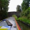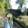
Clay Pit Bridge No 63
is a minor waterways place
on the Shropshire Union Canal (Llangollen Canal - Main Line) between
Frankton Junction (Junction of Llangollen and Montgomery Canals) (1 mile and 5 furlongs
to the southwest) and
Ellesmere Branch Junction (1 mile and 6¼ furlongs
to the northeast).
The nearest place in the direction of Frankton Junction is Winston Farm Visitor Moorings (48 hour moorings);
2 furlongs
away.
The nearest place in the direction of Ellesmere Branch Junction is Tetchill Visitor Moorings (48 hour moorings);
¼ furlongs
away.
There is access (via steps) to the towpath here.
Mooring here is ok (a perfectly adequate mooring).
There is a bridge here which takes a minor road over the canal.
| Val Hill Visitor Moorings | 6¼ furlongs | |
| Val Hill 3 Bridge No 66 | 5¾ furlongs | |
| Val Hill 2 Bridge No 65 | 4¼ furlongs | |
| Val Hill 1 Bridge No 64 | 3 furlongs | |
| Winston Farm Visitor Moorings | 2 furlongs | |
| Clay Pit Bridge No 63 | ||
| Tetchill Visitor Moorings | ¼ furlongs | |
| Coachman's Bridge No 62 | 2½ furlongs | |
| White Mill Bridge No 61 | 4¼ furlongs | |
| Tetchill Aqueduct | 6 furlongs | |
| Stanks Bridge No 60 | 1 mile | |
There are no links to external websites from here.
Why not log in and add some (select "External websites" from the menu (sometimes this is under "Edit"))?
Why not log in and add some (select "External websites" from the menu (sometimes this is under "Edit"))?
Mouseover for more information or show routes to facility
Nearest water point
In the direction of Hurleston Junction
Ellesmere Services — 1 mile, 6 furlongs away
On this waterway in the direction of Hurleston Junction
Blackwater Meadow Marina — 1 mile, 7¼ furlongs away
On this waterway in the direction of Hurleston Junction
Bettisfield Services — 6 miles, 4¼ furlongs away
On this waterway in the direction of Hurleston Junction
Whixall Marina — 8 miles, 7 furlongs away
Travel to Whixall Moss Junction, then on the Shropshire Union Canal (Llangollen Canal - Prees Branch) to Whixall Marina
Grindley Brook Water Points — 14 miles, 7¼ furlongs away
On this waterway in the direction of Hurleston Junction
In the direction of Llantisilio - Horseshoe Falls
Weston Arm Services (C&RT) — 2 miles, 2 furlongs and 4 locks away
Travel to Frankton Junction, then on the Shropshire Union Canal (Montgomery Canal - connected and navigable) to Weston Arm Junction, then on the Shropshire Union Canal (Weston Branch) to Weston Arm Services (C&RT)
New Marton Water Points — 5 miles, ¾ furlongs and 2 locks away
On this waterway in the direction of Llantisilio - Horseshoe Falls
Chirk Marina — 10 miles, ½ furlongs and 2 locks away
On this waterway in the direction of Llantisilio - Horseshoe Falls
Coedfryn Water Point — 11 miles, 7 furlongs and 2 locks away
On this waterway in the direction of Llantisilio - Horseshoe Falls
The Old Wharf — 12 miles, 2 furlongs and 2 locks away
Travel to Ruabon Branch Junction, then on the Shropshire Union Canal (Llangollen Canal - Ruabon Branch) to The Old Wharf
Trevor Basin — 12 miles, 3 furlongs and 2 locks away
Travel to Ruabon Branch Junction, then on the Shropshire Union Canal (Llangollen Canal - Ruabon Branch) to Trevor Basin
Maesbury Wharf — 7 miles, 6 furlongs and 8 locks away
Travel to Frankton Junction, then on the Shropshire Union Canal (Montgomery Canal - connected and navigable) to Maesbury Wharf
Llangollen Services — 16 miles, 5¾ furlongs and 2 locks away
On this waterway in the direction of Llantisilio - Horseshoe Falls
Llangollen Basin — 17 miles, ¾ furlongs and 2 locks away
On this waterway in the direction of Llantisilio - Horseshoe FallsNearest rubbish disposal
In the direction of Hurleston Junction
Ellesmere Services — 1 mile, 6 furlongs away
On this waterway in the direction of Hurleston Junction
Whixall Marina — 8 miles, 7 furlongs away
Travel to Whixall Moss Junction, then on the Shropshire Union Canal (Llangollen Canal - Prees Branch) to Whixall Marina
Grindley Brook Services — 15 miles away
On this waterway in the direction of Hurleston Junction
In the direction of Llantisilio - Horseshoe Falls
Weston Arm Services (C&RT) — 2 miles, 2 furlongs and 4 locks away
Travel to Frankton Junction, then on the Shropshire Union Canal (Montgomery Canal - connected and navigable) to Weston Arm Junction, then on the Shropshire Union Canal (Weston Branch) to Weston Arm Services (C&RT)
Llangollen Services — 16 miles, 5¾ furlongs and 2 locks away
On this waterway in the direction of Llantisilio - Horseshoe Falls
Llangollen Basin — 17 miles, ¾ furlongs and 2 locks away
On this waterway in the direction of Llantisilio - Horseshoe FallsNearest chemical toilet disposal
In the direction of Hurleston Junction
Ellesmere Services — 1 mile, 6 furlongs away
On this waterway in the direction of Hurleston Junction
Whixall Marina — 8 miles, 7 furlongs away
Travel to Whixall Moss Junction, then on the Shropshire Union Canal (Llangollen Canal - Prees Branch) to Whixall Marina
Grindley Brook Services — 15 miles away
On this waterway in the direction of Hurleston Junction
In the direction of Llantisilio - Horseshoe Falls
Whittington Wharf Narrowboats — 2 miles, 6¼ furlongs away
On this waterway in the direction of Llantisilio - Horseshoe Falls
Weston Arm Services (C&RT) — 2 miles, 2 furlongs and 4 locks away
Travel to Frankton Junction, then on the Shropshire Union Canal (Montgomery Canal - connected and navigable) to Weston Arm Junction, then on the Shropshire Union Canal (Weston Branch) to Weston Arm Services (C&RT)
Chirk Marina — 10 miles, ½ furlongs and 2 locks away
On this waterway in the direction of Llantisilio - Horseshoe Falls
Maesbury Wharf — 7 miles, 6 furlongs and 8 locks away
Travel to Frankton Junction, then on the Shropshire Union Canal (Montgomery Canal - connected and navigable) to Maesbury Wharf
Llangollen Services — 16 miles, 5¾ furlongs and 2 locks away
On this waterway in the direction of Llantisilio - Horseshoe FallsNearest place to turn
In the direction of Hurleston Junction
Sewage Works Winding Hole — 1 mile, 2 furlongs away
On this waterway in the direction of Hurleston Junction
Ellesmere Branch Junction — 1 mile, 6¼ furlongs away
On this waterway in the direction of Hurleston Junction
Ellesmere Town Wharf — 2 miles, ¼ furlongs away
Travel to Ellesmere Branch Junction, then on the Shropshire Union Canal (Llangollen Canal - Ellesmere Branch) to Ellesmere Town Wharf
Baysil Wood Winding Hole — 3 miles, 4 furlongs away
On this waterway in the direction of Hurleston Junction
Hampton Bank Winding Hole — 5 miles, 3¼ furlongs away
On this waterway in the direction of Hurleston Junction
Whixall Moss Junction — 8 miles, 3 furlongs away
On this waterway in the direction of Hurleston Junction
Whixall Marina — 8 miles, 7 furlongs away
Travel to Whixall Moss Junction, then on the Shropshire Union Canal (Llangollen Canal - Prees Branch) to Whixall Marina
Tilstock Park Winding Hole — 10 miles, 6¾ furlongs away
On this waterway in the direction of Hurleston Junction
Hassell's No 1 Lift Bridge Winding Hole — 13 miles, 4 furlongs away
On this waterway in the direction of Hurleston Junction
Whitchurch Winding Hole — 13 miles, 7 furlongs away
On this waterway in the direction of Hurleston Junction
In the direction of Llantisilio - Horseshoe Falls
Frankton Junction — 1 mile, 5 furlongs away
On this waterway in the direction of Llantisilio - Horseshoe Falls
Polletts Bridge Winding Hole — 3 miles, 1¼ furlongs away
On this waterway in the direction of Llantisilio - Horseshoe Falls
Weston Arm Junction — 2 miles, 1 furlong and 4 locks away
Travel to Frankton Junction, then on the Shropshire Union Canal (Montgomery Canal - connected and navigable) to Weston Arm Junction
Hawkswood Winding Hole — 2 miles, 7½ furlongs and 5 locks away
Travel to Frankton Junction, then on the Shropshire Union Canal (Montgomery Canal - connected and navigable) to Hawkswood Winding Hole
Rhoswiel Bridge Winding Hole — 7 miles, 4¾ furlongs and 2 locks away
On this waterway in the direction of Llantisilio - Horseshoe Falls
Queen's Head Winding Hole — 5 miles, 4 furlongs and 5 locks away
Travel to Frankton Junction, then on the Shropshire Union Canal (Montgomery Canal - connected and navigable) to Queen's Head Winding Hole
Chirk Pool — 8 miles, 5½ furlongs and 2 locks away
On this waterway in the direction of Llantisilio - Horseshoe Falls
Chirk Golf Course Winding Hole — 9 miles, 5½ furlongs and 2 locks away
On this waterway in the direction of Llantisilio - Horseshoe Falls
Chirk Marina — 10 miles, ½ furlongs and 2 locks away
On this waterway in the direction of Llantisilio - Horseshoe Falls
Coedfryn Winding Hole — 11 miles, 6 furlongs and 2 locks away
On this waterway in the direction of Llantisilio - Horseshoe FallsNearest self-operated pump-out
In the direction of Hurleston Junction
Grindley Brook Pump-Out — 14 miles, 7½ furlongs away
On this waterway in the direction of Hurleston Junction
In the direction of Llantisilio - Horseshoe Falls
Maesbury Wharf — 7 miles, 6 furlongs and 8 locks away
Travel to Frankton Junction, then on the Shropshire Union Canal (Montgomery Canal - connected and navigable) to Maesbury WharfNearest boatyard pump-out
In the direction of Hurleston Junction
Blackwater Meadow Marina — 1 mile, 7¼ furlongs away
On this waterway in the direction of Hurleston Junction
Whixall Marina — 8 miles, 7 furlongs away
Travel to Whixall Moss Junction, then on the Shropshire Union Canal (Llangollen Canal - Prees Branch) to Whixall Marina
Whitchurch Marina — 13 miles, 6 furlongs away
On this waterway in the direction of Hurleston Junction
In the direction of Llantisilio - Horseshoe Falls
Whittington Wharf Narrowboats — 2 miles, 6¼ furlongs away
On this waterway in the direction of Llantisilio - Horseshoe Falls
Chirk Marina — 10 miles, ½ furlongs and 2 locks away
On this waterway in the direction of Llantisilio - Horseshoe Falls
The Old Wharf — 12 miles, 2 furlongs and 2 locks away
Travel to Ruabon Branch Junction, then on the Shropshire Union Canal (Llangollen Canal - Ruabon Branch) to The Old WharfDirection of TV transmitter (From Wolfbane Cybernetic)
There is no page on Wikipedia called “Clay Pit Bridge”
Wikipedia pages that might relate to Clay Pit Bridge
[Clay Pit Ponds State Park Preserve]
Clay Pit Ponds State Park Preserve is 265-acre (1.07 km2) state park located near the southwestern shore of Staten Island, New York. It is the only state
[Llangollen Canal]
up the banks with more clay on a continuous basis, who became known as the Whixall Moss Gang. Clay was obtained from the clay pit which became Whixall Marina
[Ellesmere Canal]
Weston Branch was originally intended to be the main line of the canal. Bridge numbering (which starts at Hurleston Junction) continues down the Llanymynech
[Mud]
Mud is soil, loam, silt or clay mixed with water. It usually forms after rainfall or near water sources. Ancient mud deposits harden over geological time
[Conveyor bridge]
It was scrapped in 1959 after exposure of clay beds made mining in the pit unsafe. A large conveyor bridge with 200 m span and 50 m height, fed by a bucket-wheel
[Clay Regazzoni]
Gianclaudio Giuseppe "Clay" Regazzoni (5 September 1939 – 15 December 2006) was a Swiss racing driver. He competed in Formula One races from 1970 to 1980
[Angle of repose]
blunders into the pit, its weight causes the sand to collapse below it, drawing the victim toward the center where the predator that dug the pit lies in wait
[Glynde]
at Glynde Bridge. The work in the chalk pits was labour-intensive, with over a hundred men employed in the pits at their peak. A clay pit was opened
[List of collieries in Lancashire since 1854]
Colliery Coppull Hic-bibi, Coppull Wood Pits Nos 1 and 2, Coppull Alexandra, Haigh Aqueduct, Haigh Bawkhouse, Haigh Bridge, Haigh Britannia, Haigh Godfrey, Haigh
[Listed buildings in Ellesmere Rural]
(Coachman's Bridge), Ellesmere Rural (1055908)", National Heritage List for England, retrieved 28 May 2018 Historic England, "Bridge No. 63 (Clay Pit Bridge), Ellesmere
Results of Google Search
BRIDGE NUMBER 63 (CLAY PIT BRIDGE), Ellesmere Rural ...Details. ELLESMERE RURAL C.P. SHROPSHIRE UNION CANAL SJ 33 SE ( Llangollen Branch) 8/163 Bridge No. 63 (Clay Pit - Bridge) - II Accommodation ...
Download this stock image: Clay Pit Bridge on the Llangollen Canal near Tetchill, Shropshire, England - H5KEXH from Alamy's library of millions of high ...
Clay Pit Bridge, No 63, Llangollen Canal. Done. Comment. 67 views. 0 faves. 0 comments. Taken on October 9, 2012. Some rights reserved · Canon PowerShot ...
Dec 2, 2016 ... Clay Pit Bridge [No 63], from the north. taken 4 years ago, near to Tetchill, Shropshire, Great Britain. More sizes. Clay Pit Bridge [No 63], from ...
5.71. 92.55. Coachman's Bridge No 62. 0.23. 4.08. 5.42. 97.97. Clay Pit Bridge No 63. 0.31. 4.40. 7.52. 105.48. Val Hill 1 Bridge No 64. 0.38. 4.78. 9.14. 114.63.
Apr 10, 2017 ... The canal passes through quiet countryside to the west of Tetchill and under bridge 63.
The bridge has a string course, a stone-coped parapet, projecting keybricks, and square corner piers. II. Bridge No. 63 (Clay Pit Bridge)
As at Current Day (staying at Clay Pit Bridge No. 63, near Tetchill, to see out the global pandemic Covid19). Our journey to date: Starting out from Aqueduct ...


![Clay Pit Bridge [No 63], from the north. Carrying a track and a public footpath over the Llangollen Canal. by Christine Johnstone – 18 September 2016](https://s1.geograph.org.uk/geophotos/05/21/28/5212833_2062961c_120x120.jpg)


![Cattle and sheep on the bank of the Llangollen Canal. Just south of Clay Pit Bridge [No 63]. by Christine Johnstone – 19 September 2016](https://s2.geograph.org.uk/geophotos/05/21/29/5212902_9dd71133_120x120.jpg)


