CanalPlanAC

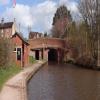
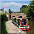
Newcastle Road Bridge No 95

 
Newcastle Road, Stone ST15 8JX, United Kingdom (B5027)
 
Information about the place
Newcastle Road Bridge No 95 is a minor waterways place on the Trent and Mersey Canal (Main Line - Great Haywood to Etruria) between Etruria Junction (Junction with the Trent and Mersey Canal, Caldon Branch, Uttoxeter 30 miles) (8 miles and 6½ furlongs and 12 locks to the north) and Great Haywood Junction (Junction of Trent and Mersey and Staffordshire and Worcestershire Canals) (10 miles and 1½ furlongs and 6 locks to the southeast).
 
It is the centre of Stone.
 
The nearest place in the direction of Etruria Junction is Stone Lock No 29; a few yards away.
 
The nearest place in the direction of Great Haywood Junction is Stone Services; a few yards away.

There may be access to the towpath here.

Mooring here is unrated.

There is a bridge here which takes a major road over the canal.


Amenities

Amenities in Stone

 Somerfield - Stone - Store# 3280
 Fish & Chips
 Fish & Chips
 Shell Fuel Card

Amenities at other places in Stone

 Somerfield - Stone - Store# 1523 at Stone Wharf
 Stone, Pasta Di Piazza La Favorita at Star Lock Pipe Bridge
 Poste of Stone at Stone Wharf
 Red Lion at Scotch Brook Aqueduct
 Stone at Stone Wharf
 Wetherspoons at Stone Wharf
 Bargain Booze at Star Lock Pipe Bridge
 Indian Takeaway at Hospital Bridge No 94
 Subway Sandwich Shop at Star Lock Pipe Bridge
 Barclays at Hospital Bridge No 94
 Cashpoint at Hospital Bridge No 94
 Cashpoint at Stone Lock No 28
 Cashpoint at Stone Wharf
 Cashpoint at Stone Wharf
 Lloyds Bank at Stone Wharf
 NatWest at Stone Wharf
 Canal Cruising Co Ltd at Stone Lock No 28
 Morrisons Fuel at Star Lock Pipe Bridge
 Stoneboat Building Co Ltd at Site of Stone Boat Building Chandlery
 Wm Morrisons Supermarkets 262 at Scotch Brook Aqueduct
 Stone Station at Roger Fuller's Boatyard
 
Maps
If you are a user and are logged on, or if you are actively planning a route, a map will be displayed here.
Show on external mapping site: Google | OSM | Bing
 
Photos
 
External websites
 Trent & Mersey Canal Society – founded in 1974 — associated with Trent and Mersey Canal
 A Little Bit of Stone — associated with Stone
Stone's online news and community platform
 
Nearest facilities

Mouseover for more information or show routes to facility

Nearest water point

In the direction of Great Haywood Junction

Stone Servicesa few yards away
On this waterway in the direction of Great Haywood Junction
Stafford Road Bridge No 933¼ furlongs and 2 locks away
On this waterway in the direction of Great Haywood Junction
Great Haywood Services Wharf10 miles, 1¼ furlongs and 6 locks away
On this waterway in the direction of Great Haywood Junction
Maple Wood Marina15 miles, 4¼ furlongs and 7 locks away
Travel to Great Haywood Junction, then on the Staffordshire and Worcestershire Canal (Main Line: Autherley to Great Haywood) to Maple Wood Marina
Ash Tree Bridge Water Point16 miles, 5 furlongs and 8 locks away
Travel to Great Haywood Junction, then on the Trent and Mersey Canal (Main Line - Fradley to Great Haywood) to Ash Tree Bridge Water Point

In the direction of Etruria Junction

Stoke Top Lock No 408 miles, 6 furlongs and 11 locks away
On this waterway in the direction of Etruria Junction
Etruria Services8 miles, 7 furlongs and 12 locks away
Travel to Etruria Junction, then on the Trent and Mersey Canal (Caldon Branch - Main Line to Froghall) to Etruria Services
Harecastle Tunnel (southern entrance)12 miles, 3¼ furlongs and 12 locks away
Travel to Etruria Junction, then on the Trent and Mersey Canal (Main Line - Etruria to Hardings Wood) to Harecastle Tunnel (southern entrance)
Harecastle Tunnel (northern entrance)14 miles, ½ furlongs and 12 locks away
Travel to Etruria Junction, then on the Trent and Mersey Canal (Main Line - Etruria to Hardings Wood) to Harecastle Tunnel (northern entrance)
Hall Green Footbridge No 9315 miles, 7½ furlongs and 13 locks away
Travel to Etruria Junction, then on the Trent and Mersey Canal (Main Line - Etruria to Hardings Wood) to Hardings Wood Junction, then on the Trent and Mersey Canal (Hall Green Branch) to Hall Green Stop Lock, then on the Macclesfield Canal to Hall Green Footbridge No 93
Red Bull Services15 miles and 15 locks away
Travel to Etruria Junction, then on the Trent and Mersey Canal (Main Line - Etruria to Hardings Wood) to Hardings Wood Junction, then on the Trent and Mersey Canal (Main Line - Harding's Wood to Middlewich) to Red Bull Services
Park Lane Services17 miles, 2¾ furlongs and 21 locks away
Travel to Etruria Junction, then on the Trent and Mersey Canal (Caldon Branch - Main Line to Froghall) to Park Lane Services

Nearest rubbish disposal

In the direction of Great Haywood Junction

Stone Visitor Moorings4½ furlongs and 2 locks away
On this waterway in the direction of Great Haywood Junction
Aston Marina (entrance)2 miles and 3 locks away
On this waterway in the direction of Great Haywood Junction
Great Haywood Services Wharf10 miles, 1¼ furlongs and 6 locks away
On this waterway in the direction of Great Haywood Junction

In the direction of Etruria Junction

Stoke Top Lock No 408 miles, 6 furlongs and 11 locks away
On this waterway in the direction of Etruria Junction
Etruria Services8 miles, 7 furlongs and 12 locks away
Travel to Etruria Junction, then on the Trent and Mersey Canal (Caldon Branch - Main Line to Froghall) to Etruria Services
Planet Lock No 39 miles, 4 furlongs and 14 locks away
Travel to Etruria Junction, then on the Trent and Mersey Canal (Caldon Branch - Main Line to Froghall) to Planet Lock No 3
Harecastle Tunnel (northern entrance)14 miles, ½ furlongs and 12 locks away
Travel to Etruria Junction, then on the Trent and Mersey Canal (Main Line - Etruria to Hardings Wood) to Harecastle Tunnel (northern entrance)
Red Bull Services15 miles and 15 locks away
Travel to Etruria Junction, then on the Trent and Mersey Canal (Main Line - Etruria to Hardings Wood) to Hardings Wood Junction, then on the Trent and Mersey Canal (Main Line - Harding's Wood to Middlewich) to Red Bull Services
Park Lane Services17 miles, 2¾ furlongs and 21 locks away
Travel to Etruria Junction, then on the Trent and Mersey Canal (Caldon Branch - Main Line to Froghall) to Park Lane Services

Nearest chemical toilet disposal

In the direction of Great Haywood Junction

Stone Servicesa few yards away
On this waterway in the direction of Great Haywood Junction
Aston Marina (entrance)2 miles and 3 locks away
On this waterway in the direction of Great Haywood Junction
Great Haywood Services Wharf10 miles, 1¼ furlongs and 6 locks away
On this waterway in the direction of Great Haywood Junction
Maple Wood Marina15 miles, 4¼ furlongs and 7 locks away
Travel to Great Haywood Junction, then on the Staffordshire and Worcestershire Canal (Main Line: Autherley to Great Haywood) to Maple Wood Marina

In the direction of Etruria Junction

Etruria Services8 miles, 7 furlongs and 12 locks away
Travel to Etruria Junction, then on the Trent and Mersey Canal (Caldon Branch - Main Line to Froghall) to Etruria Services
Harecastle Tunnel (northern entrance)14 miles, ½ furlongs and 12 locks away
Travel to Etruria Junction, then on the Trent and Mersey Canal (Main Line - Etruria to Hardings Wood) to Harecastle Tunnel (northern entrance)
Red Bull Services15 miles and 15 locks away
Travel to Etruria Junction, then on the Trent and Mersey Canal (Main Line - Etruria to Hardings Wood) to Hardings Wood Junction, then on the Trent and Mersey Canal (Main Line - Harding's Wood to Middlewich) to Red Bull Services
Park Lane Services17 miles, 2¾ furlongs and 21 locks away
Travel to Etruria Junction, then on the Trent and Mersey Canal (Caldon Branch - Main Line to Froghall) to Park Lane Services

Nearest place to turn

In the direction of Great Haywood Junction

Stone Wharf2 furlongs away
On this waterway in the direction of Great Haywood Junction
Stone Bottom Lock Winding Hole4 furlongs and 2 locks away
On this waterway in the direction of Great Haywood Junction
Sandon Winding Hole4 miles, 4½ furlongs and 3 locks away
On this waterway in the direction of Great Haywood Junction
Sandy Lane Winding Hole6 miles, ½ furlongs and 4 locks away
On this waterway in the direction of Great Haywood Junction
Ingestre Winding Hole8 miles and 5 locks away
On this waterway in the direction of Great Haywood Junction
Great Haywood Marina9 miles, 6 furlongs and 6 locks away
On this waterway in the direction of Great Haywood Junction
Great Haywood Junction10 miles, 1½ furlongs and 6 locks away
On this waterway in the direction of Great Haywood Junction
Great Haywood Basin10 miles, 1¾ furlongs and 6 locks away
Travel to Great Haywood Junction, then on the Staffordshire and Worcestershire Canal (Main Line: Autherley to Great Haywood) to Great Haywood Basin
Tixall Wide (northeastern entrance)10 miles, 7 furlongs and 6 locks away
Travel to Great Haywood Junction, then on the Staffordshire and Worcestershire Canal (Main Line: Autherley to Great Haywood) to Tixall Wide (northeastern entrance)
Tixall Wide10 miles, 7¾ furlongs and 6 locks away
Travel to Great Haywood Junction, then on the Staffordshire and Worcestershire Canal (Main Line: Autherley to Great Haywood) to Tixall Wide
Tixall Wide (southwestern entrance)11 miles, ½ furlongs and 6 locks away
Travel to Great Haywood Junction, then on the Staffordshire and Worcestershire Canal (Main Line: Autherley to Great Haywood) to Tixall Wide (southwestern entrance)
Milford Winding Hole12 miles, 5 furlongs and 7 locks away
Travel to Great Haywood Junction, then on the Staffordshire and Worcestershire Canal (Main Line: Autherley to Great Haywood) to Milford Winding Hole

In the direction of Etruria Junction

Whitebridge Lane Winding Hole5½ furlongs and 2 locks away
On this waterway in the direction of Etruria Junction
Meaford Winding Hole1 mile, 1¼ furlongs and 5 locks away
On this waterway in the direction of Etruria Junction
Brook House Winding Hole3 miles, 4¼ furlongs and 6 locks away
On this waterway in the direction of Etruria Junction
Jonathan Road Winding Hole4 miles, 1¼ furlongs and 7 locks away
On this waterway in the direction of Etruria Junction
Trentham Winding Hole5 miles, 1½ furlongs and 7 locks away
On this waterway in the direction of Etruria Junction
Sideway Winding Hole6 miles, 3¾ furlongs and 7 locks away
On this waterway in the direction of Etruria Junction
Stoke Basin Bridge No 1117 miles, 2¾ furlongs and 7 locks away
On this waterway in the direction of Etruria Junction
Site of Junction with Newcastle-Under-Lyme Canal7 miles, 6¼ furlongs and 7 locks away
On this waterway in the direction of Etruria Junction

Nearest self-operated pump-out

Nearest boatyard pump-out

In the direction of Great Haywood Junction

Stone Wharf2 furlongs away
On this waterway in the direction of Great Haywood Junction
Aston Marina (entrance)2 miles and 3 locks away
On this waterway in the direction of Great Haywood Junction
Great Haywood Marina9 miles, 6 furlongs and 6 locks away
On this waterway in the direction of Great Haywood Junction
Great Haywood Services Wharf10 miles, 1¼ furlongs and 6 locks away
On this waterway in the direction of Great Haywood Junction
Great Haywood Basin10 miles, 1¾ furlongs and 6 locks away
Travel to Great Haywood Junction, then on the Staffordshire and Worcestershire Canal (Main Line: Autherley to Great Haywood) to Great Haywood Basin
Maple Wood Marina15 miles, 4¼ furlongs and 7 locks away
Travel to Great Haywood Junction, then on the Staffordshire and Worcestershire Canal (Main Line: Autherley to Great Haywood) to Maple Wood Marina

In the direction of Etruria Junction

Festival Park Marina9 miles, ¾ furlongs and 12 locks away
Travel to Etruria Junction, then on the Trent and Mersey Canal (Main Line - Etruria to Hardings Wood) to Festival Park Marina
Longport Wharf10 miles, 7¼ furlongs and 12 locks away
Travel to Etruria Junction, then on the Trent and Mersey Canal (Main Line - Etruria to Hardings Wood) to Longport Wharf
Heritage Narrowboats16 miles, 7½ furlongs and 13 locks away
Travel to Etruria Junction, then on the Trent and Mersey Canal (Main Line - Etruria to Hardings Wood) to Hardings Wood Junction, then on the Trent and Mersey Canal (Hall Green Branch) to Hall Green Stop Lock, then on the Macclesfield Canal to Heritage Narrowboats
Direction of TV transmitter (From Wolfbane Cybernetic)
 
 
Geograph
 
Wikipedia

There is no page on Wikipedia called “Newcastle Road Bridge”

Wikipedia pages that might relate to Newcastle Road Bridge
[Tyne Bridge] The Tyne Bridge is a through arch bridge over the River Tyne in North East England, linking Newcastle upon Tyne and Gateshead. The bridge was designed [High Level Bridge] The High Level Bridge is a road and railway bridge spanning the River Tyne between Newcastle upon Tyne and Gateshead in North East England. It is considered [Redheugh Bridge] The Redheugh Bridge (/ˈrɛd.jʊf/, RED-yuuf) is a road bridge spanning the River Tyne west of Newcastle upon Tyne city centre on the north bank and Gateshead [Newcastle upon Tyne] first recorded settlement in what is now Newcastle was Pons Aelius ("Hadrian's bridge"), a Roman fort and bridge across the River Tyne. It was given the [Martin Bridge] The Martin Bridge is a road bridge that carries the Manning River Drive across the Manning River in Taree, in the Mid North Coast region of New South [Blaydon Bridge] Blaydon Bridge is one of the main bridges crossing the River Tyne in North East England linking Scotswood in Newcastle upon Tyne and Blaydon in Gateshead [Newcastle Link Road] Newcastle Link Road is a limited-access road in New South Wales and is a part of the A15 route which links Newcastle to the Pacific Motorway and Hunter [Bridge] A bridge is a structure built to span a physical obstacle, such as a body of water, valley, or road, without closing the way underneath. It is constructed [A1 (Newcastle upon Tyne)] The A1 road around Gateshead and Newcastle upon Tyne after arriving from the south as the A1(M) from its origin in London, currently runs from the A1(M) [History of Newcastle upon Tyne] The history of Newcastle dates from about AD 120, when the Romans built the first bridge to cross the River Tyne at that point. The bridge was called Pons
 
Google

Results of Google Search

Newcastle Rd Bridge 95, Stone | Canal & River Trust
From Date: 26/01/2015 06:00. To Date: 13/02/2015 18:00 inclusive. Type: Navigation Restriction. Reason: 3rd Party Works. Is the towpath closed? No ...
Newcastle Road Bridge No 95 © Mat Fascione :: Geograph Britain ...
Jul 12, 2015 ... Next to Stone Lock No 29 on the Trent & Mersey Canal, in the Staffordshire market town of Stone.
Listed buildings in Stone, Staffordshire - Wikipedia
Stone is a civil parish in the Borough of Stafford, Staffordshire, England. It contains 75 listed ... The other listed buildings include churches and structures in churchyards, road bridges, former mills, a former hospital, a milestone, a railway station and ... (Newcastle Road Bridge) and Lock No. ... 95, Trent and Mersey Canal.jpg.
Travel Advisories - Delaware Department of Transportation
An interactive Google Map displaying traffic cameras, weather stations, travel advisories and closures throughout the state. Posted Bridge Restrictions Map. An  ...
Interstate 95 in Delaware - Wikipedia
Interstate 95 (I-95) is an Interstate highway running along the East Coast of the United States ... Not far from the Maryland border, the road crosses Muddy Run before it comes to a toll plaza. I-95 ... After this bridge, I-95 has a northbound ramp to Airport Road that serves to provide access to southbound US 202/DE 141.
DelDOT Projects Portal - Delaware Department of Transportation
HSIP NCC, SR 273 and I-95 Interchange Improvement thumbnail. HSIP NCC, SR 273 and I-95 Interchange Improvement. HSIP NCC, SR 273, Appleby Road to ...
Toll Rates for the Thomas J. Hatem Memorial Bridge (US 40) | mdta ...
Home · E-ZPASS · ICC/MD 200 · Toll Rates · MDTA Police · Employment · Traffic Cams · Projects and Studies ... NOTE: At the Thomas J. Hatem Memorial Bridge, tolls are collected in the eastbound ... Non-Maryland E-ZPass Transponder Rates : ... toll plazas (excludes Intercounty Connector and the I-95 Express Toll Lanes).
A cruise along the Trent and Mersey Canal, Hardings Wood ...
Jan 22, 2018 - Looking back to Newcastle Road Bridge (No. 95), 2014. ( 14.4 miles / 23.1 km / 12 locks )
Traffic
DE-141: at the I-95 work zone new traffic pattern. ... The full closure of the St. Georges Bridge, which carries U.S. Route 13 over the Chesapeake and ... WDEL's Road Scholar: Wet spring not slowing Route 141 reconstruction at Barley Mill.