CanalPlanAC

Picton Lane Bridge No 136A

 
Stoak Nature Park, Picton Lane, Stoak CH2 4HL, United Kingdom
 
Information about the place
Picton Lane Bridge No 136A is a place on the waterways on the Shropshire Union Canal (Wirral Line - Main Line) between River Dee Branch Junction (Junction with the Shropshire Union (Chester Canal) and the River Dee Branch) (5 miles and 2 furlongs to the southwest) and Ellesmere Port Upper Basin (3 miles and 1 furlong and 2 locks to the northwest).
 
 
The nearest place in the direction of River Dee Branch Junction is Stoak Minor Bridge No 136; a few yards away.
 
The nearest place in the direction of Ellesmere Port Upper Basin is Stoak Bridge No 137; 1¼ furlongs away.

There may be access to the towpath here.

Mooring here is unrated.

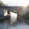
There is a bridge here which takes a minor road over the canal.


Amenities
 
Maps
If you are a user and are logged on, or if you are actively planning a route, a map will be displayed here.
Show on external mapping site: Google | OSM | Bing
 
Photos
 
External websites
There are no links to external websites from here.
Why not log in and add some (select "External websites" from the menu (sometimes this is under "Edit"))?
 
Nearest facilities

Mouseover for more information or show routes to facility

Nearest water point

In the direction of Ellesmere Port Junction

Ellesmere Port Visitor Moorings2 miles, 7¼ furlongs away
On this waterway in the direction of Ellesmere Port Junction
Salthouse Dock8 miles, 7½ furlongs and 5 locks away
Travel to Ellesmere Port Junction, then on the Manchester Ship Canal (Main Line) to Mersey - Ship Canal Junction, then on the River Mersey (Tidal Section) to Mersey - South Docks Junction, then on the Liverpool South Docks to Salthouse Dock
Sutton Weaver Swing Bridge12 miles, 3 furlongs and 4 locks away
Travel to Ellesmere Port Junction, then on the Manchester Ship Canal (Main Line) to Weaver Mouth, then on the River Weaver (Weston Marsh Lock Line) to Weston Marsh Lock Entrance, then on the River Weaver (Main Line) to Sutton Weaver Swing Bridge
Dutton Locks No 417 miles and 4 locks away
Travel to Ellesmere Port Junction, then on the Manchester Ship Canal (Main Line) to Weaver Mouth, then on the River Weaver (Weston Marsh Lock Line) to Weston Marsh Lock Entrance, then on the River Weaver (Main Line) to Dutton Locks No 4
Acton Swing Bridge18 miles, 1½ furlongs and 5 locks away
Travel to Ellesmere Port Junction, then on the Manchester Ship Canal (Main Line) to Weaver Mouth, then on the River Weaver (Weston Marsh Lock Line) to Weston Marsh Lock Entrance, then on the River Weaver (Main Line) to Acton Swing Bridge
Litherland Visitor Moorings14 miles, 1½ furlongs and 11 locks away
Travel to Ellesmere Port Junction, then on the Manchester Ship Canal (Main Line) to Mersey - Ship Canal Junction, then on the River Mersey (Tidal Section) to Mersey - South Docks Junction, then on the Liverpool South Docks to Salthouse Dock, then on the Leeds and Liverpool Canal (Liverpool Link) to Stanley Dock, then on the Leeds and Liverpool Canal (Stanley Dock Branch) to Stanley Dock Cut Junction, then on the Leeds and Liverpool Canal (Main Line - Liverpool to Wigan) to Litherland Visitor Moorings

In the direction of River Dee Branch Junction

Taylor's Boatyard Drydock5 miles, 2 furlongs away
Travel to River Dee Branch Junction, then on the Shropshire Union Canal (Chester Canal - Bunbury to Chester) to Taylor's Boatyard Drydock
C&RT Water Point (Chester)6 miles, 4 furlongs and 4 locks away
Travel to River Dee Branch Junction, then on the Shropshire Union Canal (Chester Canal - Bunbury to Chester) to C&RT Water Point (Chester)
Water Point (Christleton)7 miles, 6½ furlongs and 8 locks away
Travel to River Dee Branch Junction, then on the Shropshire Union Canal (Chester Canal - Bunbury to Chester) to Water Point (Christleton)
Tattenhall Marina13 miles, ¾ furlongs and 8 locks away
Travel to River Dee Branch Junction, then on the Shropshire Union Canal (Chester Canal - Bunbury to Chester) to Tattenhall Marina
Bunbury Staircase Locks Nos 30 and 3118 miles, 3½ furlongs and 12 locks away
Travel to River Dee Branch Junction, then on the Shropshire Union Canal (Chester Canal - Bunbury to Chester) to Bunbury Staircase Locks Nos 30 and 31
Calveley Service Station19 miles, 3¼ furlongs and 14 locks away
Travel to River Dee Branch Junction, then on the Shropshire Union Canal (Chester Canal - Bunbury to Chester) to Winding Hole above Bunbury Locks, then on the Shropshire Union Canal (Chester Canal - Nantwich to Bunbury) to Calveley Service Station

Nearest rubbish disposal

In the direction of Ellesmere Port Junction

Salthouse Dock8 miles, 7½ furlongs and 5 locks away
Travel to Ellesmere Port Junction, then on the Manchester Ship Canal (Main Line) to Mersey - Ship Canal Junction, then on the River Mersey (Tidal Section) to Mersey - South Docks Junction, then on the Liverpool South Docks to Salthouse Dock
Sutton Weaver Swing Bridge12 miles, 3 furlongs and 4 locks away
Travel to Ellesmere Port Junction, then on the Manchester Ship Canal (Main Line) to Weaver Mouth, then on the River Weaver (Weston Marsh Lock Line) to Weston Marsh Lock Entrance, then on the River Weaver (Main Line) to Sutton Weaver Swing Bridge
Acton Swing Bridge18 miles, 1½ furlongs and 5 locks away
Travel to Ellesmere Port Junction, then on the Manchester Ship Canal (Main Line) to Weaver Mouth, then on the River Weaver (Weston Marsh Lock Line) to Weston Marsh Lock Entrance, then on the River Weaver (Main Line) to Acton Swing Bridge
Litherland Visitor Moorings14 miles, 1½ furlongs and 11 locks away
Travel to Ellesmere Port Junction, then on the Manchester Ship Canal (Main Line) to Mersey - Ship Canal Junction, then on the River Mersey (Tidal Section) to Mersey - South Docks Junction, then on the Liverpool South Docks to Salthouse Dock, then on the Leeds and Liverpool Canal (Liverpool Link) to Stanley Dock, then on the Leeds and Liverpool Canal (Stanley Dock Branch) to Stanley Dock Cut Junction, then on the Leeds and Liverpool Canal (Main Line - Liverpool to Wigan) to Litherland Visitor Moorings

In the direction of River Dee Branch Junction

St Martin's Way Bridge No 123J5 miles, 3¾ furlongs and 3 locks away
Travel to River Dee Branch Junction, then on the Shropshire Union Canal (Chester Canal - Bunbury to Chester) to St Martin's Way Bridge No 123J
Tattenhall Marina13 miles, ¾ furlongs and 8 locks away
Travel to River Dee Branch Junction, then on the Shropshire Union Canal (Chester Canal - Bunbury to Chester) to Tattenhall Marina
Bunbury Staircase Locks Nos 30 and 3118 miles, 3½ furlongs and 12 locks away
Travel to River Dee Branch Junction, then on the Shropshire Union Canal (Chester Canal - Bunbury to Chester) to Bunbury Staircase Locks Nos 30 and 31
Calveley Service Station19 miles, 3¼ furlongs and 14 locks away
Travel to River Dee Branch Junction, then on the Shropshire Union Canal (Chester Canal - Bunbury to Chester) to Winding Hole above Bunbury Locks, then on the Shropshire Union Canal (Chester Canal - Nantwich to Bunbury) to Calveley Service Station

Nearest chemical toilet disposal

In the direction of Ellesmere Port Junction

Sutton Weaver Swing Bridge12 miles, 3 furlongs and 4 locks away
Travel to Ellesmere Port Junction, then on the Manchester Ship Canal (Main Line) to Weaver Mouth, then on the River Weaver (Weston Marsh Lock Line) to Weston Marsh Lock Entrance, then on the River Weaver (Main Line) to Sutton Weaver Swing Bridge
Litherland Visitor Moorings14 miles, 1½ furlongs and 11 locks away
Travel to Ellesmere Port Junction, then on the Manchester Ship Canal (Main Line) to Mersey - Ship Canal Junction, then on the River Mersey (Tidal Section) to Mersey - South Docks Junction, then on the Liverpool South Docks to Salthouse Dock, then on the Leeds and Liverpool Canal (Liverpool Link) to Stanley Dock, then on the Leeds and Liverpool Canal (Stanley Dock Branch) to Stanley Dock Cut Junction, then on the Leeds and Liverpool Canal (Main Line - Liverpool to Wigan) to Litherland Visitor Moorings

In the direction of River Dee Branch Junction

Dee Branch Top Lock Footbridge5 miles, 2 furlongs and 1 lock away
Travel to River Dee Branch Junction, then on the Shropshire Union Canal (Dee Branch) to Dee Branch Top Lock Footbridge
Tattenhall Marina13 miles, ¾ furlongs and 8 locks away
Travel to River Dee Branch Junction, then on the Shropshire Union Canal (Chester Canal - Bunbury to Chester) to Tattenhall Marina
Bunbury Staircase Locks Nos 30 and 3118 miles, 3½ furlongs and 12 locks away
Travel to River Dee Branch Junction, then on the Shropshire Union Canal (Chester Canal - Bunbury to Chester) to Bunbury Staircase Locks Nos 30 and 31
Calveley Service Station19 miles, 3¼ furlongs and 14 locks away
Travel to River Dee Branch Junction, then on the Shropshire Union Canal (Chester Canal - Bunbury to Chester) to Winding Hole above Bunbury Locks, then on the Shropshire Union Canal (Chester Canal - Nantwich to Bunbury) to Calveley Service Station

Nearest place to turn

In the direction of Ellesmere Port Junction

Stanney Mill Bridge Winding Hole1 mile, 1½ furlongs away
On this waterway in the direction of Ellesmere Port Junction
Stanlow Winding Hole2 miles, 4 furlongs away
On this waterway in the direction of Ellesmere Port Junction
Winding Hole above Ellesmere Port Locks3 miles, ¼ furlongs away
On this waterway in the direction of Ellesmere Port Junction
Ellesmere Port Upper Basin3 miles, 1 furlong and 2 locks away
On this waterway in the direction of Ellesmere Port Junction
Ellesmere Port Lower Basin3 miles, 1½ furlongs and 3 locks away
On this waterway in the direction of Ellesmere Port Junction
Ellesmere Port Junction3 miles, 2 furlongs and 3 locks away
On this waterway in the direction of Ellesmere Port Junction
Salthouse Dock8 miles, 7½ furlongs and 5 locks away
Travel to Ellesmere Port Junction, then on the Manchester Ship Canal (Main Line) to Mersey - Ship Canal Junction, then on the River Mersey (Tidal Section) to Mersey - South Docks Junction, then on the Liverpool South Docks to Salthouse Dock
Sutton Weir Exit13 miles, 2½ furlongs and 3 locks away
Travel to Ellesmere Port Junction, then on the Manchester Ship Canal (Main Line) to Weaver Mouth, then on the River Weaver (Old River) to Sutton Weir Exit
Stanley Dock10 miles, 2¾ furlongs and 7 locks away
Travel to Ellesmere Port Junction, then on the Manchester Ship Canal (Main Line) to Mersey - Ship Canal Junction, then on the River Mersey (Tidal Section) to Mersey - South Docks Junction, then on the Liverpool South Docks to Salthouse Dock, then on the Leeds and Liverpool Canal (Liverpool Link) to Stanley Dock
Stanley Dock Cut Junction10 miles, 4¾ furlongs and 11 locks away
Travel to Ellesmere Port Junction, then on the Manchester Ship Canal (Main Line) to Mersey - Ship Canal Junction, then on the River Mersey (Tidal Section) to Mersey - South Docks Junction, then on the Liverpool South Docks to Salthouse Dock, then on the Leeds and Liverpool Canal (Liverpool Link) to Stanley Dock, then on the Leeds and Liverpool Canal (Stanley Dock Branch) to Stanley Dock Cut Junction
Eldonian Village11 miles, ¾ furlongs and 11 locks away
Travel to Ellesmere Port Junction, then on the Manchester Ship Canal (Main Line) to Mersey - Ship Canal Junction, then on the River Mersey (Tidal Section) to Mersey - South Docks Junction, then on the Liverpool South Docks to Salthouse Dock, then on the Leeds and Liverpool Canal (Liverpool Link) to Stanley Dock, then on the Leeds and Liverpool Canal (Stanley Dock Branch) to Stanley Dock Cut Junction, then on the Leeds and Liverpool Canal (Main Line - Liverpool to Wigan) to Eldonian Village
Bank Hall Winding Hole11 miles, 2½ furlongs and 11 locks away
Travel to Ellesmere Port Junction, then on the Manchester Ship Canal (Main Line) to Mersey - Ship Canal Junction, then on the River Mersey (Tidal Section) to Mersey - South Docks Junction, then on the Liverpool South Docks to Salthouse Dock, then on the Leeds and Liverpool Canal (Liverpool Link) to Stanley Dock, then on the Leeds and Liverpool Canal (Stanley Dock Branch) to Stanley Dock Cut Junction, then on the Leeds and Liverpool Canal (Main Line - Liverpool to Wigan) to Bank Hall Winding Hole

In the direction of River Dee Branch Junction

Backford Bridge Winding Hole2 miles, 1¾ furlongs away
On this waterway in the direction of River Dee Branch Junction
River Dee Branch Junction5 miles, 2 furlongs away
On this waterway in the direction of River Dee Branch Junction
Tower Wharf Visitor Moorings5 miles, 2½ furlongs away
Travel to River Dee Branch Junction, then on the Shropshire Union Canal (Chester Canal - Bunbury to Chester) to Tower Wharf Visitor Moorings
Cow Lane Bridge Winding Hole5 miles, 6¾ furlongs and 3 locks away
Travel to River Dee Branch Junction, then on the Shropshire Union Canal (Chester Canal - Bunbury to Chester) to Cow Lane Bridge Winding Hole
River Dee Junction5 miles, 2¾ furlongs and 4 locks away
Travel to River Dee Branch Junction, then on the Shropshire Union Canal (Dee Branch) to River Dee Junction
Quarry Bridge Winding Hole8 miles, ¼ furlongs and 8 locks away
Travel to River Dee Branch Junction, then on the Shropshire Union Canal (Chester Canal - Bunbury to Chester) to Quarry Bridge Winding Hole
Egg Bridge Winding Hole9 miles, 3¾ furlongs and 8 locks away
Travel to River Dee Branch Junction, then on the Shropshire Union Canal (Chester Canal - Bunbury to Chester) to Egg Bridge Winding Hole
Crows Nest Bridge Winding Hole12 miles, 7¾ furlongs and 8 locks away
Travel to River Dee Branch Junction, then on the Shropshire Union Canal (Chester Canal - Bunbury to Chester) to Crows Nest Bridge Winding Hole
Direction of TV transmitter (From Wolfbane Cybernetic)
 
 
Geograph
 
Wikipedia

There is no page on Wikipedia called “Picton Lane Bridge No 136A”

Wikipedia pages that might relate to Picton Lane Bridge No 136A
[Carmarthen] Bridge some 700 feet (210 m) to the east. In 1828, a monument was erected at the west end of the town to honour Lieutenant General Sir Thomas Picton, [Listed buildings in Stoke, Cheshire West and Chester] England, "Picton Lane Bridge (136), Stoak (1330220)", National Heritage List for England, retrieved 13 September 2013 Historic England, "Stoak Bridge (137) [Princes Highway] built as four-lane dual carriageway.[citation needed]. The only major engineering structures along its route are the twin Tom Uglys Bridge across Georges [Ontario Highway 401] busiest multi-structure bridge at Hogg's Hollow in Toronto. The four bridges, two for each direction with the collector and express lanes, carried an average [List of former provincial highways in Ontario] York Regional Road 73.  Highway 48B  Highway 49 – Between Picton and the Quinte Skyway Bridge.  Highway 50 – Toronto section; also referred to as Albion [Constituency election results in the 1929 United Kingdom general election] The Wrekin Party Candidate Votes % ±% Labour Edith Picton-Turbervill 14,569 44.4 +0.1 Unionist Thomas Oakley 11,707 35.6 -20.1 Liberal W. E. Boyes 6,576 [Vermont] 2007. Esther Munroe Swift, Vermont Place-Names: Footprints in History Picton Press, 1977 "New Connecticut (Vermont) declares independence". History Channel [State Highway 73 (New Zealand)] with Cass/Hokitika via the Southern Alps. It is mostly two lane, with some single-lane bridges north of Springfield but is mostly dual carriageway in Christchurch [Pacific Highway (Australia), Major intersections] intersections, from south to north include junctions with the Warringah Freeway, Lane Cove Tunnel, Gore Hill Freeway, Mona Vale Road / Ryde Road, Cumberland Highway [Corn exchanges in England] quarters; oatmeal 89,073 loads. The corn exchange was rebuilt in 1853–54 by J A Picton, and again in 1953–59 after destruction in the Second World War. Diss (1854)
 
Google

Results of Google Search

Name New Stanney Bridge, 140A Access at New Stanney Bridge ...
Brick towpath surface with concrete coping. Public road bridge. c.1934. Good. Highways. Agency ... Not known. None ... CRT. None. Picton Lane Bridge, 136A.
Oxfam's high street shops & donation points | Oxfam GB | Shop
We won't live with poverty. © 2015. Oxfam is a registered charity in England and Wales (no 202918) and Scotland (SC039042). Oxfam GB is a member of Oxfam ...
Fire and Rescue NSW
No ministerial press releases or related information issued by the ... eastbound lanes and 1 of 2 westbound lanes are closed on The Horsley Dr due to a car and  ...
Bridge to nowhere - Wikipedia
A bridge to nowhere is a bridge where one or both ends are broken or incomplete and does not .... The Bridge to Nowhere, built in 1936, is an isolated 40-metre road bridge over the Mangapurua Stream in Whanganui National Park, North ...
homes.co.nz - Search for a property
Explore free estimated values, sales histories & council records of homes in your area. 1.5 million NZ properties on a beautiful map interface. No login required.
Google Street View on the App Store
Use your phone's camera (no camera accessories required) ... This itself is ok but when moving around from one place to down the road to explore the photos ...
Regional Roads - Main Roads Western Australia
Jan 15, 2019 ... Agnew Sandstone Road, Goldfields Highway to 55 km west. Coolgardie- Esperance ... Road, whole road. Boyanup-Picton Road, whole road.
Ottawa, ON Map & Directions - MapQuest
Get directions, maps, and traffic for Ottawa, ON. Check flight prices and hotel availability for your visit.
Contact US | Bridge Lane Group Practice
Contact US. Telephone: Tel: 020 3538 0882. Address: Bridge Lane Group Practice 20 Bridge Lane Battersea London SW11 3AD. Capture ...