Gateforth Landing 
Selby, North Yorkshire, England, United Kingdom
Address is taken from a point 1631 yards away.

Gateforth Landing
is a minor waterways place
on the Aire and Calder Navigation (Selby Section) between
Paper House Bridge (4½ furlongs
to the southwest) and
Selby Junction (River Ouse) (Junction of Selby Canal and River Ouse (Yorkshire)) (3 miles and 7¾ furlongs
and 1 lock
to the northeast).
The nearest place in the direction of Paper House Bridge is Gateforth Landing Narrows;
1¼ furlongs
away.
The nearest place in the direction of Selby Junction (River Ouse) is East Coast Railway Bridge;
1½ furlongs
away.
Mooring here is ok (a perfectly adequate mooring).
| Haddlesey Flood Lock No 3 | 1 mile, 2½ furlongs | |
| Tankards Bridge | 1 mile, 1¾ furlongs | |
| Tankards Bridge Narrows | 1 mile, 1 furlong | |
| Paper House Bridge | 4½ furlongs | |
| Gateforth Landing Narrows | 1¼ furlongs | |
| Gateforth Landing | ||
| East Coast Railway Bridge | 1½ furlongs | |
| Burton Hall Bridge | 4¾ furlongs | |
| Burn Bridge | 1 mile, 3 furlongs | |
| Henwick Hall Lane Narrows | 1 mile, 6¾ furlongs | |
| Henwick Hall Lane Bridge | 2 miles, ¾ furlongs | |
A few moorings here.
There are no links to external websites from here.
Why not log in and add some (select "External websites" from the menu (sometimes this is under "Edit"))?
Mouseover for more information or show routes to facility
Nearest water point
In the direction of Selby Junction (River Ouse)
Selby Basin — 3 miles, 3½ furlongs away
On this waterway in the direction of Selby Junction (River Ouse)
Naburn Lock — 17 miles, 3¾ furlongs and 1 lock away
Travel to Selby Junction (River Ouse), then on the River Ouse : Yorkshire (tidal section - Naburn to Goole) to Naburn Lock
In the direction of Bank Dole Junction
Beal Lock No 2 — 5 miles, 1¼ furlongs and 1 lock away
On this waterway in the direction of Bank Dole Junction
Beal Bridge — 5 miles, 2½ furlongs and 2 locks away
On this waterway in the direction of Bank Dole Junction
Bank Dole Lock No 1 — 7 miles, 5 furlongs and 2 locks away
On this waterway in the direction of Bank Dole Junction
Ferrybridge Flood Lock No 11 — 9 miles, 3¼ furlongs and 3 locks away
Travel to Bank Dole Junction, then on the Aire and Calder Navigation (Main Line - Goole to Castleford) to Ferrybridge Flood Lock No 11
Ferrybridge Flood Lock Footbridge — 9 miles, 3½ furlongs and 4 locks away
Travel to Bank Dole Junction, then on the Aire and Calder Navigation (Main Line - Goole to Castleford) to Ferrybridge Flood Lock Footbridge
Whitley Lock No 12 — 11 miles, 6¼ furlongs and 3 locks away
Travel to Bank Dole Junction, then on the Aire and Calder Navigation (Main Line - Goole to Castleford) to Whitley Lock No 12
Bulholme Lock No 10 — 14 miles, 1¼ furlongs and 4 locks away
Travel to Bank Dole Junction, then on the Aire and Calder Navigation (Main Line - Goole to Castleford) to Bulholme Lock No 10
Castleford Sanitary Station — 14 miles, 6 furlongs and 5 locks away
Travel to Bank Dole Junction, then on the Aire and Calder Navigation (Main Line - Goole to Castleford) to Castleford Sanitary Station
Pollington Manor Swing Bridge — 15 miles, 4¼ furlongs and 5 locks away
Travel to Bank Dole Junction, then on the Aire and Calder Navigation (Main Line - Goole to Castleford) to Pollington Manor Swing Bridge
Pollington Visitor Mooring — 15 miles, 4¾ furlongs and 5 locks away
Travel to Bank Dole Junction, then on the Aire and Calder Navigation (Main Line - Goole to Castleford) to Pollington Visitor Mooring
Woodnook Lock No 6 — 17 miles, ½ furlongs and 6 locks away
Travel to Bank Dole Junction, then on the Aire and Calder Navigation (Main Line - Goole to Castleford) to Castleford Junction, then on the Aire and Calder Navigation (Wakefield Section) to Woodnook Lock No 6
Fairies Hill Moorings — 16 miles, 7¼ furlongs and 7 locks away
Travel to Bank Dole Junction, then on the Aire and Calder Navigation (Main Line - Goole to Castleford) to Castleford Junction, then on the Aire and Calder Navigation (Wakefield Section) to Fairies Hill Lock Junction, then on the Aire and Calder Navigation (Wakefield Section - Fairies Hill Mooring Arm) to Fairies Hill Moorings
Lemonroyd Lock No 7 — 18 miles, 2¼ furlongs and 6 locks away
Travel to Bank Dole Junction, then on the Aire and Calder Navigation (Main Line - Goole to Castleford) to Castleford Junction, then on the Aire and Calder Navigation (Main Line - Castleford to Leeds) to Lemonroyd Lock No 7
Lemonroyd Marina — 18 miles, 3¼ furlongs and 7 locks away
Travel to Bank Dole Junction, then on the Aire and Calder Navigation (Main Line - Goole to Castleford) to Castleford Junction, then on the Aire and Calder Navigation (Main Line - Castleford to Leeds) to Lemonroyd Marina
King's Road Lock No 3 — 18 miles, 2 furlongs and 7 locks away
Travel to Bank Dole Junction, then on the Aire and Calder Navigation (Main Line - Goole to Castleford) to Castleford Junction, then on the Aire and Calder Navigation (Wakefield Section) to King's Road Lock No 3
Woodlesford Lock No 5 — 19 miles, 5 furlongs and 7 locks away
Travel to Bank Dole Junction, then on the Aire and Calder Navigation (Main Line - Goole to Castleford) to Castleford Junction, then on the Aire and Calder Navigation (Main Line - Castleford to Leeds) to Woodlesford Lock No 5
Stanley Ferry Water Point — 19 miles, 7¼ furlongs and 9 locks away
Travel to Bank Dole Junction, then on the Aire and Calder Navigation (Main Line - Goole to Castleford) to Castleford Junction, then on the Aire and Calder Navigation (Wakefield Section) to Stanley Ferry Water Point
Ramsdens Bridge Sanitary Station — 19 miles, 7¾ furlongs and 9 locks away
Travel to Bank Dole Junction, then on the Aire and Calder Navigation (Main Line - Goole to Castleford) to Castleford Junction, then on the Aire and Calder Navigation (Wakefield Section) to Ramsdens Bridge Sanitary StationNearest rubbish disposal
In the direction of Selby Junction (River Ouse)
Selby Basin — 3 miles, 3½ furlongs away
On this waterway in the direction of Selby Junction (River Ouse)
Naburn Lock — 17 miles, 3¾ furlongs and 1 lock away
Travel to Selby Junction (River Ouse), then on the River Ouse : Yorkshire (tidal section - Naburn to Goole) to Naburn Lock
In the direction of Bank Dole Junction
Whitley Lock No 12 — 11 miles, 6¼ furlongs and 3 locks away
Travel to Bank Dole Junction, then on the Aire and Calder Navigation (Main Line - Goole to Castleford) to Whitley Lock No 12
Castleford Sanitary Station — 14 miles, 6 furlongs and 5 locks away
Travel to Bank Dole Junction, then on the Aire and Calder Navigation (Main Line - Goole to Castleford) to Castleford Sanitary Station
Lemonroyd Marina — 18 miles, 3¼ furlongs and 7 locks away
Travel to Bank Dole Junction, then on the Aire and Calder Navigation (Main Line - Goole to Castleford) to Castleford Junction, then on the Aire and Calder Navigation (Main Line - Castleford to Leeds) to Lemonroyd Marina
Woodlesford Lock No 5 — 19 miles, 5 furlongs and 7 locks away
Travel to Bank Dole Junction, then on the Aire and Calder Navigation (Main Line - Goole to Castleford) to Castleford Junction, then on the Aire and Calder Navigation (Main Line - Castleford to Leeds) to Woodlesford Lock No 5
Ramsdens Bridge Visitor Moorings — 19 miles, 7½ furlongs and 9 locks away
Travel to Bank Dole Junction, then on the Aire and Calder Navigation (Main Line - Goole to Castleford) to Castleford Junction, then on the Aire and Calder Navigation (Wakefield Section) to Ramsdens Bridge Visitor MooringsNearest chemical toilet disposal
In the direction of Selby Junction (River Ouse)
Selby Basin — 3 miles, 3½ furlongs away
On this waterway in the direction of Selby Junction (River Ouse)
Naburn Lock — 17 miles, 3¾ furlongs and 1 lock away
Travel to Selby Junction (River Ouse), then on the River Ouse : Yorkshire (tidal section - Naburn to Goole) to Naburn Lock
In the direction of Bank Dole Junction
Whitley Lock No 12 — 11 miles, 6¼ furlongs and 3 locks away
Travel to Bank Dole Junction, then on the Aire and Calder Navigation (Main Line - Goole to Castleford) to Whitley Lock No 12
Castleford Sanitary Station — 14 miles, 6 furlongs and 5 locks away
Travel to Bank Dole Junction, then on the Aire and Calder Navigation (Main Line - Goole to Castleford) to Castleford Sanitary Station
Fairies Hill Moorings — 16 miles, 7¼ furlongs and 7 locks away
Travel to Bank Dole Junction, then on the Aire and Calder Navigation (Main Line - Goole to Castleford) to Castleford Junction, then on the Aire and Calder Navigation (Wakefield Section) to Fairies Hill Lock Junction, then on the Aire and Calder Navigation (Wakefield Section - Fairies Hill Mooring Arm) to Fairies Hill Moorings
Lemonroyd Marina — 18 miles, 3¼ furlongs and 7 locks away
Travel to Bank Dole Junction, then on the Aire and Calder Navigation (Main Line - Goole to Castleford) to Castleford Junction, then on the Aire and Calder Navigation (Main Line - Castleford to Leeds) to Lemonroyd Marina
Ramsdens Bridge Sanitary Station — 19 miles, 7¾ furlongs and 9 locks away
Travel to Bank Dole Junction, then on the Aire and Calder Navigation (Main Line - Goole to Castleford) to Castleford Junction, then on the Aire and Calder Navigation (Wakefield Section) to Ramsdens Bridge Sanitary StationNearest place to turn
In the direction of Selby Junction (River Ouse)
Selby Basin — 3 miles, 3½ furlongs away
On this waterway in the direction of Selby Junction (River Ouse)
Naburn Lock Winding Hole — 17 miles, 4¼ furlongs and 2 locks away
Travel to Selby Junction (River Ouse), then on the River Ouse : Yorkshire (tidal section - Naburn to Goole) to Naburn Lock, then on the River Ouse : Yorkshire (non-tidal section) to Naburn Lock Winding Hole
Naburn Lock Weir Entrance — 17 miles, 5¾ furlongs and 2 locks away
Travel to Selby Junction (River Ouse), then on the River Ouse : Yorkshire (tidal section - Naburn to Goole) to Naburn Lock, then on the River Ouse : Yorkshire (non-tidal section) to Naburn Lock Weir Entrance
In the direction of Bank Dole Junction
Haddlesey Junction — 1 mile, 2¾ furlongs and 1 lock away
On this waterway in the direction of Bank Dole Junction
Beal Lock No 2 Weir Entrance — 5 miles, 2¼ furlongs and 2 locks away
On this waterway in the direction of Bank Dole Junction
Bank Dole Lock Junction — 7 miles, 4¾ furlongs and 2 locks away
On this waterway in the direction of Bank Dole Junction
Bulholme Lock Weir Exit — 14 miles, ¾ furlongs and 4 locks away
Travel to Bank Dole Junction, then on the Aire and Calder Navigation (Main Line - Goole to Castleford) to Bulholme Lock Weir Exit
Lemonroyd Lock Weir Exit — 18 miles, 1¼ furlongs and 6 locks away
Travel to Bank Dole Junction, then on the Aire and Calder Navigation (Main Line - Goole to Castleford) to Castleford Junction, then on the Aire and Calder Navigation (Main Line - Castleford to Leeds) to Lemonroyd Lock Weir Exit
Fairies Hill Lock Arm — 17 miles, 2 furlongs and 7 locks away
Travel to Bank Dole Junction, then on the Aire and Calder Navigation (Main Line - Goole to Castleford) to Castleford Junction, then on the Aire and Calder Navigation (Wakefield Section) to Fairies Hill Lock Arm
Fleet Lane Arm — 18 miles, 5½ furlongs and 7 locks away
Travel to Bank Dole Junction, then on the Aire and Calder Navigation (Main Line - Goole to Castleford) to Castleford Junction, then on the Aire and Calder Navigation (Main Line - Castleford to Leeds) to Fleet Lane Arm
Stanley Ferry Marina — 19 miles, 6½ furlongs and 9 locks away
Travel to Bank Dole Junction, then on the Aire and Calder Navigation (Main Line - Goole to Castleford) to Castleford Junction, then on the Aire and Calder Navigation (Wakefield Section) to Stanley Ferry MarinaNearest self-operated pump-out
In the direction of Selby Junction (River Ouse)
Naburn Lock — 17 miles, 3¾ furlongs and 1 lock away
Travel to Selby Junction (River Ouse), then on the River Ouse : Yorkshire (tidal section - Naburn to Goole) to Naburn Lock
In the direction of Bank Dole Junction
Castleford Sanitary Station — 14 miles, 6 furlongs and 5 locks away
Travel to Bank Dole Junction, then on the Aire and Calder Navigation (Main Line - Goole to Castleford) to Castleford Sanitary Station
Ramsdens Bridge Sanitary Station — 19 miles, 7¾ furlongs and 9 locks away
Travel to Bank Dole Junction, then on the Aire and Calder Navigation (Main Line - Goole to Castleford) to Castleford Junction, then on the Aire and Calder Navigation (Wakefield Section) to Ramsdens Bridge Sanitary StationNearest boatyard pump-out
In the direction of Bank Dole Junction
Lemonroyd Marina — 18 miles, 3¼ furlongs and 7 locks away
Travel to Bank Dole Junction, then on the Aire and Calder Navigation (Main Line - Goole to Castleford) to Castleford Junction, then on the Aire and Calder Navigation (Main Line - Castleford to Leeds) to Lemonroyd MarinaDirection of TV transmitter (From Wolfbane Cybernetic)
There is no page on Wikipedia called “Gateforth Landing”
Wikipedia pages that might relate to Gateforth Landing
[Edward Hawke, 1st Baron Hawke]
sole heiress of Walter Brooke (1695-1722) of Burton Hall, Gateforth near Hull and of Gateforth Hall in Yorkshire, by his wife Catherine Hammond (d.1721)
Results of Google Search
Dec 16, 2018 ... Stone wharf provided for the landing of goods for the village of Gateforth, about 1 mile distant. There is a benchmark ...
Browse a wide range of flats to buy in Landing Lane, Gateforth, Selby YO8 with Primelocation. See apartments from the leading agents in Landing Lane, ...
View information about Landing Lane, Gateforth, Selby, YO89LG postcode, including population, age, housing, relationships, broadband, religion and ...
The average house price in Landing Lane, Gateforth, Selby YO8 is £207058. Find average house prices, current average values, other historic property data ...
RIVET: NBM RIVET WALL NW SIDE CANAL GATEFORTH LANDING (ODN 6.130m, AGL 0.0m). Location Grid reference: SE 5765 2846. Landranger 105: York ...
Find Sand & Gravel Suppliers near Landing Road, YO8, Gateforth, Selby, with business contact details, opening hours and reviews. Search for leading suppliers ...
Keepers Cottage, Landing Lane, Gateforth, Selby YO8 9LG. 4 bedrooms; 2 bathrooms; 2 reception rooms. Freehold; Detached house. Save ...
Everything you need to know about Landing Road in the village of Gateforth. Including hotels, house prices, mortgage information, postcodes, street crime and ...


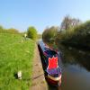
![Gateforth Landing, Selby Canal. A potential mooring space, with benches. See [[3172189]] for a view from the land side. by Christine Johnstone – 30 October 2015](https://s3.geograph.org.uk/geophotos/04/72/83/4728315_0aeb8481_120x120.jpg)