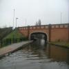
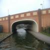
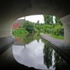
Spring Road Canal Bridge No 6A
is a minor waterways place
on the Coventry Canal (Main Line - Coventry to Hawkesbury) between
Hawkesbury Junction (Junction of the Coventry Canal Main Line with the Oxford Canal Northern Section.) (2 miles and 2¼ furlongs
to the northeast) and
Coventry Basin (Canal Terminus) (3 miles and 1¾ furlongs
to the southwest).
The nearest place in the direction of Hawkesbury Junction is Foleshill Winding Hole;
¼ furlongs
away.
The nearest place in the direction of Coventry Basin is Signal Box PH (Hungry Horse pub and restaurant);
3 furlongs
away.
Mooring here is unrated.
There is a bridge here which takes a dual carriageway over the canal.
Longford Footbridge No 9A | 1 mile, 1¾ furlongs | |
Judds Lane Bridge No 9 | 1 mile, ½ furlongs | |
New Inn Bridge No 8 | 6¼ furlongs | |
Old Church Road Bridge No 7 | 1½ furlongs | |
Foleshill Winding Hole | ¼ furlongs | |
Spring Road Canal Bridge No 6A | ||
Signal Box PH | 3 furlongs | |
Navigation Bridge No 6 | 3¼ furlongs | |
Stoke Heath Pipe Bridge | 6¼ furlongs | |
Heath Crescent Tunnel No 5B (northern entrance) | 7½ furlongs | |
Heath Crescent Tunnel No 5B (southern entrance) | 1 mile |
There's a convenient Lidl supermarket just up by the roundabout 200m NW of the bridge. Access the road from the south side of the bridge to avoid crossing the busy road.
There are no links to external websites from here.
Why not log in and add some (select "External websites" from the menu (sometimes this is under "Edit"))?
Mouseover for more information or show routes to facility
Nearest water point
In the direction of Coventry Basin
Coventry Visitor Moorings (outside basin) — 3 miles, 1 furlong away
On this waterway in the direction of Coventry Basin
Coventry Basin Services — 3 miles, 1½ furlongs away
On this waterway in the direction of Coventry Basin
In the direction of Hawkesbury Junction
Hawkesbury Services — 2 miles, 2 furlongs away
On this waterway in the direction of Hawkesbury Junction
Hawkesbury Water Point (Engine House) — 2 miles, 3 furlongs away
Travel to Hawkesbury Junction, then on the Coventry Canal (Main Line - Hawkesbury to Fazeley) to Hawkesbury Water Point (Engine House)
Hawkesbury Water Point (stop lock) — 2 miles, 3 furlongs and 1 lock away
Travel to Hawkesbury Junction, then on the Oxford Canal (Northern Section - Main Line) to Hawkesbury Water Point (stop lock)
Ansty Water Point — 6 miles and 1 lock away
Travel to Hawkesbury Junction, then on the Oxford Canal (Northern Section - Main Line) to Ansty Water Point
Springwood Haven Marina — 9 miles, 6 furlongs away
Travel to Hawkesbury Junction, then on the Coventry Canal (Main Line - Hawkesbury to Fazeley) to Springwood Haven Marina
Limekiln Bridge No 15 — 10 miles, 1¼ furlongs away
Travel to Hawkesbury Junction, then on the Coventry Canal (Main Line - Hawkesbury to Fazeley) to Marston Junction, then on the Ashby Canal (Main Line) to Limekiln Bridge No 15
Stretton Stop — 9 miles, 4½ furlongs and 1 lock away
Travel to Hawkesbury Junction, then on the Oxford Canal (Northern Section - Main Line) to Stretton Stop
C&RT Hartshill Maintenance Yard and Wharf — 11 miles, ¾ furlongs away
Travel to Hawkesbury Junction, then on the Coventry Canal (Main Line - Hawkesbury to Fazeley) to C&RT Hartshill Maintenance Yard and Wharf
Trinity Marina — 11 miles, 1¼ furlongs away
Travel to Hawkesbury Junction, then on the Coventry Canal (Main Line - Hawkesbury to Fazeley) to Marston Junction, then on the Ashby Canal (Main Line) to Trinity Marina
Atherstone Top Lock Winding Hole — 13 miles, 1 furlong away
Travel to Hawkesbury Junction, then on the Coventry Canal (Main Line - Hawkesbury to Fazeley) to Atherstone Top Lock Winding Hole
Newbold Wharf — 13 miles, 6¼ furlongs and 1 lock away
Travel to Hawkesbury Junction, then on the Oxford Canal (Northern Section - Main Line) to Newbold Wharf
Rugby Visitor Moorings — 15 miles, 2 furlongs and 1 lock away
Travel to Hawkesbury Junction, then on the Oxford Canal (Northern Section - Main Line) to Rugby Visitor Moorings
Sutton Cheney Wharf — 16 miles, 3¼ furlongs away
Travel to Hawkesbury Junction, then on the Coventry Canal (Main Line - Hawkesbury to Fazeley) to Marston Junction, then on the Ashby Canal (Main Line) to Sutton Cheney Wharf
Atherstone Lock No 5 — 13 miles, 3¾ furlongs and 4 locks away
Travel to Hawkesbury Junction, then on the Coventry Canal (Main Line - Hawkesbury to Fazeley) to Atherstone Lock No 5
Hillmorton Water Point — 17 miles, 5½ furlongs and 1 lock away
Travel to Hawkesbury Junction, then on the Oxford Canal (Northern Section - Main Line) to Hillmorton Water Point
Baddesley Basin — 13 miles, 7 furlongs and 6 locks away
Travel to Hawkesbury Junction, then on the Coventry Canal (Main Line - Hawkesbury to Fazeley) to Baddesley Basin
Bosworth Wharf Bridge No 42 — 19 miles, 7¾ furlongs away
Travel to Hawkesbury Junction, then on the Coventry Canal (Main Line - Hawkesbury to Fazeley) to Marston Junction, then on the Ashby Canal (Main Line) to Bosworth Wharf Bridge No 42
Bradley Green Services — 15 miles, 4 furlongs and 11 locks away
Travel to Hawkesbury Junction, then on the Coventry Canal (Main Line - Hawkesbury to Fazeley) to Bradley Green ServicesNearest rubbish disposal
In the direction of Hawkesbury Junction
Hawkesbury Services — 2 miles, 2 furlongs away
On this waterway in the direction of Hawkesbury Junction
Trinity Marina — 11 miles, 1¼ furlongs away
Travel to Hawkesbury Junction, then on the Coventry Canal (Main Line - Hawkesbury to Fazeley) to Marston Junction, then on the Ashby Canal (Main Line) to Trinity Marina
Mancetter Marina — 11 miles, 6 furlongs away
Travel to Hawkesbury Junction, then on the Coventry Canal (Main Line - Hawkesbury to Fazeley) to Mancetter Marina
Atherstone Top Lock Winding Hole — 13 miles, 1 furlong away
Travel to Hawkesbury Junction, then on the Coventry Canal (Main Line - Hawkesbury to Fazeley) to Atherstone Top Lock Winding Hole
Stoke Golding Wharf — 13 miles, 7 furlongs away
Travel to Hawkesbury Junction, then on the Coventry Canal (Main Line - Hawkesbury to Fazeley) to Marston Junction, then on the Ashby Canal (Main Line) to Stoke Golding Wharf
Newbold Wharf — 13 miles, 6¼ furlongs and 1 lock away
Travel to Hawkesbury Junction, then on the Oxford Canal (Northern Section - Main Line) to Newbold Wharf
Hillmorton Bridge No 71 — 17 miles, 7¼ furlongs and 2 locks away
Travel to Hawkesbury Junction, then on the Oxford Canal (Northern Section - Main Line) to Hillmorton Bridge No 71
Bradley Green Services — 15 miles, 4 furlongs and 11 locks away
Travel to Hawkesbury Junction, then on the Coventry Canal (Main Line - Hawkesbury to Fazeley) to Bradley Green ServicesNearest chemical toilet disposal
In the direction of Coventry Basin
Coventry Basin Services — 3 miles, 1½ furlongs away
On this waterway in the direction of Coventry Basin
In the direction of Hawkesbury Junction
Hawkesbury Services — 2 miles, 2 furlongs away
On this waterway in the direction of Hawkesbury Junction
Springwood Haven Marina — 9 miles, 6 furlongs away
Travel to Hawkesbury Junction, then on the Coventry Canal (Main Line - Hawkesbury to Fazeley) to Springwood Haven Marina
Trinity Marina — 11 miles, 1¼ furlongs away
Travel to Hawkesbury Junction, then on the Coventry Canal (Main Line - Hawkesbury to Fazeley) to Marston Junction, then on the Ashby Canal (Main Line) to Trinity Marina
Atherstone Top Lock Winding Hole — 13 miles, 1 furlong away
Travel to Hawkesbury Junction, then on the Coventry Canal (Main Line - Hawkesbury to Fazeley) to Atherstone Top Lock Winding Hole
Rugby Visitor Moorings — 15 miles, 2 furlongs and 1 lock away
Travel to Hawkesbury Junction, then on the Oxford Canal (Northern Section - Main Line) to Rugby Visitor Moorings
Sutton Cheney Wharf — 16 miles, 3¼ furlongs away
Travel to Hawkesbury Junction, then on the Coventry Canal (Main Line - Hawkesbury to Fazeley) to Marston Junction, then on the Ashby Canal (Main Line) to Sutton Cheney Wharf
Clifton Wharf — 16 miles, 2¼ furlongs and 1 lock away
Travel to Hawkesbury Junction, then on the Oxford Canal (Northern Section - Main Line) to Clifton Wharf
Hillmorton Bridge No 71 — 17 miles, 7¼ furlongs and 2 locks away
Travel to Hawkesbury Junction, then on the Oxford Canal (Northern Section - Main Line) to Hillmorton Bridge No 71
Bradley Green Services — 15 miles, 4 furlongs and 11 locks away
Travel to Hawkesbury Junction, then on the Coventry Canal (Main Line - Hawkesbury to Fazeley) to Bradley Green ServicesNearest place to turn
In the direction of Coventry Basin
Stoke Heath Basin — 1 mile, 1¾ furlongs away
On this waterway in the direction of Coventry Basin
William Henry Bridge Winding Hole — 2 miles, 1¼ furlongs away
On this waterway in the direction of Coventry Basin
Coventry Basin Winding Point — 3 miles, 1¾ furlongs away
On this waterway in the direction of Coventry Basin
In the direction of Hawkesbury Junction
Foleshill Winding Hole — ¼ furlongs away
On this waterway in the direction of Hawkesbury Junction
Hawkesbury Junction — 2 miles, 2¼ furlongs away
On this waterway in the direction of Hawkesbury Junction
Bedworth Winding Hole — 3 miles, 1¼ furlongs away
Travel to Hawkesbury Junction, then on the Coventry Canal (Main Line - Hawkesbury to Fazeley) to Bedworth Winding Hole
Wyken Arm Junction — 3 miles, 6¼ furlongs and 1 lock away
Travel to Hawkesbury Junction, then on the Oxford Canal (Northern Section - Main Line) to Wyken Arm Junction
Wyken Arm Terminal Basin — 4 miles, ¼ furlongs and 1 lock away
Travel to Hawkesbury Junction, then on the Oxford Canal (Northern Section - Main Line) to Wyken Arm Junction, then on the Oxford Canal (Northern Section - Wyken Arm) to Wyken Arm Terminal Basin
Marston Junction — 5 miles, ¾ furlongs away
Travel to Hawkesbury Junction, then on the Coventry Canal (Main Line - Hawkesbury to Fazeley) to Marston Junction
Junction with Griff Arm (disused) — 6 miles, 1½ furlongs away
Travel to Hawkesbury Junction, then on the Coventry Canal (Main Line - Hawkesbury to Fazeley) to Junction with Griff Arm (disused)
Wash Lane Winding Hole — 7 miles, 7½ furlongs away
Travel to Hawkesbury Junction, then on the Coventry Canal (Main Line - Hawkesbury to Fazeley) to Wash Lane Winding Hole
White House Winding Hole — 10 miles, ½ furlongs away
Travel to Hawkesbury Junction, then on the Coventry Canal (Main Line - Hawkesbury to Fazeley) to White House Winding Hole
Stretton Arm Junction — 9 miles, 4¾ furlongs and 1 lock away
Travel to Hawkesbury Junction, then on the Oxford Canal (Northern Section - Main Line) to Stretton Arm Junction
Hinckley Wharf Arm Junction — 10 miles, 5½ furlongs away
Travel to Hawkesbury Junction, then on the Coventry Canal (Main Line - Hawkesbury to Fazeley) to Marston Junction, then on the Ashby Canal (Main Line) to Hinckley Wharf Arm Junction
Stretton Arm Winding Hole — 9 miles, 7½ furlongs and 1 lock away
Travel to Hawkesbury Junction, then on the Oxford Canal (Northern Section - Main Line) to Stretton Arm Junction, then on the Oxford Canal (Northern Section - Stretton Arm) to Stretton Arm Winding Hole
Brinklow Arm Junction (disused) — 10 miles, ¾ furlongs and 1 lock away
Travel to Hawkesbury Junction, then on the Oxford Canal (Northern Section - Main Line) to Brinklow Arm Junction (disused)
Trinity Marina — 11 miles, 1¼ furlongs away
Travel to Hawkesbury Junction, then on the Coventry Canal (Main Line - Hawkesbury to Fazeley) to Marston Junction, then on the Ashby Canal (Main Line) to Trinity Marina
Cherrytree Farm Winding Hole — 11 miles, 3¼ furlongs away
Travel to Hawkesbury Junction, then on the Coventry Canal (Main Line - Hawkesbury to Fazeley) to Cherrytree Farm Winding Hole
Worthington Farm Bridge Winding Hole — 11 miles, 6 furlongs away
Travel to Hawkesbury Junction, then on the Coventry Canal (Main Line - Hawkesbury to Fazeley) to Worthington Farm Bridge Winding Hole
Fennis Field Arm — 11 miles, 7 furlongs and 1 lock away
Travel to Hawkesbury Junction, then on the Oxford Canal (Northern Section - Main Line) to Fennis Field ArmNearest self-operated pump-out
In the direction of Coventry Basin
Coventry Basin Services — 3 miles, 1½ furlongs away
On this waterway in the direction of Coventry Basin
In the direction of Hawkesbury Junction
Trinity Marina — 11 miles, 1¼ furlongs away
Travel to Hawkesbury Junction, then on the Coventry Canal (Main Line - Hawkesbury to Fazeley) to Marston Junction, then on the Ashby Canal (Main Line) to Trinity MarinaNearest boatyard pump-out
In the direction of Hawkesbury Junction
Boot Wharf — 7 miles, 1¾ furlongs away
Travel to Hawkesbury Junction, then on the Coventry Canal (Main Line - Hawkesbury to Fazeley) to Boot Wharf
Springwood Haven Marina — 9 miles, 6 furlongs away
Travel to Hawkesbury Junction, then on the Coventry Canal (Main Line - Hawkesbury to Fazeley) to Springwood Haven Marina
Stretton Stop — 9 miles, 4½ furlongs and 1 lock away
Travel to Hawkesbury Junction, then on the Oxford Canal (Northern Section - Main Line) to Stretton Stop
Trinity Marina — 11 miles, 1¼ furlongs away
Travel to Hawkesbury Junction, then on the Coventry Canal (Main Line - Hawkesbury to Fazeley) to Marston Junction, then on the Ashby Canal (Main Line) to Trinity Marina
Mancetter Marina — 11 miles, 6 furlongs away
Travel to Hawkesbury Junction, then on the Coventry Canal (Main Line - Hawkesbury to Fazeley) to Mancetter Marina
Falls Bridge Wharf — 13 miles, 1¼ furlongs and 1 lock away
Travel to Hawkesbury Junction, then on the Oxford Canal (Northern Section - Main Line) to Falls Bridge Wharf
Clifton Wharf — 16 miles, 2¼ furlongs and 1 lock away
Travel to Hawkesbury Junction, then on the Oxford Canal (Northern Section - Main Line) to Clifton WharfDirection of TV transmitter (From Wolfbane Cybernetic)
There is no page on Wikipedia called “Spring Road Canal Bridge No 6A”
Wikipedia pages that might relate to Spring Road Canal Bridge No 6A
[Corinth Canal]
arguably making the peninsula an island. The canal was dug through the isthmus at sea level and has no locks. It is 6.4 kilometres (4 mi) in length and only
[Welland Canal]
at a point now marked as such on the west end of Bridge No. 11 (formerly Highway 20). This canal opened for a trial run on November 30, 1829 (exactly
[Black Country New Road]
opened at the same time as the Great Bridge to West Bromwich section, which also included the Great Bridge relief road (Great Western Way). The second phase
[Bridgewater Canal]
Liverpool Canal at Leigh. It once connected with the River Mersey at Runcorn but has since been cut off by a slip road to the Silver Jubilee Bridge. The Bridgewater
[Kiel Canal]
Several railway lines and federal roads (Autobahnen and Bundesstraßen) cross the canal on eleven fixed links. The bridges have a clearance of 42 metres (138 ft)
[U.S. Route 6 in Massachusetts]
the concurrency to cross the Bourne Bridge across the Cape Cod Canal. US 6 then follows the western side of the canal along the Scenic Highway into Sagamore
[Chesapeake and Ohio Canal]
Four Lock Road, Clear Spring, Washington County, MD", 3 measured drawings HAER No. MD-69, "Chesapeake & Ohio Canal, White's Ferry Iron Bridge, Mile 35
[River Severn]
craft, users must obtain permits from the Canal & River Trust, who are the navigation authority. During spring freshet the river can be closed to navigation
[Special routes of U.S. Route 6]
sides of the canal along 2-way roads. At the eastern terminus of MA 25, US 6 Eastbound once crossed the Cape Cod Canal via the Bourne Bridge then followed
[Capture of the Caen canal and Orne river bridges]
The capture of the Caen canal and Orne river bridges (popularly known as Operation Deadstick, and in official documents as Operation Coup de Main) was
Results of Google Search
Cape Cod Canal Transportation Study - Executive SummaryThe Cape Cod Canal, the Sagamore and Bourne Bridges, and the surrounding open space ... too narrow, there are no roadway shoulders, and bicycle and pedestrian ... Town Hall Square, and Spring Hill National Historic Districts in. Sandwich ... approximately 2 9 miles from the Route 6A/Sandwich Road intersection to ...
Express service: A train that does not always operate or sometimes skips a station. ADA accessible ... Westchester Ave and Middletown Rd ... Spring St and Cleveland Place, Spring St and Lafayette St. Two side platforms. No Transfers. Subway, local station. Canal St. Canal St and Lafayette St ... Brooklyn Bridge City Hall.
vehicles on the Canal bridges during the summer compared to the non-summer. ... Route 25 EB Off Ramp to Maple Springs Rd. 695. 1,055. 1,745. 14,800 ... Future No-Build Transportation Conditions 3-7. Cape Cod Canal. ")6A. £¤6. ")6A. ")3.
From: Bridge #2 (No road access) To … ... Section – 6 (1.0 mile) This section adopted by: Ed Herrmann(Spring Valley) & Ray Sandrolini(Peru) ... Bridge #6A.
After the crossing Sagamore Bridge any of the first 3 exits off Route 6 leads into Sandwich. ... bridge go almost all the way around and travel along the Canal to Route 6. ... Green Briar Nature Center and Jam Kitchen, 6 Discovery Hill Rd (off Rt. 6A, ... All require non-resident parking stickers $40/season, Sandwich Town Hall ...
U.S. Route 6 (US 6) in Massachusetts is a 117.95 mi (189.83 km) long portion of the ... The bridges from the Cape Cod Canal, to Oak Street in Barnstable Village ( a ... both roads Route 6A), but this was rejected, as the town decided instead to let ... exit number removed in 1985; west end of unsigned Route 6A concurrency.
Jul 12, 2020 ... The New York State Canal Corporation, Cross-Westchester Expressway, and ... 5.0, Exit 6A ... Spring Valley Toll, No toll for passenger cars.
century transportation; early road and bridge specifications and building practices; the ... The general utility of artificial roads and canals is at this time so universally ... (2)6a: The Falling Creek Bridge: Part 1: A Brief History of the Falling Creek Bridge ... of Route 629 into Bath County, to Route 39, and thence to Warm Springs.
Restaurants near Cape Cod Canal Visitors Center, Sandwich on Tripadvisor: Find traveler reviews ... 101 Route 6a At the corner of Route 6A and Tupper Road .
Highway road bridge known as Coventry Canal bridge No 6A built 1996. Spring Road Foleshill Coventry West Midlands. Nearby cities: Coordinates: 52°26'3"N ...