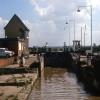
Keadby Junction Lock
is a minor waterways place
on the Sheffield and South Yorkshire Navigation (Stainforth and Keadby Canal) between
Keadby Visitor Moorings (¾ furlongs
to the west) and
Keadby Junction (Junction of Stainforth and Keadby Canal with River Trent) (½ furlongs
to the east).
The nearest place in the direction of Keadby Visitor Moorings is Trentside Swing Bridge;
¼ furlongs
away.
Mooring here is impossible (it may be physically impossible, forbidden, or allowed only for specific short-term purposes).
This is a lock with a rise of varies depending on tide..
| Pilfrey Bridge | 1 mile, 3½ furlongs | |
| Vazon Road Swing Bridge | 5 furlongs | |
| Vazon Sliding Railway Bridge | 4½ furlongs | |
| Keadby Visitor Moorings | ¾ furlongs | |
| Trentside Swing Bridge | ¼ furlongs | |
| Keadby Junction Lock | ||
| Keadby Junction | ½ furlongs | |
Amenities nearby at Keadby Junction
Passage through this lock is dependant on the state of the tide. Book passage 48 hrs in advance and seek guidance on preferable time. Lock keeper 07733124611 or alternative 0197755451
- S&SY navigation info — associated with Sheffield and South Yorkshire Navigation
- Sheffield & South Yorkshire navigation info from IWA
Mouseover for more information or show routes to facility
Nearest water point
In the direction of Stainforth Junction
Keadby Visitor Moorings — ¾ furlongs and 1 lock away
On this waterway in the direction of Stainforth Junction
Thorne Visitor Moorings — 9 miles, 7 furlongs and 1 lock away
On this waterway in the direction of Stainforth Junction
Bramwith Swing Bridge — 14 miles, 1½ furlongs and 2 locks away
Travel to Stainforth Junction, then on the Sheffield and South Yorkshire Navigation (Bramwith to Stainforth) to Bramwith Swing Bridge
Bramwith Lock No 14 — 14 miles, 4½ furlongs and 2 locks away
Travel to Stainforth Junction, then on the Sheffield and South Yorkshire Navigation (Bramwith to Stainforth) to Bramwith Lock No 14
Barnby Dun Lift Bridge — 15 miles, 7 furlongs and 3 locks away
Travel to Stainforth Junction, then on the Sheffield and South Yorkshire Navigation (Bramwith to Stainforth) to Bramwith Junction, then on the Sheffield and South Yorkshire Navigation (Main Line) to Barnby Dun Lift Bridge
Long Sandall Lock No 13 — 18 miles, ½ furlongs and 3 locks away
Travel to Stainforth Junction, then on the Sheffield and South Yorkshire Navigation (Bramwith to Stainforth) to Bramwith Junction, then on the Sheffield and South Yorkshire Navigation (Main Line) to Long Sandall Lock No 13
In the direction of Keadby Junction
West Stockwith Basin — 12 miles, 6¾ furlongs and 2 locks away
Travel to Keadby Junction, then on the River Trent (tidal section - Cromwell to Keadby) to Chesterfield Canal - River Trent Junction, then on the Chesterfield Canal (Retford to the Trent) to West Stockwith Basin
Goole Marina — 17 miles, 7¼ furlongs and 2 locks away
Travel to Keadby Junction, then on the River Trent (tidal section - Keadby to Trent Falls) to Trent Falls, then on the River Ouse : Yorkshire (tidal section - Goole to Trent Falls) to Ouse - Aire and Calder Junction, then on the Aire and Calder Navigation (Main Line - Goole to Castleford) to Goole Marina
Dutch Riverside — 18 miles, ¾ furlongs and 2 locks away
Travel to Keadby Junction, then on the River Trent (tidal section - Keadby to Trent Falls) to Trent Falls, then on the River Ouse : Yorkshire (tidal section - Goole to Trent Falls) to Ouse - Aire and Calder Junction, then on the Aire and Calder Navigation (Main Line - Goole to Castleford) to Dutch RiversideNearest rubbish disposal
In the direction of Stainforth Junction
Keadby Visitor Moorings — ¾ furlongs and 1 lock away
On this waterway in the direction of Stainforth Junction
Thorne Visitor Moorings — 9 miles, 7 furlongs and 1 lock away
On this waterway in the direction of Stainforth Junction
Bramwith Swing Bridge — 14 miles, 1½ furlongs and 2 locks away
Travel to Stainforth Junction, then on the Sheffield and South Yorkshire Navigation (Bramwith to Stainforth) to Bramwith Swing Bridge
Barnby Dun Lift Bridge — 15 miles, 7 furlongs and 3 locks away
Travel to Stainforth Junction, then on the Sheffield and South Yorkshire Navigation (Bramwith to Stainforth) to Bramwith Junction, then on the Sheffield and South Yorkshire Navigation (Main Line) to Barnby Dun Lift Bridge
In the direction of Keadby Junction
West Stockwith Basin — 12 miles, 6¾ furlongs and 2 locks away
Travel to Keadby Junction, then on the River Trent (tidal section - Cromwell to Keadby) to Chesterfield Canal - River Trent Junction, then on the Chesterfield Canal (Retford to the Trent) to West Stockwith Basin
Goole Marina — 17 miles, 7¼ furlongs and 2 locks away
Travel to Keadby Junction, then on the River Trent (tidal section - Keadby to Trent Falls) to Trent Falls, then on the River Ouse : Yorkshire (tidal section - Goole to Trent Falls) to Ouse - Aire and Calder Junction, then on the Aire and Calder Navigation (Main Line - Goole to Castleford) to Goole Marina
Dutch Riverside — 18 miles, ¾ furlongs and 2 locks away
Travel to Keadby Junction, then on the River Trent (tidal section - Keadby to Trent Falls) to Trent Falls, then on the River Ouse : Yorkshire (tidal section - Goole to Trent Falls) to Ouse - Aire and Calder Junction, then on the Aire and Calder Navigation (Main Line - Goole to Castleford) to Dutch RiversideNearest chemical toilet disposal
In the direction of Stainforth Junction
Keadby Visitor Moorings — ¾ furlongs and 1 lock away
On this waterway in the direction of Stainforth Junction
Thorne Visitor Moorings — 9 miles, 7 furlongs and 1 lock away
On this waterway in the direction of Stainforth Junction
Bramwith Swing Bridge — 14 miles, 1½ furlongs and 2 locks away
Travel to Stainforth Junction, then on the Sheffield and South Yorkshire Navigation (Bramwith to Stainforth) to Bramwith Swing Bridge
Barnby Dun Lift Bridge — 15 miles, 7 furlongs and 3 locks away
Travel to Stainforth Junction, then on the Sheffield and South Yorkshire Navigation (Bramwith to Stainforth) to Bramwith Junction, then on the Sheffield and South Yorkshire Navigation (Main Line) to Barnby Dun Lift Bridge
In the direction of Keadby Junction
West Stockwith Basin — 12 miles, 6¾ furlongs and 2 locks away
Travel to Keadby Junction, then on the River Trent (tidal section - Cromwell to Keadby) to Chesterfield Canal - River Trent Junction, then on the Chesterfield Canal (Retford to the Trent) to West Stockwith Basin
Goole Marina — 17 miles, 7¼ furlongs and 2 locks away
Travel to Keadby Junction, then on the River Trent (tidal section - Keadby to Trent Falls) to Trent Falls, then on the River Ouse : Yorkshire (tidal section - Goole to Trent Falls) to Ouse - Aire and Calder Junction, then on the Aire and Calder Navigation (Main Line - Goole to Castleford) to Goole Marina
Dutch Riverside — 18 miles, ¾ furlongs and 2 locks away
Travel to Keadby Junction, then on the River Trent (tidal section - Keadby to Trent Falls) to Trent Falls, then on the River Ouse : Yorkshire (tidal section - Goole to Trent Falls) to Ouse - Aire and Calder Junction, then on the Aire and Calder Navigation (Main Line - Goole to Castleford) to Dutch RiversideNearest place to turn
In the direction of Stainforth Junction
Huddle Grounds Winding Hole — 12 miles, 2½ furlongs and 2 locks away
On this waterway in the direction of Stainforth Junction
Wheatley Hall Road Winding Hole — 19 miles, 1 furlong and 4 locks away
Travel to Stainforth Junction, then on the Sheffield and South Yorkshire Navigation (Bramwith to Stainforth) to Bramwith Junction, then on the Sheffield and South Yorkshire Navigation (Main Line) to Wheatley Hall Road Winding Hole
In the direction of Keadby Junction
West Stockwith Basin — 12 miles, 6¾ furlongs and 2 locks away
Travel to Keadby Junction, then on the River Trent (tidal section - Cromwell to Keadby) to Chesterfield Canal - River Trent Junction, then on the Chesterfield Canal (Retford to the Trent) to West Stockwith Basin
River Foulness Junction — 15 miles, 2 furlongs and 2 locks away
Travel to Keadby Junction, then on the River Trent (tidal section - Keadby to Trent Falls) to Trent Falls, then on the River Humber to Humber - Market Weighton Junction, then on the Market Weighton Canal to River Foulness Junction
Manor Farm Winding Hole — 15 miles, 3 furlongs and 4 locks away
Travel to Keadby Junction, then on the River Trent (tidal section - Cromwell to Keadby) to Chesterfield Canal - River Trent Junction, then on the Chesterfield Canal (Retford to the Trent) to Manor Farm Winding Hole
Viking Marina — 18 miles and 2 locks away
Travel to Keadby Junction, then on the River Trent (tidal section - Keadby to Trent Falls) to Trent Falls, then on the River Ouse : Yorkshire (tidal section - Goole to Trent Falls) to Ouse - Aire and Calder Junction, then on the Aire and Calder Navigation (Main Line - Goole to Castleford) to Viking Marina
Drakeholes Tunnel (southern entrance) — 19 miles, 2½ furlongs and 6 locks away
Travel to Keadby Junction, then on the River Trent (tidal section - Cromwell to Keadby) to Chesterfield Canal - River Trent Junction, then on the Chesterfield Canal (Retford to the Trent) to Drakeholes Tunnel (southern entrance)
Drakeholes Visitor Moorings — 19 miles, 3 furlongs and 6 locks away
Travel to Keadby Junction, then on the River Trent (tidal section - Cromwell to Keadby) to Chesterfield Canal - River Trent Junction, then on the Chesterfield Canal (Retford to the Trent) to Drakeholes Visitor MooringsNearest self-operated pump-out
In the direction of Stainforth Junction
Long Sandall Lock No 13 — 18 miles, ½ furlongs and 3 locks away
Travel to Stainforth Junction, then on the Sheffield and South Yorkshire Navigation (Bramwith to Stainforth) to Bramwith Junction, then on the Sheffield and South Yorkshire Navigation (Main Line) to Long Sandall Lock No 13Nearest boatyard pump-out
In the direction of Stainforth Junction
Blue Water Marina — 9 miles, 1¾ furlongs and 1 lock away
On this waterway in the direction of Stainforth Junction
Thorne Swing Bridge — 9 miles, 6½ furlongs and 1 lock away
On this waterway in the direction of Stainforth Junction
In the direction of Keadby Junction
Goole Marina — 17 miles, 7¼ furlongs and 2 locks away
Travel to Keadby Junction, then on the River Trent (tidal section - Keadby to Trent Falls) to Trent Falls, then on the River Ouse : Yorkshire (tidal section - Goole to Trent Falls) to Ouse - Aire and Calder Junction, then on the Aire and Calder Navigation (Main Line - Goole to Castleford) to Goole MarinaDirection of TV transmitter (From Wolfbane Cybernetic)
There is no page on Wikipedia called “Keadby Junction Lock”
Wikipedia pages that might relate to Keadby Junction Lock
[Stainforth and Keadby Canal]
The operation was always restricted by the size of Keadby Lock, although vessels longer than the lock could pass through when the river was level with the
[New Junction Canal]
opened in 1905. It links the River Don Navigation and the Stainforth and Keadby Canal with the Aire and Calder Navigation (Knottingley Canal). It is completely
[Keadby railway station]
point where the Stainforth and Keadby Canal passed through a lock to access the river. On 1 May 1866, the first Keadby Bridge and the associated diversionary
[Sheffield and South Yorkshire Navigation]
Sheffield, Rotherham, and Doncaster with the River Trent at Keadby and (via the New Junction Canal) the Aire and Calder Navigation. The system consisted
[River Trent]
over the river is at Keadby where it is joined by both the Stainforth and Keadby Canal and the River Torne. Downstream of Keadby the river progressively
[River Don Navigation]
and lock cuts were built, and, by 1751, the river was navigable to Tinsley. The network was expanded by the opening of the Stainforth and Keadby Canal
[South Yorkshire Railway]
of the Stainforth and Keadby Canal to Thorne. The line initially terminating at Thorne Waterside railway station (or "Thorne Lock"),[citation needed] which
[Aire and Calder Navigation]
via the New Junction Canal, forms a link with Doncaster, Rotherham and Sheffield to the south west, and the tidal River Trent at Keadby to the east.
[Hatfield Chase]
Althorpe on the River Trent. Discharge to the Trent was subsequently moved to Keadby, and the gravity drainage was supplemented by pumps when a pumping station
[Calder and Hebble Navigation]
Liverpool Canal in the west, and to Selby, York, Goole and the Humber, Keadby and the River Trent, and Sheffield, Rotherham and Doncaster in the east
Results of Google Search
Stainforth and Keadby Canal - WikipediaShortly after the junction, Bramwith Lock lowers the level of the canal. The River Don, after flowing under the New Junction Canal, joins the canal and continues ...
Jan 16, 2018 ... In this part we take on the eerily calm (and bloody cold) tidal River Trent, setting off from Keadby Lock. All filmed on an iPhone 8+, edited using ...
Many of the locks (not Keadby Lock) require a Sanitary Station key to operate and have traffic lights (not Keadby or Thorne locks or the Tinsley Flight) to indicate ...
Keadby Lock operating times Booking: Book 24 hrs in advance with lock keepers on 07733 124611 Summer operating times: April - November - 06:00 to 21:00 ...
Apr 28, 2017 ... Had thought about following some one to Keadby lock from Cromwell Lock. Cruiser is a widebeam 2.80m Seamaster 23 built 1972, draught 0.48 ...
The Stainforth and Keadby Canal runs for some 14 miles from the New Junction Canal at Bramwith Junction to the tidal River Trent at Keadby. Bramwith Lock.
The New Junction canal ; Stainforth & Keadby canal. Straight lines ... To find a bridge in the middle of this manned (though not always) lock was most peculiar.

![Boarded-up building, north side, Keadby Lock. The premises of J. Wharton [Shipping] Ltd, Railway Wharf. Seen from a barge in the lock. by Christine Johnstone – 12 September 2015](https://s0.geograph.org.uk/geophotos/04/68/26/4682624_7f803194_120x120.jpg)


![Keadby Lock, open to take a boat from the Trent. The eastern end of the Stainforth & Keadby Canal [South Yorkshire Navigation]. Taken from the barge Sobriety, turning in from the Trent on a rising tide. The boat had travelled from Goole, via Hessle. by Christine Johnstone – 12 September 2015](https://s2.geograph.org.uk/geophotos/04/68/26/4682618_8c11b2d4_120x120.jpg)


![Keadby railway station (site), Lincolnshire. Opened in 1859 by the South Yorkshire Railway, later part of the Manchester Sheffield & Lincolnshire Railway and then the Great Central Railway as the terminus of the line from Doncaster. This station was effectively replaced in 1866 by the first Althorpe station on a more southerly alignment which crossed the River Trent, but Keadby was still served by passenger trains until 1874.View east along the former track-bed towards the buffers. The site appeared to be vacant when this image was taken. See also [[7918565]] for the replacement station. by Nigel Thompson – 06 November 2024](https://s0.geograph.org.uk/geophotos/07/91/85/7918552_983aec16_120x120.jpg)


![Entrance to Keadby Lock, west bank of the River Trent. The eastern end of the Stainforth and Keadby Canal [part of the South Yorkshire Navigation]. Seen from the barge Sobriety, which is about to enter the canal from the river. The green traffic light gives the go ahead. by Christine Johnstone – 12 September 2015](https://s0.geograph.org.uk/geophotos/04/68/26/4682612_b10ab017_120x120.jpg)


![Keadby - former lock-up shop. At the southern end of Trent Side. The Auld South Yorkshire Inn used to be behind this shop - see the 2007 photo [[507497]]. Perhaps the fire damage of 2010 resulted in the pub's closure and demolition - see http://www.scunthorpetelegraph.co.uk/Investigation-blaze-Auld-South-Yorkshire-pub/story-11181721-detail/story.html . by Dave Bevis – 30 August 2014](https://s0.geograph.org.uk/geophotos/04/14/67/4146768_3206942b_120x120.jpg)