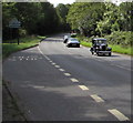
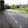
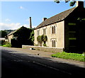
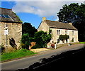
Stantons Bridge
Bowbridge Lock, Stroud GL5 2JZ, United Kingdom

Stantons Bridge
is a minor waterways place
on the Cotswold Canals (Thames and Severn Canal - Wide section) between
Bourne Lock No 8 (Rescued 1995) (1 mile and 5½ furlongs
and 4 locks
to the southeast) and
Site of Entrance to Wallbridge Basin (The junction between the Stroudwater Navigation and the Thames & Severn Canal.) (1 mile and 1¾ furlongs
and 3 locks
to the northwest).
The nearest place in the direction of Bourne Lock No 8 is Griffin Mill Lock No 4 (Restored 2014);
1¾ furlongs
away.
The nearest place in the direction of Site of Entrance to Wallbridge Basin is Bowbridge Lock No 3 (Restored 2015);
1¾ furlongs
away.
There may be access to the towpath here.
Mooring here is unrated.
There is a bridge here which takes a track over the canal.
| Bagpath Bridge | 5½ furlongs | |
| Ham Mill Lock No 5 | 4 furlongs | |
| Ham Mill Bridge | 4 furlongs | |
| Jubilee Footbridge | 2½ furlongs | |
| Griffin Mill Lock No 4 | 1¾ furlongs | |
| Stantons Bridge | ||
| Bowbridge Lock No 3 | 1¾ furlongs | |
| Bowbridge Bridge | 1¾ furlongs | |
| River Frome Aqueduct | 4 furlongs | |
| Stroud Railway Viaduct | 5 furlongs | |
| Capel's Mill New Canal Channel | 5¼ furlongs | |
There are no links to external websites from here.
Why not log in and add some (select "External websites" from the menu (sometimes this is under "Edit"))?
Why not log in and add some (select "External websites" from the menu (sometimes this is under "Edit"))?
Mouseover for more information or show routes to facility
Nearest water point
In the direction of Site of Entrance to Wallbridge Basin
Saul Junction Marina — 7 miles, 7¾ furlongs and 15 locks away
Travel to Site of Entrance to Wallbridge Basin, then on the Cotswold Canals (Stroudwater Navigation - Un-navigable Section) to Walk Bridge, then on the Cotswold Canals (Stroudwater Navigation - Navigable Section) to Saul Junction Marina
Saul Junction Winding Hole — 8 miles, 1 furlong and 15 locks away
Travel to Site of Entrance to Wallbridge Basin, then on the Cotswold Canals (Stroudwater Navigation - Un-navigable Section) to Walk Bridge, then on the Cotswold Canals (Stroudwater Navigation - Navigable Section) to Saul Junction, then on the Gloucester and Sharpness Canal to Saul Junction Winding Hole
Cotswold Canals Trust Visitor Centre - Saul Junction — 8 miles, 2 furlongs and 15 locks away
Travel to Site of Entrance to Wallbridge Basin, then on the Cotswold Canals (Stroudwater Navigation - Un-navigable Section) to Walk Bridge, then on the Cotswold Canals (Stroudwater Navigation - Navigable Section) to Saul Junction, then on the Gloucester and Sharpness Canal to Cotswold Canals Trust Visitor Centre - Saul Junction
Fretherne Bridge — 8 miles, 7 furlongs and 15 locks away
Travel to Site of Entrance to Wallbridge Basin, then on the Cotswold Canals (Stroudwater Navigation - Un-navigable Section) to Walk Bridge, then on the Cotswold Canals (Stroudwater Navigation - Navigable Section) to Saul Junction, then on the Gloucester and Sharpness Canal to Fretherne Bridge
Splatt Bridge — 9 miles, 7¾ furlongs and 15 locks away
Travel to Site of Entrance to Wallbridge Basin, then on the Cotswold Canals (Stroudwater Navigation - Un-navigable Section) to Walk Bridge, then on the Cotswold Canals (Stroudwater Navigation - Navigable Section) to Saul Junction, then on the Gloucester and Sharpness Canal to Splatt Bridge
Patch Bridge — 11 miles, 6¾ furlongs and 15 locks away
Travel to Site of Entrance to Wallbridge Basin, then on the Cotswold Canals (Stroudwater Navigation - Un-navigable Section) to Walk Bridge, then on the Cotswold Canals (Stroudwater Navigation - Navigable Section) to Saul Junction, then on the Gloucester and Sharpness Canal to Patch Bridge
Sellars Bridge — 11 miles, 6¾ furlongs and 15 locks away
Travel to Site of Entrance to Wallbridge Basin, then on the Cotswold Canals (Stroudwater Navigation - Un-navigable Section) to Walk Bridge, then on the Cotswold Canals (Stroudwater Navigation - Navigable Section) to Saul Junction, then on the Gloucester and Sharpness Canal to Sellars Bridge
Purton Lower Bridge — 14 miles, 2¼ furlongs and 15 locks away
Travel to Site of Entrance to Wallbridge Basin, then on the Cotswold Canals (Stroudwater Navigation - Un-navigable Section) to Walk Bridge, then on the Cotswold Canals (Stroudwater Navigation - Navigable Section) to Saul Junction, then on the Gloucester and Sharpness Canal to Purton Lower Bridge
Llanthony Pontoons — 15 miles, 4¾ furlongs and 15 locks away
Travel to Site of Entrance to Wallbridge Basin, then on the Cotswold Canals (Stroudwater Navigation - Un-navigable Section) to Walk Bridge, then on the Cotswold Canals (Stroudwater Navigation - Navigable Section) to Saul Junction, then on the Gloucester and Sharpness Canal to Llanthony Pontoons
Llanthony Road Bridge — 15 miles, 5½ furlongs and 15 locks away
Travel to Site of Entrance to Wallbridge Basin, then on the Cotswold Canals (Stroudwater Navigation - Un-navigable Section) to Walk Bridge, then on the Cotswold Canals (Stroudwater Navigation - Navigable Section) to Saul Junction, then on the Gloucester and Sharpness Canal to Llanthony Road Bridge
Gloucester Waterways Museum Arm — 15 miles, 6 furlongs and 15 locks away
Travel to Site of Entrance to Wallbridge Basin, then on the Cotswold Canals (Stroudwater Navigation - Un-navigable Section) to Walk Bridge, then on the Cotswold Canals (Stroudwater Navigation - Navigable Section) to Saul Junction, then on the Gloucester and Sharpness Canal to Gloucester Waterways Museum Arm
Gloucester Dock Lock — 15 miles, 7 furlongs and 15 locks away
Travel to Site of Entrance to Wallbridge Basin, then on the Cotswold Canals (Stroudwater Navigation - Un-navigable Section) to Walk Bridge, then on the Cotswold Canals (Stroudwater Navigation - Navigable Section) to Saul Junction, then on the Gloucester and Sharpness Canal to Gloucester Dock LockNearest rubbish disposal
In the direction of Site of Entrance to Wallbridge Basin
Saul Junction Marina — 7 miles, 7¾ furlongs and 15 locks away
Travel to Site of Entrance to Wallbridge Basin, then on the Cotswold Canals (Stroudwater Navigation - Un-navigable Section) to Walk Bridge, then on the Cotswold Canals (Stroudwater Navigation - Navigable Section) to Saul Junction Marina
Saul Junction Winding Hole — 8 miles, 1 furlong and 15 locks away
Travel to Site of Entrance to Wallbridge Basin, then on the Cotswold Canals (Stroudwater Navigation - Un-navigable Section) to Walk Bridge, then on the Cotswold Canals (Stroudwater Navigation - Navigable Section) to Saul Junction, then on the Gloucester and Sharpness Canal to Saul Junction Winding Hole
Fretherne Bridge — 8 miles, 7 furlongs and 15 locks away
Travel to Site of Entrance to Wallbridge Basin, then on the Cotswold Canals (Stroudwater Navigation - Un-navigable Section) to Walk Bridge, then on the Cotswold Canals (Stroudwater Navigation - Navigable Section) to Saul Junction, then on the Gloucester and Sharpness Canal to Fretherne Bridge
Parkend Bridge — 9 miles, 5½ furlongs and 15 locks away
Travel to Site of Entrance to Wallbridge Basin, then on the Cotswold Canals (Stroudwater Navigation - Un-navigable Section) to Walk Bridge, then on the Cotswold Canals (Stroudwater Navigation - Navigable Section) to Saul Junction, then on the Gloucester and Sharpness Canal to Parkend Bridge
Splatt Bridge — 9 miles, 7¾ furlongs and 15 locks away
Travel to Site of Entrance to Wallbridge Basin, then on the Cotswold Canals (Stroudwater Navigation - Un-navigable Section) to Walk Bridge, then on the Cotswold Canals (Stroudwater Navigation - Navigable Section) to Saul Junction, then on the Gloucester and Sharpness Canal to Splatt Bridge
Patch Bridge — 11 miles, 6¾ furlongs and 15 locks away
Travel to Site of Entrance to Wallbridge Basin, then on the Cotswold Canals (Stroudwater Navigation - Un-navigable Section) to Walk Bridge, then on the Cotswold Canals (Stroudwater Navigation - Navigable Section) to Saul Junction, then on the Gloucester and Sharpness Canal to Patch Bridge
Sellars Bridge — 11 miles, 6¾ furlongs and 15 locks away
Travel to Site of Entrance to Wallbridge Basin, then on the Cotswold Canals (Stroudwater Navigation - Un-navigable Section) to Walk Bridge, then on the Cotswold Canals (Stroudwater Navigation - Navigable Section) to Saul Junction, then on the Gloucester and Sharpness Canal to Sellars Bridge
Purton Lower Bridge — 14 miles, 2¼ furlongs and 15 locks away
Travel to Site of Entrance to Wallbridge Basin, then on the Cotswold Canals (Stroudwater Navigation - Un-navigable Section) to Walk Bridge, then on the Cotswold Canals (Stroudwater Navigation - Navigable Section) to Saul Junction, then on the Gloucester and Sharpness Canal to Purton Lower Bridge
Sharpness Barge Arm — 15 miles, 5½ furlongs and 15 locks away
Travel to Site of Entrance to Wallbridge Basin, then on the Cotswold Canals (Stroudwater Navigation - Un-navigable Section) to Walk Bridge, then on the Cotswold Canals (Stroudwater Navigation - Navigable Section) to Saul Junction, then on the Gloucester and Sharpness Canal to Sharpness Barge Arm
Llanthony Road Bridge — 15 miles, 5½ furlongs and 15 locks away
Travel to Site of Entrance to Wallbridge Basin, then on the Cotswold Canals (Stroudwater Navigation - Un-navigable Section) to Walk Bridge, then on the Cotswold Canals (Stroudwater Navigation - Navigable Section) to Saul Junction, then on the Gloucester and Sharpness Canal to Llanthony Road BridgeNearest chemical toilet disposal
In the direction of Site of Entrance to Wallbridge Basin
Saul Junction Marina — 7 miles, 7¾ furlongs and 15 locks away
Travel to Site of Entrance to Wallbridge Basin, then on the Cotswold Canals (Stroudwater Navigation - Un-navigable Section) to Walk Bridge, then on the Cotswold Canals (Stroudwater Navigation - Navigable Section) to Saul Junction Marina
Cotswold Canals Trust Visitor Centre - Saul Junction — 8 miles, 2 furlongs and 15 locks away
Travel to Site of Entrance to Wallbridge Basin, then on the Cotswold Canals (Stroudwater Navigation - Un-navigable Section) to Walk Bridge, then on the Cotswold Canals (Stroudwater Navigation - Navigable Section) to Saul Junction, then on the Gloucester and Sharpness Canal to Cotswold Canals Trust Visitor Centre - Saul Junction
Sharpness Barge Arm — 15 miles, 5½ furlongs and 15 locks away
Travel to Site of Entrance to Wallbridge Basin, then on the Cotswold Canals (Stroudwater Navigation - Un-navigable Section) to Walk Bridge, then on the Cotswold Canals (Stroudwater Navigation - Navigable Section) to Saul Junction, then on the Gloucester and Sharpness Canal to Sharpness Barge Arm
Llanthony Road Bridge — 15 miles, 5½ furlongs and 15 locks away
Travel to Site of Entrance to Wallbridge Basin, then on the Cotswold Canals (Stroudwater Navigation - Un-navigable Section) to Walk Bridge, then on the Cotswold Canals (Stroudwater Navigation - Navigable Section) to Saul Junction, then on the Gloucester and Sharpness Canal to Llanthony Road BridgeNearest place to turn
In the direction of Bourne Mill Bridge
Brimscombe Port — 1 mile, 4¼ furlongs and 4 locks away
On this waterway in the direction of Bourne Mill Bridge
Latton Junction — 18 miles, 7¾ furlongs and 36 locks away
Travel to Bourne Mill Bridge, then on the Cotswold Canals (Thames and Severn Canal - Wide/long lock section) to Bourne Bridge, then on the Cotswold Canals (Thames and Severn Canal - Main section) to Latton Junction
In the direction of Site of Entrance to Wallbridge Basin
Ryeford Winding Hole — 3 miles, 2¼ furlongs and 7 locks away
Travel to Site of Entrance to Wallbridge Basin, then on the Cotswold Canals (Stroudwater Navigation - Un-navigable Section) to Ryeford Winding Hole
The Ocean — 4 miles, 2 furlongs and 7 locks away
Travel to Site of Entrance to Wallbridge Basin, then on the Cotswold Canals (Stroudwater Navigation - Un-navigable Section) to The Ocean
Saul Junction Winding Hole — 8 miles, 1 furlong and 15 locks away
Travel to Site of Entrance to Wallbridge Basin, then on the Cotswold Canals (Stroudwater Navigation - Un-navigable Section) to Walk Bridge, then on the Cotswold Canals (Stroudwater Navigation - Navigable Section) to Saul Junction, then on the Gloucester and Sharpness Canal to Saul Junction Winding Hole
Pegthorne Bridge Winding Hole — 8 miles, 5¾ furlongs and 15 locks away
Travel to Site of Entrance to Wallbridge Basin, then on the Cotswold Canals (Stroudwater Navigation - Un-navigable Section) to Walk Bridge, then on the Cotswold Canals (Stroudwater Navigation - Navigable Section) to Saul Junction, then on the Gloucester and Sharpness Canal to Pegthorne Bridge Winding Hole
Quedgeley Oil Depot — 12 miles, ¼ furlongs and 15 locks away
Travel to Site of Entrance to Wallbridge Basin, then on the Cotswold Canals (Stroudwater Navigation - Un-navigable Section) to Walk Bridge, then on the Cotswold Canals (Stroudwater Navigation - Navigable Section) to Saul Junction, then on the Gloucester and Sharpness Canal to Quedgeley Oil Depot
Monk Meadow Dock — 15 miles, 2½ furlongs and 15 locks away
Travel to Site of Entrance to Wallbridge Basin, then on the Cotswold Canals (Stroudwater Navigation - Un-navigable Section) to Walk Bridge, then on the Cotswold Canals (Stroudwater Navigation - Navigable Section) to Saul Junction, then on the Gloucester and Sharpness Canal to Monk Meadow Dock
Sharpness Barge Arm — 15 miles, 5½ furlongs and 15 locks away
Travel to Site of Entrance to Wallbridge Basin, then on the Cotswold Canals (Stroudwater Navigation - Un-navigable Section) to Walk Bridge, then on the Cotswold Canals (Stroudwater Navigation - Navigable Section) to Saul Junction, then on the Gloucester and Sharpness Canal to Sharpness Barge Arm
Gloucester Docks — 15 miles, 6¼ furlongs and 15 locks away
Travel to Site of Entrance to Wallbridge Basin, then on the Cotswold Canals (Stroudwater Navigation - Un-navigable Section) to Walk Bridge, then on the Cotswold Canals (Stroudwater Navigation - Navigable Section) to Saul Junction, then on the Gloucester and Sharpness Canal to Gloucester Docks
Waterways Office (South Wales and Severn Waterways) - Canal & River Trust — 15 miles, 6¾ furlongs and 15 locks away
Travel to Site of Entrance to Wallbridge Basin, then on the Cotswold Canals (Stroudwater Navigation - Un-navigable Section) to Walk Bridge, then on the Cotswold Canals (Stroudwater Navigation - Navigable Section) to Saul Junction, then on the Gloucester and Sharpness Canal to Waterways Office (South Wales and Severn Waterways) - Canal & River Trust
Gloucester / Sharpness - Severn Junction — 15 miles, 7¼ furlongs and 16 locks away
Travel to Site of Entrance to Wallbridge Basin, then on the Cotswold Canals (Stroudwater Navigation - Un-navigable Section) to Walk Bridge, then on the Cotswold Canals (Stroudwater Navigation - Navigable Section) to Saul Junction, then on the Gloucester and Sharpness Canal to Gloucester / Sharpness - Severn Junction
Upper Parting Junction — 18 miles, 4 furlongs and 16 locks away
Travel to Site of Entrance to Wallbridge Basin, then on the Cotswold Canals (Stroudwater Navigation - Un-navigable Section) to Walk Bridge, then on the Cotswold Canals (Stroudwater Navigation - Navigable Section) to Saul Junction, then on the Gloucester and Sharpness Canal to Gloucester / Sharpness - Severn Junction, then on the River Severn (main river - Worcester to Gloucester) to Upper Parting Junction
Over Winding Hole — 17 miles, 7 furlongs and 17 locks away
Travel to Site of Entrance to Wallbridge Basin, then on the Cotswold Canals (Stroudwater Navigation - Un-navigable Section) to Walk Bridge, then on the Cotswold Canals (Stroudwater Navigation - Navigable Section) to Saul Junction, then on the Gloucester and Sharpness Canal to Gloucester / Sharpness - Severn Junction, then on the River Severn (old river navigation) to Lower Parting, then on the River Severn (Maisemore Channel - Southern Section) to Over Junction, then on the Hereford and Gloucester Canal to Over Winding HoleNearest self-operated pump-out
In the direction of Site of Entrance to Wallbridge Basin
Cotswold Canals Trust Visitor Centre - Saul Junction — 8 miles, 2 furlongs and 15 locks away
Travel to Site of Entrance to Wallbridge Basin, then on the Cotswold Canals (Stroudwater Navigation - Un-navigable Section) to Walk Bridge, then on the Cotswold Canals (Stroudwater Navigation - Navigable Section) to Saul Junction, then on the Gloucester and Sharpness Canal to Cotswold Canals Trust Visitor Centre - Saul Junction
Purton Lower Bridge — 14 miles, 2¼ furlongs and 15 locks away
Travel to Site of Entrance to Wallbridge Basin, then on the Cotswold Canals (Stroudwater Navigation - Un-navigable Section) to Walk Bridge, then on the Cotswold Canals (Stroudwater Navigation - Navigable Section) to Saul Junction, then on the Gloucester and Sharpness Canal to Purton Lower Bridge
Llanthony Pontoons — 15 miles, 4¾ furlongs and 15 locks away
Travel to Site of Entrance to Wallbridge Basin, then on the Cotswold Canals (Stroudwater Navigation - Un-navigable Section) to Walk Bridge, then on the Cotswold Canals (Stroudwater Navigation - Navigable Section) to Saul Junction, then on the Gloucester and Sharpness Canal to Llanthony PontoonsNearest boatyard pump-out
In the direction of Site of Entrance to Wallbridge Basin
Saul Junction Marina — 7 miles, 7¾ furlongs and 15 locks away
Travel to Site of Entrance to Wallbridge Basin, then on the Cotswold Canals (Stroudwater Navigation - Un-navigable Section) to Walk Bridge, then on the Cotswold Canals (Stroudwater Navigation - Navigable Section) to Saul Junction Marina
Patch Bridge — 11 miles, 6¾ furlongs and 15 locks away
Travel to Site of Entrance to Wallbridge Basin, then on the Cotswold Canals (Stroudwater Navigation - Un-navigable Section) to Walk Bridge, then on the Cotswold Canals (Stroudwater Navigation - Navigable Section) to Saul Junction, then on the Gloucester and Sharpness Canal to Patch BridgeDirection of TV transmitter (From Wolfbane Cybernetic)
There is no page on Wikipedia called “Stantons Bridge”
Wikipedia pages that might relate to Stantons Bridge
[Stanton Street Bridge]
The Good Neighbor International Bridge, commonly known as the Stanton Street Bridge, is an international bridge connecting the United States-Mexico border
[Stanton by Bridge]
Stanton by Bridge is a village and civil parish in the English county of Derbyshire. The population of the civil parish at the 2011 census was 246. St
[Edwin Stanton]
Stanton died four days after his nomination was confirmed by the Senate. Before the American Revolution, Stanton's paternal ancestors, the Stantons and
[Swarkestone Bridge]
Swarkestone Bridge is a medieval bridge crossing the River Trent between the villages of Swarkestone and Stanton by Bridge, about 6 miles south of Derby
[Stanton]
Suffolk New Stanton, Derbyshire Stanton by Bridge, Derbyshire Stanton by Dale, Derbyshire Stanton Chare, Suffolk Stanton Drew, Bristol Stanton Fitzwarren
[Fort Steuben Bridge]
Pennsylvania, the project was referred to as the "Stanton Bridge over the Ohio River at Steubenville, Ohio". The bridge spanned 1,584 ft 9 in (483.03 m) and had
[Dixon Bridge Disaster]
The Dixon Bridge Disaster, also known as the Truesdell Bridge Disaster, occurred on Sunday, May 4, 1873, when the bridge across the Rock River at Dixon
[St Michael's Church, Stanton by Bridge]
St Michael's Church, Stanton by Bridge is a Grade I listed parish church in the Church of England in Stanton by Bridge, Derbyshire. The church is medieval
[El Paso Stanton Street Port of Entry]
The El Paso Stanton Street Port of Entry, located at the Good Neighbor International Bridge is limited to processing passenger vehicles that are enrolled
[Bridge of the Americas (El Paso–Ciudad Juárez)]
Ysleta–Zaragoza International Bridge, Paso del Norte Bridge and Stanton Street Bridge. The bridges were constructed from 1996 to 1998. The bridge is owned by the International
Results of Google Search
Summer Bridge ProgramThe Stanton Summer Bridge program was developed three years ago as a means of providing a transitional interactive experience for all incoming freshmen  ...
Stanton by Bridge is a village and civil parish in the English county of Derbyshire. The population of the civil parish at the 2011 census was 246.
Two such persons on this ice bridge were Eldridge Stanton, age 32 and his wife Clara Stanton, age 38, both natives of Toronto, Ontario. The Stanton's had been ...
St Michael's Church, Stanton by Bridge is a Grade I listed parish church in the Church of England in Stanton by Bridge, Derbyshire.
Jul 1, 2018 ... Students from the ages of 3 to 11 at Stanton Bridge Primary School participated in activities on World Environment Day that focussed on the ...
Feb 10, 2012 ... On the bridge at the time it tore free from the shore besides Eldridge and Clara Stanton were Ignatius Roth age 17 and Burrell Hecock, age 17, ...
The City of El Paso International Bridges Department manages three of the region's international ports of entry- the Paso Del Norte, Stanton and Zaragoza.
Jan 28, 2018 ... This is a standard canal company pattern brick-built accommodation bridge. The bricks are handmade and of a dark red colour, laid to a fairly ...
Edwin McMasters Stanton was the Secretary of War in the Lincoln administration ... Stanton represented Pennsylvania in the case and claimed that the bridge ...
Jan 12, 2017 ... Center Avenue bridge across Interstate 70 which will be closed to traffic this spring as part of 70 corridor improvements in New Stanton, Pa. on ...



![The River Frome near Bowbridge Lock. Looking upstream [locally south]. by Christine Johnstone – 28 March 2016](https://s0.geograph.org.uk/geophotos/04/89/19/4891972_80653e6a_120x120.jpg)

