CanalPlanAC

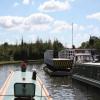
Purton Lower Bridge

 
Purton Lower Bridge, Hinton GL13 9HT, United Kingdom
 
Information about the place
Purton Lower Bridge is a minor waterways place on the Gloucester and Sharpness Canal between Sharpness Barge Arm (Junction of old and new lines of canal. Long term private mooring.) (1 mile and 3¼ furlongs to the southwest) and Saul Junction (Junction of the Gloucester and Sharpness Canal with the Stroudwater Navigation) (6 miles and 1½ furlongs to the northeast).
 
 
The nearest place in the direction of Sharpness Barge Arm is Purton Timber Pond; 4¼ furlongs away.
 
The nearest place in the direction of Saul Junction is Purton Upper Bridge; ¾ furlongs away.

Mooring here is unrated.

Facilities: boater-operated pump-out, rubbish disposal and water point.

There is a swing bridge here.

High Level Swing Bridge1 mile, 3¾ furlongs
Sharpness Barge Arm1 mile, 3¼ furlongs
Sharpness Visitor Mooring1 mile, 2¼ furlongs
Severn Railway Bridge Site1 mile, ½ furlongs
Purton Timber Pond4¼ furlongs
Purton Lower Bridge
Purton Upper Bridge¾ furlongs
Patch Bridge2 miles, 3¾ furlongs
Cambridge Arms Bridge3 miles, 1½ furlongs
Junction with Cambridge Feeder Branch3 miles, 2¼ furlongs
Splatt Bridge4 miles, 2½ furlongs
 
 
Amenities
 
Maps
If you are a user and are logged on, or if you are actively planning a route, a map will be displayed here.
Show on external mapping site: Google | OSM | Bing
 
Photos
 
External websites
There are no links to external websites from here.
Why not log in and add some (select "External websites" from the menu (sometimes this is under "Edit"))?
 
Nearest facilities

Mouseover for more information or show routes to facility

Nearest water point

The nearest water point is here. Others are at:

In the direction of Gloucester / Sharpness - Severn Junction

Patch Bridge2 miles, 3¾ furlongs away
On this waterway in the direction of Gloucester / Sharpness - Severn Junction
Splatt Bridge4 miles, 2½ furlongs away
On this waterway in the direction of Gloucester / Sharpness - Severn Junction
Fretherne Bridge5 miles, 3¼ furlongs away
On this waterway in the direction of Gloucester / Sharpness - Severn Junction On this waterway in the direction of Gloucester / Sharpness - Severn Junction
Saul Junction Winding Hole6 miles, 1¼ furlongs away
On this waterway in the direction of Gloucester / Sharpness - Severn Junction
Saul Junction Marina6 miles, 2¾ furlongs away
Travel to Saul Junction, then on the Cotswold Canals (Stroudwater Navigation - Navigable Section) to Saul Junction Marina
Sellars Bridge9 miles, 7½ furlongs away
On this waterway in the direction of Gloucester / Sharpness - Severn Junction
Llanthony Pontoons13 miles, 5½ furlongs away
On this waterway in the direction of Gloucester / Sharpness - Severn Junction
Llanthony Road Bridge13 miles, 6½ furlongs away
On this waterway in the direction of Gloucester / Sharpness - Severn Junction
Gloucester Waterways Museum Arm13 miles, 6¾ furlongs away
On this waterway in the direction of Gloucester / Sharpness - Severn Junction
Gloucester Dock Lock13 miles, 7¾ furlongs away
On this waterway in the direction of Gloucester / Sharpness - Severn Junction

Nearest rubbish disposal

The nearest rubbish disposal is here. Others are at:

In the direction of Sharpness Junction

Sharpness Barge Arm1 mile, 3¼ furlongs away
On this waterway in the direction of Sharpness Junction

In the direction of Gloucester / Sharpness - Severn Junction

Patch Bridge2 miles, 3¾ furlongs away
On this waterway in the direction of Gloucester / Sharpness - Severn Junction
Splatt Bridge4 miles, 2½ furlongs away
On this waterway in the direction of Gloucester / Sharpness - Severn Junction
Fretherne Bridge5 miles, 3¼ furlongs away
On this waterway in the direction of Gloucester / Sharpness - Severn Junction
Saul Junction Winding Hole6 miles, 1¼ furlongs away
On this waterway in the direction of Gloucester / Sharpness - Severn Junction
Saul Junction Marina6 miles, 2¾ furlongs away
Travel to Saul Junction, then on the Cotswold Canals (Stroudwater Navigation - Navigable Section) to Saul Junction Marina
Parkend Bridge7 miles, 6¼ furlongs away
On this waterway in the direction of Gloucester / Sharpness - Severn Junction
Sellars Bridge9 miles, 7½ furlongs away
On this waterway in the direction of Gloucester / Sharpness - Severn Junction
Llanthony Road Bridge13 miles, 6½ furlongs away
On this waterway in the direction of Gloucester / Sharpness - Severn Junction

Nearest chemical toilet disposal

In the direction of Sharpness Junction

Sharpness Barge Arm1 mile, 3¼ furlongs away
On this waterway in the direction of Sharpness Junction

In the direction of Gloucester / Sharpness - Severn Junction

On this waterway in the direction of Gloucester / Sharpness - Severn Junction
Saul Junction Marina6 miles, 2¾ furlongs away
Travel to Saul Junction, then on the Cotswold Canals (Stroudwater Navigation - Navigable Section) to Saul Junction Marina
Llanthony Road Bridge13 miles, 6½ furlongs away
On this waterway in the direction of Gloucester / Sharpness - Severn Junction

Nearest place to turn

In the direction of Sharpness Junction

Sharpness Barge Arm1 mile, 3¼ furlongs away
On this waterway in the direction of Sharpness Junction

In the direction of Gloucester / Sharpness - Severn Junction

Saul Junction Winding Hole6 miles, 1¼ furlongs away
On this waterway in the direction of Gloucester / Sharpness - Severn Junction
Pegthorne Bridge Winding Hole6 miles, 6½ furlongs away
On this waterway in the direction of Gloucester / Sharpness - Severn Junction
Quedgeley Oil Depot10 miles, 1 furlong away
On this waterway in the direction of Gloucester / Sharpness - Severn Junction
Monk Meadow Dock13 miles, 3¼ furlongs away
On this waterway in the direction of Gloucester / Sharpness - Severn Junction
Gloucester Docks13 miles, 7¼ furlongs away
On this waterway in the direction of Gloucester / Sharpness - Severn Junction On this waterway in the direction of Gloucester / Sharpness - Severn Junction
Gloucester / Sharpness - Severn Junction14 miles and 1 lock away
On this waterway in the direction of Gloucester / Sharpness - Severn Junction
The Ocean10 miles, ¼ furlongs and 8 locks away
Travel to Saul Junction, then on the Cotswold Canals (Stroudwater Navigation - Navigable Section) to Walk Bridge, then on the Cotswold Canals (Stroudwater Navigation - Un-navigable Section) to The Ocean
Upper Parting Junction16 miles, 4¾ furlongs and 1 lock away
Travel to Gloucester / Sharpness - Severn Junction, then on the River Severn (main river - Worcester to Gloucester) to Upper Parting Junction
Over Winding Hole15 miles, 7¾ furlongs and 2 locks away
Travel to Gloucester / Sharpness - Severn Junction, then on the River Severn (old river navigation) to Lower Parting, then on the River Severn (Maisemore Channel - Southern Section) to Over Junction, then on the Hereford and Gloucester Canal to Over Winding Hole
Ryeford Winding Hole11 miles and 8 locks away
Travel to Saul Junction, then on the Cotswold Canals (Stroudwater Navigation - Navigable Section) to Walk Bridge, then on the Cotswold Canals (Stroudwater Navigation - Un-navigable Section) to Ryeford Winding Hole
Brimscombe Port15 miles, 6½ furlongs and 19 locks away
Travel to Saul Junction, then on the Cotswold Canals (Stroudwater Navigation - Navigable Section) to Walk Bridge, then on the Cotswold Canals (Stroudwater Navigation - Un-navigable Section) to Site of Entrance to Wallbridge Basin, then on the Cotswold Canals (Thames and Severn Canal - Wide section) to Brimscombe Port

Nearest self-operated pump-out

The nearest self-operated pump-out is here. Others are at:

In the direction of Gloucester / Sharpness - Severn Junction

On this waterway in the direction of Gloucester / Sharpness - Severn Junction
Llanthony Pontoons13 miles, 5½ furlongs away
On this waterway in the direction of Gloucester / Sharpness - Severn Junction

Nearest boatyard pump-out

In the direction of Gloucester / Sharpness - Severn Junction

Patch Bridge2 miles, 3¾ furlongs away
On this waterway in the direction of Gloucester / Sharpness - Severn Junction
Saul Junction Marina6 miles, 2¾ furlongs away
Travel to Saul Junction, then on the Cotswold Canals (Stroudwater Navigation - Navigable Section) to Saul Junction Marina
Direction of TV transmitter (From Wolfbane Cybernetic)
 
 
Geograph
 
Wikipedia

There is no page on Wikipedia called “Purton Lower Bridge”

Wikipedia pages that might relate to Purton Lower Bridge
[Gloucester and Sharpness Canal] called for old vessels to be run aground along the bank of the Severn, near Purton, to create a makeshift tidal erosion barrier to reinforce the narrow strip [List of places in Gloucestershire] Pillowell, Pope's Hill, Poulton, Prestbury, Priding, Prior's Norton, Purton near Berkeley, Purton near Lydney Quedgeley, Quenington Randwick, The Reddings, Redmarley [List of crossings of the River Severn] many unique bridges to cope with this. There were historically also ferry crossings on the tidal river at: Minsterworth Framilode Purton, Lydney Newnham [River Severn] example at New Passage, Purton and Arlingham. The last ferry was the Aust Ferry, which closed in 1966 when the Severn Bridge opened. One of the Aust ferries [Motte-and-bailey castle] DeVries, p.204. King (1991), p.35. Kaufmann and Kaufmann, p.109. Purton, p.195. Purton, pp.195-6; Collardelle and Mazard, pp.71, 78; Jansen, p.195; Kaufmann [Severn Railway Bridge] The Severn Railway Bridge (historically called the Severn Bridge) was a bridge carrying the railway across the River Severn between Sharpness and Lydney [Keep] 206; Anderson, p.223. Durand, p.81; Purton, p.140. Durand, p.81; Purton, p.140; Anderson, p.208. Purton, p.141. Purton, p.141, 270. Anderson, p.237. Kaufmann [Charles Dickens] belongs to the tradition of the sentimental novel is debatable. Valerie Purton, in her book Dickens and the Sentimental Tradition, sees him continuing [Hanoi] Retrieved 24 November 2013. Tư trị thông giám, quyển 250. Kiernan 2019, p. 123. Purton 2009, p. 106. The Muslim Merchants of Premodern China, The History of a [Aust Ferry] buildings and surroundings Video by the Ferry Preservation Group Friends of Purton Gloucestershire Transport History Hull Times Index 1928-45 Launch of ferryboat
 
Google

Results of Google Search

Purton Lower Bridge, Gloucester & Sharpness Canal | Canal & River ...
Apr 16, 2019 ... Please be aware that divers will be working at Purton Lower Bridge, to inspect a water main owned by Bristol Water. This will require the bridge ...
Purton South L1 :: Waterside Moorings
The site is just to the west of Purton Lower Bridge, along Riddle Street in Purton village, and is accessed through a metal pedestrian gate. Vehicle access to the ...
Property details for 1 Lower Bridge Cottage Purton Berkeley GL13 ...
Use Zoopla to view property details for 1 Lower Bridge Cottage Purton Berkeley GL13 9HU including a current value estimate, local information, birdseye views ...
Gloucester & sharpness canal, lower Purton bridge - YouTube
Jul 26, 2014 ... Full Bridge open & close with a very slow narrow boat going through at purton, Berkeley,
Gloucester and Sharpness Canal - Wikipedia
Fretherne Bridge. Splatt Bridge. River Cam. Cambridge Arms Bridge. Patch Bridge. Purton Upper Bridge. Purton Lower Bridge. Sharpness Barge Arm (from old ...
Mallana moored at Purton Lower Bridge, Gloucester Sharpness Canal
Download this stock image: Mallana moored at Purton Lower Bridge, Gloucester Sharpness Canal - TB4PNR from Alamy's library of millions of high resolution ...
Mallana Moored At Purton Lower Bridge, Gloucester Sharpness ...
Picture of Mallana moored at Purton Lower Bridge, Gloucester Sharpness Canal stock photo, images and stock photography. Image 125347715.
File:Purton Upper Bridge - geograph.org.uk - 103054.jpg ...
English: Purton Upper Bridge. On the Gloucester and Sharpness Canal. There is another swing bridge (Purton Lower Bridge) not far downstream of here.
Purton Lower Bridge
moveable bridge, bridge, road bridge. Purton Lower Bridge. Nearby cities: Coordinates: 51°44'13"N 2°26'55"W. Add your comment in english. Add comment for ...