CanalPlanAC

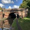
Bridge No 44 Pipe Bridge

 
Hanbury Road, Bromsgrove B60 4LA, United Kingdom
 
Information about the place
Bridge No 44 Pipe Bridge is a minor waterways place on the Worcester and Birmingham Canal (Diglis Basin to King's Norton Junction) between Hanbury Junction (Junction with Droitwich Junction Canal (Restored - Opened 1/July/2011). Hanbury Wharf) (3 miles and 2 furlongs and 6 locks to the southwest) and King's Norton Junction (Junction of Stratford and Worcester and Birmingham Canals) (12 miles and ½ furlongs and 36 locks to the northeast).
 
 
The nearest place in the direction of Hanbury Junction is Navigation Inn (Stoke Prior) (150 yds walk north along Hanbury Road); a few yards away.
 
The nearest place in the direction of King's Norton Junction is Hanbury Road Bridge No 44 (Separate footbridge alongside road bridge); a few yards away.

Mooring here is unrated.

There is a bridge here which takes a pipe over the canal.


Amenities

Amenities nearby at Navigation Inn (Stoke Prior)

 J L Pinder & Son
 
Maps
If you are a user and are logged on, or if you are actively planning a route, a map will be displayed here.
Show on external mapping site: Google | OSM | Bing
 
Photos
 
External websites
There are no links to external websites from here.
Why not log in and add some (select "External websites" from the menu (sometimes this is under "Edit"))?
 
Nearest facilities

Mouseover for more information or show routes to facility

Nearest water point

In the direction of King's Norton Junction

Tardebigge Wharf3 miles, 2¾ furlongs and 36 locks away
On this waterway in the direction of King's Norton Junction
Hopwood Visitor Moorings8 miles, 6½ furlongs and 36 locks away
On this waterway in the direction of King's Norton Junction
King's Norton Water Point11 miles, 7¾ furlongs and 36 locks away
On this waterway in the direction of King's Norton Junction
Yardley Wood Water Point14 miles, 5 furlongs and 36 locks away
Travel to King's Norton Junction, then on the Stratford-on-Avon Canal (Northern Section) to Yardley Wood Water Point
Holliday Wharf17 miles, 2½ furlongs and 36 locks away
Travel to King's Norton Junction, then on the Worcester and Birmingham Canal (Birmingham to King's Norton) to Holliday Wharf
Worcester Bar17 miles, 4½ furlongs and 36 locks away
Travel to King's Norton Junction, then on the Worcester and Birmingham Canal (Birmingham to King's Norton) to Worcester Bar
Hawne Basin17 miles, 5¼ furlongs and 36 locks away
Travel to King's Norton Junction, then on the Worcester and Birmingham Canal (Birmingham to King's Norton) to New Selly Oak Junction, then on the Birmingham Canal Navigations (Dudley Canal No 2 - Lapal Canal - Original Line East End ) to Somery Road Bridge, then on the Birmingham Canal Navigations (Dudley Canal No 2 - Lapal Canal - Abandoned Line ) to Lapal Canal - New line Diverges From Original Route, then on the Birmingham Canal Navigations (Dudley Canal No 2 - Lapal Canal - Original Line West End ) to Coombeswood, then on the Birmingham Canal Navigations (Dudley Canal No 2 - Coombeswood ) to Hawne Basin
Cambrian Wharf Services18 miles, ½ furlongs and 36 locks away
Travel to King's Norton Junction, then on the Worcester and Birmingham Canal (Birmingham to King's Norton) to Worcester Bar, then on the Birmingham Canal Navigations (Main Line) to Deep Cuttings Junction, then on the Birmingham Canal Navigations (Newhall Branch) to Cambrian Wharf Services
Earlswood Reservoir Feeder18 miles, 6¼ furlongs and 36 locks away
Travel to King's Norton Junction, then on the Stratford-on-Avon Canal (Northern Section) to Earlswood Reservoir Feeder

In the direction of Diglis Basin

Stoke Works Water Point5¾ furlongs away
On this waterway in the direction of Diglis Basin
Hanbury Boatyard3 miles, 2¾ furlongs and 6 locks away
On this waterway in the direction of Diglis Basin
Droitwich Spa Marina3 miles, 5 furlongs and 9 locks away
Travel to Hanbury Junction, then on the Droitwich Canals (Droitwich Junction Canal) to Droitwich Spa Marina
Netherwich Basin5 miles, ½ furlongs and 14 locks away
Travel to Hanbury Junction, then on the Droitwich Canals (Droitwich Junction Canal) to Droitwich Junction, then on the Droitwich Canals (Droitwich Barge Canal) to Netherwich Basin
Lowesmoor Basin11 miles, 2¼ furlongs and 18 locks away
On this waterway in the direction of Diglis Basin
Diglis Services12 miles, 1¾ furlongs and 20 locks away
On this waterway in the direction of Diglis Basin
Diglis Locks12 miles, 6 furlongs and 22 locks away
Travel to Diglis Basin, then on the Worcester and Birmingham Canal (Diglis Junction to Diglis Basin) to Diglis Junction, then on the River Severn (main river - Worcester to Gloucester) to Diglis Locks
Worcester Trip Boat Moorings13 miles, 1¾ furlongs and 22 locks away
Travel to Diglis Basin, then on the Worcester and Birmingham Canal (Diglis Junction to Diglis Basin) to Diglis Junction, then on the River Severn (main river - Stourport to Worcester) to Worcester Trip Boat Moorings
Holt Lock (Holt Fleet)13 miles, 4 furlongs and 22 locks away
Travel to Hanbury Junction, then on the Droitwich Canals (Droitwich Junction Canal) to Droitwich Junction, then on the Droitwich Canals (Droitwich Barge Canal) to Hawford Junction, then on the River Severn (main river - Stourport to Worcester) to Holt Lock (Holt Fleet)
Lincomb Lock17 miles, 5¾ furlongs and 23 locks away
Travel to Hanbury Junction, then on the Droitwich Canals (Droitwich Junction Canal) to Droitwich Junction, then on the Droitwich Canals (Droitwich Barge Canal) to Hawford Junction, then on the River Severn (main river - Stourport to Worcester) to Lincomb Lock
Upper Basin Waterpoint19 miles, 1 furlong and 26 locks away
Travel to Hanbury Junction, then on the Droitwich Canals (Droitwich Junction Canal) to Droitwich Junction, then on the Droitwich Canals (Droitwich Barge Canal) to Hawford Junction, then on the River Severn (main river - Stourport to Worcester) to Severn - Stourport Broad Locks Entrance, then on the Staffordshire and Worcestershire Canal (Stourport Basins: Broad Route) to Stourport Upper Basin, then on the Staffordshire and Worcestershire Canal (Stourport Basins: Narrow Route) to Upper Basin Waterpoint

Nearest rubbish disposal

In the direction of King's Norton Junction

Stoke Bottom Lock No 23a few yards away
On this waterway in the direction of King's Norton Junction
Tardebigge Wharf3 miles, 2¾ furlongs and 36 locks away
On this waterway in the direction of King's Norton Junction
Worcester Bar17 miles, 4½ furlongs and 36 locks away
Travel to King's Norton Junction, then on the Worcester and Birmingham Canal (Birmingham to King's Norton) to Worcester Bar
Hawne Basin17 miles, 5¼ furlongs and 36 locks away
Travel to King's Norton Junction, then on the Worcester and Birmingham Canal (Birmingham to King's Norton) to New Selly Oak Junction, then on the Birmingham Canal Navigations (Dudley Canal No 2 - Lapal Canal - Original Line East End ) to Somery Road Bridge, then on the Birmingham Canal Navigations (Dudley Canal No 2 - Lapal Canal - Abandoned Line ) to Lapal Canal - New line Diverges From Original Route, then on the Birmingham Canal Navigations (Dudley Canal No 2 - Lapal Canal - Original Line West End ) to Coombeswood, then on the Birmingham Canal Navigations (Dudley Canal No 2 - Coombeswood ) to Hawne Basin
Cambrian Wharf Services18 miles, ½ furlongs and 36 locks away
Travel to King's Norton Junction, then on the Worcester and Birmingham Canal (Birmingham to King's Norton) to Worcester Bar, then on the Birmingham Canal Navigations (Main Line) to Deep Cuttings Junction, then on the Birmingham Canal Navigations (Newhall Branch) to Cambrian Wharf Services
Waring's Green Wharf19 miles, 6 furlongs and 36 locks away
Travel to King's Norton Junction, then on the Stratford-on-Avon Canal (Northern Section) to Waring's Green Wharf
Farmers Bridge Lock No 818 miles, 3¾ furlongs and 43 locks away
Travel to King's Norton Junction, then on the Worcester and Birmingham Canal (Birmingham to King's Norton) to Worcester Bar, then on the Birmingham Canal Navigations (Main Line) to Deep Cuttings Junction, then on the Birmingham Canal Navigations (Newhall Branch) to Farmers Bridge Junction, then on the Birmingham Canal Navigations (Birmingham and Fazeley Canal - Main Line) to Farmers Bridge Lock No 8

In the direction of Diglis Basin

Droitwich Spa Marina3 miles, 5 furlongs and 9 locks away
Travel to Hanbury Junction, then on the Droitwich Canals (Droitwich Junction Canal) to Droitwich Spa Marina
Netherwich Basin5 miles, ½ furlongs and 14 locks away
Travel to Hanbury Junction, then on the Droitwich Canals (Droitwich Junction Canal) to Droitwich Junction, then on the Droitwich Canals (Droitwich Barge Canal) to Netherwich Basin
Lowesmoor Basin11 miles, 2¼ furlongs and 18 locks away
On this waterway in the direction of Diglis Basin
Diglis Basin12 miles, 2½ furlongs and 20 locks away
On this waterway in the direction of Diglis Basin
Sabrina Footbridge13 miles, 3½ furlongs and 22 locks away
Travel to Diglis Basin, then on the Worcester and Birmingham Canal (Diglis Junction to Diglis Basin) to Diglis Junction, then on the River Severn (main river - Stourport to Worcester) to Sabrina Footbridge
Upper Basin Waterpoint19 miles, 1 furlong and 26 locks away
Travel to Hanbury Junction, then on the Droitwich Canals (Droitwich Junction Canal) to Droitwich Junction, then on the Droitwich Canals (Droitwich Barge Canal) to Hawford Junction, then on the River Severn (main river - Stourport to Worcester) to Severn - Stourport Broad Locks Entrance, then on the Staffordshire and Worcestershire Canal (Stourport Basins: Broad Route) to Stourport Upper Basin, then on the Staffordshire and Worcestershire Canal (Stourport Basins: Narrow Route) to Upper Basin Waterpoint

Nearest chemical toilet disposal

In the direction of King's Norton Junction

Stoke Bottom Lock No 23a few yards away
On this waterway in the direction of King's Norton Junction
Tardebigge Wharf3 miles, 2¾ furlongs and 36 locks away
On this waterway in the direction of King's Norton Junction
Holliday Wharf17 miles, 2½ furlongs and 36 locks away
Travel to King's Norton Junction, then on the Worcester and Birmingham Canal (Birmingham to King's Norton) to Holliday Wharf
Worcester Bar17 miles, 4½ furlongs and 36 locks away
Travel to King's Norton Junction, then on the Worcester and Birmingham Canal (Birmingham to King's Norton) to Worcester Bar
Hawne Basin17 miles, 5¼ furlongs and 36 locks away
Travel to King's Norton Junction, then on the Worcester and Birmingham Canal (Birmingham to King's Norton) to New Selly Oak Junction, then on the Birmingham Canal Navigations (Dudley Canal No 2 - Lapal Canal - Original Line East End ) to Somery Road Bridge, then on the Birmingham Canal Navigations (Dudley Canal No 2 - Lapal Canal - Abandoned Line ) to Lapal Canal - New line Diverges From Original Route, then on the Birmingham Canal Navigations (Dudley Canal No 2 - Lapal Canal - Original Line West End ) to Coombeswood, then on the Birmingham Canal Navigations (Dudley Canal No 2 - Coombeswood ) to Hawne Basin
Cambrian Wharf Services18 miles, ½ furlongs and 36 locks away
Travel to King's Norton Junction, then on the Worcester and Birmingham Canal (Birmingham to King's Norton) to Worcester Bar, then on the Birmingham Canal Navigations (Main Line) to Deep Cuttings Junction, then on the Birmingham Canal Navigations (Newhall Branch) to Cambrian Wharf Services
Earlswood Reservoir Feeder18 miles, 6¼ furlongs and 36 locks away
Travel to King's Norton Junction, then on the Stratford-on-Avon Canal (Northern Section) to Earlswood Reservoir Feeder
Waring's Green Wharf19 miles, 6 furlongs and 36 locks away
Travel to King's Norton Junction, then on the Stratford-on-Avon Canal (Northern Section) to Waring's Green Wharf

In the direction of Diglis Basin

Droitwich Spa Marina3 miles, 5 furlongs and 9 locks away
Travel to Hanbury Junction, then on the Droitwich Canals (Droitwich Junction Canal) to Droitwich Spa Marina
Lowesmoor Basin11 miles, 2¼ furlongs and 18 locks away
On this waterway in the direction of Diglis Basin
Diglis Services12 miles, 1¾ furlongs and 20 locks away
On this waterway in the direction of Diglis Basin
Stourport Marina18 miles, 1 furlong and 24 locks away
Travel to Hanbury Junction, then on the Droitwich Canals (Droitwich Junction Canal) to Droitwich Junction, then on the Droitwich Canals (Droitwich Barge Canal) to Hawford Junction, then on the River Severn (main river - Stourport to Worcester) to Stourport Marina
Upper Basin Waterpoint19 miles, 1 furlong and 26 locks away
Travel to Hanbury Junction, then on the Droitwich Canals (Droitwich Junction Canal) to Droitwich Junction, then on the Droitwich Canals (Droitwich Barge Canal) to Hawford Junction, then on the River Severn (main river - Stourport to Worcester) to Severn - Stourport Broad Locks Entrance, then on the Staffordshire and Worcestershire Canal (Stourport Basins: Broad Route) to Stourport Upper Basin, then on the Staffordshire and Worcestershire Canal (Stourport Basins: Narrow Route) to Upper Basin Waterpoint

Nearest place to turn

In the direction of King's Norton Junction

Stoke Wharf¾ furlongs and 1 lock away
On this waterway in the direction of King's Norton Junction

In the direction of Diglis Basin

Astwood Winding Hole1 mile, 4¼ furlongs and 4 locks away
On this waterway in the direction of Diglis Basin
Hanbury Junction Winding Hole3 miles, ½ furlongs and 6 locks away
On this waterway in the direction of Diglis Basin
Hanbury Junction3 miles, 2 furlongs and 6 locks away
On this waterway in the direction of Diglis Basin
Hanbury Boatyard3 miles, 2¾ furlongs and 6 locks away
On this waterway in the direction of Diglis Basin
Dunhampstead Boatyard5 miles, 1¼ furlongs and 6 locks away
On this waterway in the direction of Diglis Basin
Dunhampstead Winding Hole5 miles, 3½ furlongs and 6 locks away
On this waterway in the direction of Diglis Basin
Tibberton Winding Hole6 miles, 3 furlongs and 6 locks away
On this waterway in the direction of Diglis Basin
Droitwich Spa Marina3 miles, 5 furlongs and 9 locks away
Travel to Hanbury Junction, then on the Droitwich Canals (Droitwich Junction Canal) to Droitwich Spa Marina
Lock No 6 Winding Hole4 miles, ¼ furlongs and 11 locks away
Travel to Hanbury Junction, then on the Droitwich Canals (Droitwich Junction Canal) to Lock No 6 Winding Hole
Droitwich Town Wharf4 miles, 6½ furlongs and 14 locks away
Travel to Hanbury Junction, then on the Droitwich Canals (Droitwich Junction Canal) to Droitwich Junction, then on the Droitwich Canals (Droitwich Barge Canal) to Droitwich Town Wharf
Netherwich Basin5 miles, ½ furlongs and 14 locks away
Travel to Hanbury Junction, then on the Droitwich Canals (Droitwich Junction Canal) to Droitwich Junction, then on the Droitwich Canals (Droitwich Barge Canal) to Netherwich Basin
Winding Hole (east of Salwarpe Road Bridge)5 miles, 2 furlongs and 14 locks away
Travel to Hanbury Junction, then on the Droitwich Canals (Droitwich Junction Canal) to Droitwich Junction, then on the Droitwich Canals (Droitwich Barge Canal) to Winding Hole (east of Salwarpe Road Bridge)
Ladywood Top Lock Winding Hole7 miles, 6¾ furlongs and 14 locks away
Travel to Hanbury Junction, then on the Droitwich Canals (Droitwich Junction Canal) to Droitwich Junction, then on the Droitwich Canals (Droitwich Barge Canal) to Ladywood Top Lock Winding Hole
Bilford Locks Winding Hole10 miles, ¼ furlongs and 15 locks away
On this waterway in the direction of Diglis Basin
Lowesmoor Basin11 miles, 2¼ furlongs and 18 locks away
On this waterway in the direction of Diglis Basin
Bevere Lock Weir Entrance10 miles, 6½ furlongs and 22 locks away
Travel to Hanbury Junction, then on the Droitwich Canals (Droitwich Junction Canal) to Droitwich Junction, then on the Droitwich Canals (Droitwich Barge Canal) to Hawford Junction, then on the River Severn (main river - Stourport to Worcester) to Bevere Lock Weir Entrance
Bevere Lock Weir Exit11 miles, 1 furlong and 23 locks away
Travel to Hanbury Junction, then on the Droitwich Canals (Droitwich Junction Canal) to Droitwich Junction, then on the Droitwich Canals (Droitwich Barge Canal) to Hawford Junction, then on the River Severn (main river - Stourport to Worcester) to Bevere Lock Weir Exit
Diglis Junction12 miles, 3½ furlongs and 22 locks away
Travel to Diglis Basin, then on the Worcester and Birmingham Canal (Diglis Junction to Diglis Basin) to Diglis Junction
Holt Lock Weir Exit13 miles, 3 furlongs and 22 locks away
Travel to Hanbury Junction, then on the Droitwich Canals (Droitwich Junction Canal) to Droitwich Junction, then on the Droitwich Canals (Droitwich Barge Canal) to Hawford Junction, then on the River Severn (main river - Stourport to Worcester) to Holt Lock Weir Exit

Nearest self-operated pump-out

In the direction of Diglis Basin

Droitwich Spa Marina3 miles, 5 furlongs and 9 locks away
Travel to Hanbury Junction, then on the Droitwich Canals (Droitwich Junction Canal) to Droitwich Spa Marina
Diglis Services12 miles, 1¾ furlongs and 20 locks away
On this waterway in the direction of Diglis Basin

Nearest boatyard pump-out

In the direction of King's Norton Junction

Hawne Basin17 miles, 5¼ furlongs and 36 locks away
Travel to King's Norton Junction, then on the Worcester and Birmingham Canal (Birmingham to King's Norton) to New Selly Oak Junction, then on the Birmingham Canal Navigations (Dudley Canal No 2 - Lapal Canal - Original Line East End ) to Somery Road Bridge, then on the Birmingham Canal Navigations (Dudley Canal No 2 - Lapal Canal - Abandoned Line ) to Lapal Canal - New line Diverges From Original Route, then on the Birmingham Canal Navigations (Dudley Canal No 2 - Lapal Canal - Original Line West End ) to Coombeswood, then on the Birmingham Canal Navigations (Dudley Canal No 2 - Coombeswood ) to Hawne Basin
Sherborne Wharf Services18 miles, ¾ furlongs and 36 locks away
Travel to King's Norton Junction, then on the Worcester and Birmingham Canal (Birmingham to King's Norton) to Worcester Bar, then on the Birmingham Canal Navigations (Main Line) to Sherborne Wharf Services
Earlswood Reservoir Feeder18 miles, 6¼ furlongs and 36 locks away
Travel to King's Norton Junction, then on the Stratford-on-Avon Canal (Northern Section) to Earlswood Reservoir Feeder
Waring's Green Wharf19 miles, 6 furlongs and 36 locks away
Travel to King's Norton Junction, then on the Stratford-on-Avon Canal (Northern Section) to Waring's Green Wharf

In the direction of Diglis Basin

Hanbury Boatyard3 miles, 2¾ furlongs and 6 locks away
On this waterway in the direction of Diglis Basin
Dunhampstead Boatyard5 miles, 1¼ furlongs and 6 locks away
On this waterway in the direction of Diglis Basin
Lowesmoor Basin11 miles, 2¼ furlongs and 18 locks away
On this waterway in the direction of Diglis Basin
Stourport Marina18 miles, 1 furlong and 24 locks away
Travel to Hanbury Junction, then on the Droitwich Canals (Droitwich Junction Canal) to Droitwich Junction, then on the Droitwich Canals (Droitwich Barge Canal) to Hawford Junction, then on the River Severn (main river - Stourport to Worcester) to Stourport Marina
Stourport Upper Basin19 miles, 1 furlong and 26 locks away
Travel to Hanbury Junction, then on the Droitwich Canals (Droitwich Junction Canal) to Droitwich Junction, then on the Droitwich Canals (Droitwich Barge Canal) to Hawford Junction, then on the River Severn (main river - Stourport to Worcester) to Severn - Stourport Broad Locks Entrance, then on the Staffordshire and Worcestershire Canal (Stourport Basins: Broad Route) to Stourport Upper Basin
Upper Staircase Lock Landing Pontoon19 miles, 1½ furlongs and 26 locks away
Travel to Hanbury Junction, then on the Droitwich Canals (Droitwich Junction Canal) to Droitwich Junction, then on the Droitwich Canals (Droitwich Barge Canal) to Hawford Junction, then on the River Severn (main river - Stourport to Worcester) to Severn - Stourport Broad Locks Entrance, then on the Staffordshire and Worcestershire Canal (Stourport Basins: Broad Route) to Stourport Upper Basin, then on the Staffordshire and Worcestershire Canal (Stourport Basins: Narrow Route) to Upper Staircase Lock Landing Pontoon
Direction of TV transmitter (From Wolfbane Cybernetic)
 
 
Geograph
 
Wikipedia

There is no page on Wikipedia called “Bridge No 44 Pipe Bridge”

Wikipedia pages that might relate to Bridge No 44 Pipe Bridge
[Victoria Bridge (Penrith)] Victoria Bridge, The Nepean Bridge and RTA Bridge No. 333. It was added to the New South Wales State Heritage Register on 27 May 2016. The bridge initially [Little Pipe Creek bridge and viaduct] The Little Pipe Creek bridge and viaduct is a 705-foot (215 m) continuous truss bridge with main span and 19 viaduct sections as well as an active railroad [Tay Bridge] "like the spigot and faucet of a domestic water pipe" was felt be a useful analogy at the Tay Bridge Court of Inquiry but would probably baffle modern [The Bridge (2011 TV series)] The Bridge (Danish: Broen Danish pronunciation: [bʁoːn]; Swedish: Bron Swedish pronunciation: [bruːn]) is a Nordic noir crime television series created [Medford Pipe Bridge] The Medford Pipe Bridge is a historic plate girder pipeline bridge over the Mystic River, between S. Court St. and the Mystic Valley Parkway in Medford [Hebden Bridge] Hebden Bridge also grew to include a Picture House (seating 500) and offices for Hebden Bridge Urban District Council. Hebden Bridge has no swimming [List of bridge failures] This is a list of bridge failures. Harry Potter and the Half-Blood Prince (2005 novel): the fictional Brockdale Bridge, by the Death Eaters (replaced by [Hampton Roads Bridge–Tunnel] November 1, 1957 at a cost of $44 million as a toll facility. As population and traffic grew, construction on a parallel bridge-tunnel facility began in 1972 [Bridge No. 90646] Council accepted the proposal by Lyle Culvert & Pipe Company to build an Armco multi-plate arch bridge. The facing was proposed to be irregularly coursed [Hawkesbury River railway bridge] The Hawkesbury River railway bridge is a heritage-listed railway bridge in New South Wales, Australia that carries the Main North railway line across the
 
Google