Springwood Railway Viaduct No 26
is a minor waterways place
on the Huddersfield Narrow Canal between
Golcar (1 mile and 4¾ furlongs
and 8 locks
to the west) and
Aspley Basin (Huddersfield) (Moorings for Huddersfield and Junction of Huddersfield Broad and Narrow Canals) (1 mile and 1¼ furlongs
and 4 locks
to the east).
The nearest place in the direction of Golcar is Paddock Foot Lock No 5E;
¼ furlongs
away.
The nearest place in the direction of Aspley Basin (Huddersfield) is Longroyd Lock No 4E;
¾ furlongs
away.
Mooring here is unrated.
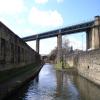
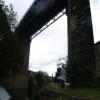
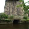
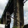
There is a bridge here which takes a railway over the canal.
| Stoney Battery Pipe Bridge | 4 furlongs | |
| Mark Bottom Bridge No 30 | 3 furlongs | |
| Birkhouse Lane Bridge No 29 | 1 furlong | |
| Paddock Foot Aqueduct | ¼ furlongs | |
| Paddock Foot Lock No 5E | ¼ furlongs | |
| Springwood Railway Viaduct No 26 | ||
| Longroyd Lock No 4E | ¾ furlongs | |
| Manchester Road Bridge No 25 | 1 furlong | |
| Site of Sellers Lock No 3E | 2½ furlongs | |
| Site of former Sellers Tunnel | 2¾ furlongs | |
| Sellers Lock No 3E | 4 furlongs | |
There are no links to external websites from here.
Why not log in and add some (select "External websites" from the menu (sometimes this is under "Edit"))?
Why not log in and add some (select "External websites" from the menu (sometimes this is under "Edit"))?
Mouseover for more information or show routes to facility
Nearest water point
In the direction of Ashton-under-Lyne Junction
Waterside Lock No 21E — 3 miles, 4¼ furlongs and 16 locks away
On this waterway in the direction of Ashton-under-Lyne Junction
Slaithwaite Winding Hole — 3 miles, 5 furlongs and 17 locks away
On this waterway in the direction of Ashton-under-Lyne Junction
Standedge Tunnel (eastern entrance) — 7 miles and 38 locks away
On this waterway in the direction of Ashton-under-Lyne Junction
Standedge Tunnel (western entrance) — 10 miles, 1¾ furlongs and 38 locks away
On this waterway in the direction of Ashton-under-Lyne Junction
Wool Road Bridge No 70 — 12 miles, 1¾ furlongs and 47 locks away
On this waterway in the direction of Ashton-under-Lyne Junction
Grove Road Bridge No 96 — 18 miles, 1¾ furlongs and 62 locks away
On this waterway in the direction of Ashton-under-Lyne Junction
In the direction of Aspley Basin (Huddersfield)
Aspley Basin (Huddersfield) — 1 mile, 1¼ furlongs and 4 locks away
On this waterway in the direction of Aspley Basin (Huddersfield)
Shepley Bridge Sanitary Station — 7 miles, 5¾ furlongs and 15 locks away
Travel to Aspley Basin (Huddersfield), then on the Huddersfield Broad Canal to Cooper Bridge Junction, then on the Calder and Hebble Navigation (Main Line) to Shepley Bridge Sanitary Station
Brighouse Basin — 6 miles, 7¾ furlongs and 17 locks away
Travel to Aspley Basin (Huddersfield), then on the Huddersfield Broad Canal to Cooper Bridge Junction, then on the Calder and Hebble Navigation (Main Line) to Brighouse Basin
Salterhebble Sanitary Station — 11 miles, 1½ furlongs and 26 locks away
Travel to Aspley Basin (Huddersfield), then on the Huddersfield Broad Canal to Cooper Bridge Junction, then on the Calder and Hebble Navigation (Main Line) to Salterhebble Sanitary Station
Broad Cut Low Lock No 3 — 14 miles, 2¾ furlongs and 23 locks away
Travel to Aspley Basin (Huddersfield), then on the Huddersfield Broad Canal to Cooper Bridge Junction, then on the Calder and Hebble Navigation (Main Line) to Broad Cut Low Lock No 3
Salterhebble Junction — 11 miles, 2 furlongs and 27 locks away
Travel to Aspley Basin (Huddersfield), then on the Huddersfield Broad Canal to Cooper Bridge Junction, then on the Calder and Hebble Navigation (Main Line) to Salterhebble Junction
Sowerby Bridge Basin — 13 miles, 3¾ furlongs and 27 locks away
Travel to Aspley Basin (Huddersfield), then on the Huddersfield Broad Canal to Cooper Bridge Junction, then on the Calder and Hebble Navigation (Main Line) to Salterhebble Junction, then on the Calder and Hebble Navigation (Main Line) to Sowerby Bridge Basin
Ramsdens Bridge Sanitary Station — 19 miles, 6½ furlongs and 27 locks away
Travel to Aspley Basin (Huddersfield), then on the Huddersfield Broad Canal to Cooper Bridge Junction, then on the Calder and Hebble Navigation (Main Line) to Fall Ing Junction, then on the Aire and Calder Navigation (Wakefield Section) to Ramsdens Bridge Sanitary Station
Stanley Ferry Water Point — 19 miles, 7¼ furlongs and 27 locks away
Travel to Aspley Basin (Huddersfield), then on the Huddersfield Broad Canal to Cooper Bridge Junction, then on the Calder and Hebble Navigation (Main Line) to Fall Ing Junction, then on the Aire and Calder Navigation (Wakefield Section) to Stanley Ferry Water Point
Hebden Bridge Services — 18 miles, 7¼ furlongs and 34 locks away
Travel to Aspley Basin (Huddersfield), then on the Huddersfield Broad Canal to Cooper Bridge Junction, then on the Calder and Hebble Navigation (Main Line) to Salterhebble Junction, then on the Calder and Hebble Navigation (Main Line) to Sowerby Bridge Junction, then on the Rochdale Canal to Hebden Bridge ServicesNearest rubbish disposal
In the direction of Ashton-under-Lyne Junction
Pickle Lock No 22E — 3 miles, 5½ furlongs and 17 locks away
On this waterway in the direction of Ashton-under-Lyne Junction
Wool Road Visitor Mooring — 12 miles, 2 furlongs and 47 locks away
On this waterway in the direction of Ashton-under-Lyne Junction
In the direction of Aspley Basin (Huddersfield)
Aspley Basin (Huddersfield) — 1 mile, 1¼ furlongs and 4 locks away
On this waterway in the direction of Aspley Basin (Huddersfield)
Shepley Bridge Sanitary Station — 7 miles, 5¾ furlongs and 15 locks away
Travel to Aspley Basin (Huddersfield), then on the Huddersfield Broad Canal to Cooper Bridge Junction, then on the Calder and Hebble Navigation (Main Line) to Shepley Bridge Sanitary Station
Brighouse Lower Basin Visitor Moorings — 6 miles, 7¼ furlongs and 16 locks away
Travel to Aspley Basin (Huddersfield), then on the Huddersfield Broad Canal to Cooper Bridge Junction, then on the Calder and Hebble Navigation (Main Line) to Brighouse Lower Basin Visitor Moorings
Horbury Basin Residential Moorings & Sanitary Station — 12 miles, 2¼ furlongs and 22 locks away
Travel to Aspley Basin (Huddersfield), then on the Huddersfield Broad Canal to Cooper Bridge Junction, then on the Calder and Hebble Navigation (Main Line) to Horbury Basin Residential Moorings & Sanitary Station
Salterhebble Sanitary Station — 11 miles, 1½ furlongs and 26 locks away
Travel to Aspley Basin (Huddersfield), then on the Huddersfield Broad Canal to Cooper Bridge Junction, then on the Calder and Hebble Navigation (Main Line) to Salterhebble Sanitary Station
Sowerby Bridge Basin — 13 miles, 3¾ furlongs and 27 locks away
Travel to Aspley Basin (Huddersfield), then on the Huddersfield Broad Canal to Cooper Bridge Junction, then on the Calder and Hebble Navigation (Main Line) to Salterhebble Junction, then on the Calder and Hebble Navigation (Main Line) to Sowerby Bridge Basin
Ramsdens Bridge Visitor Moorings — 19 miles, 7 furlongs and 27 locks away
Travel to Aspley Basin (Huddersfield), then on the Huddersfield Broad Canal to Cooper Bridge Junction, then on the Calder and Hebble Navigation (Main Line) to Fall Ing Junction, then on the Aire and Calder Navigation (Wakefield Section) to Ramsdens Bridge Visitor Moorings
Hebden Bridge Services — 18 miles, 7¼ furlongs and 34 locks away
Travel to Aspley Basin (Huddersfield), then on the Huddersfield Broad Canal to Cooper Bridge Junction, then on the Calder and Hebble Navigation (Main Line) to Salterhebble Junction, then on the Calder and Hebble Navigation (Main Line) to Sowerby Bridge Junction, then on the Rochdale Canal to Hebden Bridge ServicesNearest chemical toilet disposal
In the direction of Ashton-under-Lyne Junction
Waterside Lock No 21E — 3 miles, 4¼ furlongs and 16 locks away
On this waterway in the direction of Ashton-under-Lyne Junction
Pickle Lock No 22E — 3 miles, 5½ furlongs and 17 locks away
On this waterway in the direction of Ashton-under-Lyne Junction
Wool Road Bridge No 70 — 12 miles, 1¾ furlongs and 47 locks away
On this waterway in the direction of Ashton-under-Lyne Junction
Grove Road Bridge No 96 — 18 miles, 1¾ furlongs and 62 locks away
On this waterway in the direction of Ashton-under-Lyne Junction
In the direction of Aspley Basin (Huddersfield)
Aspley Basin (Huddersfield) — 1 mile, 1¼ furlongs and 4 locks away
On this waterway in the direction of Aspley Basin (Huddersfield)
Shepley Bridge Sanitary Station — 7 miles, 5¾ furlongs and 15 locks away
Travel to Aspley Basin (Huddersfield), then on the Huddersfield Broad Canal to Cooper Bridge Junction, then on the Calder and Hebble Navigation (Main Line) to Shepley Bridge Sanitary Station
Brighouse Basin — 6 miles, 7¾ furlongs and 17 locks away
Travel to Aspley Basin (Huddersfield), then on the Huddersfield Broad Canal to Cooper Bridge Junction, then on the Calder and Hebble Navigation (Main Line) to Brighouse Basin
Savile Town Wharf and Basin (Dewsbury) — 11 miles, 1¼ furlongs and 19 locks away
Travel to Aspley Basin (Huddersfield), then on the Huddersfield Broad Canal to Cooper Bridge Junction, then on the Calder and Hebble Navigation (Main Line) to Dewsbury Arm Junction, then on the Calder and Hebble Navigation (Dewsbury Old Cut) to Savile Town Wharf and Basin (Dewsbury)
Horbury Basin Residential Moorings & Sanitary Station — 12 miles, 2¼ furlongs and 22 locks away
Travel to Aspley Basin (Huddersfield), then on the Huddersfield Broad Canal to Cooper Bridge Junction, then on the Calder and Hebble Navigation (Main Line) to Horbury Basin Residential Moorings & Sanitary Station
Salterhebble Sanitary Station — 11 miles, 1½ furlongs and 26 locks away
Travel to Aspley Basin (Huddersfield), then on the Huddersfield Broad Canal to Cooper Bridge Junction, then on the Calder and Hebble Navigation (Main Line) to Salterhebble Sanitary Station
Sowerby Bridge Basin — 13 miles, 3¾ furlongs and 27 locks away
Travel to Aspley Basin (Huddersfield), then on the Huddersfield Broad Canal to Cooper Bridge Junction, then on the Calder and Hebble Navigation (Main Line) to Salterhebble Junction, then on the Calder and Hebble Navigation (Main Line) to Sowerby Bridge Basin
Ramsdens Bridge Sanitary Station — 19 miles, 6½ furlongs and 27 locks away
Travel to Aspley Basin (Huddersfield), then on the Huddersfield Broad Canal to Cooper Bridge Junction, then on the Calder and Hebble Navigation (Main Line) to Fall Ing Junction, then on the Aire and Calder Navigation (Wakefield Section) to Ramsdens Bridge Sanitary Station
Hebden Bridge Services — 18 miles, 7¼ furlongs and 34 locks away
Travel to Aspley Basin (Huddersfield), then on the Huddersfield Broad Canal to Cooper Bridge Junction, then on the Calder and Hebble Navigation (Main Line) to Salterhebble Junction, then on the Calder and Hebble Navigation (Main Line) to Sowerby Bridge Junction, then on the Rochdale Canal to Hebden Bridge ServicesNearest place to turn
In the direction of Ashton-under-Lyne Junction
Isis Lock Winding Hole — 1 mile, ¼ furlongs and 4 locks away
On this waterway in the direction of Ashton-under-Lyne Junction
Linthwaite Winding Hole — 2 miles, 4½ furlongs and 12 locks away
On this waterway in the direction of Ashton-under-Lyne Junction
Slaithwaite Winding Hole — 3 miles, 5 furlongs and 17 locks away
On this waterway in the direction of Ashton-under-Lyne Junction
Booth Lock Winding Hole — 5 miles, 2 furlongs and 27 locks away
On this waterway in the direction of Ashton-under-Lyne Junction
In the direction of Aspley Basin (Huddersfield)
University Arm — 1 mile, ½ furlongs and 4 locks away
On this waterway in the direction of Aspley Basin (Huddersfield)
Aspley Basin (Huddersfield) — 1 mile, 1¼ furlongs and 4 locks away
On this waterway in the direction of Aspley Basin (Huddersfield)
Anchor Street Winding Hole — 1 mile, 6¼ furlongs and 4 locks away
Travel to Aspley Basin (Huddersfield), then on the Huddersfield Broad Canal to Anchor Street Winding Hole
New Road Winding Hole — 2 miles, 1½ furlongs and 4 locks away
Travel to Aspley Basin (Huddersfield), then on the Huddersfield Broad Canal to New Road Winding Hole
Deighton Road Bridge Winding Hole — 3 miles, 3¼ furlongs and 9 locks away
Travel to Aspley Basin (Huddersfield), then on the Huddersfield Broad Canal to Deighton Road Bridge Winding Hole
Cooper Bridge Junction — 4 miles, 5¼ furlongs and 13 locks away
Travel to Aspley Basin (Huddersfield), then on the Huddersfield Broad Canal to Cooper Bridge Junction
Battye Weir Entrance — 5 miles, 2¼ furlongs and 14 locks away
Travel to Aspley Basin (Huddersfield), then on the Huddersfield Broad Canal to Cooper Bridge Junction, then on the Calder and Hebble Navigation (Main Line) to Battye Weir Entrance
Shepley Bridge Marina — 7 miles, 6 furlongs and 15 locks away
Travel to Aspley Basin (Huddersfield), then on the Huddersfield Broad Canal to Cooper Bridge Junction, then on the Calder and Hebble Navigation (Main Line) to Shepley Bridge Marina
Brighouse Basin — 6 miles, 7¾ furlongs and 17 locks away
Travel to Aspley Basin (Huddersfield), then on the Huddersfield Broad Canal to Cooper Bridge Junction, then on the Calder and Hebble Navigation (Main Line) to Brighouse Basin
Ganny Winding Hole — 7 miles, 5 furlongs and 18 locks away
Travel to Aspley Basin (Huddersfield), then on the Huddersfield Broad Canal to Cooper Bridge Junction, then on the Calder and Hebble Navigation (Main Line) to Ganny Winding Hole
Dewsbury Arm Junction — 10 miles, 1¼ furlongs and 19 locks away
Travel to Aspley Basin (Huddersfield), then on the Huddersfield Broad Canal to Cooper Bridge Junction, then on the Calder and Hebble Navigation (Main Line) to Dewsbury Arm Junction
Savile Town Wharf and Basin (Dewsbury) — 11 miles, 1¼ furlongs and 19 locks away
Travel to Aspley Basin (Huddersfield), then on the Huddersfield Broad Canal to Cooper Bridge Junction, then on the Calder and Hebble Navigation (Main Line) to Dewsbury Arm Junction, then on the Calder and Hebble Navigation (Dewsbury Old Cut) to Savile Town Wharf and Basin (Dewsbury)
Horbury Basin Residential Moorings & Sanitary Station — 12 miles, 2¼ furlongs and 22 locks away
Travel to Aspley Basin (Huddersfield), then on the Huddersfield Broad Canal to Cooper Bridge Junction, then on the Calder and Hebble Navigation (Main Line) to Horbury Basin Residential Moorings & Sanitary Station
Salterhebble Wharf — 11 miles, 1 furlong and 25 locks away
Travel to Aspley Basin (Huddersfield), then on the Huddersfield Broad Canal to Cooper Bridge Junction, then on the Calder and Hebble Navigation (Main Line) to Salterhebble Wharf
Salterhebble Bottom Basin Visitor Moorings — 11 miles, 1¼ furlongs and 25 locks away
Travel to Aspley Basin (Huddersfield), then on the Huddersfield Broad Canal to Cooper Bridge Junction, then on the Calder and Hebble Navigation (Main Line) to Salterhebble Bottom Basin Visitor Moorings
Salterhebble Sanitary Station — 11 miles, 1½ furlongs and 26 locks away
Travel to Aspley Basin (Huddersfield), then on the Huddersfield Broad Canal to Cooper Bridge Junction, then on the Calder and Hebble Navigation (Main Line) to Salterhebble Sanitary StationNearest self-operated pump-out
In the direction of Ashton-under-Lyne Junction
Slaithwaite Winding Hole — 3 miles, 5 furlongs and 17 locks away
On this waterway in the direction of Ashton-under-Lyne Junction
Wool Road Bridge No 70 — 12 miles, 1¾ furlongs and 47 locks away
On this waterway in the direction of Ashton-under-Lyne Junction
In the direction of Aspley Basin (Huddersfield)
Ramsdens Bridge Sanitary Station — 19 miles, 6½ furlongs and 27 locks away
Travel to Aspley Basin (Huddersfield), then on the Huddersfield Broad Canal to Cooper Bridge Junction, then on the Calder and Hebble Navigation (Main Line) to Fall Ing Junction, then on the Aire and Calder Navigation (Wakefield Section) to Ramsdens Bridge Sanitary Station
Hebden Bridge Services — 18 miles, 7¼ furlongs and 34 locks away
Travel to Aspley Basin (Huddersfield), then on the Huddersfield Broad Canal to Cooper Bridge Junction, then on the Calder and Hebble Navigation (Main Line) to Salterhebble Junction, then on the Calder and Hebble Navigation (Main Line) to Sowerby Bridge Junction, then on the Rochdale Canal to Hebden Bridge ServicesNearest boatyard pump-out
In the direction of Aspley Basin (Huddersfield)
Aspley Basin (Huddersfield) — 1 mile, 1¼ furlongs and 4 locks away
On this waterway in the direction of Aspley Basin (Huddersfield)
Shepley Bridge Marina — 7 miles, 6 furlongs and 15 locks away
Travel to Aspley Basin (Huddersfield), then on the Huddersfield Broad Canal to Cooper Bridge Junction, then on the Calder and Hebble Navigation (Main Line) to Shepley Bridge Marina
Sowerby Bridge Basin — 13 miles, 3¾ furlongs and 27 locks away
Travel to Aspley Basin (Huddersfield), then on the Huddersfield Broad Canal to Cooper Bridge Junction, then on the Calder and Hebble Navigation (Main Line) to Salterhebble Junction, then on the Calder and Hebble Navigation (Main Line) to Sowerby Bridge BasinDirection of TV transmitter (From Wolfbane Cybernetic)
There is no page on Wikipedia called “Springwood Railway Viaduct”
Wikipedia pages that might relate to Springwood Railway Viaduct
[Penistone Line]
and Yorkshire Railway (L&YR). From the joint L&YR/London and North Western Railway Huddersfield station, trains ran south to Springwood Junction (south
[Lockwood railway station]
short tunnel then crosses another large viaduct across the River Colne before joining the main line at Springwood Junction. The station is unstaffed and
[Great Western Highway]
severed in 1868 by the construction of the Springwood-Mount Victoria section of the Main Western Railway. The railway itself was deviated at this point in the
[Lapstone Zig Zag]
associated Knapsack Viaduct, a sandstone arch viaduct, were designed by John Whitton, Engineer-in-Charge of New South Wales Government Railways, and were built
[Central railway station, Sydney]
heritage-listed railway station located in the centre of Sydney, New South Wales, Australia. The station is the largest and busiest railway station in New
[Nepean River]
Springwood Road Victoria Railway Bridge Emu Plains Penrith Completed in 1907, the bridge carries the electrified and duplicated Main Western railway line
[List of Blue Mountains subjects]
Scenic World Shipley Plateau Six Foot Track Springwood, New South Wales Springwood High School Springwood railway station The Blue Mountains (Elgar) Thirlmere
[Railway accidents in New South Wales]
on 1 April 2011, a Zig Zag Railway maintenance vehicle (the Hi-Rail), collided with a two-car Rail Motor on the No 1 Viaduct, Top Road, between Clarence
[Hydro Majestic Hotel]
Riverview Mount Tomah Mount Victoria Mount Wilson North Katoomba Shipley Springwood Sun Valley Valley Heights Warrimoo Wentworth Falls Winmalee Woodford Yellow
[Main Western railway line, New South Wales]
earthwork, although it included a substantial seven-span sandstone viaduct (the Knapsack Viaduct) built by engineer, John Whitton. By 1910, the line was replaced
Results of Google Search
Mar 3, 2014 ... ▻GooglePlay : https://play.google.com/store/apps/de... This is an interesting puzzle game for those who like to build. The essence of the game ...
The railways of New South Wales, Australia have had many incidents and accidents since their ... On 4 June 1898, the 1.50am No.29 down train departed Bathurst. ... The collision resulted in the death of 26 persons. ... by two diesel locomotives crashed into the rear of a passenger train on a viaduct south of Liverpool station.
Spring Wood Studio Apartments offer a stylish and comfortable base for business ... Smoking Allowed: No ... Reviewed October 26, 2018 ... Hebden Bridge is 20 minutes away on a lovely riverside walk and has some very interesting shops. ... and marina brings visitors at a more leisurly pace than the railway which despite.
How to get from Peakhurst to Springwood by train, bus, taxi, car or towncar ... Station to Springwood Station, which is the cheapest option and takes around 2h 26m. ... How do I travel from Peakhurst to Springwood without a car? ... Peakhurst to Goulburn Peakhurst to Mollymook Peakhurst to Sea Cliff Bridge Peakhurst to ...
Bus Route 26 ... Fare: Public = $1.00 each way, Qualified Seniors 60+/Veterans/ Persons with Disabilities = No fare; DART passes will not be accepted. October ...
Find a place. Your location. Trails. Dedicated lanes. Bicycle-friendly roads. Dirt/ unpaved trails. Live traffic. Fast. Slow. 100 km. Set depart & arrive time.
Mar 20, 1990 ... confessions and it is believed that he is not responsible for most of the ... wallet was found near the Peach Creek Bridge on Hwy 59 in New Caney, ... December 26, 1981 - Inside the Summer Hill Subdivision located approximately ... passing train observed a body in “Contrary Creek†located alongside the.
January means the possibility of frozen water pipes, and not only for homes and ... The HERO Center will be used to train first responders, and will also be open to ... Beattie is in his 26th year teaching biology at Hastings High School when he  ...


